The best road cycling routes around Tejeda Y Segoyuela
5.0
(3)
207
riders
26
rides
Road cycling around Tejeda Y Segoyuela offers varied terrain, from the gently undulating sections of the Campo Charro to more mountainous routes approaching the Sierra de Francia. This region, located in the province of Salamanca, Spain, provides a diverse landscape for cyclists. Well-maintained roads and generally less traffic enhance the experience for longer rides through open fields and challenging ascents.
Best road cycling routes around Tejeda Y Segoyuela
- The most popular road cycling route is Campo Charro Loop from Tamames…
Last updated: May 16, 2026
71.2km
03:02
610m
610m
Cycle a moderate 44.2-mile (71.2 km) route around Tamames and Río Huebra, exploring rural villages and historic sites in Campo Charro.
31
riders
88.8km
04:32
1,310m
1,310m
Hard road ride. Very good fitness required. Some segments of this route may be unpaved and difficult to ride.

Sign up for free
31
riders
99.1km
05:23
2,050m
2,050m
Hard road ride. Very good fitness required. Mostly well-paved surfaces and easy to ride.
17
riders
86.3km
04:28
1,530m
1,540m
Hard road ride. Very good fitness required. Mostly well-paved surfaces and easy to ride.
12
riders
73.4km
03:29
1,000m
1,000m
Hard road ride. Very good fitness required. Mostly well-paved surfaces and easy to ride.
Get access to more routes and recommendations from other explorers.
Sign up for free
Already have an account?
Our route recommendations are based on thousands of hikes, rides, and runs completed by other people on komoot.
Start today with a free account
Your next adventure awaits.
Login or Signup
Popular around Tejeda Y Segoyuela

Tips from the Community

On the SA-205 highway, just outside San Esteban de la Sierra heading towards Santibáñez de la Sierra, you'll find the entrance to the Sierra Viewpoints Route, which includes several spectacular panoramic viewpoints. Views: The Alagón River Valley and its meanders. The Sierra de Francia mountain range with the Peña de Francia peak in the background. The Sierra de Béjar mountain range and the Las Quilamas Natural Area. This viewpoint is a magnificent natural balcony, perfect for photography and birdwatching (vultures, eagles, black storks).
2
0
What to see in Miranda del Castañar Medieval Walls: Over 600 meters remain intact, with four gates facing the cardinal directions: San Ginés, Nuestra Señora, La Villa, and El Postigo. Zúñiga Castle: A 15th-century fortress, symbol of the former County of Miranda. Although the interior is not open to the public, its exterior and keep are impressive. Square Bullring: Considered one of the oldest in Spain, built in the 16th century on the site of the former parade ground. Church of Santiago and San Ginés: Gothic in style (13th-16th centuries), with a detached 17th-century bell tower. Houses with Coats of Arms: More than 80 noble coats of arms adorn the facades, reflecting the town's aristocratic past.
8
0
Miranda del Castañar, one of the most beautiful villages in Spain, is located in the Sierra de Francia (Salamanca): Founded in 1213 by Alfonso IX of León as a town and council, it was the administrative capital of the Sierra de Francia. In the 15th century, the County of Miranda was created under the control of the Zúñiga family, consolidating its strategic importance.
9
0
This is the tourist and gastronomic area of Guijuelo, considered the birthplace of acorn-fed Iberian ham with Protected Designation of Origin (PDO Guijuelo). More than 150 ham and cured meat producers are concentrated here. The cold, dry climate of the Sierra de Béjar favors a slow, natural curing process, giving the ham a sweeter, more unctuous flavor.
3
0

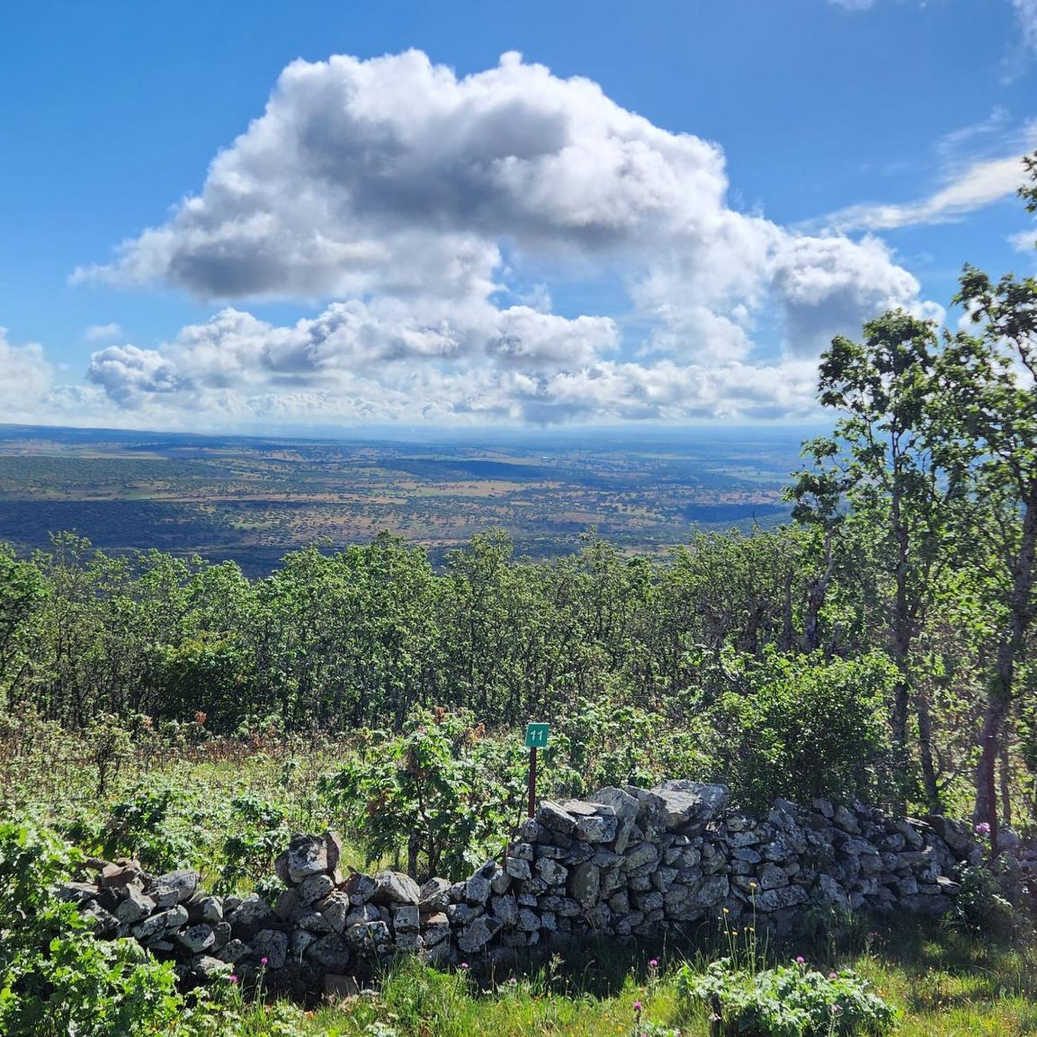
View of the vast Sierra de Francia. Countless church trees grow in the area around Madronal.
0
0


The climb up this narrow valley is a delight, especially on days when there is not much traffic. The views, the sounds of nature, the vegetation, the aromas of rockroses and other wild flowers allow us to almost forget that we are going uphill for a good part of the journey :-D
0
0

From this place you can see San Esteban de la Sierra and the landscapes of the Quilamas Natural Area around it. The road in perfect condition.
2
1
Frequently Asked Questions
How many road cycling routes are available around Tejeda Y Segoyuela?
There are over 25 road cycling routes around Tejeda Y Segoyuela, offering a diverse range of experiences for cyclists. These routes are highly rated by the komoot community, with an average score of 5.0 stars.
What kind of terrain can I expect when road cycling in Tejeda Y Segoyuela?
The region offers varied terrain, from the gently undulating sections of the Campo Charro, characterized by its 'dehesa' landscapes with holm oaks, to more mountainous routes as you approach the Sierra de Francia. You'll find both open fields and challenging ascents through ancient oak and chestnut forests.
Are there road cycling routes suitable for beginners or less experienced cyclists?
Yes, Tejeda Y Segoyuela offers routes suitable for various skill levels. While many routes feature significant climbs, there are at least 3 routes classified as easy, and 13 as moderate, providing options for those looking for less strenuous rides. The Campo Charro Loop from Tamames is a moderate option that explores the distinctive dehesa landscapes.
Are there challenging road cycling routes with significant climbs in the area?
Absolutely. The region is known for its challenging routes, especially those heading towards the Sierra de Francia. For instance, the Ascent to Puerto de Valero – San Miguel de Valero loop from La Sierpe is a difficult 55.2-mile path featuring substantial elevation gain. Another demanding option is the Miranda de Castañar – Ascent to Puerto de Valero loop from Linares de Riofrío, which covers over 60 miles with significant climbing.
What natural features or landmarks can I see along the road cycling routes?
Road cycling routes in this area often pass through diverse landscapes. You might encounter the distinctive dehesa of Campo Charro, ancient oak and chestnut forests, and mountainous terrain. Notable natural features include the Cervero Peak and the Ascent to Puerto de Valero. You may also spot the Small lagoon in Navarredonda de la Rinconada.
Are there any scenic viewpoints accessible by road bike?
Yes, many routes offer fine views, particularly as you gain elevation towards the Sierra de Francia. The area around the Santuario de Nuestra Señora de la Peña de Francia, while not directly on a route listed here, is renowned for its panoramic vistas and is a significant landmark in the broader region accessible from Tejeda y Segoyuela.
Are there circular road cycling routes available?
Yes, many of the routes in the area are circular, allowing you to start and end in the same location. Examples include the Campo Charro Loop from Tamames and the Ascent to Puerto de Valero – San Miguel de Valero loop from La Sierpe.
What is the best time of year for road cycling in Tejeda Y Segoyuela?
The region generally offers pleasant conditions for road cycling, with well-maintained roads and less traffic. Spring and autumn are often ideal, providing milder temperatures and beautiful scenery as the dehesa and forests change colors. Summers can be warm, while winters are cooler but still offer opportunities for cycling.
What do other road cyclists enjoy the most about road cycling in Tejeda Y Segoyuela?
The area is highly rated by the komoot community, with an average score of 5.0 stars. Reviewers often praise the diverse terrain, ranging from the distinctive dehesa landscapes to challenging mountain passes, and the generally less trafficked, well-maintained roads that enhance the cycling experience.
Are there any historical sites or traditional villages to explore near the cycling routes?
Yes, the region is rich in cultural heritage. The Sierra de Francia area, accessible from Tejeda y Segoyuela, is known for its villages with well-preserved traditional architecture. Within Tejeda y Segoyuela itself, you can find the ruins of a 15th-century castle and the Convent of San Antonio, offering interesting points of interest off the bike.
Can I find refreshments or accommodation along the road cycling routes?
While specific cafes or pubs on every route are not detailed, the traditional villages in the Sierra de Francia and settlements like Cilleros de la Bastida or La Sagrada often provide opportunities for refreshments and sometimes accommodation. It's advisable to plan your stops, especially on longer routes.
Most popular routes around Tejeda Y Segoyuela
Most popular attractions around Tejeda Y Segoyuela

Get inspired with the komoot mobile app


Explore more
Browse the best Road cycling routes in other regions.
