The best MTB trails around Tornadizos De Ávila
4.6
(80)
769
riders
163
rides
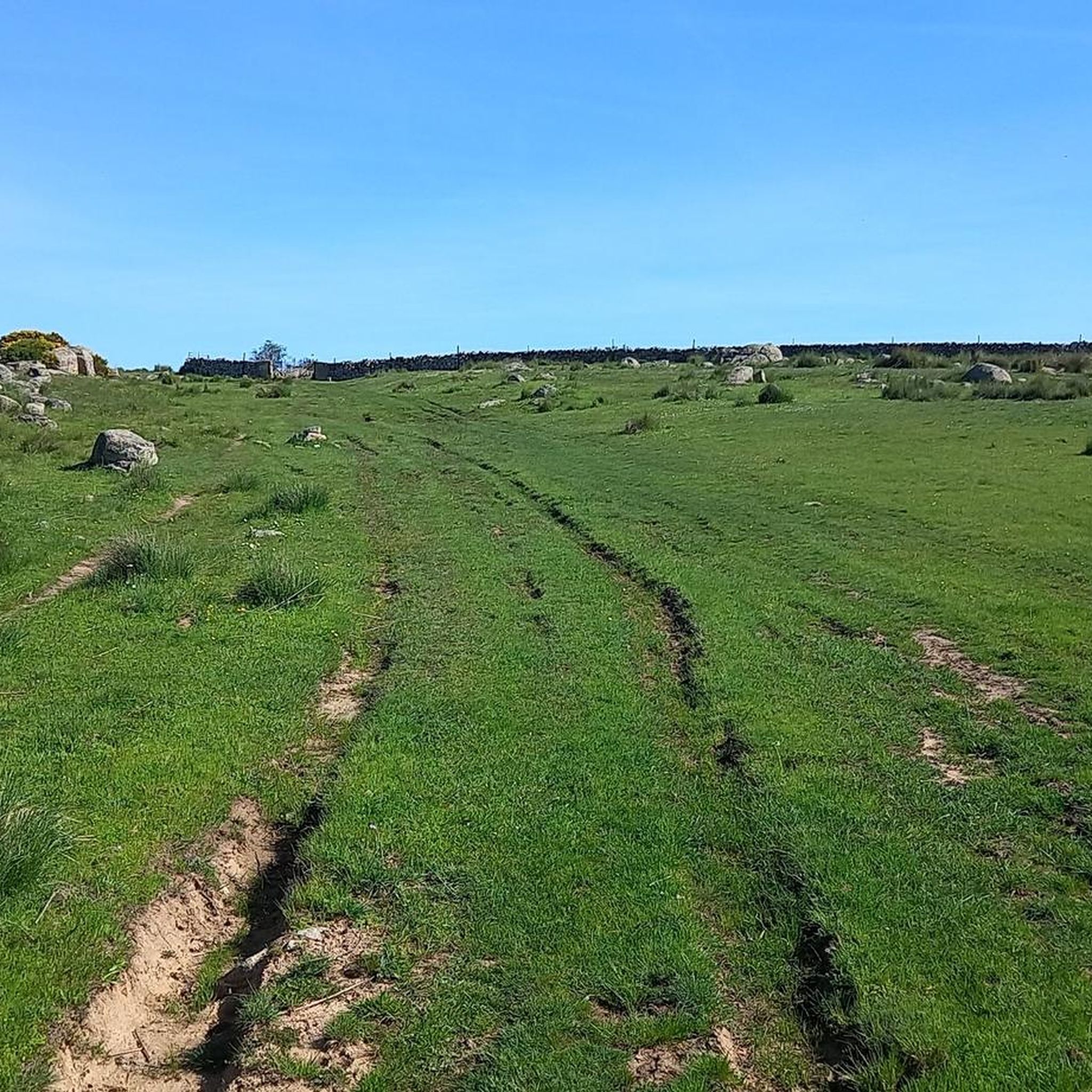
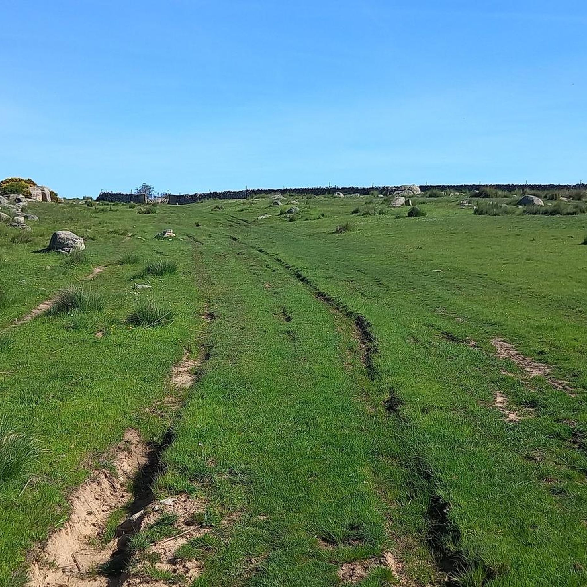
Mountain bike trails around Tornadizos de Ávila offer diverse terrain, transitioning from the open Valle Amblés to the rugged, rocky foothills of the Paramera mountain range. The region is characterized by significant elevation changes, with routes winding through areas shaped by the Adaja River and its tributaries. These landscapes provide varied conditions for mountain biking, from valley paths to more challenging ascents in the higher ground.
Best mountain bike trails around Tornadizos De Ávila
- The most popular mountain bike trail…
Last updated: July 28, 2026
5.0
(1)
1
riders
37.2km
03:20
570m
570m
This moderate 23.1-mile mountain biking route from Ávila explores varied terrain, including the scenic Embalse de Becerril and fun singletra
5.0
(1)
11
riders
79.2km
07:14
1,290m
1,290m
Hard mountain bike ride. Very good fitness required. Advanced riding skills necessary.

Sign up for free
13
riders
54.9km
04:25
480m
480m
Moderate mountain bike ride. Good fitness required. Advanced riding skills necessary.
5.0
(1)
13
riders
Easy mountain bike ride. Great for any fitness level. Suitable for all skill levels.
8
riders
42.5km
04:00
930m
930m
Hard mountain bike ride. Very good fitness required. Advanced riding skills necessary. Some portions of the route may require you to push your bike.
Get access to more routes and recommendations from other explorers.
Sign up for free
Already have an account?
Our route recommendations are based on thousands of hikes, rides, and runs completed by other people on komoot.
Start today with a free account
Your next adventure awaits.
Login or Signup


Tips from the Community

The Church of San Miguel Arcángel in Tornadizos de Ávila is a church of great historical and cultural significance. Built of ashlar and masonry, it is liturgical in nature. The Brotherhood of the Holy True Cross, an institution of great importance in local religious life, was founded in this parish more than four centuries ago.
1
0

It's an open pass in the inhospitable landscape typical of this area. It's highly recommended because it offers easy connections to other passes such as Serranillos and Mijares.
0
0
The Casasola Route in Navalperal de Pinares is one of the longest and most popular hiking trails in the area. With a length of approximately 23 kilometers and a cumulative ascent of 346 meters, this route offers a complete experience for hiking enthusiasts. The route begins at the Hermitage of San Antonio and passes through diverse landscapes, including oak forests, reforested pine forests, and mountain meadows.
1
0

A relatively simple port, with good asphalt and road visibility, moderate (average 5%) and constant gradients. It can be tricky on a windy day.
0
0
This bridge was built to facilitate crossing the Adaja River and connect the Roman city of Ávila with the opposite bank. Although only the hidden abutments on the edges of the original Roman bridge remain, the bridge visible today dates back to the 12th century.
13
0

Stage 2. Ávila/Madrid 140 km. 2,500 m positive. On the way back to Madrid we followed the route of the Camino de Santiago de Levante to the Alberche River with some variations to maintain cyclability and an acceptable average. The yellow arrows on the Jacobean route point towards Santiago de Compostela and at some intersections it is not easy to see them in the opposite direction. The track is essential to follow these “author” routes. The route leaves Ávila along the plain of the Chico River to Tornadizos de Ávila and continues along the cattle trails from the sources of the Tornadizos River to some spectacular pastoral meadows in the hills of El Cabezuelo. The final stretch of the climb follows a path that has good cyclability with good grinding technique and expertise on mountain trails. The path passes a gate with yellow arrows and goes down to the port of Boquerón, between the Cuerda de los Polvisos and the Malagón mountain range, one of the entrances to the great Herradón de Pinares grave. The descent along the Camino de Santiago is an uncomfortable and complicated trial with the bags due to the pavement and the vegetation and to maintain the pace we go down the road gliding over a deceptive landscape, we pass through El Herradón and continue to San Bartolomé de Pinares. The climb through the cobblestone streets of the town is tough and the exit through the forks of the Camino de Levante ends with an infernal wall, until the slope ends on a hill adorned with a milestone of the Jacobean route that has indications of the distances to different places. in the world, from Ávila and Madrid to Beijing or New Zealand.
0
0
Aldea del Rey Niño is a Spanish district that belongs to the municipality of Ávila, capital of the homonymous province, in the autonomous community of Castilla y León. Although its full history is not yet fully documented, archaeological remains have been found indicating the existence of Roman settlements in the area. The town is located inside the municipality of Ávila, in the foothills of the Sierra de Yemas. If you ever get the chance, I highly recommend exploring this charming area. 🏞️🌿
2
0
The hermitage, built in granite stone, flint and brick masonry, consists of three naves. On the main altar, where the image of Sonsoles is located, a ribbed vault rises. Although its predominant style is baroque, it also presents Gothic elements due to renovations and reconstructions over time. The current hermitage was the work of Martín de Solózano in the 15th century, who was commissioned to demolish the previous building. The image of Our Lady of Sonsoles, created and hidden before the Muslim invasion, has been venerated since the 13th century. Illustrious personalities of Spain, such as Saint Teresa of Jesús and the painter Valeriano Domínguez Becquer, have visited this sanctuary. Even the then infante Don Juan Carlos de Borbón visited it in 1960. If you ever have the opportunity, I recommend visiting this place full of history and devotion. 🙏🌟
4
0
Frequently Asked Questions
How many mountain bike trails are available in Tornadizos de Ávila?
Tornadizos de Ávila offers a wide selection of mountain bike trails, with nearly 140 routes recorded on komoot. These routes cater to various skill levels, including easy, moderate, and difficult options.
What kind of terrain can I expect on mountain bike trails in Tornadizos de Ávila?
The terrain in Tornadizos de Ávila is quite varied. You'll find paths transitioning from the open Valle Amblés to the rugged, rocky foothills of the Paramera mountain range. Routes often wind through areas shaped by the Adaja River and its tributaries, offering a mix of valley paths and more challenging ascents in higher ground. Some routes might involve uneven terrain, requiring pushing your bike at times, especially on more difficult sections.
Are there easy mountain bike trails suitable for beginners or families in Tornadizos de Ávila?
Yes, Tornadizos de Ávila has several easy mountain bike trails perfect for beginners or family outings. For example, the St. Michael the Archangel Church – View of the Valley and Fields loop is an easy 19 km trail offering scenic views. Another accessible option is the St. Michael the Archangel Church – Alto Bike Lane loop, an 18.4 km path that navigates through varied landscapes.
What are some challenging mountain bike routes for experienced riders?
For experienced riders seeking a challenge, Tornadizos de Ávila offers several difficult routes. The 11% ramp (20 meters) – El Herradón loop from Herradón-La Cañada is a demanding 42.4 km route with significant elevation gain. Another option is the Steep and dangerous descent loop from Herradón-La Cañada, which covers 41.1 km and includes challenging descents.
Are there any circular mountain bike routes in the area?
Many mountain bike routes in Tornadizos de Ávila are designed as loops, allowing you to start and finish at the same point. Examples include the easy St. Michael the Archangel Church – View of the Valley and Fields loop and the moderate Alto Bike Lane – View of the Valley and Fields loop, which leads through the Valle Amblés.
What natural attractions or scenic viewpoints can I find along the mountain bike trails?
The region offers beautiful natural features and scenic viewpoints. You can enjoy panoramic views from Cerro de la Cabeza, which reaches an elevation of 1335 meters. The Navalperal de Pinares Reservoir is also a picturesque spot ideal for enjoying nature. The trails themselves often provide views of the Valle Amblés and the rugged Paramera mountain range.
Are there any historical landmarks or points of interest near the mountain bike routes?
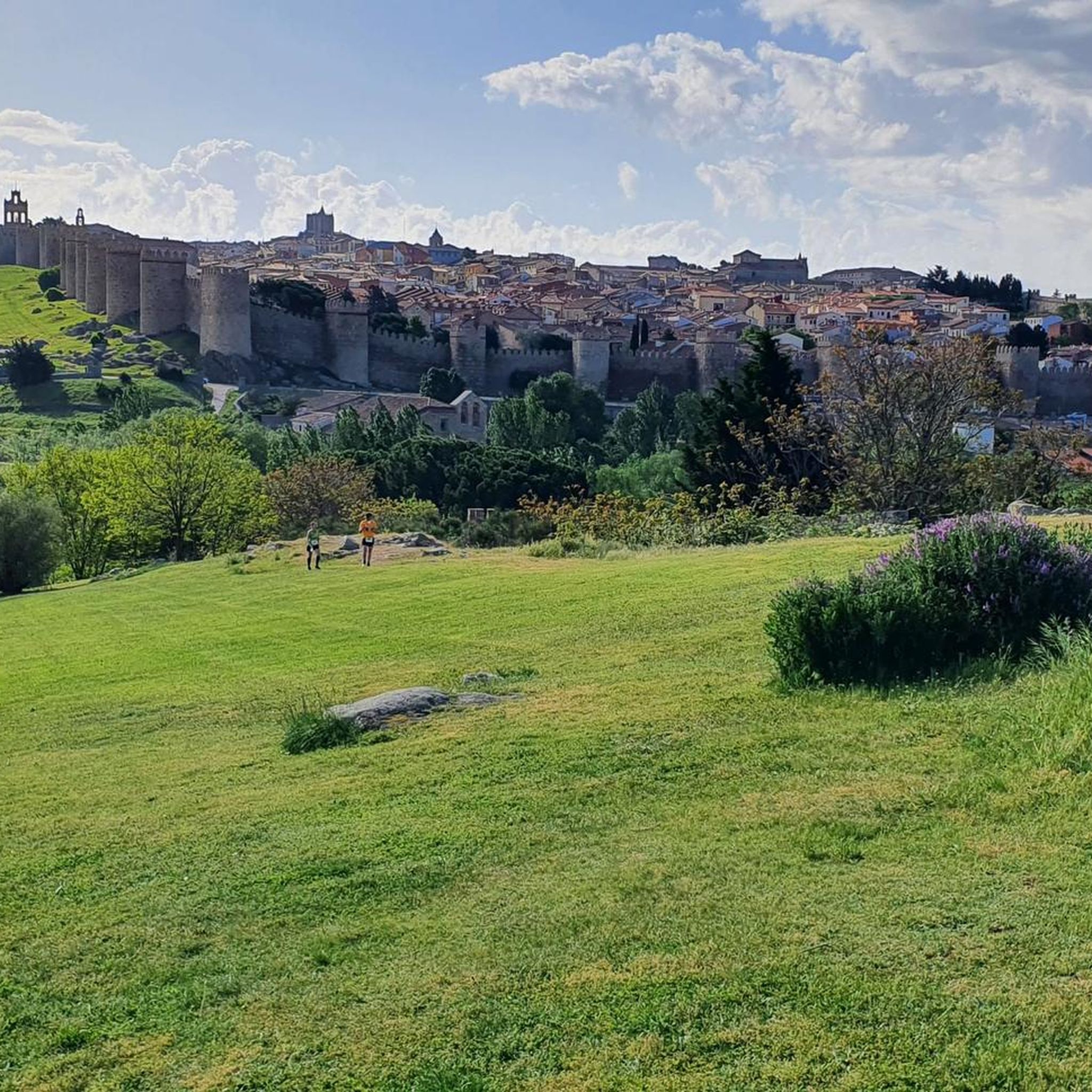
Yes, the area around Tornadizos de Ávila is rich in historical landmarks. You can explore parts of the impressive Ávila City Walls, visit the historic Plaza del Mercado Chico, or see the Old Roman bridge over the Adaja River. The Basilica of San Vicente of Ávila is another significant religious building nearby.
What do other mountain bikers say about the trails in Tornadizos de Ávila?
The mountain bike trails in Tornadizos de Ávila are highly rated by the komoot community, with an average score of 4.5 stars from over 90 reviews. More than 1,000 mountain bikers have explored the varied terrain, often praising the diverse landscapes and the options available for different skill levels.
Is there parking available near the mountain bike trails in Tornadizos de Ávila?
As Tornadizos de Ávila is a rural area, parking is generally available within the village or at common starting points for routes. It's advisable to check specific route descriptions or local signage for designated parking areas, especially when starting from smaller hamlets or trailheads.
What is the best time of year for mountain biking in Tornadizos de Ávila?
The region's landscapes change aesthetically with the seasons. Spring and autumn generally offer the most pleasant conditions for mountain biking, with milder temperatures and vibrant scenery. Summers can be hot, especially in the open valley, while winters might bring colder weather, though the area is generally accessible year-round.
Are there any cafes or places to eat near the mountain bike trails?
Tornadizos de Ávila is a rural village, and you can find local establishments within the village itself where you can refuel after your ride. For more options, the nearby city of Ávila, just 8 kilometers away, offers a wider selection of cafes, bars, and restaurants.
Most popular routes around Tornadizos De Ávila
Most popular attractions around Tornadizos De Ávila

Get inspired with the komoot mobile app


Explore more
Browse the best MTB trails in other regions.
