The 15 Most Amazing Peaks around Agaete
Mountain peaks around Agaete define the dramatic landscapes of Gran Canaria's northwestern coast, where rugged mountains meet the Atlantic Ocean. The municipality is characterized by its majestic mountainous terrain, including the Tamadaba Natural Park, which features extensive pine forests and impressive cliffs. This region offers diverse natural features and opportunities for exploration, from high-altitude summits to verdant valleys. The area's unique microclimate supports lush vegetation and even coffee cultivation in the Agaete Valley.
Best mountain peaks around Agaete
- The most…
Last updated: July 12, 2026
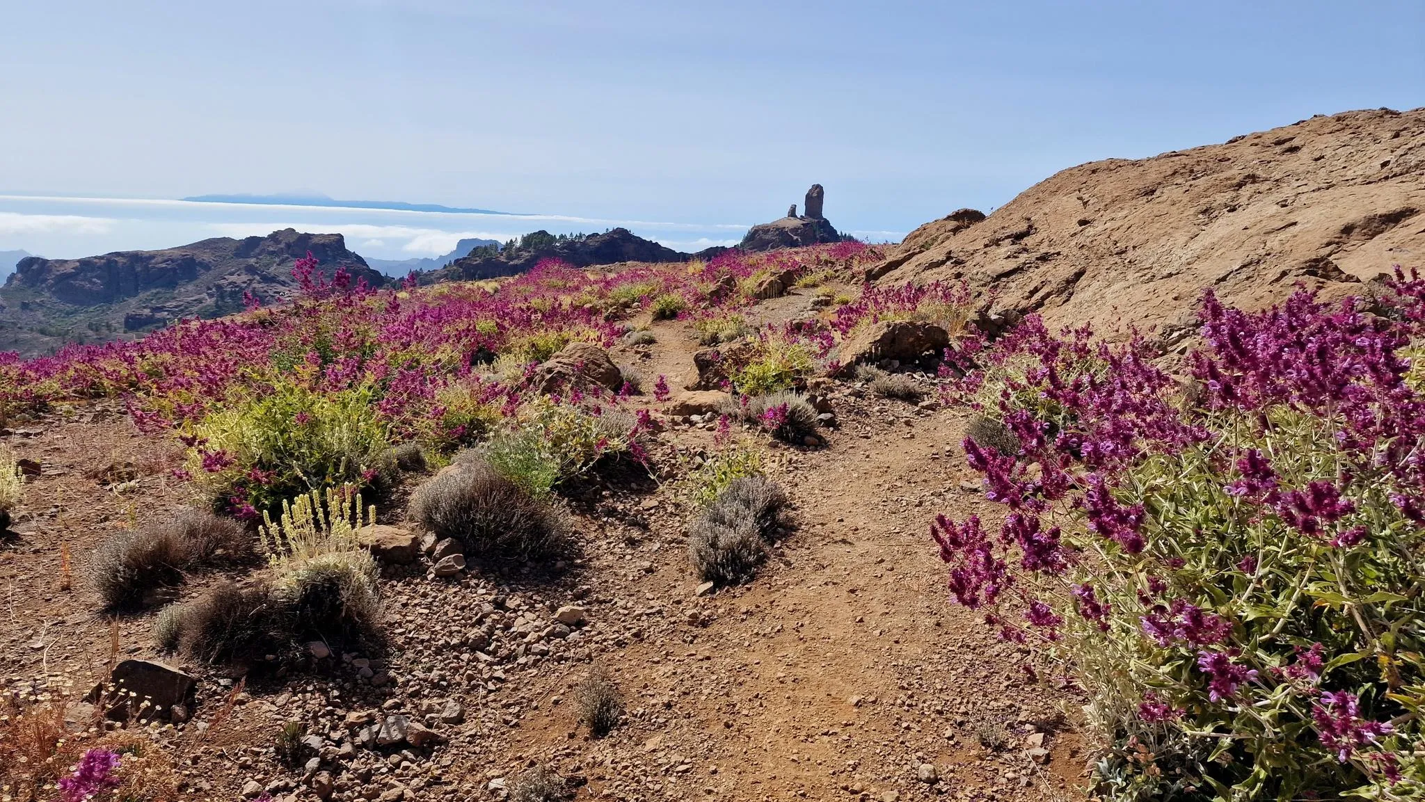
Roque Nublo
Highlight • Natural Monument
Showing Translation
Tip by

Tamadaba Peak
Highlight • Summit
Translated by Google •
Tip by

Sign up now to discover places like this
Get recommendations on the best single tracks, peaks, & plenty of other exciting outdoor places.
Sign up for free
Roque Bentayga
Highlight • Natural Monument
The Bentayga …
Translated by Google •
Tip by

Serpentine Trail to Altavista
Highlight (Segment) • Trail
Translated by Google •
Tip by

Risco Faneque Summit
Highlight • Summit
Source: odyssea.eu/data/?markerID=20376
Translated by Google •
Tip by

Sign up for free to discover even more peaks around Agaete.
Sign up for free
Already have an account?
Start today with a free account
Your next adventure awaits.
Login or Signup
Popular around Agaete

GranGuanche Audax Trail – my first ultra race on the Canary Islands

Trail on the Canary Islands – discover the legendary races!
An island of contrasts – crossing Gran Canaria
Hiking around Agaete
Road Cycling Routes around Agaete
Running Trails around Agaete
Cycling around Agaete
MTB Trails around Agaete

Mountain Hikes around Agaete
Other adventures around Agaete


Tips from the Community

The archaeological hiking trail on the Roque Bentayga offers not only a museum and great views but also impressions of the historical religious place of worship.
0
0
There is a free visitor center at Roque Bentayga - with parking. From there you can walk up the Bentaga in a few minutes, which was used as a religious place of worship. Great views from this impressive and historic mountain in the middle of the crater. Hikers should note that the access road is only open during opening hours. There are two barriers that are otherwise closed. Below the first barrier there are some parking spaces at the road junction.
0
0

The ascent to the summit leads through romantic pine forests on well-developed paths. Highly recommended if you want to travel north on Gran Canaria.
1
0

It is very worthwhile to climb up to Roque Nublo not only to see the rock formation itself, but also to enjoy the spectacular views it offers from above. The sunsets are incredible.
3
1


The path to this view is quite easy and easy to follow.
1
0

At 1,027 meters, the Faneque cliff is one of the highest cliffs in the world and the highest in Europe, located on the cliffs in the northwest of Gran Canaria in the heart of the Tamadaba Natural Park. Source: http://www.odyssea.eu/data/?markerID=20376
1
0
The Tamadaba Nature Park is one of the least man-made areas on Gran Canaria. It stretches over an area of 7,500 hectares in the westernmost part of the island from the mountain peak down to the coast. The nature park is located within the western part of Gran Canaria, which has been declared a UNESCO biosphere reserve. The park offers visitors beautiful forests full of endemic pines, dizzying cliffs on its almost inaccessible coasts and an extraordinary biodiversity in its gorges. Source: https://www.hallokanarischeinseln.com/naturraeume/gran-canaria/naturpark-tamadaba/
1
1
Frequently Asked Questions
What are the most prominent mountain peaks and features to explore around Agaete?
The region around Agaete is defined by its majestic mountainous terrain. Key features include the Tamadaba Peak within the Tamadaba Natural Park, which offers panoramic views from its 1443-meter summit. Another significant landmark is Roque Faneque, an imposing cliff with a dramatic 1,008-meter vertical drop to the sea. The verdant Agaete Valley, surrounded by high mountains, is also a notable area for its unique microclimate and lush vegetation.
Are there any family-friendly mountain walks or viewpoints near Agaete?
Yes, there are options for families. Morro de las Lechugas is a family-friendly viewpoint and summit, offering impressive views of Gran Canaria's western coast and, on clear days, the island of Tenerife. The path to this viewpoint is generally easy to walk, making it suitable for families.
What kind of hiking trails can I find in the mountains around Agaete?
The mountains around Agaete offer a variety of hiking trails, ranging from moderate to challenging. You can explore trails within the Tamadaba Natural Park, known for its extensive pine forests and impressive cliffs. The Agaete Valley also serves as a starting point for many hikes into the surrounding mountains. For more detailed routes, you can explore the Mountain Hikes around Agaete guide.
What is the best time of year to visit the mountain peaks around Agaete for hiking?
The unique microclimate of Agaete means that hiking is generally pleasant year-round. However, for the most comfortable experience, the cooler months from autumn to spring (October to May) are often preferred, as summer temperatures can be quite high, especially at lower altitudes. Always check local weather conditions before heading out.
Are there any historical or cultural sites among the mountain peaks?
Yes, the region holds historical significance. Roque Bentayga is a natural monument and a significant historical site. This distinctive stone monolith was historically used as a religious center by the ancient Canarians, with remains of old structures preserved at its base. It stands at 1404 meters high and offers a glimpse into the island's past.
Can I find any unique natural features or biodiversity in the Tamadaba Natural Park?
Tamadaba Natural Park is one of Gran Canaria's best-preserved natural areas, boasting the island's largest pine forest. Its unique microclimate, volcanic soil, humidity, and trade winds support rich biodiversity. This special environment even allows for the cultivation of coffee in the Agaete Valley, making it the only place in Europe where coffee is grown. The park also features impressive cliffs and volcanic areas.
What other outdoor activities are available near the mountain peaks of Agaete besides hiking?
Beyond hiking, the mountainous terrain around Agaete is excellent for various outdoor sports. You can find numerous routes for road cycling, with challenging climbs and scenic descents. There are also options for gravel biking, allowing you to explore diverse landscapes on two wheels.
Where can I find the most spectacular viewpoints in the Agaete mountains?
For breathtaking vistas, consider visiting Tamadaba Peak, which provides wonderful views in all directions. Morro de las Lechugas also offers impressive views of the western coast and the island of Tenerife. Additionally, higher points within Tamadaba Natural Park provide views of the 'Dragon's Tail' coastal formation.
Is it possible to see Roque Nublo from the Agaete region, and what makes it special?
Yes, Roque Nublo, considered the symbol of Gran Canaria, is visible from various points in the Agaete region, especially from higher elevations. This striking basalt rock measures about 80 meters high and offers extensive views of other nearby rock monoliths. It was a sacred mountain for the Guanches, who built a place of worship at its foot.
Are there any trails that offer a unique perspective of the Agaete Valley?
The Agaete Valley itself is surrounded by high mountains, and many trails lead into the surrounding areas, providing spectacular views of its lush slopes and unique microclimate. Era de Berbique, located at over 600 meters, is accessible via a spectacular ascent through the Agaete ravine and offers expansive views of the Valley, the Riscos de Tamadaba, and the northwest coast.
What do visitors particularly enjoy about the mountain peaks and natural areas around Agaete?
Visitors frequently praise the stunning panoramic views, the serene hiking experiences, and the unique natural beauty of the region. The Tamadaba Natural Park is often highlighted for its well-preserved environment and peaceful atmosphere. Many appreciate the contrast between the rugged cliffs and the lush greenery of the valleys, along with the opportunity to see iconic landmarks like Roque Nublo and Tamadaba Peak.
Most popular attractions around Agaete

Get inspired with the komoot mobile app


Explore more
See even more amazing summits around Agaete with these guides:
