The best walks and hikes around Benicàssim / Benicasim
4.5
(606)
5,003
hikers
173
hikes
Hiking around Benicàssim / Benicasim offers diverse landscapes, blending coastal beauty with mountainous terrain. The region features the Natural Park of the Desert de les Palmes, known for its ecological value and geological formations, alongside coastal trails. Peaks like El Bartolo (729 m) provide panoramic views. The area's varied topography includes both sea-level paths and elevated routes through protected natural areas.
Best hiking trails around Benicàssim / Benicasim
- The most popular hiking route is Benicàssim - Oropesa Greenway of the Sea Trail, a difficult 12.5 miles (20.1 km) trail that takes 5 hours 17 minutes to complete. This coastal path follows an old railway line, offering picturesque sea views.
- Another top favourite among local hikers is Natural Park of the Desert de les Palmes — Les Fonts del Desert (circular PR-CV 451), a moderate 8.4 miles (13.5 km) path. This route leads through lush vegetation and unique geological formations within the natural park.
- Local hikers also love the Agulles de Santa Àgueda Full Loop (PR-CV 397), a difficult 6.5 miles (10.5 km) trail leading through unique rock formations, often completed in about 3 hours 44 minutes.
- Hiking around Benicàssim / Benicasim is defined by coastal paths, mountainous terrain, and natural parks. The network offers options for different ability levels, from easy walks to challenging ascents.
- The routes in Benicàssim / Benicasim are highly rated by the komoot community with an average score of 4.5 stars from over 500 reviews. More than 4000 hikers have used komoot to explore Benicàssim / Benicasim's varied terrain.
Last updated: October 6, 2026
4.5
(48)
402
hikers
20.1km
05:17
140m
140m
Hard hike. Very good fitness required. Mostly accessible paths. Sure-footedness required.
4.6
(19)
75
hikers
Moderate hike. Good fitness required. Mostly accessible paths. Sure-footedness required.

4.5
(11)
58
hikers
10.5km
03:45
370m
370m
Hard hike. Good fitness required. Sure-footedness, sturdy shoes and alpine experience required.
4.5
(61)
169
hikers
Moderate hike. Good fitness required. Mostly accessible paths. Sure-footedness required.
4.7
(23)
160
hikers
Moderate hike. Great for any fitness level. Mostly accessible paths. Sure-footedness required.
Get access to more routes and recommendations from other explorers.
Already have an account?
Our route recommendations are based on thousands of hikes, rides, and runs completed by other people on komoot.
Start today with a free account
Your next adventure awaits.
Popular around Benicàssim / Benicasim


Other adventures around Benicàssim / Benicasim

Tips from the Community

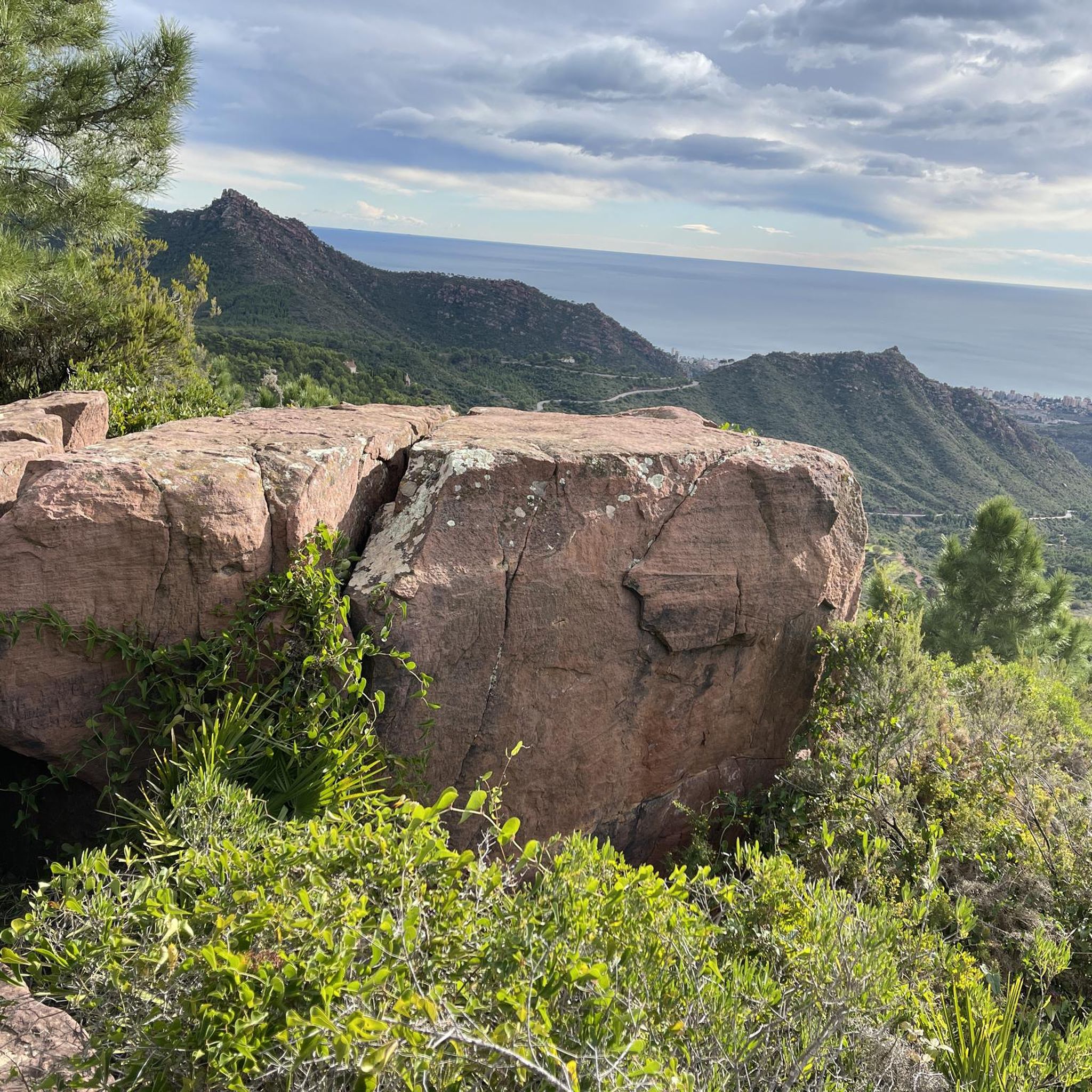
From the cave entrance, the views are impressive. The landscape opens up to a sea of pine trees that merges into the Mediterranean horizon, broken only by the reddish cliffs.
0
0

Very beautiful piece of nature
0
0
Beautiful climb...definitely do it
0
0
ideal starting point for many walks
0
0
T2 behind the antennas is sometimes difficult to find
0
0

The current state of the hermitage and the geodetic point is one of palpable deterioration to the naked eye. What a shame! The views to the east are spectacular.
0
1
Frequently Asked Questions
How many hiking trails are available in Benicàssim / Benicasim?
There are over 150 hiking routes around Benicàssim / Benicasim, offering a wide variety of experiences from coastal paths to mountainous trails. These include 39 easy, 73 moderate, and 39 difficult routes.
What kind of terrain can I expect on hikes in Benicàssim / Benicasim?
The region offers diverse landscapes, blending coastal beauty with mountainous terrain. You can find easy coastal paths like the Benicàssim - Oropesa Greenway of the Sea Trail, as well as more challenging routes through the Natural Park of the Desert de les Palmes, which features lush vegetation and unique geological formations.
Are there any family-friendly hiking options in Benicàssim / Benicasim?
Yes, Benicàssim offers several easy routes suitable for families. The Vía Verde del Mar is particularly popular, being a flat, accessible coastal path built on an old railway line, perfect for all ages. Green spaces like Heretat de Costera Park also provide settings for leisurely walks.
What are the best trails for panoramic views in Benicàssim / Benicasim?
For breathtaking vistas, consider trails within the Natural Park of the Desert de les Palmes that lead to peaks like El Bartolo (729 m) or Mola del Morico (694 m). These offer spectacular panoramic views of the coast. Additionally, viewpoints such as Benicàssim Viewpoint, Els Canons Viewpoint, and Portería Alta Viewpoint provide impressive coastal and natural scenery.
Are there any circular hiking routes in the area?
Yes, there are several circular routes. A notable one is the Natural Park of the Desert de les Palmes — Les Fonts del Desert (circular PR-CV 451), which takes you through the park's diverse landscapes. Another challenging option is the Agulles de Santa Àgueda Full Loop (PR-CV 397), known for its unique rock formations.
What historical or natural landmarks can I see along the hiking trails?
Along the trails, you can discover various points of interest. The Vía Verde del Mar features historical railway elements and ancient watchtowers like those at Cordà and Colomera. In the Natural Park of the Desert de les Palmes, you can explore monasteries, hermitages, caves, and the ruins of the Torre des Castillo de Montornes. Don't miss the Hermitage of Saint Michael on Pico Bartolo.
What is the best time of year to go hiking in Benicàssim / Benicasim?
Benicàssim is suitable for hiking for much of the year. Spring and autumn offer pleasant temperatures, ideal for exploring both coastal and inland trails. Even winter can be a good time for hiking, as the climate remains mild, though some higher mountain trails might be cooler. Summers can be hot, so early morning or late afternoon hikes are recommended during this season.
Are there any dog-friendly hiking trails in Benicàssim / Benicasim?
Many trails in Benicàssim are dog-friendly, especially the coastal paths and routes within the Natural Park of the Desert de les Palmes. It's always advisable to keep dogs on a leash, especially in protected areas, and to check specific trail regulations before you go. Ensure you carry enough water for both yourself and your pet.
What do other hikers enjoy most about hiking in Benicàssim / Benicasim?
The hiking routes in Benicàssim / Benicasim are highly rated by the komoot community, with an average score of 4.5 stars from over 500 reviews. Hikers often praise the diverse scenery, from stunning coastal views to the tranquil, lush landscapes of the Natural Park of the Desert de les Palmes, and the variety of options for different fitness levels.
Are there any moderate difficulty hikes that offer a good challenge without being too strenuous?
Yes, several moderate routes provide a good balance. The Natural Park of the Desert de les Palmes — Les Fonts del Desert (circular PR-CV 451) is a popular moderate option, leading through lush vegetation and unique geological formations. Another is the View of El Bartolo – Bartolo Cross loop from Parc Natural del Desert de les Palmes, offering rewarding views.
Is parking available near the trailheads in Benicàssim / Benicasim?
Parking is generally available near popular trailheads, especially for routes like the Vía Verde del Mar and access points to the Natural Park of the Desert de les Palmes. Specific parking information can often be found on individual route pages or local tourism websites. Public transport options might also be available for some starting points.
Can I combine hiking with other outdoor activities in Benicàssim / Benicasim?
Absolutely! Benicàssim is a hub for outdoor sports. Besides hiking, you can enjoy cycling, especially on the Vía Verde del Mar, which is popular with cyclists. The coastal areas also offer opportunities for water sports like kayaking and paddleboarding, making it easy to combine different activities during your visit.
Most popular routes around Benicàssim / Benicasim
Most popular attractions around Benicàssim / Benicasim

Get inspired with the komoot mobile app


Explore more
Browse the best Hikes in other regions.
