The best running trails around Velilla Del Río Carrión
5.0
(1)
238
runners
15
runs
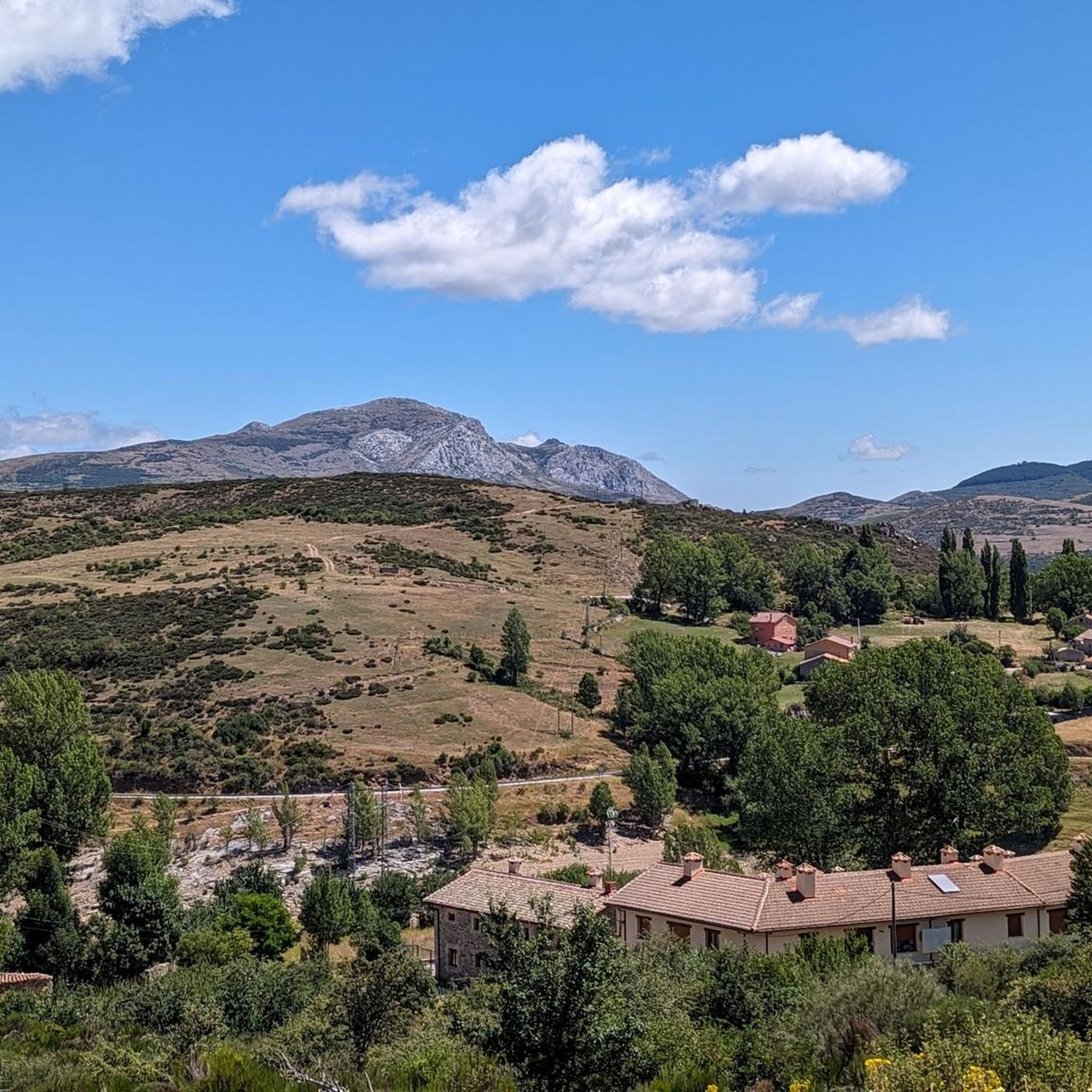
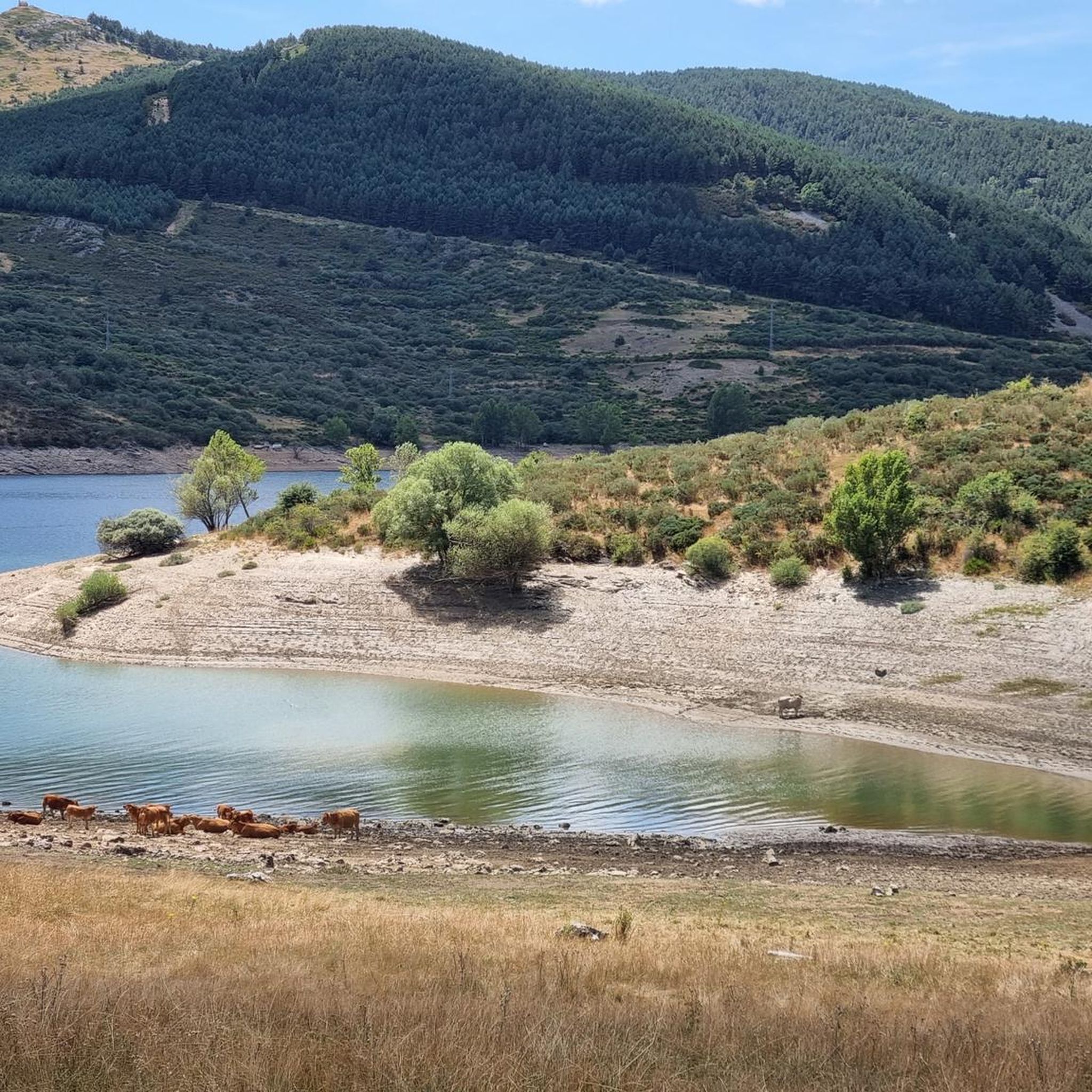
Jogging around Velilla del Río Carrión offers diverse terrain within the Montaña Palentina Natural Park. The region features a mountainous landscape with prominent peaks and varied inclines, alongside picturesque riverine paths along the Carrión River and routes tracing the Compuerto and Camporredondo reservoirs. Significant forested areas, including relict pine forests, provide shaded trails and unique environments for running.
Best jogging routes around Velilla del Río Carrión
- The most popular jogging route is Espigüete East Ridge and Mazobre Waterfall Loop,…
Last updated: May 10, 2026
47
runners
9.47km
03:23
1,060m
1,060m
Hard run. Very good fitness required. Sure-footedness, sturdy shoes and alpine experience required.
5
runners
Hard run. Very good fitness required. Sure-footedness, sturdy shoes and alpine experience required.

Sign up for free
16.0km
02:04
430m
430m
Hard run. Very good fitness required. Mostly paved surfaces. Suitable for all skill levels.
39
runners
33.0km
06:17
2,260m
2,260m
Hard run. Very good fitness required. Sure-footedness, sturdy shoes and alpine experience required.
15
runners
20.9km
03:57
1,340m
1,340m
Hard run. Very good fitness required. Sure-footedness, sturdy shoes and alpine experience required.
Get access to more routes and recommendations from other explorers.
Sign up for free
Already have an account?
Our route recommendations are based on thousands of hikes, rides, and runs completed by other people on komoot.
Start today with a free account
Your next adventure awaits.
Login or Signup

Tips from the Community

The Mazobre Waterfall, located in the Palentina Mountains within the Fuentes Carrionas and Fuente Cobre Natural Park, is one of the most spectacular spots in the province of Palencia. It is located near Cardaño de Arriba, in the municipality of Velilla del Río Carrión.
1
0

Spectacular to see it frozen and to be able to walk on it
0
0

A beautiful waterfall that can be reached after a short and relatively easy hike. The cool water is wonderfully refreshing after a walk in the sun.
1
0

If you are not in good physical shape or your knees do not allow you to climb slopes, it is not recommended. To get there, the route is marked by road and is shaded, although the environment is very very beautiful
0
0

This is the perfect place to see the highest waterfall in the Palentina Mountain and the Palencia Natural Park. If you continue along the trail there is another small trail that takes you to the base of the falls. It's worth going off the trail just to check it out.
0
0
It is a very beautiful trail that goes from the Pinollano parking lot to La Cascada del Mazobre. It is a popular hike and not too difficult for biking.
0
0
Beautiful and emblematic tree that receives its name from the old Benedictine monastery located a few meters from it. To get to this point, you have to follow a path that runs through a beautiful beech forest dotted with magnificent oaks.
0
0

Beautiful town in the Palencia Mountain located, as its name indicates, on the banks of the Carrión River. It is a good enclave to go out and discover this Natural Park. During the last century its main industry was coal mining, although now it has closed, which has caused a sharp decline in the population.
1
1
Frequently Asked Questions
How many running routes are available in Velilla del Río Carrión?
There are over 18 running routes around Velilla del Río Carrión, offering a wide range of options for different abilities and preferences within the Montaña Palentina Natural Park.
What types of terrain can I expect on the jogging trails in this region?
The region offers a diverse mix of terrain. You'll find mountainous landscapes with varied inclines, picturesque riverside paths along the Carrión River, routes tracing the Compuerto and Camporredondo reservoirs, and significant forested areas, including unique relict pine forests, providing shaded trails.
Are there any easy or beginner-friendly running routes in Velilla del Río Carrión?
While many routes are rated as difficult, the region does offer more gentle options. The Senda de los Pescadores, for instance, is described as a flat route following the Carrión River, ideal for a gentle jog. Look for routes along the river valleys or reservoir edges for less challenging terrain.
What are some challenging running trails for experienced runners?
For experienced runners seeking a challenge, Velilla del Río Carrión offers several difficult routes. The Peña Prieta y Peña del infierno por collado del Ves is a demanding 19.0 km (11.8 miles) trail with significant elevation changes through the Montaña Palentina Natural Park. Another option is the Collado del Ves – Lago de las Lomas loop from Parking Pinollano, which covers over 33 km with substantial ascent.
Are there any scenic running routes that pass by natural landmarks or points of interest?
Absolutely. Many routes offer stunning scenery. The Ruta de los Pantanos provides expansive views of the Compuerto and Camporredondo reservoirs. You can also find trails that pass by cultural points like the Trout Interpretation Center, the Fuente de la Reana, and historical ermitas. For impressive mountain views, consider routes that offer glimpses of peaks like Espigüete Summit or Peña Prieta Peak.
What do other runners say about the trails in Velilla del Río Carrión?
The running trails in Velilla del Río Carrión are highly rated by the komoot community, with an average score of 5.0 stars. Runners often praise the impressive mountains, serene river valleys, expansive reservoirs, and unique pine forests that define the area's diverse and beautiful landscapes.
Are there any circular running routes available?
Yes, there are circular running routes. An example is the Espigüete East Ridge and Mazobre Waterfall Loop, a 9.5 km (5.9 miles) trail that allows you to return to your starting point while enjoying views of the emblematic Espigüete peak and Mazobre Waterfall.
Can I find long-distance running trails in the area?
Yes, Velilla del Río Carrión is excellent for long-distance running. Trails like the Lago de las Lomas loop from Cardaño de Arriba extend for over 20 km (12.4 miles), offering endurance challenges through varied mountain terrain.
Are there any specific forested trails for running?
The Senda del Pinar de Velilla, starting near the Colonia del Brezo, offers a tranquil and scenic jogging experience through an ancient pine forest. This area is home to one of the two relict pine forests in the Cantabrian Mountains, providing a unique and shaded environment.
What is the best time of year to go jogging in Velilla del Río Carrión?
The diverse terrain means you can find suitable routes year-round. During warmer months, shaded forest paths like the Senda del Pinar de Velilla or riverside trails are ideal. In cooler seasons, the lower elevation paths along the Carrión River or reservoirs can be very pleasant. Always check local weather conditions, especially for higher mountain routes.
Are there any routes that pass by waterfalls?
Yes, the Espigüete East Ridge and Mazobre Waterfall Loop specifically highlights the Mazobre Waterfall as a feature along its path, offering a refreshing sight during your run.
Are there any huts or shelters along the running routes?
Yes, within the Montaña Palentina Natural Park, you can find several shelters. For example, there's a Free shelter in Parque Natural Montaña Palentina and the Albergue de Villaverde, which can be useful for longer runs or in case of unexpected weather changes.
Most popular routes around Velilla Del Río Carrión
Most popular attractions around Velilla Del Río Carrión

Get inspired with the komoot mobile app


Explore more
Browse the best Running Trails & Routes in other regions.
