The best road cycling routes around Jérica
4.7
(55)
3,422
riders
89
rides
Road cycling routes around Jérica are characterized by mountainous terrain, nestled between the Sierra de la Calderona and Sierra de Espadán ranges. The region features the scenic Palancia River, which has carved canyons up to 40 meters high, contributing to varied topography with significant elevation changes. This landscape offers challenging routes with substantial climbs and descents, often on well-paved surfaces. Diverse flora, including blooming almond, peach, and cherry trees in spring, enhances the cycling experience.
Best road cycling routes around…
Last updated: October 28, 2026
4.0
(1)
120
riders
82.7km
04:22
1,510m
1,510m
Hard road ride. Very good fitness required. Mostly well-paved surfaces and easy to ride.
5.0
(4)
102
riders
38.5km
01:54
520m
520m
Moderate road ride. Good fitness required. Mostly well-paved surfaces and easy to ride.

5.0
(2)
69
riders
77.6km
03:57
1,340m
1,340m
Hard road ride. Very good fitness required. Mostly well-paved surfaces and easy to ride.
30
riders
57.8km
03:15
1,170m
1,170m
Hard road ride. Very good fitness required. Mostly well-paved surfaces and easy to ride.
24
riders
104km
06:23
2,480m
2,480m
Hard road ride. Very good fitness required. Mostly well-paved surfaces and easy to ride.
Get access to more routes and recommendations from other explorers.
Already have an account?
Our route recommendations are based on thousands of hikes, rides, and runs completed by other people on komoot.
Start today with a free account
Your next adventure awaits.

Tips from the Community

Altitude: 1016 m Distance: 17.4 km Elevation gain: 699 m Average gradient: 4.02 % Road in perfect condition, about 8 m wide up to the Fuente de Ribas, where it narrows significantly until the Cueva Santa, where it regains its initial width. Asphalt in good condition except for about 2.5 km from 1 km after the Masía de Ribas to the Cueva Santa, which is older and worn, but presents no problems. Mountain pass with its continuation to the summit of Monmajor, the highest point of the Sierra Calderona and which also marks the end of this mountain range, a point from which we will enjoy an impressive 360º view. It is a quite interesting climb, both for its length and for its sustained ramps in the central part and the layout of its road, especially from the Masía de Ribas (or Rivas, which we will also see written in many places). Upon reaching the top, you can continue along a concrete track to the Pico Monmajor.
0
0

Fountain at the entrance of the town of Alcublas, a point to regroup before entering the town
0
0
Town in the interior of Valencia, it has services such as bars and restaurants, busy on weekends. For routes, it has the advantage that the supermarket also opens on Sundays.
0
0

This charming village with over 1,600 inhabitants has a very charming center, beautiful historic buildings, and charming steep alleys. Jerica is located in the Valencian Community in the province of Castellón at an altitude of 523 meters.
10
0

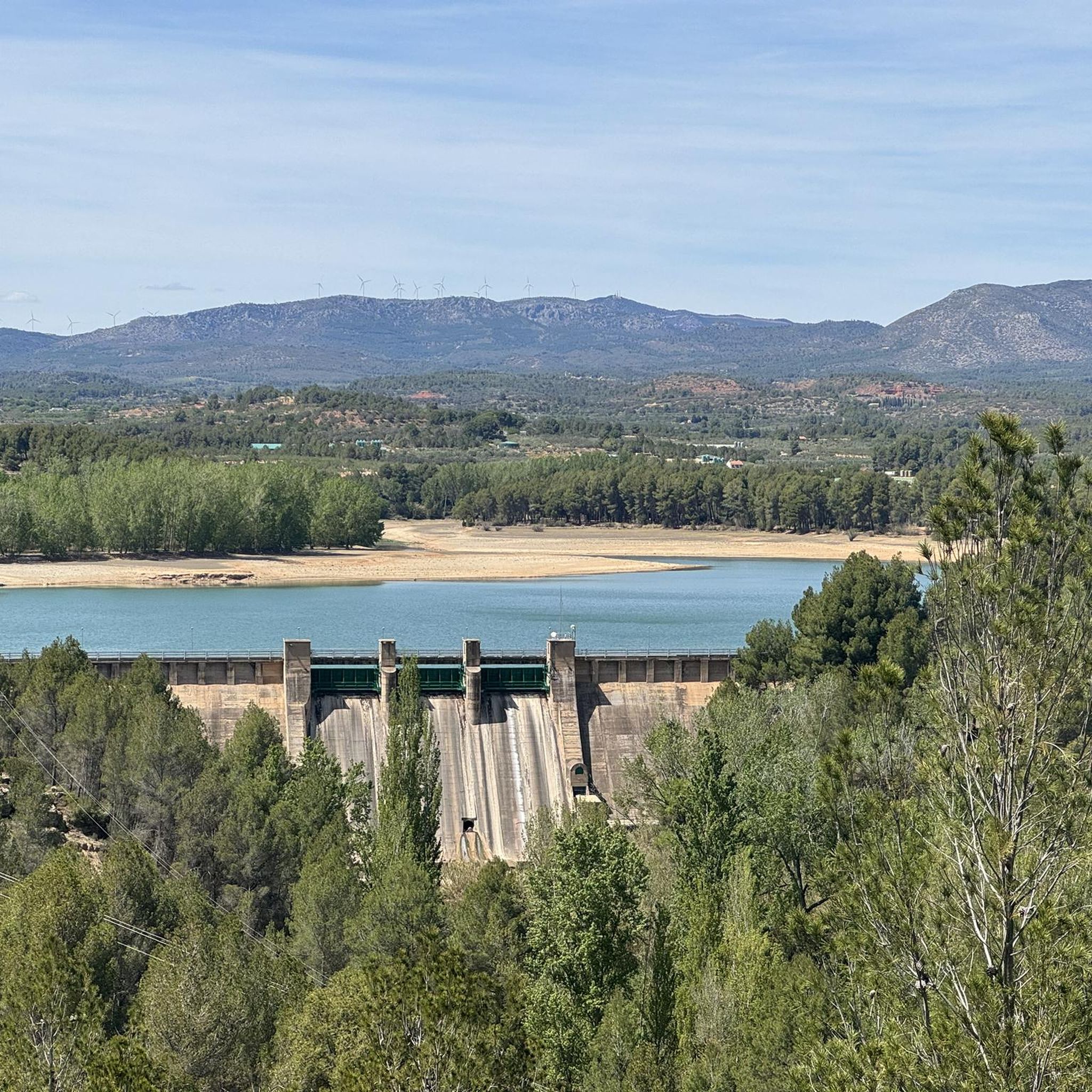
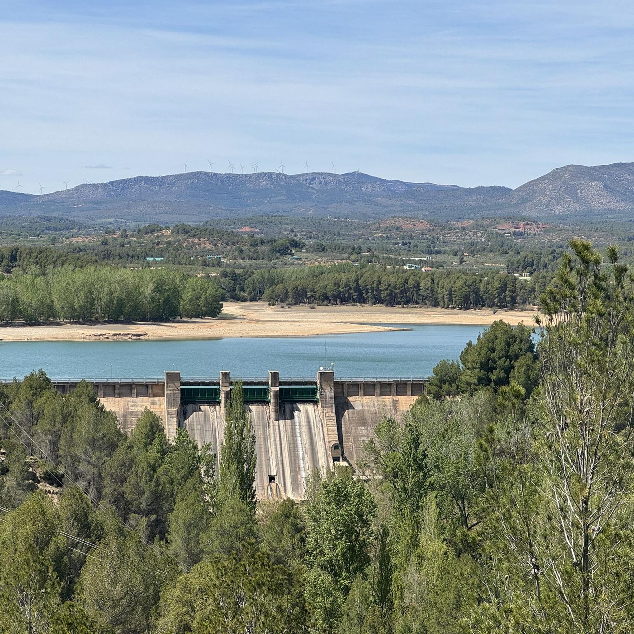
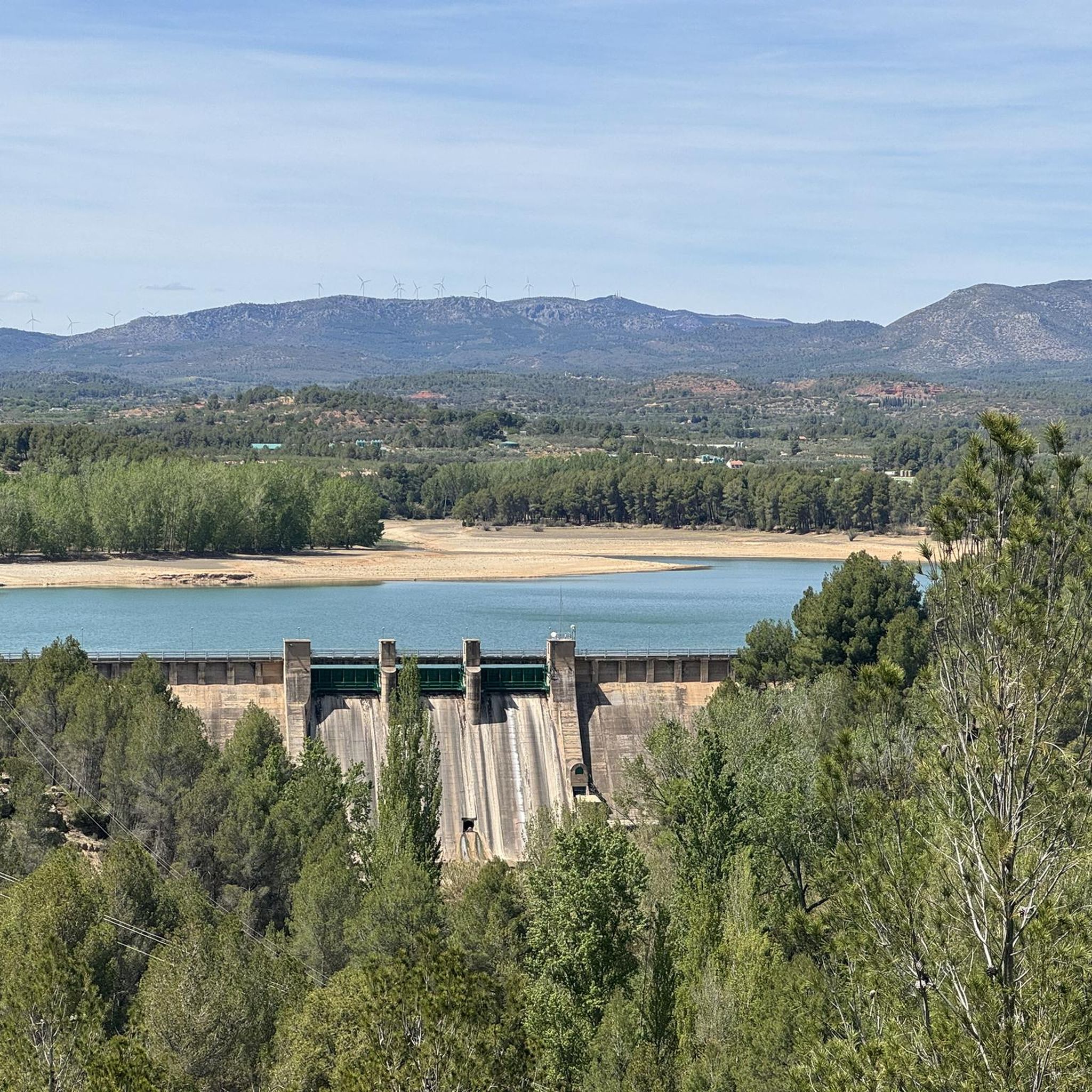
There are several points from which you can access the water. The most recommended is just past Puebla de Arenoso, the town that gives its name to the reservoir, not Montanejos.
0
0
There is a charge for admission during peak months (summer), and there is also a charge for parking. Check the municipal website for rates.
1
0
In this historic place, in 1237, King James I donated the image of the Virgin of Health to the town of Alcublas, which he carried with him on his horse.
0
0
The road is in perfect condition, 8 meters wide, with vertical signs. Light traffic, although on weekends it is heavily used by bikers until Alcublas. From this point on, traffic is light, and after Sacañet, it is practically nonexistent. There may be snow restrictions in winter from Sacañet onwards. From Sacañet onwards, the last 4.2 km are the toughest, with a gradient of 250 meters at an average of 6%, and with sections that reach 12%. The most interesting aspect is being able to link the three mountain passes starting from Lliria (Port d'Alcublas, Alto de la Cruz del Collado, and finally Puerto de La Bellida) for a total of almost 30 km and 1,400 m+. You can also climb up a dirt track (quite broken, difficult with a skinny one, even if it's gravel) to Col de La Bellida and the geodetic vertex, along the path that branches off to the left after passing the mountain pass (another 2 km at 3% but with ramps that go up to 15%).
0
0
Frequently Asked Questions
What kind of terrain can I expect on road cycling routes around Jérica?
Road cycling routes around Jérica are characterized by mountainous terrain, nestled between the Sierra de la Calderona and Sierra de Espadán ranges. The scenic Palancia River has carved canyons up to 40 meters high, contributing to a varied topography with significant elevation changes. You'll encounter challenging routes with substantial climbs and descents, often on well-paved surfaces.
How many road cycling routes are available in the Jérica area?
There are over 15 road cycling routes available around Jérica on komoot, catering to various fitness levels. These include routes ranging from moderate to difficult, with a strong emphasis on challenging rides due to the region's mountainous landscape.
Are there challenging road cycling routes for experienced cyclists?
Yes, Jérica is well-suited for experienced cyclists seeking a challenge. Many routes feature significant elevation gains. For instance, the Matet Village – View of Gaibiel Castle loop from Jérica - Viver covers 104 km with nearly 2,500m of elevation gain, while the Arcos de las Salinas – Restaurante La Estación loop from Jérica - Viver is even longer at 154 km with over 2,700m of ascent.
What natural attractions can I see along the road cycling routes?
The routes often pass through diverse landscapes. You can enjoy the scenic Palancia River and its canyons, and in spring, the blooming almond, peach, and cherry trees add vibrant colors to the scenery. Some routes may offer views of the nearby Sierra Calderona and Sierra de Espadán mountain ranges. You might also encounter natural highlights such as the Bride's Leap Waterfall or the Tío Juan Waterfall.
Are there any historical landmarks or points of interest to explore?
Yes, Jérica itself is rich in history. The town features rustic architecture and historical heritage, including the Mudejar Tower of las Campanas (Bell Tower) and the ruins of the Castle. Some routes, like the Historic center of Jérica – Torralba del Pinar loop from Jérica - Viver, will take you through the historic center, allowing you to appreciate these sights.
What is the best time of year for road cycling in Jérica?
The region's temperate climate makes it suitable for cycling for much of the year. Spring is particularly beautiful with blooming almond, peach, and cherry trees, while autumn offers rich reds, yellows, and browns in the landscape. Summers can be warm, but early mornings or late afternoons can still be pleasant. Always check local weather forecasts before heading out.
Are there any circular road cycling routes around Jérica?
Yes, many of the road cycling routes around Jérica are designed as loops, allowing you to start and end in the same location. Examples include the Montanejos – Arenos Reservoir loop from Jérica - Viver and the Historic center of Jérica – Jérica loop from Jérica - Viver, providing convenient options for your ride.
What do other road cyclists say about the routes in Jérica?
The road cycling routes in Jérica are highly rated by the komoot community, with an average score of 4.9 stars from over 20 reviews. Cyclists often praise the varied terrain, the challenging climbs, and the beautiful natural scenery, particularly the views of the Palancia River canyons and the surrounding mountain ranges.
Is Jérica accessible by public transport for cyclists?
Jérica is accessible by train, making it possible to reach the area without a car. This provides a convenient option for cyclists who prefer to use public transport to get to the starting points of their routes.
Are there any routes that pass by reservoirs or water bodies?
Yes, some routes incorporate water bodies into their scenic paths. For example, the Montanejos – Arenos Reservoir loop from Jérica - Viver passes by the Arenos Reservoir, offering picturesque views and a refreshing change of scenery during your ride.
Can I find viewpoints with panoramic views on these routes?
Given Jérica's mountainous setting between the Sierra de la Calderona and Sierra de Espadán, many routes offer panoramic viewpoints of the Valencian countryside. The significant elevation gains on routes often lead to rewarding vistas, allowing you to take in the diverse landscapes from above.
Most popular attractions around Jérica

Get inspired with the komoot mobile app


Explore more
Browse the best Road cycling routes in other regions.
