The best walks and hikes around Botorrita
4.3
(30)
167
hikers
26
hikes
Hiking around Botorrita offers diverse landscapes characterized by several ravines, including Barranco Vicario and Barranco Rojo, which create varied terrain. The River Huerva flows through the area, contributing to the natural beauty. Hikers can also explore agricultural fields and the slopes of Cabezo de Santa Bárbara, which features the natural site of "La Hiedra." The region provides a range of hiking experiences across these natural features.
Best hiking trails around Botorrita
- The most popular hiking route is Muel Waterfalls and…
Last updated: October 5, 2026
4.5
(11)
34
hikers
11.1km
03:07
210m
210m
Moderate hike. Good fitness required. Easily-accessible paths. Suitable for all skill levels.
22.1km
06:08
410m
410m
This difficult 13.7-mile hike near María de Huerva explores a historic castle, a serene lake, and a mountain pass with 1341 feet of gain.

3.5
(2)
8
hikers
13.1km
03:23
70m
70m
Moderate hike. Good fitness required. Easily-accessible paths. Suitable for all skill levels.
4
hikers
15.1km
04:19
350m
350m
Moderate hike. Good fitness required. Mostly accessible paths. Sure-footedness required.
5
hikers
7.67km
02:03
80m
80m
Moderate hike. Good fitness required. Easily-accessible paths. Suitable for all skill levels.
Get access to more routes and recommendations from other explorers.
Already have an account?
Our route recommendations are based on thousands of hikes, rides, and runs completed by other people on komoot.
Start today with a free account
Your next adventure awaits.
Tips from the Community

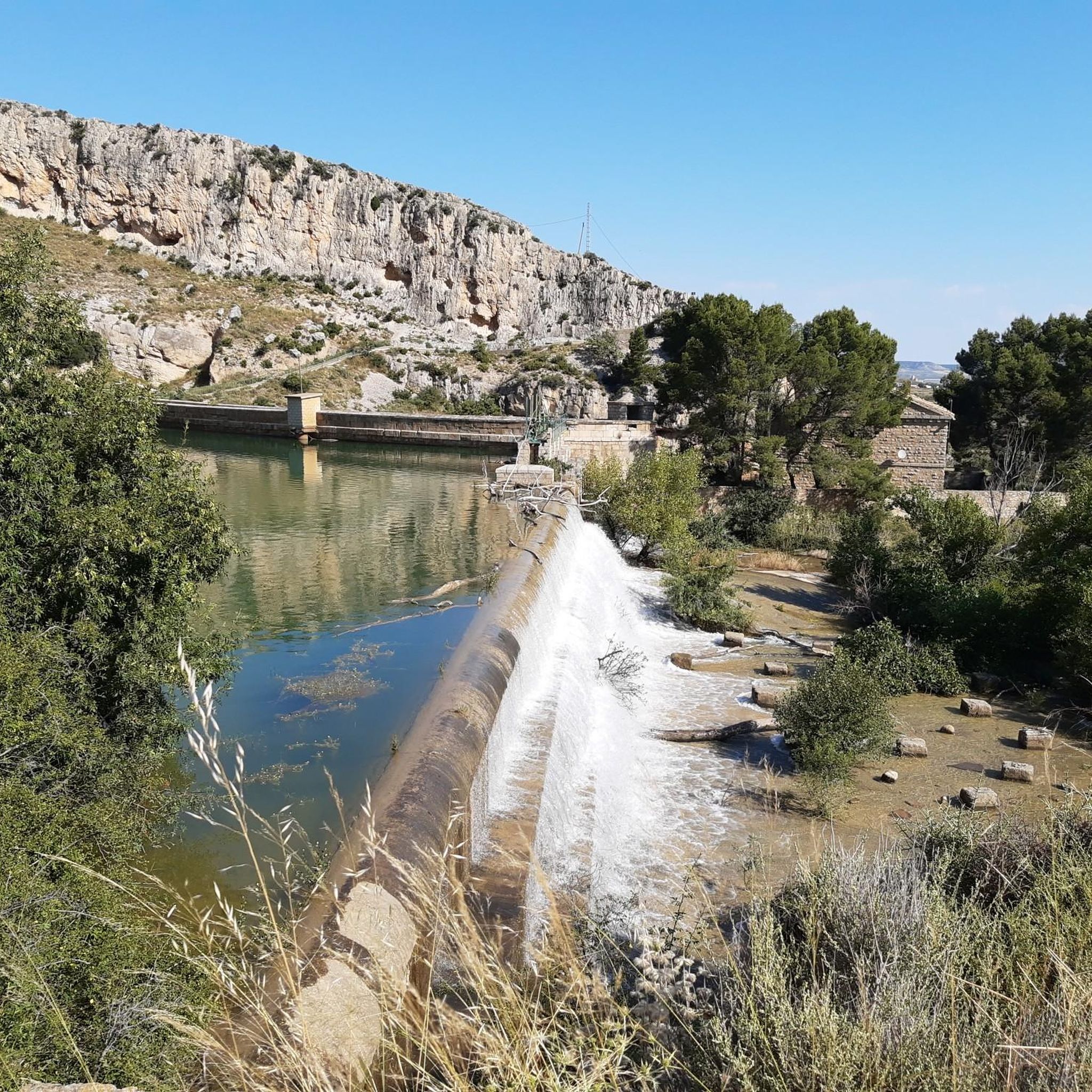
Incredible, depending on the season the flow can vary greatly. We were lucky enough to pass through when there was a lot of water, it's impressive!
1
0

Enjoy the hot days near the Muel waterfall
0
0

The Sillón Pass is a mountain pass located near María de Huerva, Aragon, Spain. It is part of several hiking and mountaineering routes that pass through natural sites such as the María de Huerva Castle, the Cabezo del Sillón, and the Sillón Ridge. These routes are ideal for experienced hikers, as some are considered advanced.
1
0

A very pleasant place to stop while cycling. There's a drinking fountain and a snack bar in the park.
0
0
The Collado del Sillón in María de Huerva is a very interesting hiking trail that offers spectacular views and an enriching experience. From the summit, you can enjoy panoramic views of Moncayo and the Pyrenees.
3
0
The Balsa de Corralé in María de Huerva is a charming place to enjoy nature. It's a water reservoir, ideal for peaceful walks and birdwatching. A hiking trail of approximately 7 kilometers runs through the Morera ravine and the Balsa Trail.
3
0
The Castle of María de Huerva, also known as the Atalaya, is a monument of Muslim origin located in the municipality of María de Huerva, in the province of Zaragoza. Built during the 10th century, Abderramán III quartered part of his troops in this castle to attack Zaragoza. The castle is located on a promontory, away from the town and on the other side of the Huerva River. Remains of an oval enclosure with a major axis of about 50 metres have been preserved, presided over by a half-ruined adobe tower.
4
0
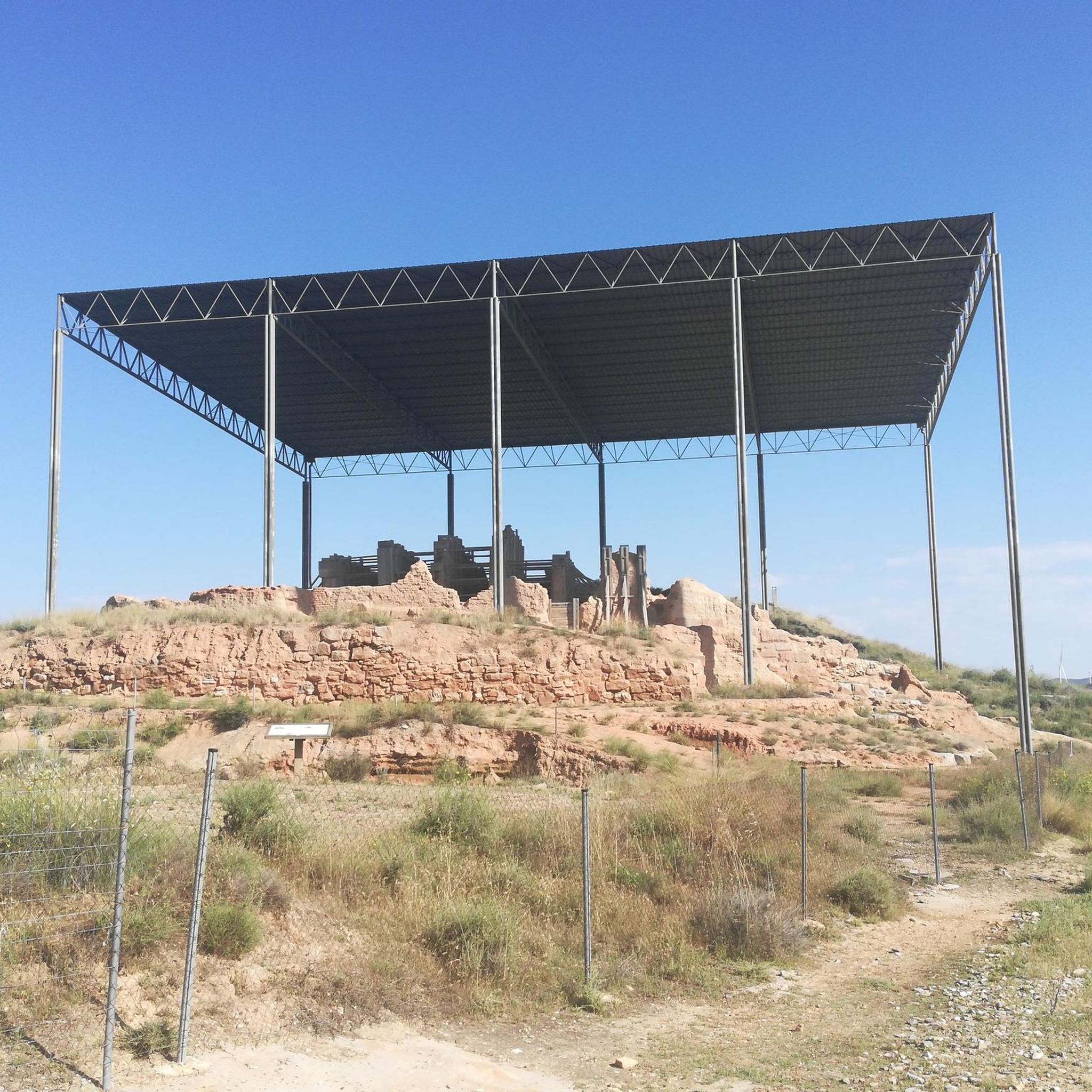
The Cabezo San Borombón is a place of great interest in the town of Muel. Next Sunday, July 14, 2024, the 12th edition of the Trail Muel: Cabezo de San Borombón will be held in Muel. In summary, Cabezo San Borombón and its surroundings offer a unique combination of nature, history and sport. An experience worth living! 🏃♂️🏞️🌟
3
0
Frequently Asked Questions
How many hiking trails are available around Botorrita, and what are their difficulty levels?
Botorrita offers a good selection of hiking trails, with over 25 routes to explore. The trails cater to various fitness levels, including 5 easy routes, 19 moderate routes, and 2 more challenging difficult routes, ensuring there's something for everyone.
Are there any trails that feature waterfalls or significant natural landmarks?
Yes, the region is known for its natural beauty. You can find trails that lead to the fascinating "La Hiedra" site on the slopes of Cabezo de Santa Bárbara, featuring a cave and lush ivy. For a route specifically featuring waterfalls, consider the Muel Waterfalls – Roman Dam of Muel loop from Arañales de Muel. This trail also passes by the Muel Waterfalls and the historic Roman Dam of Muel.
Are there any family-friendly hiking options in Botorrita?
Yes, Botorrita has several easy trails suitable for families. For a gentle outing, the Muel Waterfall – Muel Waterfalls loop from Arañales de Muel is an easy 5.4 km (3.3 miles) route that takes about 1 hour 25 minutes, perfect for a family walk.
What historical or cultural sites can be explored while hiking in Botorrita?
For those interested in history, the ancient Celtiberian archaeological site of Contrebia Belaisca is a significant landmark in Botorrita. While not directly on a komoot route in this guide, its strategic location between the River Huerva and Barranco Vicario makes it an interesting point of exploration in the area. Additionally, some routes pass by historical structures like the Roman Dam of Muel.
Are there any circular hiking routes available in the Botorrita area?
Yes, many routes in the area are circular, offering varied scenery without retracing your steps. A popular moderate circular option is the Muel Waterfalls and San Borombón Hill - circular from Muel, which covers 11.1 km (6.9 miles) and takes around 3 hours.
What kind of terrain can I expect on Botorrita's hiking trails?
The terrain around Botorrita is quite diverse. You can expect to traverse several ravines, such as Barranco Vicario and Barranco Rojo, which create interesting and varied landscapes. The River Huerva also flows through the area, offering riverside sections. Additionally, many routes feature open agricultural fields, particularly cereal fields, providing wide vistas.
What do other hikers enjoy the most about hiking in Botorrita?
The hiking trails around Botorrita are highly rated by the komoot community, with an average score of 4.4 stars from over 20 reviews. Hikers often praise the varied terrain, the natural beauty of the ravines and the River Huerva, and the opportunity to explore both natural and historical sites.
Are there any challenging hikes for experienced hikers?
Yes, for experienced hikers looking for a challenge, there are difficult routes available. The María de Huerva and Collado Sillón Loop is a difficult 22.1 km (13.7 miles) path that traverses varied terrain, including agricultural fields and sections near the River Huerva, offering a substantial day out.
What is the best time of year to go hiking in Botorrita?
The best time to hike in Botorrita is generally during spring and autumn when temperatures are milder. Spring offers the added beauty of green agricultural fields, while autumn provides pleasant weather for longer excursions. Summers can be hot, so early mornings or late afternoons are recommended if hiking during this season.
Are dogs allowed on the hiking trails in Botorrita?
While specific regulations for each trail may vary, generally, dogs are welcome on most hiking trails in the Botorrita region. It's always advisable to keep dogs on a leash, especially in areas with wildlife or near agricultural land, and to carry water for them, particularly on longer routes.
Are there any viewpoints or scenic spots along the trails?
Yes, the diverse landscape offers several scenic spots. The slopes of Cabezo de Santa Bárbara provide elevated views, and the agricultural fields offer open vistas. You might also find viewpoints like Mirador de las Planas, which offers panoramic views of the surrounding area.
Most popular attractions around Botorrita

Get inspired with the komoot mobile app


Explore more
Browse the best Hikes in other regions.
