The best road cycling routes around Verchain-Maugré
4.4
(162)
3,247
riders
353
rides
Road cycling routes around Verchain-Maugré traverse a landscape characterized by gentle rolling terrain, agricultural fields, and waterways such as the Rhonelle river and local canals. The region offers a mix of open stretches and routes that pass through small villages and historical sites like the ramparts of Le Quesnoy. Elevation changes are generally moderate, making it suitable for various fitness levels.
Best road cycling routes around Verchain-Maugré
- The most popular road cycling route is View of the Rhonelle at Artres…
Last updated: May 21, 2026
4.7
(6)
42
riders
39.3km
01:39
270m
270m
Easy road ride. Great for any fitness level. Mostly well-paved surfaces and easy to ride.
5.0
(1)
52
riders
75.4km
03:00
370m
370m
Moderate road ride. Good fitness required. Mostly well-paved surfaces and easy to ride.

Sign up for free
12
riders
42.9km
01:52
270m
270m
Easy road ride. Great for any fitness level. Mostly well-paved surfaces and easy to ride.
13
riders
55.9km
02:16
170m
170m
Moderate road ride. Good fitness required. Mostly well-paved surfaces and easy to ride.
19
riders
50.5km
02:01
220m
220m
Moderate road ride. Good fitness required. Mostly well-paved surfaces and easy to ride.
Get access to more routes and recommendations from other explorers.
Sign up for free
Already have an account?
Our route recommendations are based on thousands of hikes, rides, and runs completed by other people on komoot.
Start today with a free account
Your next adventure awaits.
Login or Signup



Tips from the Community

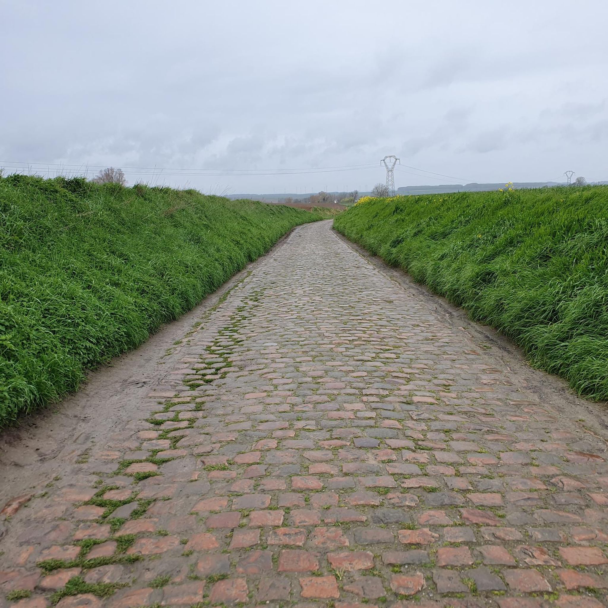
You can step on the gas again when you come from the asphalt road after Trouee Arenberg 170 km 30 lanes
1
0

Lovely spot, named after Gilbert-Duclos Lassalle (2-time winner). Official name is pavé de Wallers à Hélesmes but everyone seems to have forgotten that.... The beginning of the strip (up to the bridges) is in good condition, the 2nd part slowly gets worse and therefore heavier in the legs. Still a long way from here!
2
0

Historic site of the ramparts, built by Vauban
0
0

The ramparts, built in the Spanish period, were modified by the famous Vauban himself. We can still admire the towers surrounding the city since the seventeenth century, as well as many other monuments: the tower of the Edifieur Baudoin, one of the oldest of all, Caesar Bastion built under Louis XIV the Green stronghold and the headquarters hospital, or the Fauroeulx door, the only one that did not suffer the Second World War and its demolition. The current castle, the Cernay, was built in the seventeenth century, replacing the twelfth century built by Baldwin IV of Hainaut. You can still see some remains of the original castle that served as a residence to Charles the Bold, as a gateway and a set of Romanesque cellars.
0
0

A pleasant view of the Rhonelle
0
0
superb fresco on Paris Roubaix
0
0


The Carrière des Peupliers in Abscon is a former chalk and marl quarry used to produce lime for the USINOR factory in Denain. These industrial activities have significantly changed the landscape of the Denaisis plain. After the end of the industrial activities, the land was transferred to the Nord department. Today, the area is an interesting place for nature lovers and offers a unique insight into the industrial history of the region.
1
0
Frequently Asked Questions
How many road cycling routes are available around Verchain-Maugré?
There are over 350 road cycling routes in the Verchain-Maugré area, offering a wide variety of options for different skill levels and preferences.
What is the best time of year for road biking in Verchain-Maugré?
The best time for road biking in Verchain-Maugré is typically from spring to early autumn (April to October), when the weather is mild and the agricultural landscapes are at their most vibrant. Summer months offer longer daylight hours, while spring and autumn provide cooler temperatures ideal for longer rides.
Are there easy road bike trails around Verchain-Maugré suitable for beginners or families?
Yes, Verchain-Maugré offers over 120 easy road cycling routes. These routes often feature gentle rolling terrain and are suitable for beginners or families looking for a relaxed ride. An example is the View of the Rhonelle at Artres – Haspres loop from Saulzoir, which is 24.4 miles long with moderate elevation.
Are there more challenging road cycling routes for experienced riders in Verchain-Maugré?
While the region is characterized by gentle terrain, there are a few more challenging routes available for experienced riders, with slightly higher elevations and longer distances. The area primarily offers moderate routes, but some can be combined for extended challenges.
What kind of distances and elevations can I expect on road bike routes around Verchain-Maugré?
Road cycling routes around Verchain-Maugré generally feature moderate elevation changes. Distances vary significantly, from shorter loops suitable for a quick ride to longer routes exceeding 30 miles. For instance, the Canal bridge – Bassin Rond loop from Haspres is 34.6 miles long with approximately 268 meters of ascent.
Are there circular road bike routes in Verchain-Maugré?
Many of the road cycling routes in Verchain-Maugré are designed as circular loops, allowing you to start and finish at the same point. This is convenient for exploring the region without needing to retrace your steps. An example is the Ramparts of Le Quesnoy – Ghissignies Waterfall loop from Verchain-Maugré.
What can I see along the road cycling routes around Verchain-Maugré?
The routes often pass through agricultural fields, alongside waterways like the Rhonelle river and local canals, and connect small villages. You might encounter historical sites such as the ramparts of Le Quesnoy, or natural features like the Ghissignies Waterfall. Notable attractions include the Valenciennes Town Hall and the Vineyard Pond.
Are there road bike trails in Verchain-Maugré that pass by cafes or pubs?
Yes, many routes in Verchain-Maugré connect small villages, offering opportunities to stop at local cafes or pubs for refreshments. Planning your route through these villages can provide pleasant breaks during your ride.
Is parking available for road cyclists in Verchain-Maugré?
Parking is generally available in Verchain-Maugré and the surrounding villages, often near public spaces or village centers, making it convenient to start your road cycling adventure.
What do other road cyclists enjoy most about road cycling in Verchain-Maugré?
The area is highly rated by the komoot community, with an average score of 4.5 stars from over 160 reviews. Reviewers often praise the peaceful agricultural landscapes, the gentle rolling terrain suitable for various fitness levels, and the charming villages connected by the routes.
Are there any routes that feature waterfalls?
Yes, the Haspres – Ghissignies Waterfall loop from Haspres is a 31.1-mile route that specifically leads through rolling countryside and includes the Ghissignies Waterfall.
Most popular routes around Verchain-Maugré
Most popular attractions around Verchain-Maugré

Get inspired with the komoot mobile app


Explore more
Browse the best Road cycling routes in other regions.
