The best cycling routes around Mœuvres
4.4
(29)
267
riders
94
rides
Touring cycling around Mœuvres, a commune in the Pas-de-Calais department, features a landscape characterized by gentle elevation changes and open agricultural fields. The region's terrain ranges from 53m to 96m in altitude, making it suitable for accessible cycling. Routes often connect small towns and villages, with some paths following historical canals. This area provides a network of routes for touring cyclists seeking a relaxed experience in northern France.
Best touring cycling routes around Mœuvres
- The most popular touring cycling route is Beaumetz Cross Roads Cemetery – Chemin du Canal loop from Quéant, a 31.5 miles (50.7 km) trail that takes 3 hours 51 minutes to complete, featuring moderate climbs and canal-side sections.
- Another top favourite among local touring cyclists is Chemin du Canal – Hermies Hill British Cemetery loop from Quéant, a moderate 20.8 miles (33.5 km) path. This route offers a mix of open countryside and historical landmarks.
- Local touring cyclists also love the Beaumetz Cross Roads Cemetery – Hermies Hill British Cemetery loop from Doignies, a 23.7 miles (38.2 km) trail leading through rural landscapes and past historical sites, often completed in about 2 hours 42 minutes.
- Touring cycling around Mœuvres is defined by open fields, quiet country roads, and historical points of interest. The network offers options for easy, moderate, and difficult routes, catering to various skill levels.
- The routes in Mœuvres are highly rated by the komoot community with an average score of 4.4 stars from over 28 reviews. More than 240 touring cyclists have used komoot to explore Mœuvres's varied terrain.
Last updated: July 29, 2026
11
riders
Moderate bike ride. Good fitness required. Mostly paved surfaces. Suitable for all skill levels.
9
riders
Hard bike ride. Good fitness required. You may need to push your bike for some segments of this route.

Sign up for free
9
riders
47.1km
03:41
320m
320m
Hard bike ride. Good fitness required. You may need to push your bike for some segments of this route.
3.0
(4)
8
riders
54.7km
03:38
170m
170m
Hard bike ride. Good fitness required. You may need to push your bike for some segments of this route.
5
riders
40.6km
02:29
270m
270m
Moderate bike ride. Good fitness required. Mostly paved surfaces. Suitable for all skill levels.
Get access to more routes and recommendations from other explorers.
Sign up for free
Already have an account?
Our route recommendations are based on thousands of hikes, rides, and runs completed by other people on komoot.
Start today with a free account
Your next adventure awaits.
Login or Signup




Tips from the Community

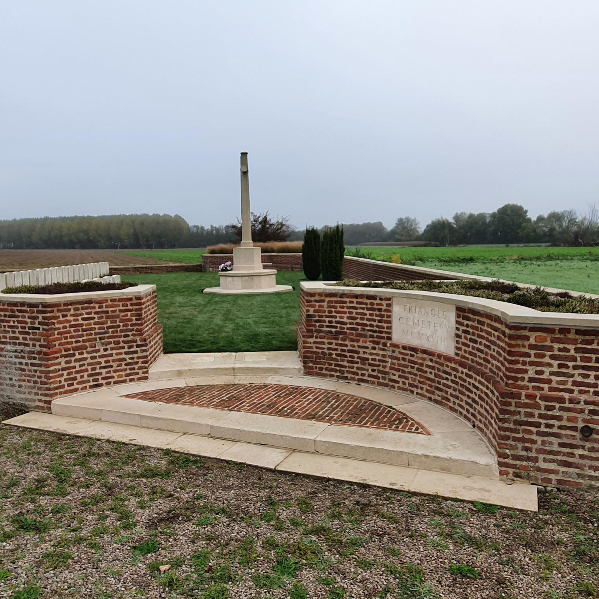
This cemetery contains the graves of 209 British soldiers and 5 New Zealanders, who fell during the fighting from March 1917 to September 1918.
0
0

The British cemetery of Sains-les-Marquion contains the graves of 255 soldiers who died during the First World War, mainly Canadians who liberated the village from German occupation in September 1918. You can admire the architecture of the cemetery, designed by W C Von Berg, and pay tribute to fallen heroes.
3
0

Sailly-en-Ostrevent is a French commune located in the Hauts-de-France region. A point of interest in Sailly-en-Ostrevent is the church of St. Albin, which, together with a large part of the village, was rebuilt after the First World War. A more special attraction is the special location Cromlech "Les sept bonnettes" with remains of the megalithic era.
4
0
The image is really small. We had to search after driving past it for the first time.
6
0
Small statue of Menhir Bouteroue by Palluel near the roundabout. The Sensée valley is known for its mysterious menhirs and dolmens: stones from Lécluse or Aubigny-au-Bac, large boulder from Oisy-le-Verger, ... Most monoliths testify to a primitive religion. Now legends are resurfacing, tongues are wagging and myths still have bright days ahead.
6
0
Arleux is a commune in the north of France, between Douai and Cambrai, in the heart of the Sensée valley. It is a green oasis and a true haven of peace with vast ponds, swamps as far as the eye can see, rivers and canals that delight nature lovers with their exceptional biodiversity. The municipal pond of Arleux is a popular spot for fishermen, where pontoons have been installed for people with reduced mobility. There are many coarse fish such as roach, bream, tench, carp, eel, bleak and gudgeon, but also predatory fish such as pike, zander and perch.
5
0
Arleux is a commune in the north of France, between Douai and Cambrai, in the heart of the Sensée valley. It is a green oasis and a true haven of peace with vast ponds, swamps as far as the eye can see, rivers and canals that delight nature lovers with their exceptional biodiversity. The municipal pond of Arleux is a popular place for fishermen, where pontoons have been installed for people with reduced mobility. There are many white fish such as roach, bream, tench, carp, eel, eel and goby, but also predatory fish such as pike, pike-perch and perch.
3
0

Super rolling gravel path, ideal for Gravel.
1
0
Frequently Asked Questions
What kind of terrain can I expect when touring cycling around Mœuvres?
The terrain around Mœuvres is characterized by gentle elevation changes and open agricultural fields. Altitudes range from 53m to 96m, making it suitable for accessible cycling. You'll find quiet country roads and some paths that follow historical canals, offering a relaxed touring experience.
How many touring cycling routes are available in the Mœuvres area?
There are over 80 touring cycling routes available around Mœuvres on komoot. These routes cater to various skill levels, including easy, moderate, and difficult options.
Are there any easy touring cycling routes suitable for beginners or families?
Yes, Mœuvres offers 33 easy touring cycling routes. These paths are generally flat and traverse open agricultural fields, connecting small towns and villages, making them suitable for a relaxed ride. While specific family-friendly routes aren't detailed, the easy routes are a good starting point.
What are some of the longer touring cycling routes in the Mœuvres region?
For longer rides, consider routes like the Canal du Nord – Lock No 4 – The Little Sensée loop from Doignies, which is about 33.5 miles (53.9 km) long. Another option is the Beaumetz Cross Roads Cemetery – Chemin du Canal loop from Quéant, covering 31.5 miles (50.7 km).
Are there any challenging touring cycling routes for experienced cyclists?
Yes, there are 11 difficult touring cycling routes around Mœuvres. These routes may feature longer distances or more significant elevation gains compared to the moderate options. An example is the Chemin du Canal – Hermies Hill British Cemetery loop from Boursies, which includes over 320 meters of elevation gain.
What kind of historical sites or landmarks can I see along the touring cycling routes?
The Mœuvres area is rich in historical points of interest. You might encounter sites like the Sains-les-Marquion British Cemetery or The Big Rock. Some routes also pass by canal locks such as Cantimpré Lock and Selles Lock, offering glimpses into the region's past.
What do other touring cyclists say about the routes in Mœuvres?
The touring cycling routes in Mœuvres are highly rated by the komoot community, with an average score of 4.4 stars from over 28 reviews. Cyclists often appreciate the quiet country roads, open fields, and the relaxed atmosphere for touring.
Are there any circular touring cycling routes available?
Many of the touring cycling routes around Mœuvres are designed as loops, allowing you to start and end at the same point. For instance, the Chemin du Canal – Hermies Hill British Cemetery loop from Quéant is a popular circular option.
What is the best time of year to go touring cycling in Mœuvres?
Northern France generally offers pleasant cycling conditions from spring through early autumn (April to October). During these months, the weather is typically milder, and the agricultural landscapes are vibrant. Always check local weather forecasts before heading out.
Is Mœuvres a good destination for touring cyclists looking for a relaxed experience?
Yes, Mœuvres is well-suited for touring cyclists seeking a relaxed experience. The region's gentle topography, network of quiet country roads, and paths along historical canals provide an accessible and enjoyable environment for leisurely rides through northern France.
Are there any specific routes that follow canals?
Yes, some touring cycling routes in the Mœuvres area incorporate sections along historical canals. For example, the Beaumetz Cross Roads Cemetery – Chemin du Canal loop from Quéant features canal-side sections, offering a unique perspective of the local waterways.
Most popular attractions around Mœuvres

Get inspired with the komoot mobile app


Explore more
Browse the best Cycling routes in other regions.
