The best mountain hikes around Bourdeau
4.7
(14)
70
hikers
7
hikes
Mountaineering routes around Bourdeau provide access to the pre-Alpine massifs near Chambéry, characterized by limestone peaks, forested slopes, and scenic mountain passes. The region offers a range of ascents, from challenging summits to routes with significant elevation gain through varied terrain. These routes often feature panoramic views of the surrounding valleys and lakes.
Best mountaineering routes around Bourdeau
- The most popular mountaineering route is Col du Chat (Chat Pass) – Cat's Tooth loop from Bourdeau, a 4.6 miles (7.4…
Last updated: October 1, 2026
4.5
(4)
23
hikers
7.43km
04:00
660m
660m
Hard mountaineering route. Good fitness required. Sure-footedness, sturdy shoes and alpine experience required.
4.0
(2)
19
hikers
6.40km
01:52
180m
170m
Easy mountaineering route. Great for any fitness level. Easily-accessible paths. Suitable for all skill levels.

5.0
(1)
9
hikers
4.51km
01:31
180m
180m
Moderate mountaineering route. Great for any fitness level. Mostly accessible paths. Sure-footedness required.
5.0
(1)
5
hikers
9.32km
02:51
290m
290m
Hard mountaineering route. Good fitness required. Sure-footedness, sturdy shoes and alpine experience required.
4.8
(4)
7
hikers
8.30km
02:28
250m
250m
Moderate mountaineering route. Good fitness required. Easily-accessible paths. Suitable for all skill levels.
Get access to more routes and recommendations from other explorers.
Already have an account?
Our route recommendations are based on thousands of hikes, rides, and runs completed by other people on komoot.
Start today with a free account
Your next adventure awaits.

Tips from the Community

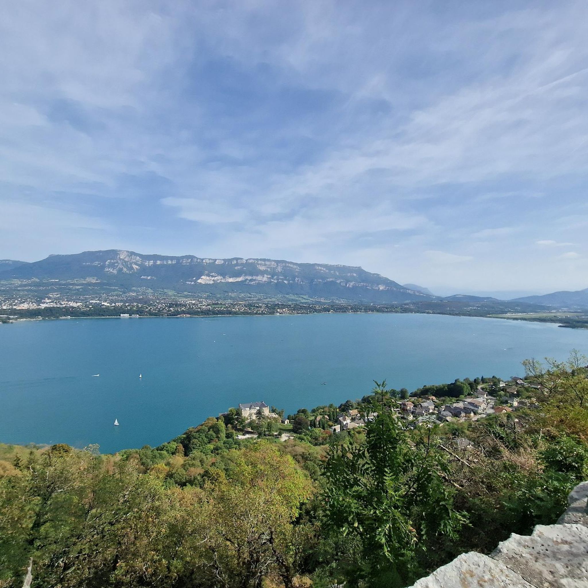
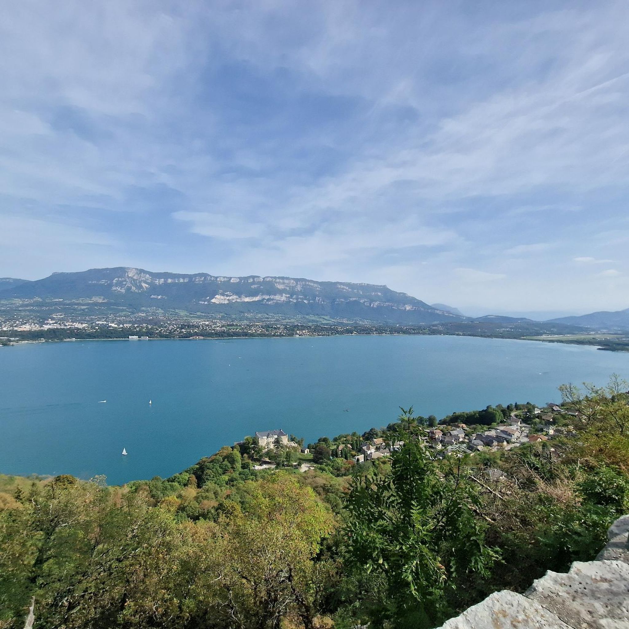
Panoramic view, over the Savoyard pre-Alps, the lake, the Dent du Chat, le Revard, Croix du Nivollet and in clear weather even as far as Mont Blanc! The route does not require any particular physical condition but requires vigilance to place your feet well in order to avoid rocks and roots on the path.
0
0


Avoid taking this path, it is dangerous, very steep and slippery with pebbles.
0
0

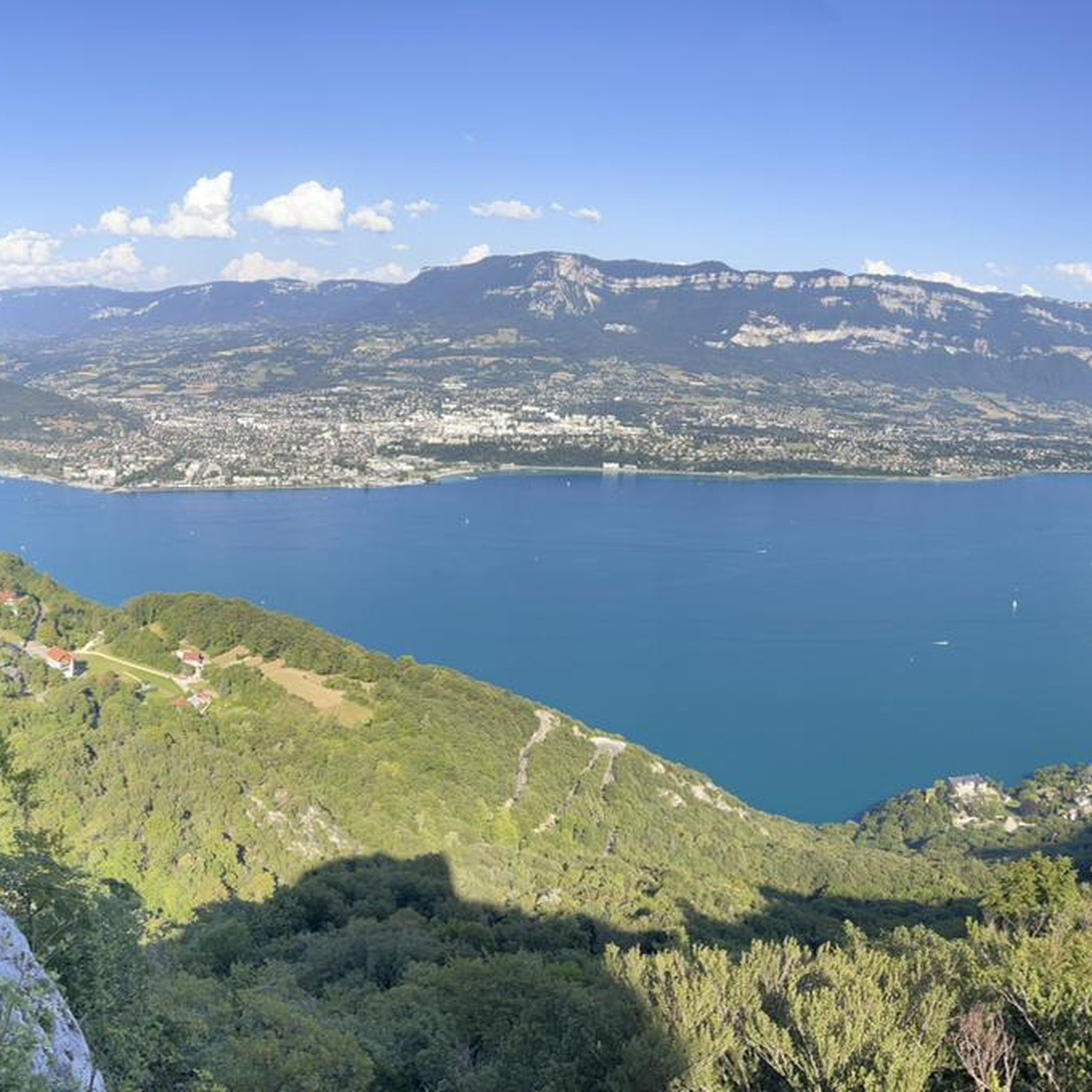
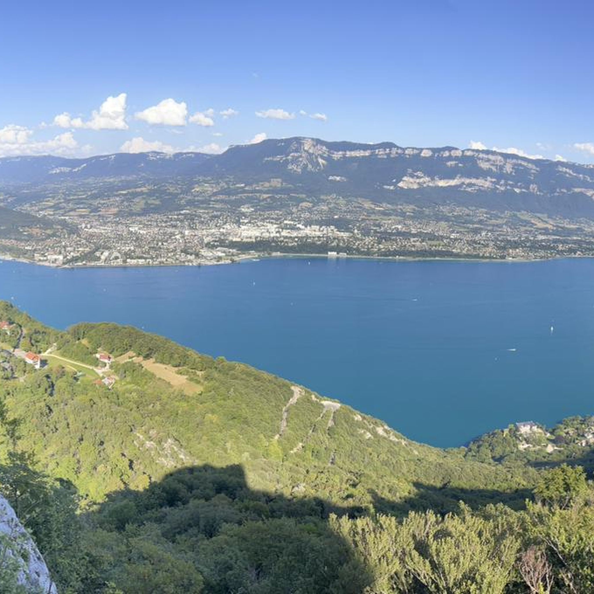
Magnificent view of Chambéry and Lake Bourget A lovely picnic area
0
0

Beautiful view of the lake.
0
0
Beautiful view of the lake.
0
0

Don't forget that even if it's in the mid-mountains, you need to be equipped for the weather, good shoes, and good physical condition.
0
0
Frequently Asked Questions
What kind of terrain can I expect on mountaineering routes near Bourdeau?
The mountaineering routes around Bourdeau primarily traverse pre-Alpine massifs, characterized by limestone peaks, dense forested slopes, and scenic mountain passes. You'll find varied terrain, from challenging ascents to paths through woodlands and open areas, often leading to panoramic viewpoints.
Are there mountaineering routes suitable for beginners around Bourdeau?
Yes, there is at least one easy mountaineering route available. For a more accessible ascent, consider the Mount Kamuniak – Nivolet Cross loop from Chambéry, which offers varied forest and open terrain.
What about more challenging mountaineering options in the Bourdeau area?
For those seeking a challenge, there are 4 difficult routes. A popular choice is the Col du Chat (Chat Pass) – Cat's Tooth loop from Bourdeau, which features significant elevation gain and panoramic views from the pass.
Are there any circular mountaineering routes around Bourdeau?
Yes, many of the mountaineering routes in the area are designed as loops. Examples include the Col du Chat (Chat Pass) – Cat's Tooth loop from Bourdeau and the Le Molard Noir – Molard Noir Viewpoint loop from Mont du Chat.
What are some notable landmarks or viewpoints I can see along these routes?
Many routes offer stunning views and pass by significant landmarks. You can reach the Nivolet Cross, enjoy views from the Mont du Chat lookout (1504 m), or traverse mountain passes like Col du Chat (638 m) and Chambotte Pass. The routes also often provide panoramic views of Lake Bourget.
What do other mountaineers enjoy the most about mountaineering in Bourdeau?
The area is highly rated by the komoot community, with an average score of 4.7 stars from over 10 reviews. Mountaineers often praise the diverse terrain, from challenging climbs to scenic forest paths, and the rewarding panoramic views from the peaks and passes.
Are there any family-friendly mountaineering routes in the Bourdeau region?
While traditional mountaineering can be demanding, routes like the Mount Kamuniak – Nivolet Cross loop from Chambéry are rated as easy, making them more accessible for families with some hiking experience. These paths offer varied terrain without extreme difficulty.
What is the best time of year for mountaineering around Bourdeau?
Given the pre-Alpine nature of the region, late spring through early autumn (May to October) generally offers the most favorable conditions for mountaineering, with less snow and more stable weather. However, always check local weather forecasts and trail conditions before heading out, especially for higher elevations.
Are dogs allowed on the mountaineering trails near Bourdeau?
While specific regulations can vary by trail or protected area, many natural trails in the French Alps region are dog-friendly, often requiring dogs to be on a leash. It's always best to check specific signage at trailheads or local park regulations for the most accurate information regarding pet access.
Are there any permits required for mountaineering near Bourdeau?
Generally, permits are not required for hiking or mountaineering on established trails in this region of the French Alps. However, if you plan to engage in specific climbing activities or enter certain protected natural reserves, it's advisable to check with local authorities or park management for any specific regulations or access requirements.
Where can I find parking or public transport options for these routes?
Many routes, particularly those starting from towns like Chambéry or near popular passes like Col du Chat, will have designated parking areas. For public transport, Chambéry is a well-connected hub, and some trailheads might be accessible via local bus services. It's recommended to check specific route descriptions for detailed trailhead access and parking information.
What should I pack for a mountaineering trip in Bourdeau?
For mountaineering in this pre-Alpine region, essential gear includes sturdy hiking boots, layered clothing suitable for changing mountain weather, rain protection, a map and compass or GPS device, sufficient water and snacks, a first-aid kit, and sun protection. Depending on the season and route difficulty, trekking poles and appropriate safety gear for steeper sections may also be beneficial.
Most popular routes around Bourdeau
Most popular attractions around Bourdeau

Get inspired with the komoot mobile app


Explore more
Browse the best Mountain Hikes & Routes in other regions.
