The best road cycling routes around Chindrieux
4.5
(408)
15,426
riders
10
rides
Road cycling routes around Chindrieux are set in the Savoie department, characterized by its location at the northern end of Lac du Bourget and the foothills of the Montagne de Sapenay. This region offers diverse terrain, from serene lakeside paths along the Savière Canal to challenging climbs like the Col du Chat. The landscape includes the Rhône River, Chautagne marshes, and forested areas, providing varied backdrops for cycling.
Best road cycling routes around Chindrieux
- The most popular road cycling route is Savière Canal – Canal de Savières Road loop from Chindrieux, a 31.6 miles (50.9 km) trail that takes 2 hours 8 minutes to complete. This route offers scenic views along the canal and the Rhône River.
- Another top favourite among local road cyclists is View of Lac du Bourget – Col du Chat loop from Chindrieux, a difficult 53.2 miles (85.6 km) path. This route features significant elevation gain and panoramic views of Lac du Bourget from the Col du Chat.
- Local road cyclists also love the Route de La Chambotte – Chindrieux loop from Chindrieux, a 19.6 miles (31.6 km) trail leading through the Montagne de Sapenay foothills, often completed in about 1 hour 41 minutes.
- Road cycling around Chindrieux is defined by Lac du Bourget, the Savière Canal, and the Montagne de Sapenay. The network offers options for easy, moderate, and difficult ability levels, catering to various cycling preferences.
- The routes in Chindrieux are highly rated by the komoot community with an average score of 4.2 stars from over 30 reviews. More than 1000 road cyclists have used komoot to explore Chindrieux's varied terrain.
Last updated: September 27, 2026
4.2
(10)
721
riders
63.9km
03:42
1,490m
1,490m
Hard road ride. Very good fitness required. Mostly well-paved surfaces and easy to ride.
4.4
(8)
140
riders
50.9km
02:08
330m
330m
Moderate road ride. Good fitness required. Mostly well-paved surfaces and easy to ride.

43
riders
34.1km
01:43
510m
510m
Moderate road ride. Good fitness required. Mostly well-paved surfaces and easy to ride.
13
riders
17.7km
01:14
630m
630m
Moderate road ride. Good fitness required. Mostly well-paved surfaces and easy to ride.
12
riders
24.6km
01:40
810m
810m
Moderate road ride. Good fitness required. Mostly well-paved surfaces and easy to ride.
Get access to more routes and recommendations from other explorers.
Already have an account?
Our route recommendations are based on thousands of hikes, rides, and runs completed by other people on komoot.
Start today with a free account
Your next adventure awaits.

Tips from the Community

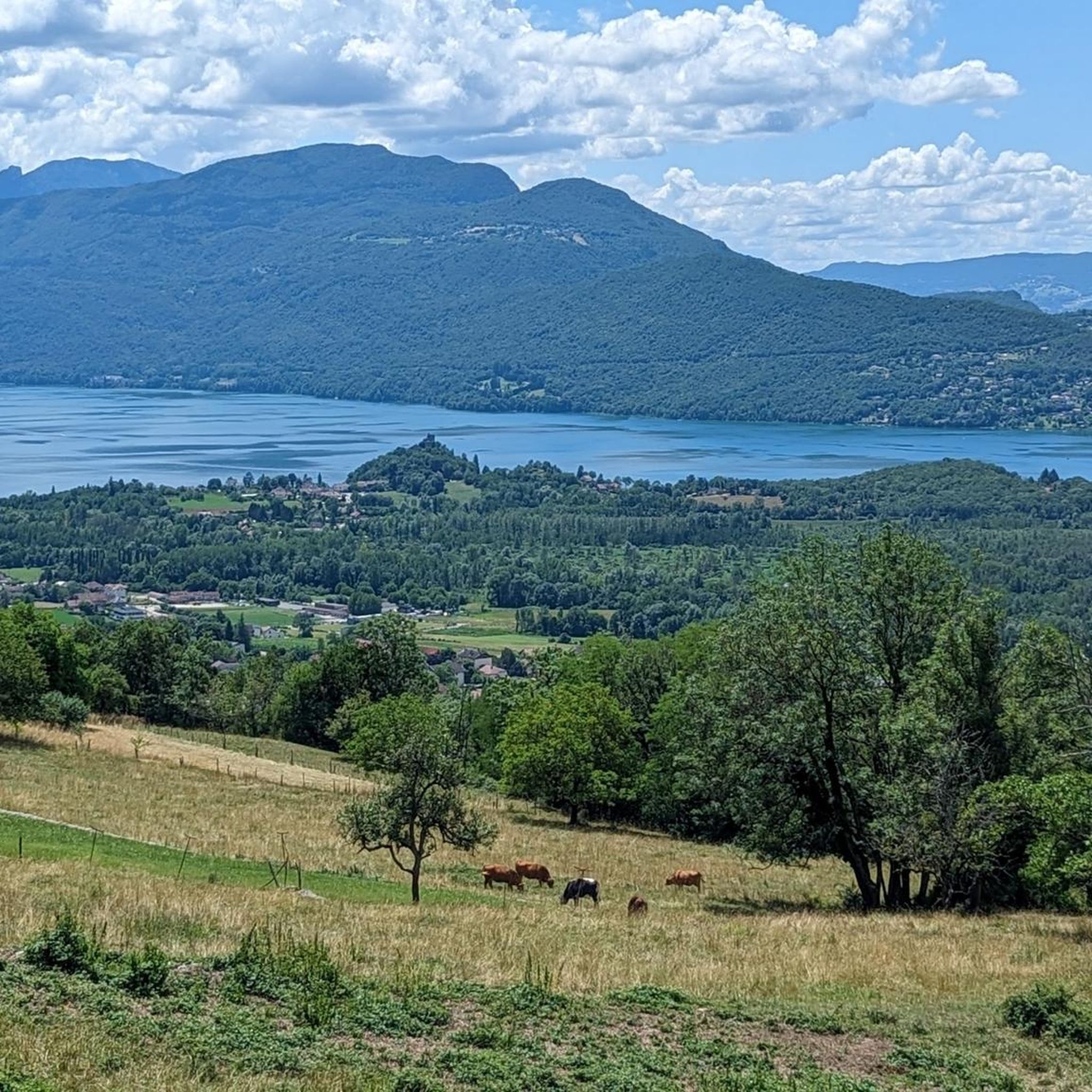
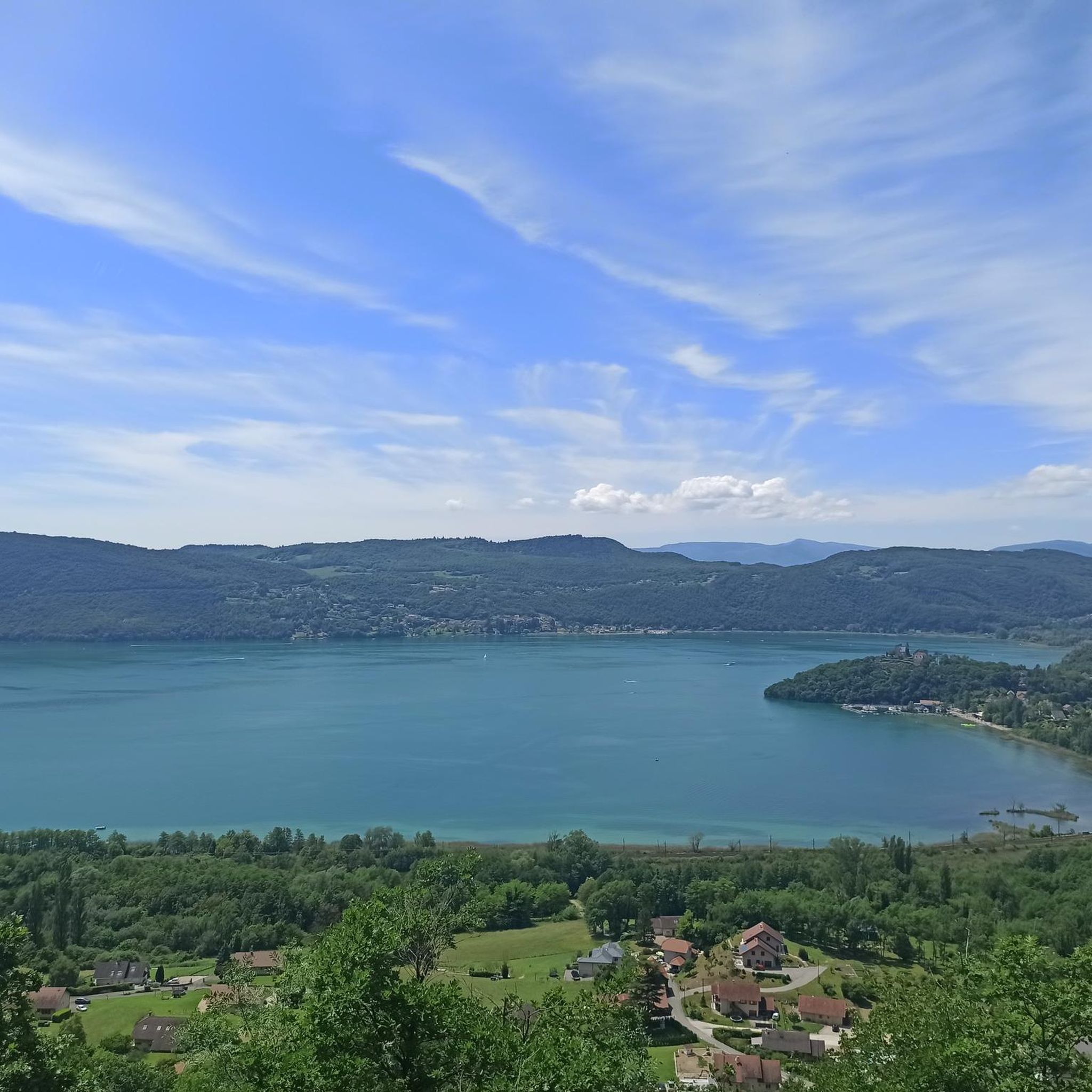
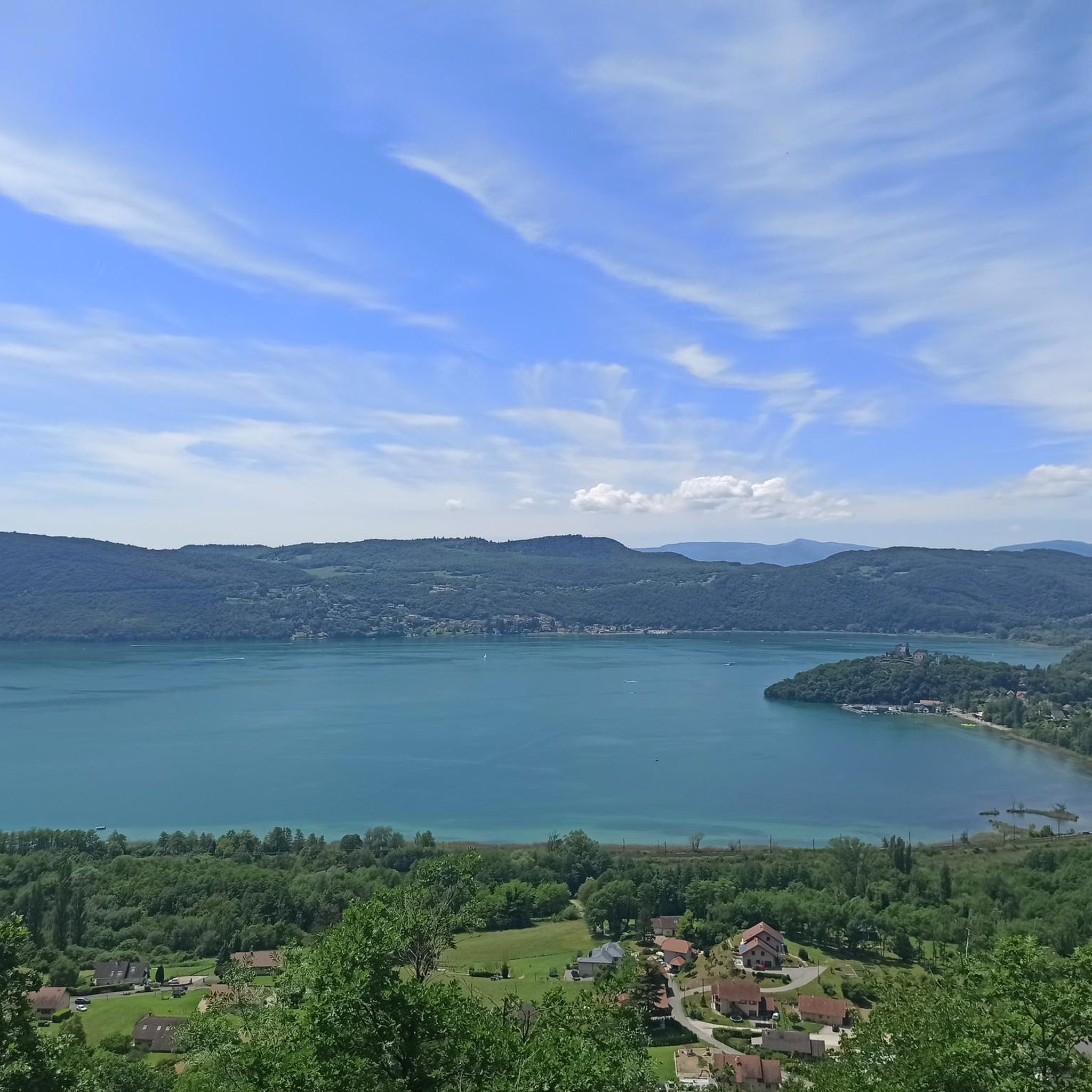
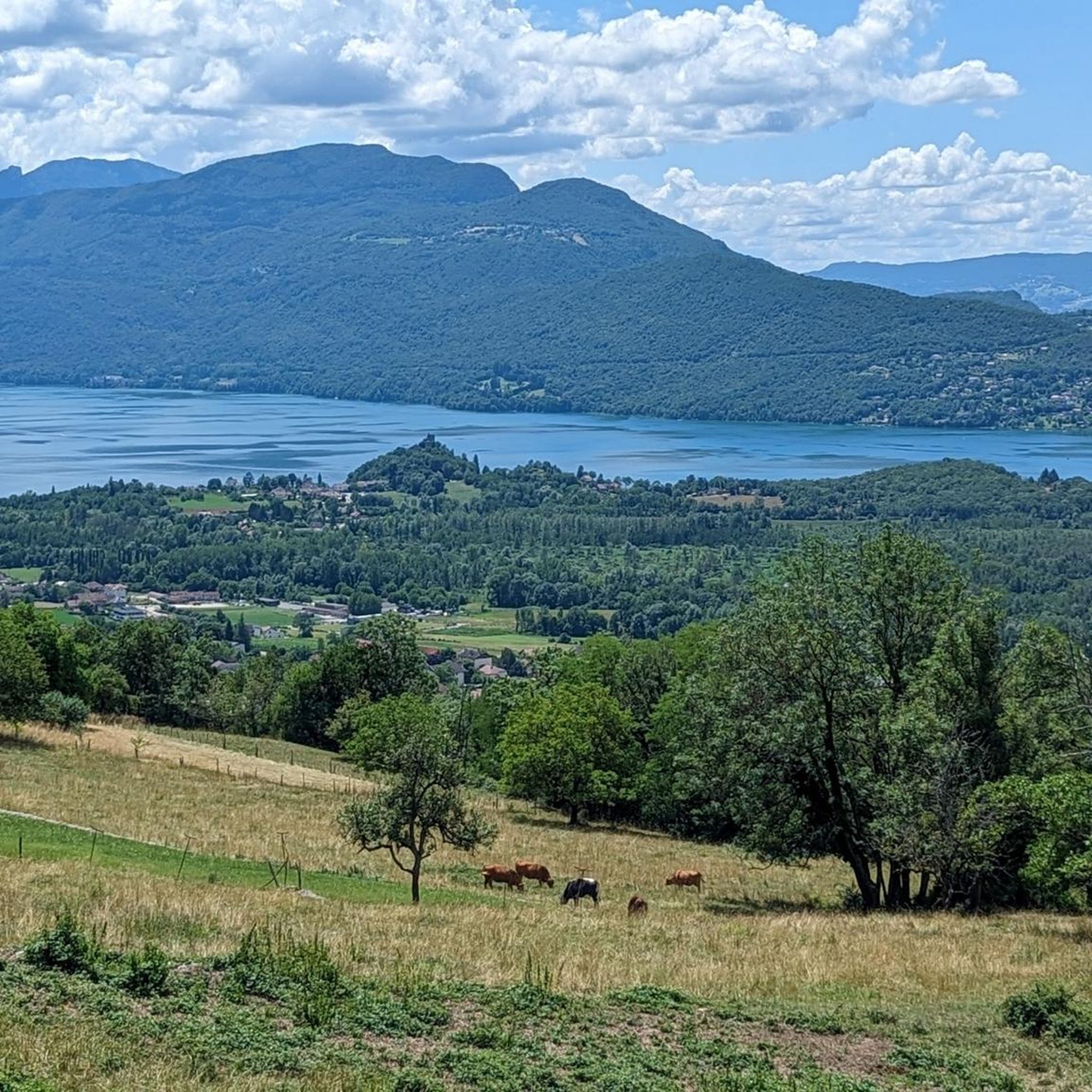
Great pass with very little traffic which allows you to enjoy a panorama in complete tranquility. The viewpoint at the summit offers a beautiful view of the Chautagne and Lake Bourget from the paragliding departure slope (accessible from a path from the parking lot up there) 🪂 Pass accessible 2km from Chindrieux station or 11km from Culoz station 🚃
0
0
Great pass with very little traffic which allows you to enjoy a panorama in complete tranquility. The viewpoint at the summit offers a beautiful view of the Chautagne and Lake Bourget from the paragliding departure slope (accessible from a path from the parking lot up there) 🪂 Pass accessible 2km from Chindrieux station or 11km from Culoz station 🚃
0
0

Peaceful with beautiful scenery
1
0


Sumpa viewpoint
1
0

Great atmosphere in this charming little village.
1
0


The four-kilometer-long canal serves as a natural outlet for the waters of Lake Bourget toward the Rhône, and vice versa when the river is in flood. Over the years, it has been widened, rectified, and cleaned to improve the passage of commercial and passenger ships. In the last century, this was an important trade route.
5
0
Frequently Asked Questions
How many road cycling routes are available around Chindrieux?
There are over 20 road cycling routes around Chindrieux, catering to various skill levels. You'll find options ranging from easy lakeside spins to challenging mountain climbs.
What kind of terrain can I expect on road cycling routes around Chindrieux?
The region offers diverse terrain, from serene lakeside paths along the Savière Canal and the Rhône River to challenging ascents in the foothills of the Montagne de Sapenay. You can expect a mix of flat sections, rolling hills, and significant climbs like the Col du Chat.
Are there road cycling routes suitable for beginners or families in Chindrieux?
Yes, Chindrieux offers several easier road cycling routes. For instance, the Savière Canal – Canal de Savières Road loop from Chindrieux is a moderate route that offers scenic views along the canal and the Rhône River, suitable for those looking for a less strenuous ride.
Where can I find challenging road cycling routes near Chindrieux?
For experienced cyclists seeking a challenge, routes like the View of Lac du Bourget – Col du Chat loop from Chindrieux offer significant elevation gain and panoramic views. The region is also close to renowned passes like the Col du Grand Colombier, known for its breathtaking vistas and demanding climbs.
What are some notable landmarks or viewpoints I can see while cycling around Chindrieux?
Many routes offer stunning views of Lac du Bourget. You can climb to the Col du Chat (638 m) or the Chambotte Pass for magnificent panoramic vistas. The Grand Colombier Cross and orientation table also provides superb 360° views of the lake and surrounding mountains.
Are there any scenic natural features along the road cycling routes?
Absolutely. You can cycle along the peaceful Savière Canal, which winds from Portout to Chanaz, or explore routes near the Rhône River and the Chautagne marshes. Lac du Bourget itself, France's deepest and largest natural lake, is a central feature of many scenic rides.
Can I find circular road cycling routes in the Chindrieux area?
Yes, many of the road cycling routes around Chindrieux are designed as loops, allowing you to start and finish in the same location. Examples include the Savière Canal – Canal de Savières Road loop and the Route de La Chambotte – Chindrieux loop.
What is the best time of year for road cycling in Chindrieux?
The region is generally pleasant for cycling from spring through autumn. Summer offers warm weather perfect for lakeside rides, while spring and autumn provide cooler temperatures and beautiful scenery, especially in the forested areas of the Montagne de Sapenay. Always check local weather forecasts before heading out.
Is parking available for cyclists in Chindrieux?
Yes, Chindrieux, being a popular outdoor destination, typically offers various parking options within the village and near popular trailheads. It's advisable to check specific starting points for routes for the most convenient parking.
What do other cyclists say about the road cycling experience in Chindrieux?
The road cycling routes in Chindrieux are highly rated by the komoot community, with an average score of 4.2 stars from over 30 reviews. Cyclists often praise the varied terrain, the stunning views of Lac du Bourget, and the well-maintained roads that cater to different fitness levels.
Are there any picturesque villages to explore along the cycling routes?
Yes, the region is home to charming villages. The historic and picturesque village of Chanaz, often called "Savoy's Little Venice," is located on the banks of the Rhône and is a popular stop for its artisans and lively atmosphere. Routes like the Route de La Chambotte – Old Town of Seyssel loop can take you through such scenic spots.
What are the typical elevation gains on the more difficult road cycling routes?
Difficult routes around Chindrieux can feature significant elevation gains. For example, the View of Lac du Bourget – Col du Chat loop involves over 2,200 meters of ascent, providing a substantial challenge for experienced riders. Other demanding routes, like the Route de La Chambotte – Col de Richemond loop, also offer over 1,200 meters of climbing.
Most popular routes around Chindrieux
Most popular attractions around Chindrieux

Get inspired with the komoot mobile app


Explore more
Browse the best Road cycling routes in other regions.
