The best walks and hikes around Chaffois
4.5
(451)
3,545
hikers
132
hikes
Hiking around Chaffois offers access to trails within the Jura Mountains, characterized by forested hills, open plateaus, and river valleys. The region's geology provides varied terrain suitable for different hiking experiences. Trails often traverse woodlands and offer views of the surrounding rural landscape. The area provides a network of paths for exploring the natural environment.
Best hiking trails around Chaffois
- The most popular hiking route is Saint-Bénigne Church loop from Pontarlier, a 4.2 miles (6.7 km) trail that takes…
Last updated: August 2, 2026
4.4
(5)
36
hikers
10.3km
02:56
230m
230m
Moderate hike. Good fitness required. Easily-accessible paths. Suitable for all skill levels.
4.0
(3)
20
hikers
10.3km
02:54
200m
200m
Moderate hike. Good fitness required. Easily-accessible paths. Suitable for all skill levels.

Sign up for free
4.5
(2)
9
hikers
3.61km
01:00
60m
60m
Easy hike. Great for any fitness level. Easily-accessible paths. Suitable for all skill levels.
7
hikers
12.5km
03:17
100m
100m
Moderate hike. Good fitness required. Easily-accessible paths. Suitable for all skill levels.
3.5
(2)
6
hikers
8.98km
02:33
200m
200m
Moderate hike. Good fitness required. Easily-accessible paths. Suitable for all skill levels.
Get access to more routes and recommendations from other explorers.
Sign up for free
Already have an account?
Our route recommendations are based on thousands of hikes, rides, and runs completed by other people on komoot.
Start today with a free account
Your next adventure awaits.
Login or Signup

Tips from the Community

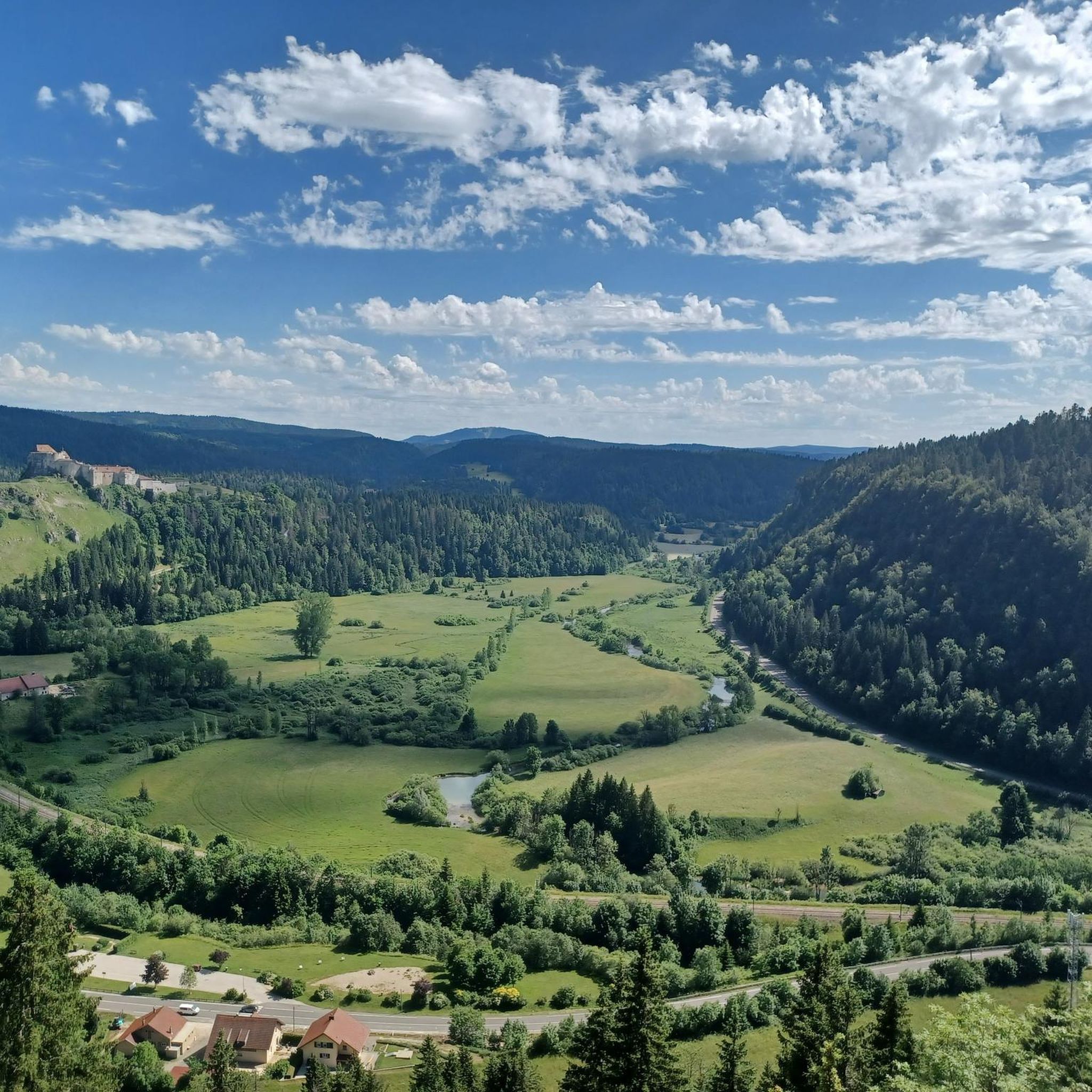
With a view of the Château de Joux and the Doubs valley below.
0
0

Built from 1801 to 1804. Located in the diocese of Besançon, in the deanery of Haut-Doubs forestier. It is served by the Parish of Saint Pierre of the Pays de Pontarlier. The abbots are Fathers François Boiteux and Philippe Nguyen-Bathong. It is listed in the Mérimée database during the 1978 inventory.
8
0

The Mont-Calvaire is a hill of Sombacour which entered the historical heritage thanks to its way of the cross punctuated by 14 stations. These stations are small buildings topped with a cross and commemorating the passion of Christ. In addition to the religious aspect of the place, the hill is also conducive to good vertical kilometer training for trail enthusiasts. Also, the view from the top is superb.
0
0

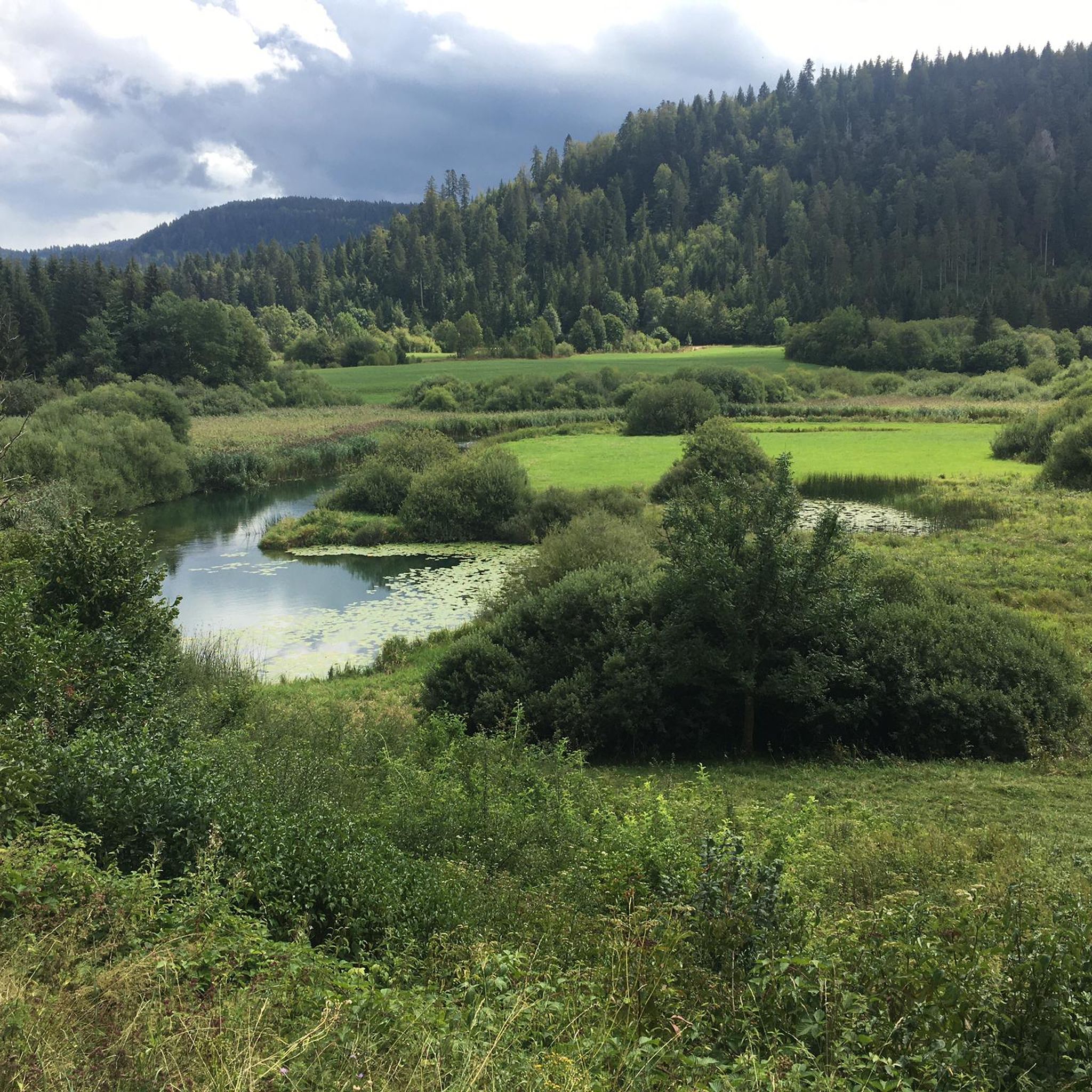
This small pond is a real haven of peace, next to an equally peaceful town. It is an ideal place to stop, refuel and contemplate the reflections of clouds or trees in the water. Ornithology enthusiasts, get your cameras!
0
0

Picturesque lake directly at the village with countless water lilies.
0
0
Frequently Asked Questions
How many hiking trails are available around Chaffois?
There are over 110 hiking routes in the Chaffois area, offering a wide range of experiences. You'll find options for various skill levels, from easy strolls to more challenging treks through the Jura Mountains.
Are there easy hiking trails suitable for beginners or families?
Yes, Chaffois offers many easy trails. Approximately half of the routes are rated as easy. A good option for a relaxed walk is the Pontarlier loop from Pontarlier, which is 4 miles (6.4 km) long and takes about 1 hour 40 minutes.
What kind of terrain can I expect on hikes around Chaffois?
The hiking trails around Chaffois primarily traverse forested hills, open plateaus, and river valleys characteristic of the Jura Mountains. You can expect varied terrain, from well-maintained paths to more natural woodland tracks.
Are there any circular hiking routes in the Chaffois area?
Many routes in Chaffois are circular, allowing you to start and end at the same point. For example, the Granges Viewpoint loop from Granges-Narboz is a moderate 6.4 miles (10.3 km) circular trail with scenic overlooks.
Can I bring my dog on the hiking trails near Chaffois?
Most trails in the Chaffois region are dog-friendly, but it's always recommended to keep your dog on a leash, especially in forested areas or near livestock. Be sure to check specific trail regulations if you plan to visit nature reserves.
What are some notable landmarks or attractions I can see while hiking?
While hiking, you can explore several interesting points. The historic Joux Castle is a prominent feature in the area, and you might encounter natural wonders like the Source de la Loue or the Gorges de Noailles.
What do other hikers enjoy most about the trails in Chaffois?
The hiking routes in Chaffois are highly rated by the komoot community, with an average score of 4.5 stars from over 400 reviews. Hikers often praise the quiet woodlands, varied landscapes, and the well-maintained paths that offer a pleasant outdoor experience.
What is the best time of year to go hiking in Chaffois?
Spring, summer, and early autumn generally offer the best conditions for hiking in Chaffois. During these seasons, the weather is milder, and the trails are typically clear. Autumn provides beautiful foliage, while spring brings blooming wildflowers.
Are there any longer, more challenging hikes for experienced hikers?
Yes, while many trails are easy or moderate, there are a few more challenging options. The region offers 6 difficult routes for those seeking a greater challenge. An example of a moderate, longer route is the Saint-Bénigne Church – Granges Viewpoint loop from Pontarlier, which is 8.6 miles (13.8 km) long.
Where can I find parking for hiking trails in Chaffois?
Parking is generally available in or near the starting points of many trails, especially in towns like Pontarlier or Granges-Narboz. It's advisable to check specific route details on komoot for recommended parking locations before you set out.
Are there options for public transport to reach hiking trailheads?
While some trailheads might be accessible by local bus services, especially those starting from larger towns like Pontarlier, public transport options can be limited in more rural areas. Planning your route in advance and checking local transport schedules is recommended.
Can I find places to eat or drink near the hiking trails?
The towns and villages surrounding Chaffois, such as Pontarlier, offer various options for food and drink, from bakeries to restaurants. While specific 'pub lunch' spots directly on trails might be rare, you can often find amenities in nearby settlements to refuel after your hike.
Most popular attractions around Chaffois

Get inspired with the komoot mobile app


Explore more
Browse the best Hikes in other regions.
