The best walks and hikes around Dangolsheim
4.4
(1840)
10,600
hikers
610
hikes
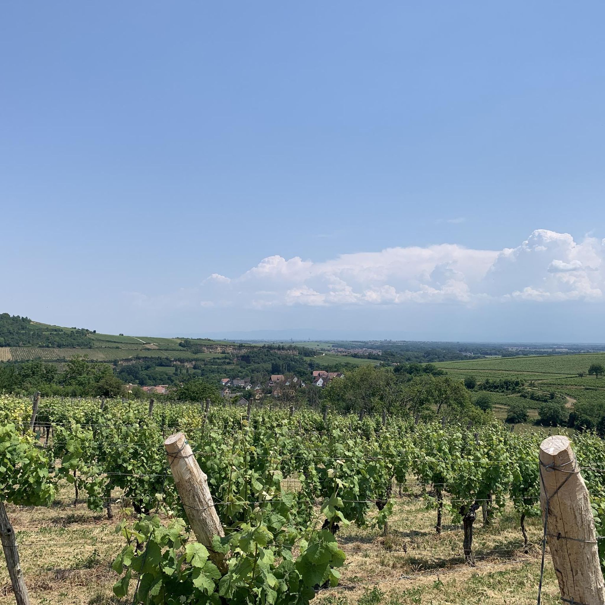
Hiking around Dangolsheim offers diverse landscapes in the Bas-Rhin department of France, characterized by vineyard hills, woodlands, and agricultural lands. The region features prominent natural features like Mont Scharrach, a hill rising to 316 meters, and the tranquil Canal de la Bruche. Trails often integrate historical attractions such as Fort de Mutzig and the Ruins of Guirbaden Castle. This varied terrain provides a range of hiking experiences for different skill levels.
Best hiking trails around Dangolsheim
- The most popular hiking…
Last updated: November 1, 2026
4.7
(17)
163
hikers
7.74km
02:14
190m
190m
Moderate hike. Good fitness required. Easily walkable paths.
4.9
(14)
30
hikers
5.81km
01:28
10m
10m
Easy hike. Easily walkable paths.

5.0
(2)
18
hikers
16.8km
04:52
440m
440m
Moderate hike. Good fitness required. Easily walkable paths.
4.0
(4)
23
hikers
11.3km
02:52
30m
30m
Moderate hike. Good fitness required. Easily walkable paths.
5.0
(4)
11
hikers
7.56km
02:03
110m
110m
Moderate hike. Good fitness required. Easily walkable paths.
Get access to more routes and recommendations from other explorers.
Already have an account?
Our route recommendations are based on thousands of hikes, rides, and runs completed by other people on komoot.
Start today with a free account
Your next adventure awaits.


Tips from the Community


Dachstein lies off the main roads in Alsace and is therefore less developed for tourism. The village nevertheless boasts some noteworthy buildings, such as: the medieval city gate, the Porte de la Bruche, the Church of St. Martin (Église Saint-Martin), which still retains Gothic elements, a nave, and a Baroque altar; the Renaissance castle (extended in the 19th century in the Neo-Renaissance style) of the de Turckheim family, the Château de Turckheim, or the Vieux Château. It was formerly a summer residence for some of the bishops of Strasbourg; the old washhouse, and the Château Hervé Bourcart, or "La Magnanerie." It is located closer to the village center and was built in 1750 as a private villa that housed the royal silkworm breeding school. It has been owned by the Hervé family since 1838. In the 1990s, the castle and its idyllic surroundings served as the setting for the film saga "The Alsatians." Magnan is an Occitan word meaning mulberry. The Magnanerie is the headquarters of a silkworm farm. The streets of Dachstein are lined with several traditional half-timbered houses, some with carved wooden galleries.
0
0

Peace, quiet, endless beauty! Top cycling route!
0
1

nice tour from Molsheim via Avolsheim back
0
0

Beautiful entrance to Dachstein lovingly decorated for Easter
2
0

As you walk along the banks of the Bruche River in Avolsheim, you will discover a peaceful route that takes you through lush landscapes and the charming Alsatian countryside, with views of the river that meanders gently along your path. This particular spot offers stunning views of the river.
0
0
Frequently Asked Questions
How many hiking trails are available around Dangolsheim?
There are over 600 hiking routes around Dangolsheim, catering to various skill levels. This includes a significant number of easy and moderate trails, with some more challenging options for experienced hikers.
What kind of terrain can I expect on hikes near Dangolsheim?
The terrain around Dangolsheim is quite varied. You'll find picturesque vineyard paths, tranquil routes along the Canal de la Bruche, and forested hills. Notable features include the Mont Scharrach, which offers elevated viewpoints, and the protected calcicolous dry grasslands.
Are there any family-friendly hiking options in Dangolsheim?
Yes, many trails are suitable for families. The paths along the Canal de la Bruche are generally flat and offer numerous benches and rest areas, making them ideal for leisurely walks with children. An easy option is the Maison de Retraite Saint – Bruche Sluices loop from Soultz-les-Bains, which is 6.1 km long.
Can I bring my dog on the hiking trails?
Many trails in the Dangolsheim region are dog-friendly, especially those through woodlands and along the Canal de la Bruche. It's always advisable to keep your dog on a leash, particularly in vineyard areas or near wildlife, and to check local regulations for specific routes.
Are there any circular hiking routes available?
Yes, many routes around Dangolsheim are circular. For instance, the Fort de Mutzig – View of Mutzig loop from Soultz-les-Bains is a moderate 16.8 km circular trail that incorporates a historic site. Another easy circular option is the Scharrachberg Hill loop from Scharrachbergheim-Irmstett, which is 4.4 km long.
What historical landmarks or attractions can I see while hiking?
The region is rich in history. You can hike to the impressive Fort de Mutzig, a significant historic site located close to Dangolsheim. The Ruins of Guirbaden Castle also offer splendid views and a rich historical experience, accessible via hiking routes.
Are there any hikes with good viewpoints?
Absolutely. The Mont Scharrach, rising to 316 meters, provides panoramic views of the Vosges mountains and the Black Forest. Several trails ascend this hill, offering excellent opportunities for scenic vistas. The View of the Bruche – Sacre Coeur (Horn) loop from Soultz-les-Bains also offers scenic views.
What is the best time of year to go hiking in Dangolsheim?
Spring and autumn are particularly pleasant for hiking in Dangolsheim. In spring, the vineyards are budding, and wildflowers bloom. Autumn offers stunning colors in the forests and vineyards, along with comfortable temperatures. Summer can be warm, but shaded forest paths and canal routes provide cooler options.
Is parking available near the trailheads?
Yes, parking is generally available near popular trailheads and attractions like the Fort de Mutzig and along the Canal de la Bruche. For vineyard hikes, you can often find parking in or near the villages. Specific parking information can usually be found on individual route descriptions.
How do other hikers rate the trails around Dangolsheim?
The hiking trails around Dangolsheim are highly regarded by the komoot community, with an average score of 4.5 stars from over 1400 reviews. Hikers often praise the diverse landscapes, well-maintained paths, and the blend of natural beauty with historical and cultural points of interest.
Are there any easy hikes suitable for beginners?
Yes, there are many easy routes perfect for beginners. Nearly half of the trails (over 270) are classified as easy. The routes along the Canal de la Bruche are particularly gentle, offering flat surfaces and pleasant scenery. The Maison de Retraite Saint – Bruche Sluices loop from Soultz-les-Bains is a good example of an easy, accessible walk.
Most popular routes around Dangolsheim
Most popular attractions around Dangolsheim

Get inspired with the komoot mobile app


Explore more
Browse the best Hikes in other regions.
