The best MTB trails around Saint-Quentin-Fallavier
4.4
(519)
1,953
riders
236
rides
Mountain bike trails around Saint-Quentin-Fallavier offer diverse terrain within an extensive natural park in the Isère region. The area features varied forest trails that wind along rivers and past ponds, providing engaging routes for cyclists. Elevations range between 206 and 364 meters, contributing to a varied landscape suitable for mountain biking. The region's natural beauty is complemented by historical elements, such as the Château de Fallavier, which many routes incorporate.
Best mountain bike trails around Saint-Quentin-Fallavier
- The most popular mountain…
Last updated: October 5, 2026
4.8
(9)
54
riders
37.5km
03:06
580m
580m
Hard mountain bike ride. Good fitness required. Advanced riding skills necessary. Some portions of the route may require you to push your bike.
4.4
(31)
162
riders
43.0km
03:44
790m
790m
Hard mountain bike ride. Good fitness required. Advanced riding skills necessary. Some portions of the route may require you to push your bike.

4.3
(18)
62
riders
34.5km
03:01
610m
610m
Hard mountain bike ride. Good fitness required. Advanced riding skills necessary. Some portions of the route may require you to push your bike.
4.6
(8)
21
riders
34.9km
01:57
130m
130m
Hard mountain bike ride. Great for any fitness level. Advanced riding skills necessary. Some portions of the route may require you to push your bike.
4.5
(6)
19
riders
23.2km
01:48
300m
300m
Moderate mountain bike ride. Great for any fitness level. Advanced riding skills necessary.
Get access to more routes and recommendations from other explorers.
Already have an account?
Our route recommendations are based on thousands of hikes, rides, and runs completed by other people on komoot.
Start today with a free account
Your next adventure awaits.

Tips from the Community

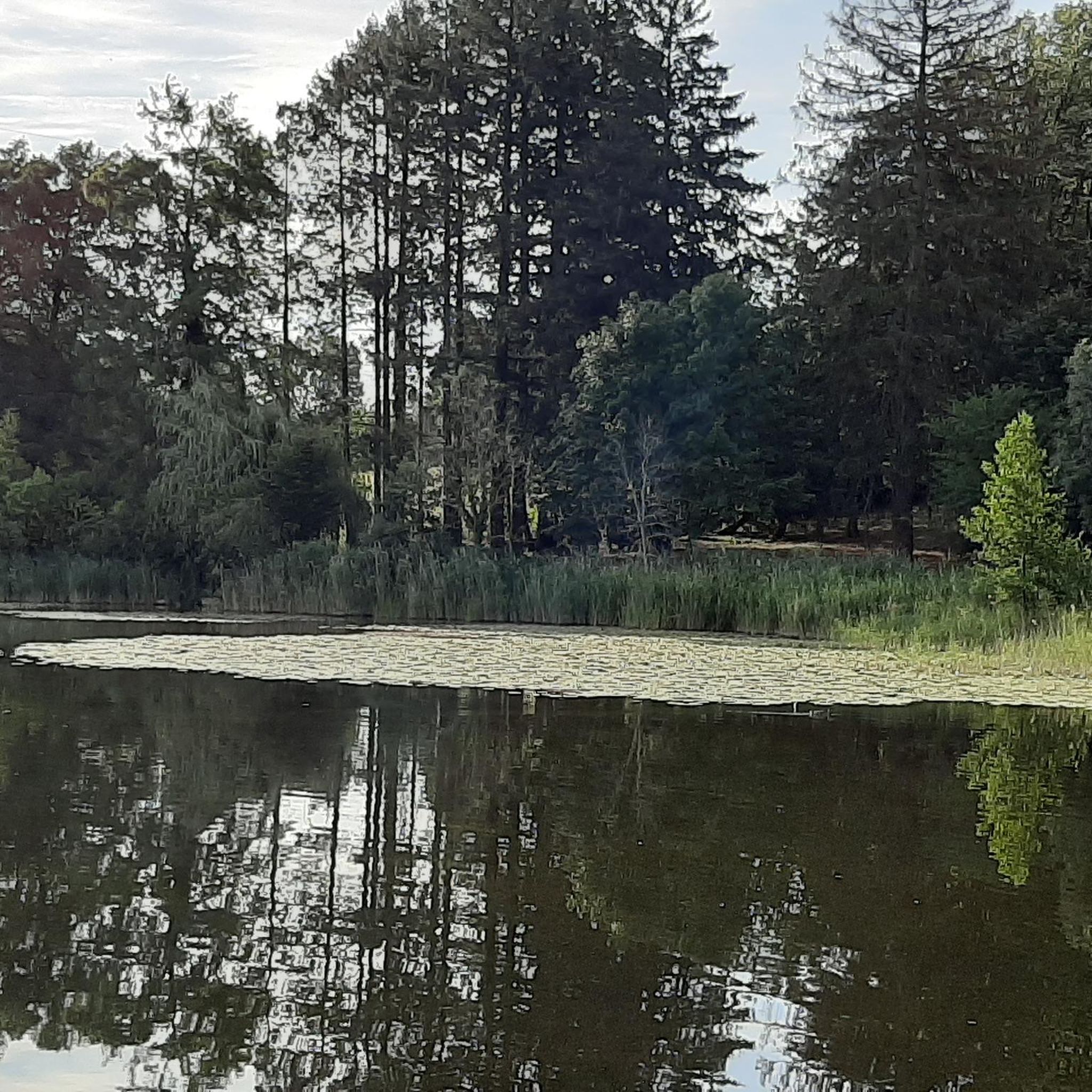
The "Trois Eaux" designation traditionally refers to the three distinct sources or supply networks (coming from wetlands, runoff from surrounding hills, and local springs) that join to form and maintain the level of this pond.
0
0
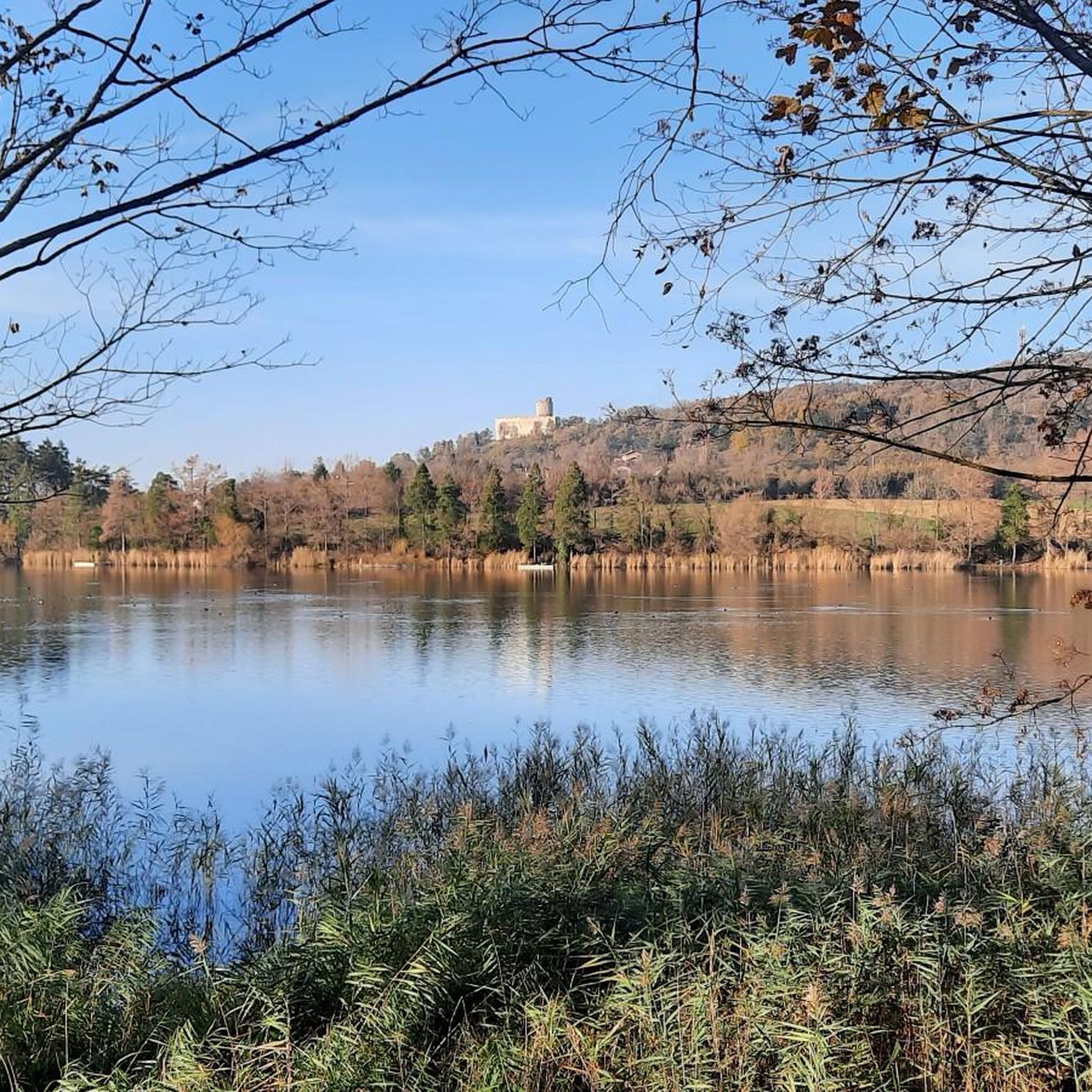
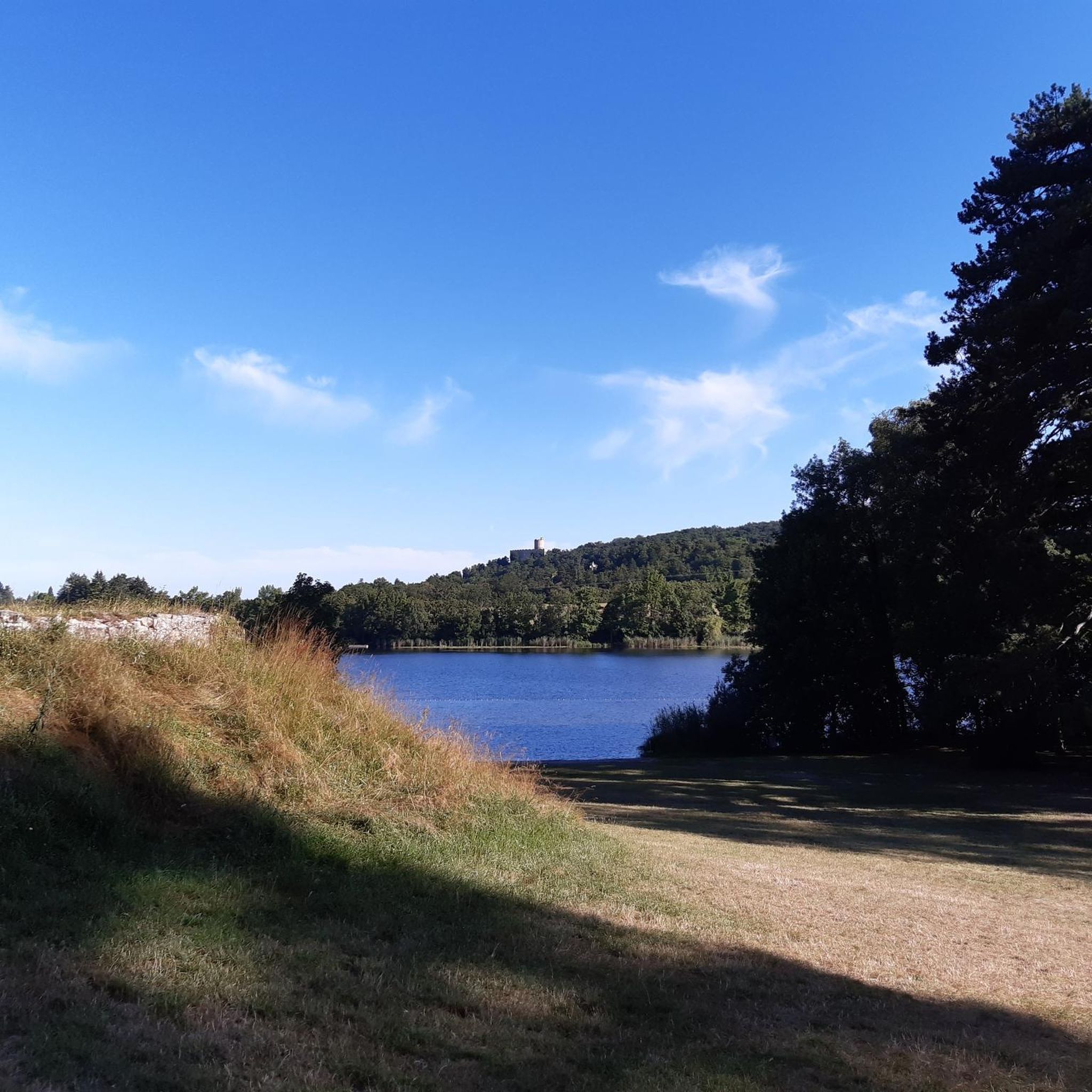
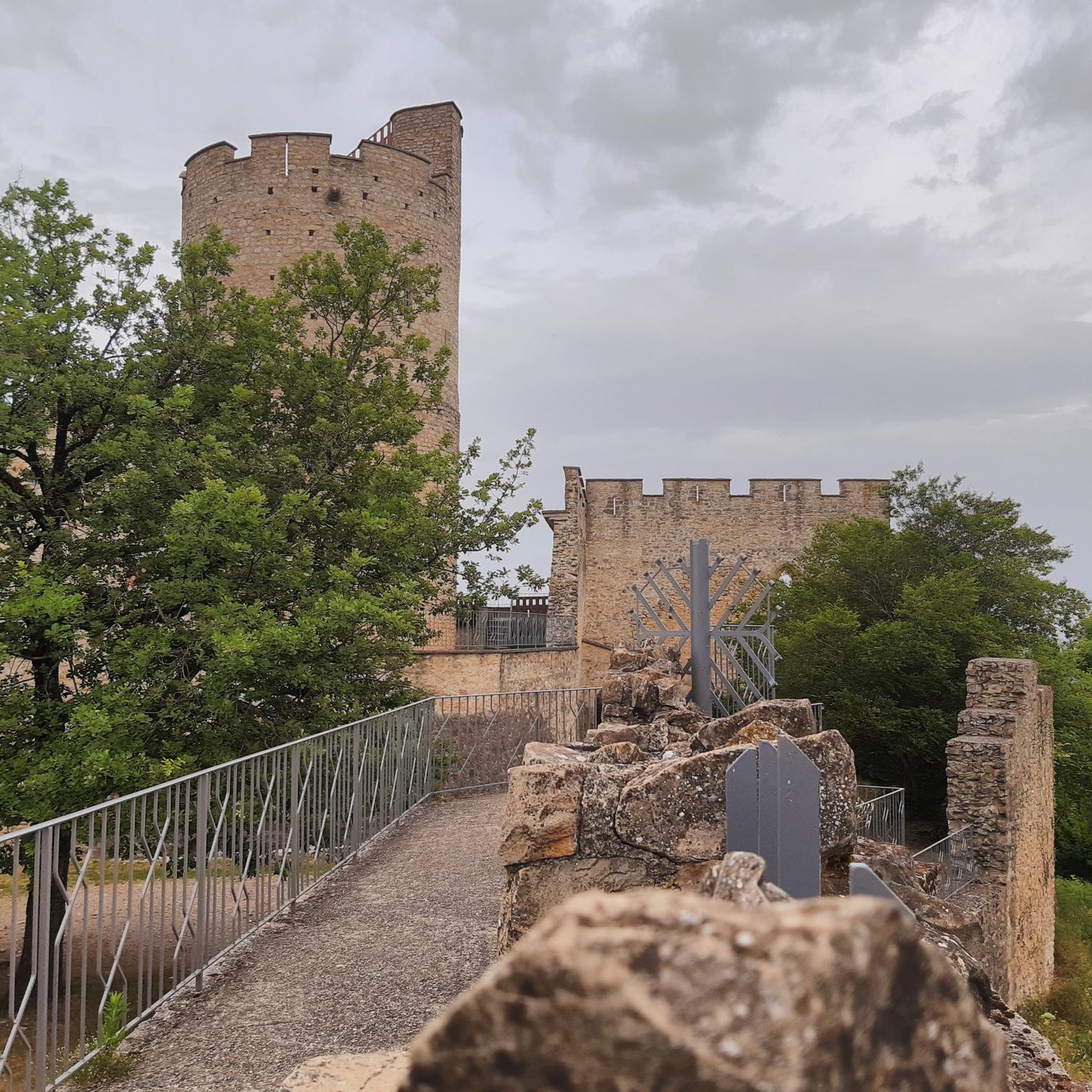
Fortified and enlarged in 1280 by Philippe de Savoie, it constituted a major strategic position facing the Dauphiné during the Dauphiné-Savoy wars. Abandoned in the 17th century, the estate was rehabilitated from 1969 by volunteers. The municipality has owned it since 1992. The site reveals an imposing circular keep, a chapel, ruined residential buildings and its fortified courtyards. Perched on the Relong hill, this historic site offers an exceptional panorama that extends to Lyon. It is also famous for having served as the setting for the very first episodes of the cult series Kaamelott by Alexandre Astier.
0
0
Located in a peri-urban area between the municipalities of Villefontaine and Vaulx-Milieu, this 14-hectare pond is part of a protected area of over 51 hectares.
0
0
The Voie Verte de la Bourbre is a secure development of about 8.5 kilometers reserved for non-motorized travel (bicycles, pedestrians, strollers, rollerblades). Managed by the CAPI (Communauté d'Agglomération de la Porte de l'Isère), it pleasantly follows the Bourbre river and today connects the towns of Bourgoin-Jallieu, L'Isle-d'Abeau and Vaulx-Milieu.
0
0

The St-Bonnet chapel, whose first vestiges could date from the 11th century, was then the center of a parish, but its importance quickly diminished. At the base of the walls of this chapel, large blocks of white limestone are quickly noticed in re-use. These blocks come, after crossing the Rhône, from the important Roman quarry of 'choin'(*) of Fay, located in the Ain towards Murs and Géligneux. They have been worked and have sealing holes. These are probably the remains of a structure intended to cross the Bionne (Biaume by its old name or Belna if one refers to the charters of the Temple of Vaulx) on the Roman road which, starting from Vienne, via Bourgoin and Aoste sur Guiers, reached Geneva. https://www.roche38.fr/copie-de-la-pierre-marquee
0
0

A beautiful section to do both uphill, to get your heart pumping into the stratosphere, and downhill.
0
0
Nice little downhill mountain bike/gravel singletrack.
0
0

Cool ruins! We really like them. 🤩
1
0
Frequently Asked Questions
How many mountain bike trails are available around Saint-Quentin-Fallavier?
There are over 230 mountain bike trails around Saint-Quentin-Fallavier. These routes offer a wide range of experiences, from easier paths to more challenging difficult routes, all within the region's extensive natural park.
What kind of terrain can I expect on the mountain bike trails in Saint-Quentin-Fallavier?
The terrain around Saint-Quentin-Fallavier is quite varied, featuring extensive natural parks, varied forest trails, and paths that wind along rivers and past ponds. Elevations range between 206 and 364 meters, providing a diverse landscape for mountain biking.
Are there any family-friendly mountain bike trails in Saint-Quentin-Fallavier?
Yes, Saint-Quentin-Fallavier offers a selection of family-friendly mountain bike trails. Out of the over 230 routes, 48 are classified as easy, making them suitable for families or those looking for a more relaxed ride. These trails often explore the natural park and scenic pond areas.
What natural features or landmarks can I see while mountain biking in the area?
Many mountain bike routes in Saint-Quentin-Fallavier incorporate natural features and historical landmarks. You can explore areas around Lake Saint-Quentin-Fallavier and Étang de Chalignieu, or pass by the historic Château de Fallavier, which sits atop Relong hill.
What do other mountain bikers enjoy most about the trails in Saint-Quentin-Fallavier?
The mountain bike trails in Saint-Quentin-Fallavier are highly rated by the komoot community, with an average score of 4.5 stars from over 440 reviews. Riders often praise the diverse terrain, the scenic backdrop of the Château de Fallavier, and the extensive network of varied forest trails that wind along rivers and past ponds.
Are there any circular mountain bike routes available?
Yes, many of the mountain bike routes around Saint-Quentin-Fallavier are circular. For example, you could try the Merlin Wood – Pont Robert loop from Saint-Quentin-Fallavier, a difficult 43.7 km trail, or the Etang Saint Quentin – Saint Bonnet Pond loop from Heyrieux, which is 38.1 km long.
What is the best time of year to go mountain biking in Saint-Quentin-Fallavier?
Saint-Quentin-Fallavier, located in the Isère region, offers pleasant conditions for mountain biking during spring, summer, and autumn. The varied forest trails and natural park are particularly beautiful when the foliage is lush or changing colors. While specific seasonal closures are not noted, checking local weather before your ride is always recommended.
Are there options for advanced mountain bikers looking for a challenge?
Absolutely. Saint-Quentin-Fallavier caters to advanced riders with 57 routes classified as difficult. These trails often feature more significant elevation changes and technical sections. An example is the Lake Saint-Quentin-Fallavier – Etang Saint Quentin loop from Saint-Quentin-Fallavier, a challenging 52.0 km path that explores the area's extensive network of trails around its lakes and ponds.
Can I reach the mountain bike trails using public transport?
Saint-Quentin-Fallavier is accessible, and while specific public transport links directly to trailheads may vary, the town itself is served by local transport options. It's advisable to check local bus schedules or regional transport services to plan your journey to the starting points of the trails.
Are there any places to eat or drink near the mountain bike trails?
The town of Saint-Quentin-Fallavier and surrounding villages offer various cafes and pubs where you can refuel after your ride. While specific establishments directly on the trails are rare, you'll find options within a short distance, especially in the town center.
What is the typical elevation gain on mountain bike trails in this region?
The landscape around Saint-Quentin-Fallavier features elevations between 206 and 364 meters. While individual routes vary, you can expect moderate to significant elevation gains, especially on the more difficult trails. For instance, the Château de Fallavier – Etang Saint Quentin loop from Heyrieux involves an ascent of nearly 600 meters.
Most popular routes around Saint-Quentin-Fallavier
Most popular attractions around Saint-Quentin-Fallavier

Get inspired with the komoot mobile app


Explore more
Browse the best MTB trails in other regions.
