The best walks and hikes around Draillant
4.5
(875)
8,105
hikers
203
hikes
Hiking around Draillant, located in the Haute-Savoie department of the Auvergne Rhône-Alpes region of France, offers diverse natural landscapes for outdoor enthusiasts. The area features prominent natural landmarks such as Mont Forchat, known for its panoramic views of Lake Geneva and Mont Blanc, and unique glacial formations like Les Vouas du Lyaud. Trails often traverse serene woodlands and forests, providing varied terrain for exploration.
Best hiking trails around Draillant
- The most popular hiking route is FFVL take-off at Très-le-mont –…
Last updated: May 16, 2026
4.7
(23)
394
hikers
6.38km
01:58
240m
240m
Easy hike. Great for any fitness level. Easily-accessible paths. Suitable for all skill levels.
4.6
(7)
152
hikers
6.91km
02:24
360m
360m
Moderate hike. Good fitness required. Mostly accessible paths. Sure-footedness required.

Sign up for free
4.3
(33)
223
hikers
7.96km
02:55
470m
470m
Moderate hike. Good fitness required. Mostly accessible paths. Sure-footedness required.
4.7
(41)
335
hikers
4.11km
01:21
170m
170m
Moderate hike. Great for any fitness level. Mostly accessible paths. Sure-footedness required.
4.6
(27)
223
hikers
16.3km
05:27
760m
760m
Hard hike. Very good fitness required. Easily-accessible paths. Suitable for all skill levels.
Get access to more routes and recommendations from other explorers.
Sign up for free
Already have an account?
Our route recommendations are based on thousands of hikes, rides, and runs completed by other people on komoot.
Start today with a free account
Your next adventure awaits.
Login or Signup

Tips from the Community


Beautiful views into the depths and beyond.
2
0

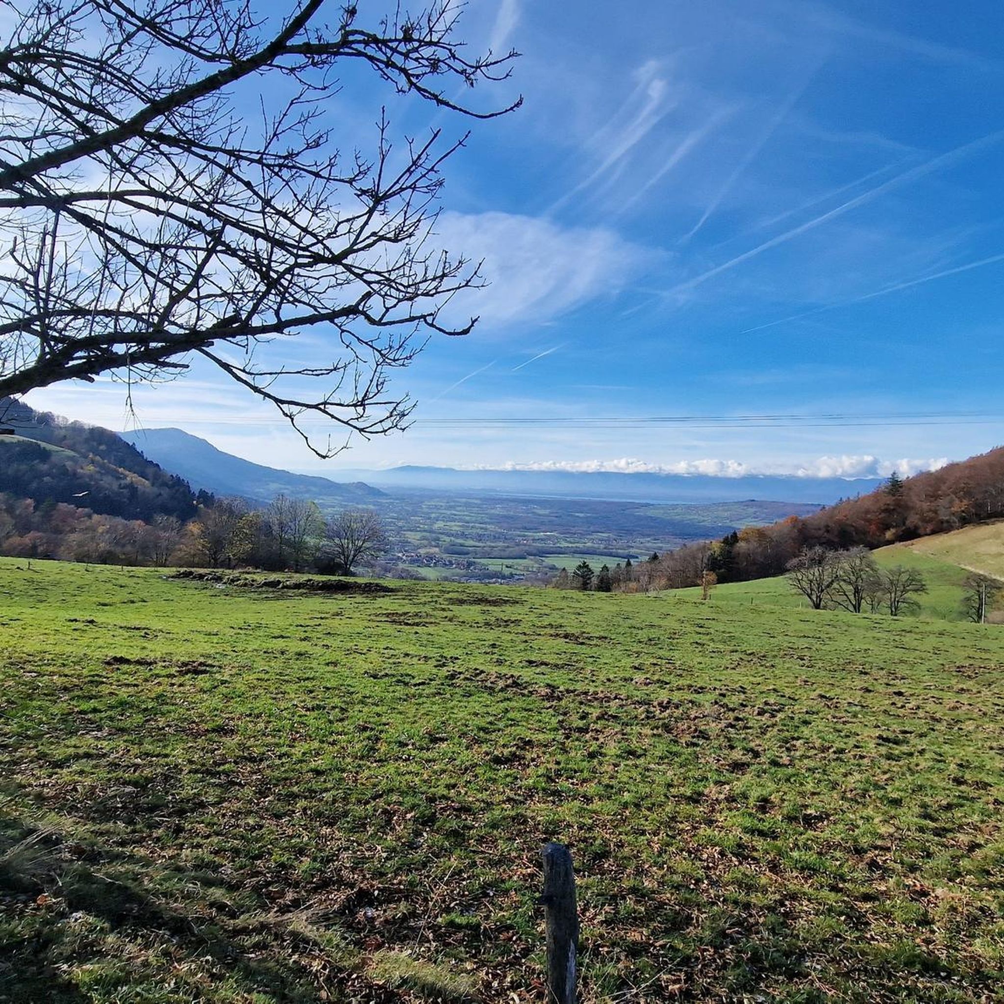
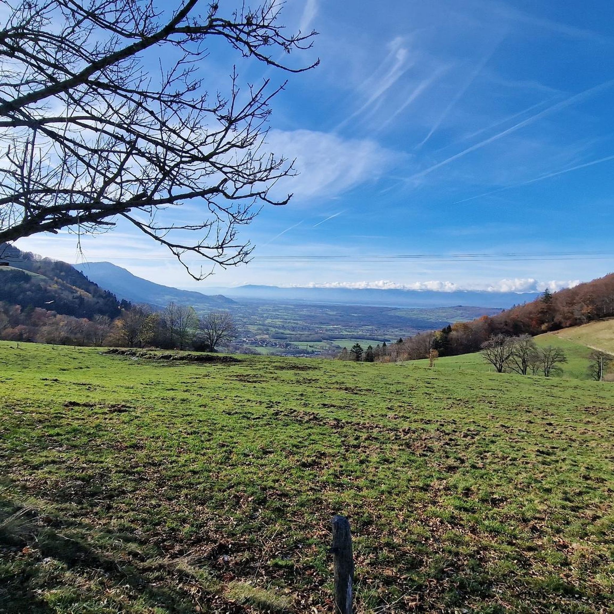
After the effort, your reward at the top of the Col du Feu is a magnificent view of the peaks of the Chablais massif and Lake Geneva.
1
0

In addition to the spiritual aspect, there are many benches around this chapel which allow you to eat a frugal (or not) snack.
0
0

The Col de l'Encrenaz is 1429m high, which is 120m lower than the Mont Forchat, which can be easily reached from here. The path is steep, but not so steep that you can't walk any more.
1
0
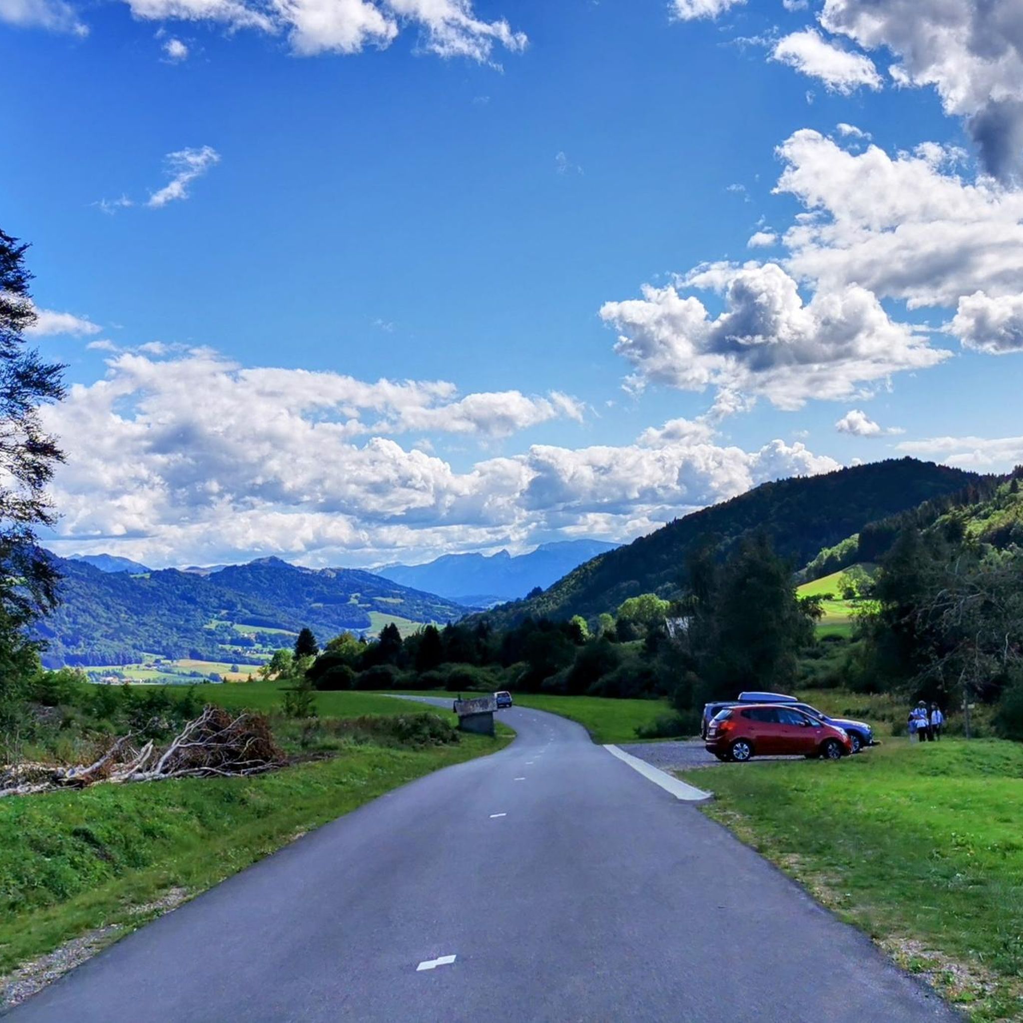
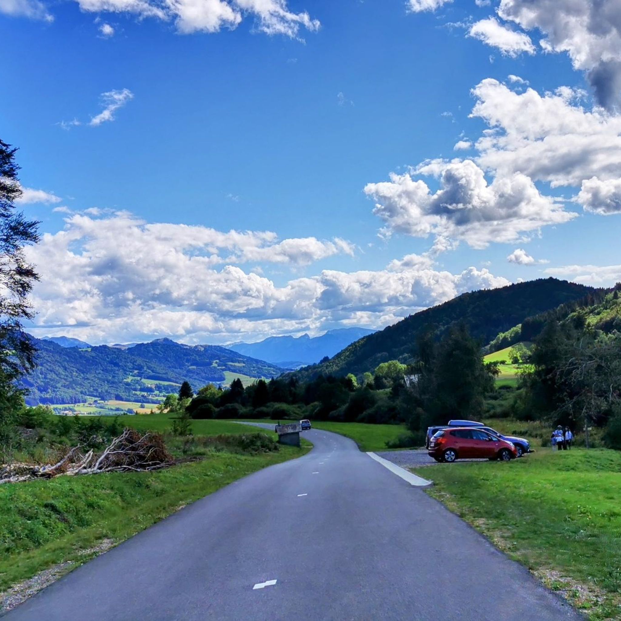
Très le Mont is a small town from which the hike to Mont Forchat or Très la Paraz starts. Unfortunately, there are no public toilets at the car park, only a restaurant at the end of the town.
0
0

Here you are at 1,117 meters above sea level. After an ascent of six kilometers coming from Orcier (north slope) and three kilometers from Lullin (south slope), you deserve a little break. The bar-restaurant located just a stone's throw away offers simple and rich cuisine. Enough to regain some strength for the rest of your day.
1
0

Wonderful view of Mont Blanc and Lac Leman
0
0
Frequently Asked Questions
How many hiking trails are available around Draillant?
The Draillant area offers a wide variety of hiking opportunities, with over 190 routes available. These range from easy strolls to more challenging ascents, catering to different skill levels.
Are there family-friendly hiking options near Draillant?
Yes, Draillant offers several routes suitable for families. The 'Col du Feu - Col des Moises' hike is described as a great family option, allowing flexibility to turn back at any point. Many trails also wind through tranquil woodlands, providing pleasant environments for all ages.
Can I bring my dog on the hiking trails in Draillant?
While specific regulations for dogs vary by trail and protected areas, generally, dogs are welcome on many hiking trails in the Draillant region, especially if kept on a leash. Always check local signage for any restrictions, particularly in nature reserves or near livestock.
What kind of terrain can I expect on hikes around Mont Forchat?
Hikes around Mont Forchat typically involve a mix of forest tracks and open paths. Routes like the Encrenaz Pass – Mount Forchat loop from Habère-Poche wind through forests, while the summit offers expansive, exposed panoramic views. Expect varied terrain with progressive climbs.
Are there any circular hiking routes in the Draillant area?
Yes, many routes in Draillant are designed as loops, allowing you to start and end at the same point. Popular circular options include the FFVL take-off at Très-le-mont – Mount Forchat loop from Orcier and the Mount Forchat loop from Col du Feu. The 'Le petit huit de Margencel' also features two distinct loops.
What are some notable natural attractions or landmarks to see while hiking?
Draillant is rich in natural beauty. You can explore the unique glacial ponds of Les Vouas du Lyaud, or visit the stunning Cascade de la Diomaz, located just 12 km away. Many trails also lead to viewpoints offering incredible vistas of Lac Léman and Mont Blanc.
Is there public transport available to reach trailheads in Draillant?
While Draillant is a smaller commune, public transport options in the Haute-Savoie region can connect you to nearby towns. From there, local bus services or a short taxi ride might be necessary to reach specific trailheads. It's advisable to check local bus schedules in advance for routes serving the Draillant area.
Where can I park when hiking in Draillant?
Many popular trailheads, especially those leading to Mont Forchat or other well-known routes, often have designated parking areas. For example, starting points like Col du Feu or Orcier typically offer parking facilities. Always look for marked parking zones to ensure you're not obstructing local access.
What is the best time of year to go hiking in Draillant?
The best time for hiking in Draillant is generally from spring through autumn (May to October). During these months, the weather is milder, and trails are typically clear of snow. Summer offers lush greenery and wildflowers, while autumn provides beautiful foliage. Winter hiking is possible but may require snowshoes or specific gear, especially at higher elevations.
Are there any challenging hikes for experienced trekkers?
Yes, for those seeking a more strenuous experience, Draillant offers challenging routes. The Col du Feu – Mount Forchat loop from Col des Moises is a difficult 16.2 km trail with significant elevation gain. Additionally, 'La Grotte aux Loups et le point de vue de la Maladière' is a shorter but steeper hike requiring good orientation skills.
What do other hikers say about the trails in Draillant?
The trails in Draillant are highly rated by the komoot community, with an average score of 4.5 stars from over 800 reviews. Hikers often praise the stunning panoramic views, particularly from Mont Forchat, the diverse natural environments including serene woodlands, and the well-maintained paths suitable for various abilities.
Are there any historical sites or cultural points of interest near the hiking trails?
Yes, the region blends natural beauty with historical intrigue. You can visit the historic Draillant Tower, which hints at the area's past. The Châteaux d'Allinges are also worth exploring, often in conjunction with nearby hikes, offering a glimpse into medieval history.
Can I find trails that offer panoramic views of Lake Geneva?
Absolutely. One of the main draws of hiking in Draillant is the breathtaking views of Lac Léman (Lake Geneva). The ascent to Mont Forchat is particularly renowned for its expansive panoramas, stretching across the entire lake. Other routes, like those passing through hamlets such as Trécout, also offer excellent viewpoints.
Most popular routes around Draillant
Most popular attractions around Draillant

Get inspired with the komoot mobile app


Explore more
Browse the best Hikes in other regions.
