The best cycling routes around Saint-Georges-De-Didonne
4.4
(1421)
11,309
riders
29
rides
Touring cycling routes around Saint-Georges-De-Didonne offer a diverse landscape for exploration, situated between the Atlantic coast and the Gironde estuary. The area features a carefully landscaped waterfront, fine sandy beaches, and limestone cliffs. Inland, the Suzac Forest provides a protected natural area with shady paths, while the municipal lake of Enlias offers a different green setting. An extensive network of cycle paths caters to various preferences, from easy coastal rides to routes exploring forests and estuary views.
Best touring cycling routes around Saint-Georges-De-Didonne
- The most popular touring cycling route is Boulevard du Marais – View of the La Roche cliff loop from Saint-Georges-de-Didonne, a 24.7 miles (39.7 km) trail that takes 2 hours 35 minutes to complete. This moderate route offers views of the La Roche cliff and coastal scenery.
- Another top favourite among local touring cyclists is Bike loop from Parc de l'Estuaire, an easy 3.9 miles (6.3 km) path. This route explores the green surroundings of the Parc de l'Estuaire.
- Local touring cyclists also love the Bike loop from Saint-Georges-de-Didonne, a 7.2 miles (11.6 km) trail leading through local areas, often completed in about 47 minutes.
- Touring cycling around Saint-Georges-De-Didonne is defined by coastal paths, the Gironde estuary, and the Suzac Forest. The network offers options for different ability levels, from easy rides to more moderate routes with varied terrain.
- The routes in Saint-Georges-De-Didonne are highly rated by the komoot community with an average score of 4.4 from over 149 reviews. More than 1,400 touring cyclists have used komoot to explore Saint-Georges-De-Didonne's varied terrain.
Last updated: October 3, 2026
4.6
(78)
661
riders
25.0km
01:32
180m
180m
Moderate bike ride. Good fitness required. Mostly paved surfaces. Suitable for all skill levels.
4.3
(15)
66
riders
Moderate bike ride. Good fitness required. Mostly paved surfaces. Suitable for all skill levels.

4.6
(5)
69
riders
7.74km
00:30
50m
50m
Easy bike ride. Great for any fitness level. Mostly paved surfaces. Suitable for all skill levels.
4.6
(5)
66
riders
6.70km
00:27
30m
30m
Easy bike ride. Great for any fitness level. Mostly paved surfaces. Suitable for all skill levels.
22
riders
Easy bike ride. Great for any fitness level. Mostly paved surfaces. Suitable for all skill levels.
Get access to more routes and recommendations from other explorers.
Already have an account?
Our route recommendations are based on thousands of hikes, rides, and runs completed by other people on komoot.
Start today with a free account
Your next adventure awaits.

Tips from the Community

Some magnificent houses date from the Belle Époque
0
0

For this nature and its church
0
0
Very nice walk or bike ride
0
0

Located on the commune of St-Palais-sur-Mer, at the tip of Terre-Nègre, it is intended to mark the southern passage of the Gironde estuary and to signal the presence of a dangerous sandbank, the la barre à l'Anglais.
0
0

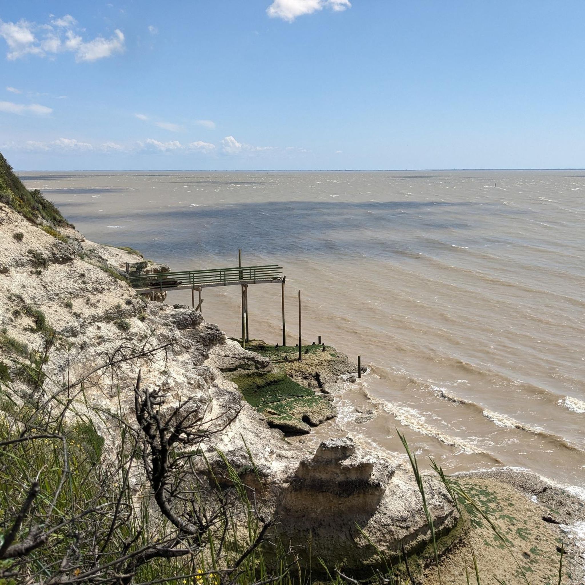
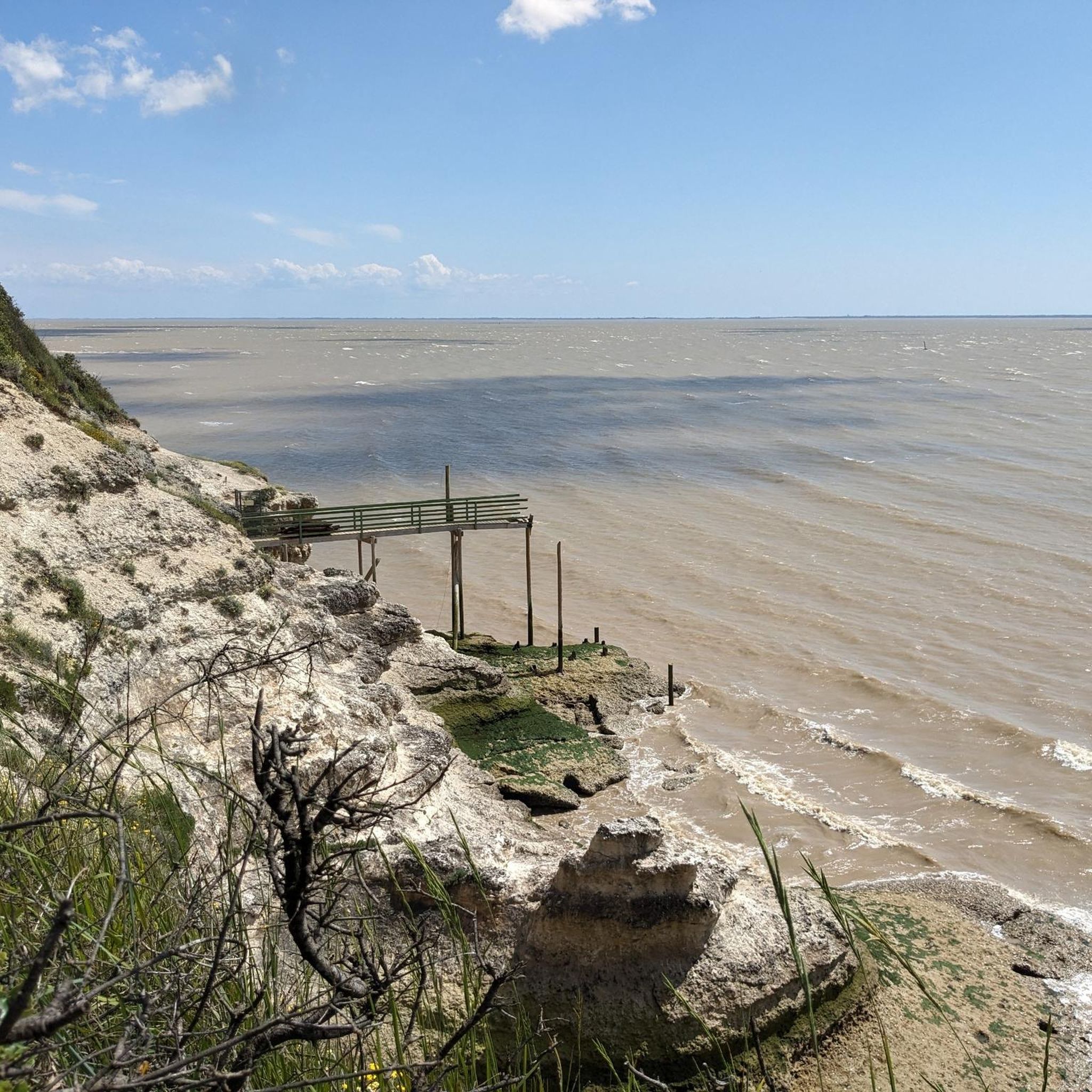
The carrelets of Saint-Palais-sur-Mer are among the most emblematic elements of the Charente coastline. Their history blends traditional fishing, tourist development, and local heritage. 🐟 Origin of the carrelets Originally, the word "carrelet" referred to a square fishing net used since the 17th century. A precise description can be found as early as 1769, in the writings of the scholar Henri-Louis Duhamel du Monceau, who mentioned this type of fishing on the Saintonge coast. 👉 At that time, these were not yet the current huts, but simply a net operated from rudimentary structures. ⚓ Artisanal fishing structures The first local carrelets were simple wooden platforms, built by the fishermen themselves to stand above the water. They were mainly used to catch shrimp, fish, and crabs near the shore, without going out to sea. 👉 It was a family and coastal fishery, less dangerous than sea fishing. 🏖️ 19th – early 20th century: transition to a leisure activity At the turn of the 20th century, with the rise of seaside resorts like Saint-Palais, the carrelets evolved. Holidaymakers and notable figures adopted this practice: construction of fixed jetties, appearance of huts on stilts. The carrelets then became places for relaxation as much as for fishing. 👉 They already contributed to the postcard image of the coast. 🪵 After 1945: democratization and multiplication After the Second World War, the number of carrelets increased sharply. They became a symbol of popular leisure and conviviality. The transition was gradually made from a means of subsistence to a recreational activity. 🌊 Storms and reconstruction The carrelets are fragile in the face of storms: 1999: massive destruction (up to 90% in some areas) 2010 (Xynthia storm): new damage Many have been rebuilt identically, respecting tradition. 🏛️ Today: protected heritage In Charente-Maritime, there are about 400 carrelets. They are: integrated into the public maritime domain allocated by administrative authorization (often renewed every 5 years) Since 2018, they have been recognized as cultural heritage of the department. 👉 In Saint-Palais, they can be observed in particular: at Pont du Diable at the conche du Concié at the Puits de l’Auture
0
0
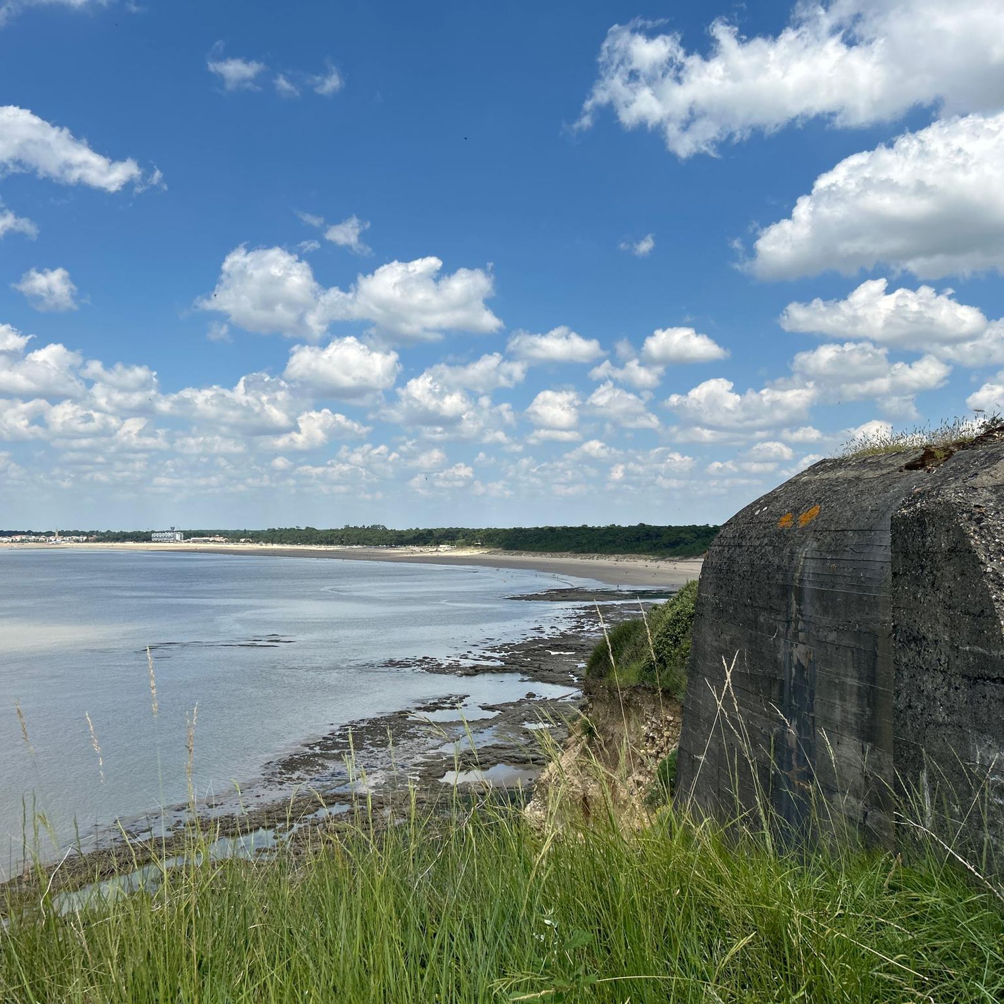
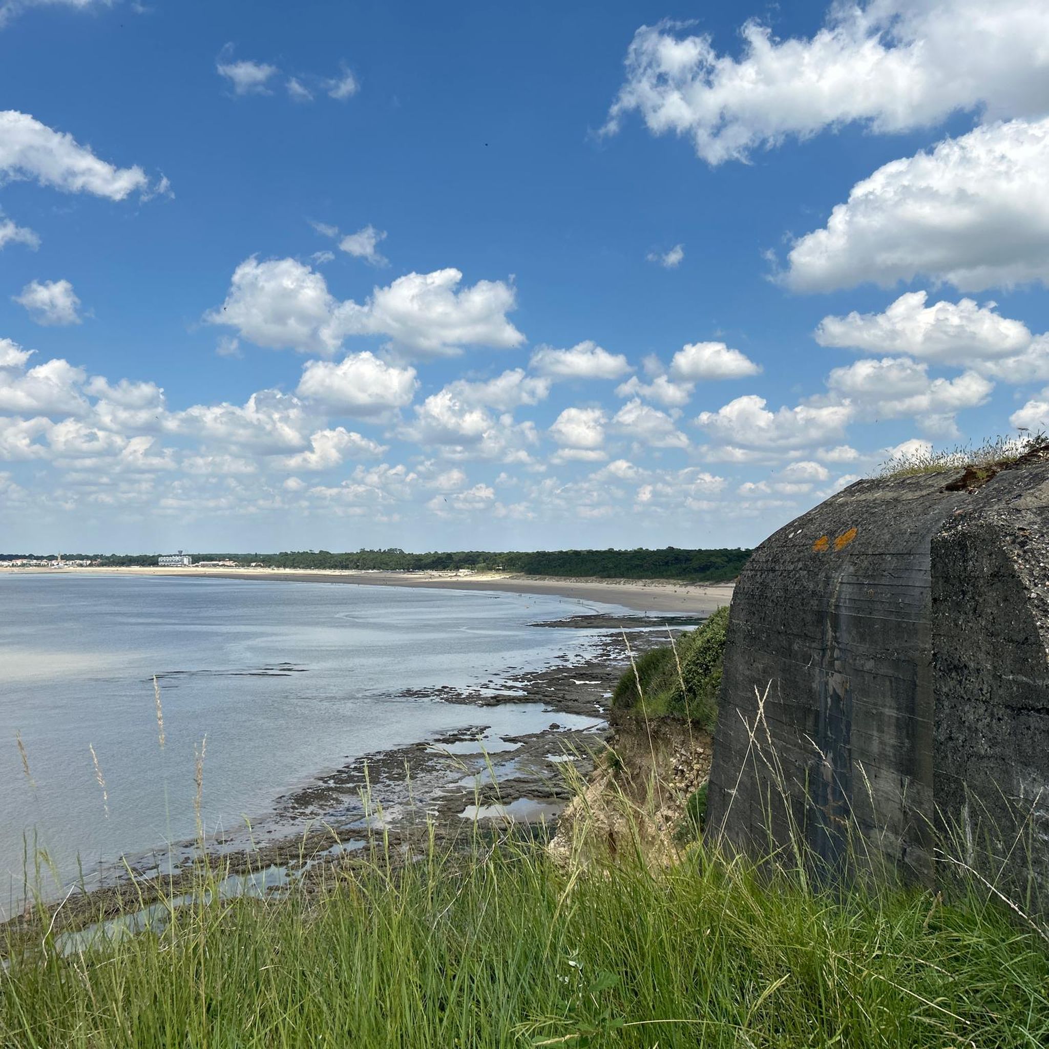
🏖️ General Overview Chay Beach is a family-friendly, fine sandy beach located in Royan (Charente-Maritime), on the Côte d’Argent promenade between Pigeonnier Beach and Pointe du Chay. It stretches for approximately 200 meters and boasts a pleasant natural setting, with a cove bordered by rocks typical of the Charente coastline. 🏝️ Features • 🌊 Beach type: fine sand, sheltered cove. • 🏄♂️ Atmosphere: relatively calm and family-friendly, ideal for children and vacationers seeking relaxation away from the large urban beaches. • 🐾 Pets: prohibited from April 1st to September 30th. • 🫧 Water quality: excellent (Blue Flag label awarded for 2025). 🧭 Lifeguard and Safety • Swimming is supervised during the season (June to early September), with areas marked by red and yellow flags. • The area is classified as a Category 3 "Supervised Beach" and lifeguards are present during the indicated hours. 🪑 Amenities On-site, you can find: • 🏖️ Sun loungers, parasols, and mattresses for rent. • 🚿 Foot rinse and public restrooms. • 📶 Wi-Fi access, first aid station, and an area accessible to people with reduced mobility (assistance may be required depending on the slope). • 🍴 Beachfront restaurant ("Le Chay" bar-restaurant with sea views). 🚶♂️ Atmosphere and Activities • 🎈 Ideal for families and leisurely strolls. • 🌞 People come here for swimming, playing on the sand, flying kites, or simply relaxing by the ocean. • 🅿️ Parking is available nearby, and the beach is easily accessible on foot or by bike from Royan town center in just a few minutes. 🧭 Practical Tips • 📆 Best time to visit: summer for supervised swimming and full services, but also during the off-season for a more peaceful atmosphere. • ☀️ Arriving early in the morning makes parking easier during peak season. • 🐶 Dogs are not allowed during the summer season; check the signs on site during the off-season.
0
0

for a typical view here on the coast.. the cycle path along the shore is also worth it
0
0

Easily accessible place, only the last meters are prohibited for cyclists.
0
0
Frequently Asked Questions
How many touring cycling routes are available around Saint-Georges-De-Didonne?
There are nearly 30 touring cycling routes around Saint-Georges-De-Didonne, offering a variety of experiences for different skill levels. Most of these, 21 to be exact, are classified as easy, while 7 are moderate.
What kind of terrain can I expect on touring cycling routes in Saint-Georges-De-Didonne?
The terrain around Saint-Georges-De-Didonne is quite varied. You'll find extensive cycle paths along the coast, through the Suzac Forest, and near the Gironde estuary. Routes range from mostly paved surfaces suitable for all fitness levels to some with unpaved segments and greater elevation gains, especially those exploring cliffs and forest areas.
Are there any easy touring cycling routes suitable for beginners or families?
Yes, Saint-Georges-De-Didonne offers many easy routes perfect for beginners and families. For instance, the Bike loop from Parc de l'Estuaire is an easy 6.3 km path exploring green surroundings. Another accessible option is the Bike loop from Saint-Georges-de-Didonne, which is 11.6 km and leads through local areas.
What are some scenic viewpoints or natural landmarks I can visit while cycling?
Saint-Georges-De-Didonne offers stunning natural landmarks. You can cycle along the coast to enjoy magnificent views of the ocean and the Gironde estuary. The Suzac Forest provides shady paths leading to the Pointe de Suzac, offering panoramic views. Routes like the Boulevard du Marais – View of the La Roche cliff loop offer coastal scenery and cliff views. Don't miss the Grottes de Matata and the Caillaud cliff at Talmont sur Gironde for unique geological features.
Are there any circular touring cycling routes in the area?
Yes, many touring cycling routes around Saint-Georges-De-Didonne are designed as loops, making them convenient for starting and ending at the same point. Examples include the Boulevard du Marais – View of the La Roche cliff loop, the Bike loop from Parc de l'Estuaire, and the Grottes de Matata – Beautiful view of Talmont loop.
What do other touring cyclists say about the routes in Saint-Georges-De-Didonne?
The touring cycling routes in Saint-Georges-De-Didonne are highly regarded by the komoot community, with an average rating of 4.4 out of 5 stars from nearly 150 reviews. Cyclists often praise the diverse landscapes, from coastal paths to forest trails, and the well-maintained cycle infrastructure.
Can I find routes that pass through charming towns or villages?
Absolutely. Many cycling routes lead to picturesque locations. For example, the Grottes de Matata – Beautiful view of Talmont loop will take you towards Talmont-sur-Gironde, classified as one of France's 'Most Beautiful Villages,' known for its cliffside views and traditional fishing huts.
Are there any touring cycling routes that include unpaved sections, suitable for gravel bikes?
Yes, if you enjoy a mix of paved and unpaved surfaces, you can explore routes like the Gravel section – Col de la pinède loop from Saint-Georges-de-Didonne. This route offers a varied experience, including gravel segments, perfect for touring cyclists looking for a bit more adventure.
What are some notable attractions or points of interest near the cycling routes?
Beyond the natural beauty, you can explore several attractions. The Saint-Georges-de-Didonne Beach and Chay Beach are great for a break. The Grottes de Matata offer unique cave formations. You might also encounter the Marsh Cycle Path in Meschers-sur-Gironde, which is a highlight in itself.
Is Saint-Georges-De-Didonne well-suited for cycle tourism?
Yes, Saint-Georges-De-Didonne is an excellent destination for cycle tourism. It boasts an extensive network of picturesque cycle paths and varied itineraries. The area's unique position between the Atlantic coast and the Gironde estuary, combined with natural features like the Suzac Forest and well-developed infrastructure, makes it ideal for exploring by touring bicycle.
What is the average duration for a touring cycling route in Saint-Georges-De-Didonne?
The duration of touring cycling routes varies significantly. Shorter, easy loops like the Bike loop from Parc de l'Estuaire can be completed in about 24 minutes. Longer, moderate routes such as the Boulevard du Marais – View of the La Roche cliff loop might take around 2 hours and 35 minutes. There are options for quick rides or longer excursions depending on your preference.
Are there any routes that offer views of the Gironde estuary?
Many routes in Saint-Georges-De-Didonne provide excellent views of the Gironde estuary. The town is uniquely situated to offer these vistas, especially from coastal paths and areas like the Pointe de Suzac within the Suzac Forest. The overall landscape is defined by its proximity to this majestic estuary.
Most popular routes around Saint-Georges-De-Didonne
Most popular attractions around Saint-Georges-De-Didonne

Get inspired with the komoot mobile app


Explore more
Browse the best Cycling routes in other regions.
