The best walks and hikes around Hermillon
4.6
(1299)
13,526
hikers
13
hikes
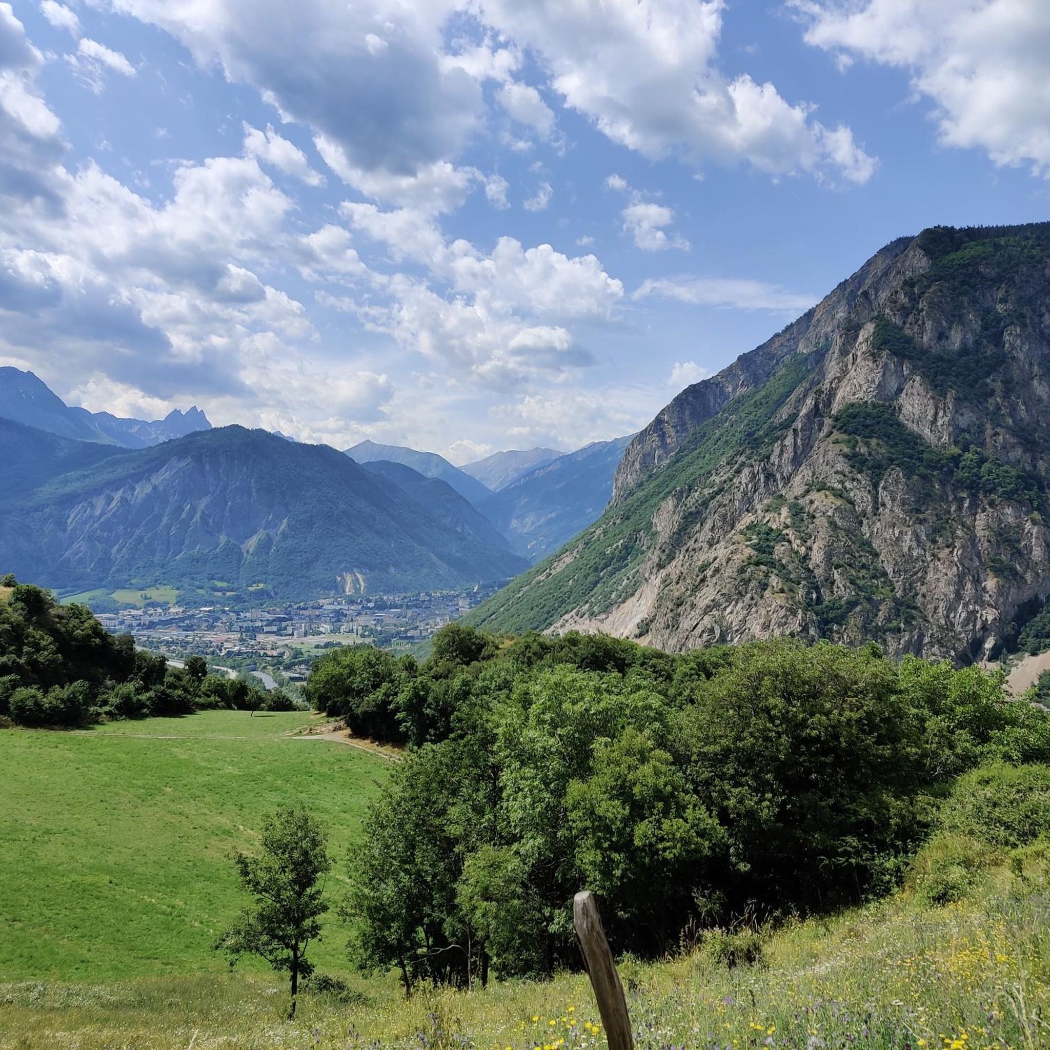
Hiking around Hermillon offers varied terrain within the Maurienne valley, characterized by a significant altitude range from 500 meters to 2768 meters. The landscape features lush forests and expansive alpine pastures, providing diverse scenery for hikers. Trails often traverse through areas with local wildlife and offer views of surrounding mountain ranges.
Best hiking trails around Hermillon
- The most popular hiking route is Le Châtel – Tour du Châtel loop from Hermillon, a 5.6 miles (9.1 km) trail that takes…
Last updated: September 28, 2026
4.6
(10)
27
hikers
9.21km
02:58
380m
370m
Moderate hike. Good fitness required. Easily-accessible paths. Suitable for all skill levels.
13
hikers
4.22km
01:28
230m
230m
Easy hike. Great for any fitness level. Easily-accessible paths. Suitable for all skill levels.

5.0
(3)
12
hikers
12.6km
05:01
890m
890m
Hard hike. Very good fitness required. Sure-footedness, sturdy shoes and alpine experience required.
12
hikers
6.66km
02:29
310m
310m
Hard hike. Good fitness required. Sure-footedness, sturdy shoes and alpine experience required.
5.0
(2)
11
hikers
9.29km
03:39
690m
680m
Moderate hike. Good fitness required. Easily-accessible paths. Suitable for all skill levels.
Get access to more routes and recommendations from other explorers.
Already have an account?
Our route recommendations are based on thousands of hikes, rides, and runs completed by other people on komoot.
Start today with a free account
Your next adventure awaits.


Tips from the Community

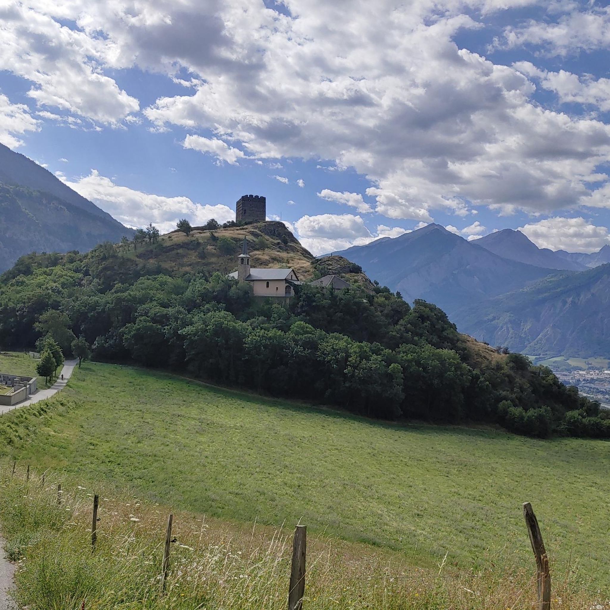
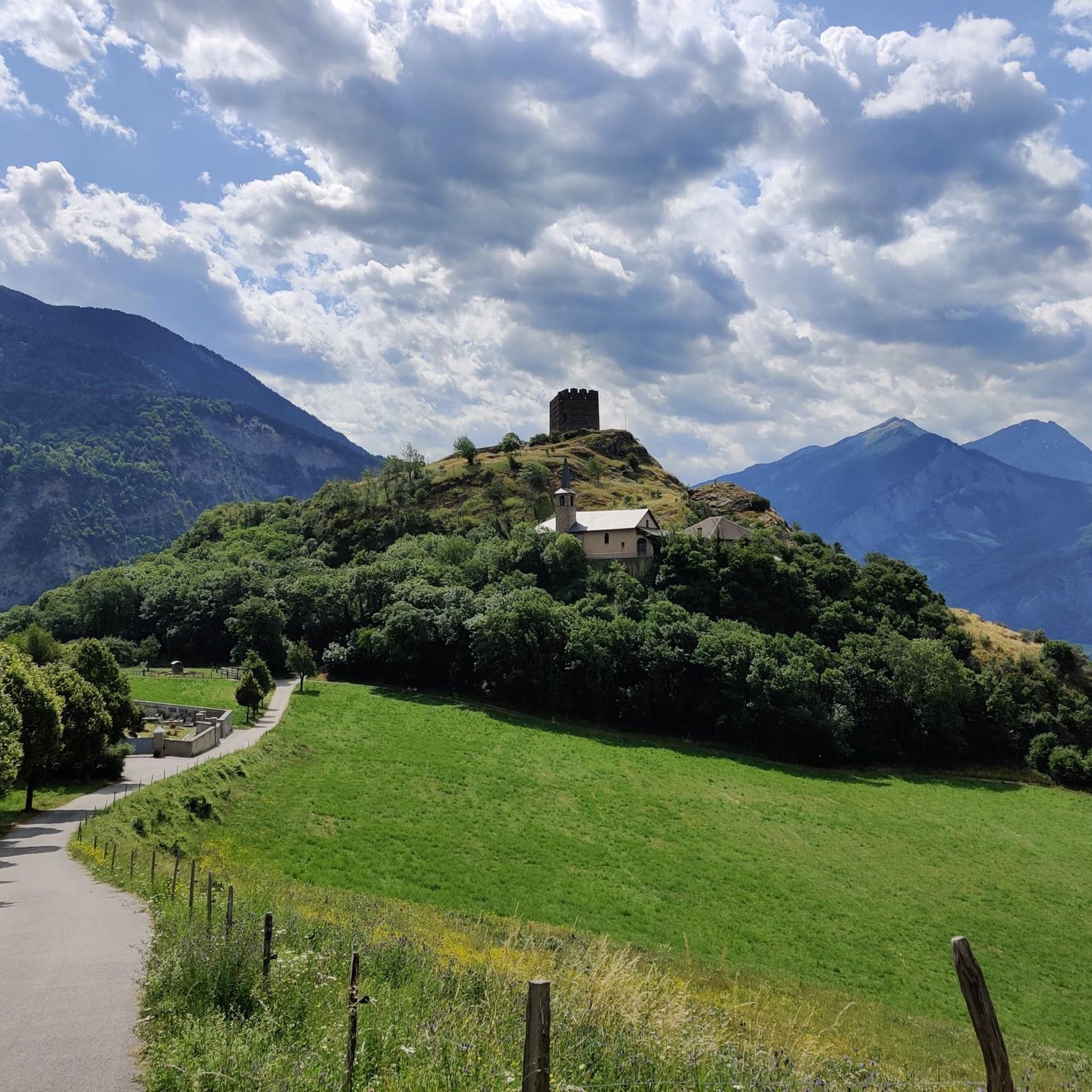
Nice church.
2
0
Church worth seeing in Montvernier.
2
0

The French nun, mystic and Doctor of the Church, Saint Thérèse of Lisieux (religious name Thérèse of the Child Jesus and the Holy Face, 1873 to 1897), expressed her faithful trust in the help of the Mother of God as follows: “In times of trials or difficulties, I turn to Mother Mary, whose gaze alone is enough to dispel all fear.”
0
0

Very little information...
0
0

The chapel was closed, for hikers there are picnic tables and an orientation table behind the chapel. Just below there is an uncontrolled water point.
1
0
very little information about this church...
0
0
Very little information. The church was burned down during the Second World War and rebuilt....
0
0
Frequently Asked Questions
How many hiking trails are available around Hermillon?
Hermillon offers a wide selection of hiking trails, with over 300 routes available. These range from easy strolls to challenging ascents, catering to various fitness levels and preferences.
What kind of terrain can I expect on hikes around Hermillon?
The terrain around Hermillon is incredibly diverse, characterized by a significant altitude range from 500 meters to 2768 meters. You can expect to traverse through lush forests, expansive alpine pastures, and sometimes even vineyards on the slopes. Many trails offer panoramic views of surrounding mountain ranges like the Belledonne massif and the Aiguilles d'Arves.
Are there easy hiking options suitable for beginners or families in Hermillon?
Yes, Hermillon has numerous easy hiking options perfect for beginners or families. Over 100 routes are classified as easy, including accessible paths like the Les 3 Croix loop and the "Sentier botanique: chemin des oratoires Hermillon." These trails often have moderate elevation gain and are suitable for all skill levels.
Are there challenging hikes for experienced mountaineers in Hermillon?
Absolutely. For experienced hikers, Hermillon offers over 60 difficult routes. Options like the Petit Dôme Above Lachat – Lachat Hamlet loop are considered hard mountaineering. The Le Grand Perron des Encombres hike is very difficult, offering wild terrain and 360-degree views of the Vanoise, recommended for athletic individuals with good composure.
What do other hikers say about the trails in Hermillon?
The hiking routes in Hermillon are highly rated by the komoot community, with an average score of 4.6 stars from over 1150 reviews. Hikers often praise the varied terrain, stunning vistas, and the wide selection of trails that cater to different abilities.
Are there any circular hiking routes around Hermillon?
Yes, many trails around Hermillon are circular, offering convenient starting and ending points. For example, the Le Châtel – Tour du Châtel loop from Hermillon is a popular moderate circular route, and the Saint Marin Chapel – Tour du Châtel loop from Hermillon provides an easy circular option.
What are some notable landmarks or viewpoints I can see while hiking in Hermillon?
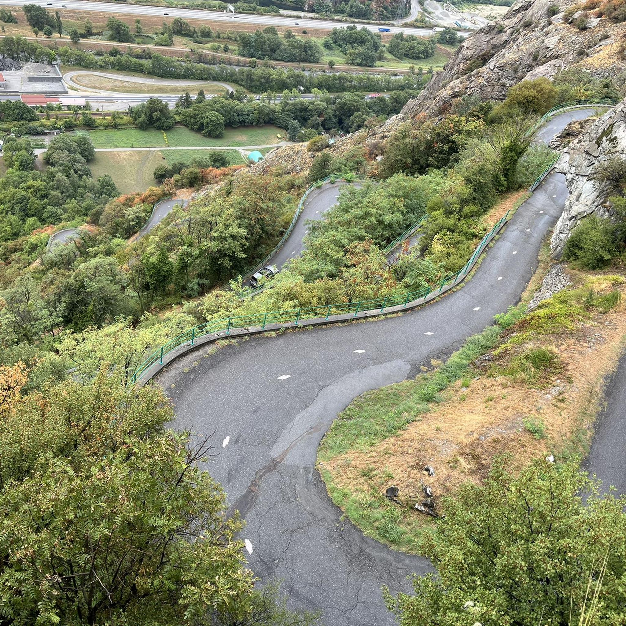
Hermillon's trails offer breathtaking views of the Belledonne massif, Aiguilles d'Arves, Mont-Blanc, and Cheval Noir. Specific viewpoints like the Boucle de la Tête de Bellard et le Grand Truc provide impressive 360-degree views. You can also explore the unique hairpin turns of the Lacets de Montvernier, or visit the charming village of Montandré. For natural monuments, consider visiting Lac du Lou or Lac Blanc.
Can I hike with my dog on the trails around Hermillon?
While many trails in the Maurienne valley are dog-friendly, it's important to be aware of local regulations, especially concerning protected areas and livestock. You may encounter Patou dogs guarding sheep in alpine pastures, so keeping your dog on a leash and under control is crucial. Always check specific trail rules before heading out.
What is the best time of year to go hiking in Hermillon?
The climate in Hermillon is generally favorable for hiking. Spring brings the unique spontaneous bloom of wild tulips, while summer offers warm weather for exploring alpine pastures. Autumn provides beautiful foliage. For higher altitude trails, summer and early autumn are ideal to avoid snow, though some lower trails may be accessible in winter with appropriate gear.
Are there any trails that feature waterfalls or canyons?
The region's landscape includes canyons and waterfalls, indicating opportunities to explore these natural features. While specific hiking routes directly to major waterfalls aren't detailed, the presence of such features suggests that some trails may offer views or access to these natural attractions, potentially even for canyoning activities.
Are there any trails that offer views of the famous Lacets de Montvernier?
Yes, some trails provide views of the iconic Lacets de Montvernier, known for its unique engineering and hairpin turns. Hikes like the Le Châtel – Tour du Châtel loop from Montvernier offer a mix of paved and unpaved paths, providing unique scenery including views of this famous road.
Is public transport available to reach hiking trailheads in Hermillon?
While specific public transport routes directly to all trailheads are not detailed, Hermillon is nestled in the Maurienne valley, which generally has local bus services connecting villages. For specific trail access, it's advisable to check local bus schedules or consider driving to trailheads where parking is often available.
Most popular routes around Hermillon
Most popular attractions around Hermillon

Get inspired with the komoot mobile app


Explore more
Browse the best Hikes in other regions.
