The best running trails around La Rivière-Saint-Sauveur
4.1
(43)
742
runners
14
runs
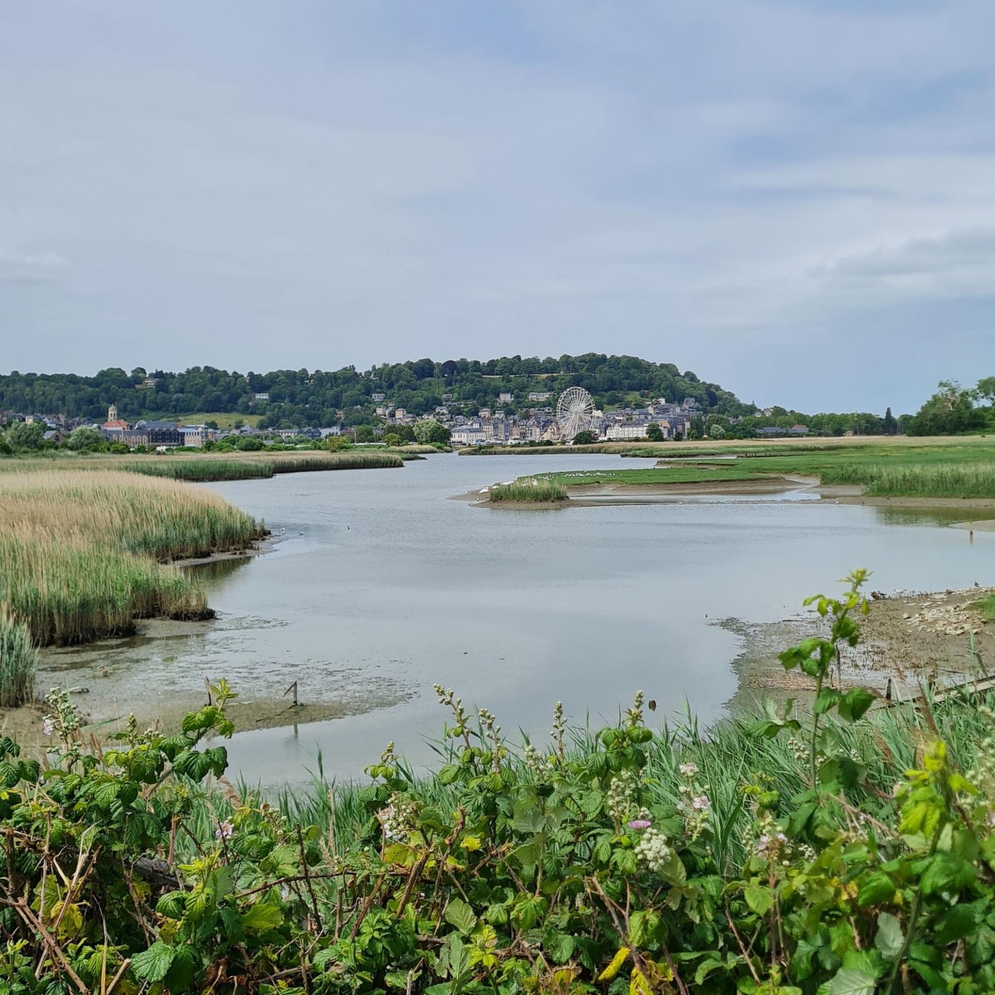
Jogging around La Rivière-Saint-Sauveur offers diverse landscapes, from waterside routes along the Orange river and Baie de Saint-Sauveur to paths through the Seine estuary and bocage. The region is characterized by its network of waterways, including the Canal de Retour d'Eau and the Morelle, which contribute to varied running environments. These natural features provide a scenic backdrop for outdoor activities, with routes catering to different fitness levels.
Best jogging routes around La Rivière-Saint-Sauveur
- The most popular jogging route is Le Jardien de Personnalités – Le bassin loop from La Rivière-Saint-Sauveur, a 6.3 miles (10.2 km) trail that takes 1 hour 5 minutes to complete. This moderate route features mostly asphalted surfaces and an elevation gain of 50 meters.
- Another top favourite among local runners is Le bassin – Le Phare du Butin loop from Honfleur, a moderate 8.1 miles (13.0 km) path. This route offers an elevation gain of 155 meters and connects to the historic Phare du Butin near Honfleur.
- Local runners also love the Le bassin loop from La Rivière-Saint-Sauveur, a 4.6 miles (7.5 km) trail leading through varied terrain, often completed in about 46 minutes.
- Jogging around La Rivière-Saint-Sauveur is defined by waterside routes, bocage landscapes, and paths along the Seine estuary. The network of running routes offers options for different ability levels, from easy, paved paths to more challenging trails.
- The routes in La Rivière-Saint-Sauveur are highly rated by the komoot community with an average score of 4.1 stars from more than 40 reviews. More than 900 runners have used komoot to explore La Rivière-Saint-Sauveur's varied terrain.
Last updated: May 9, 2026
4.6
(5)
220
runners
10.1km
01:05
50m
50m
Moderate run. Good fitness required. Mostly paved surfaces. Suitable for all skill levels.
4.3
(3)
14
runners
Moderate run. Good fitness required. Mostly paved surfaces. Suitable for all skill levels.

Sign up for free
13
runners
Moderate run. Good fitness required. Mostly paved surfaces. Suitable for all skill levels.
16
runners
Moderate run. Good fitness required. Mostly paved surfaces. Suitable for all skill levels.
10
runners
8.88km
00:55
20m
20m
Moderate run. Good fitness required. Mostly paved surfaces. Suitable for all skill levels.
Get access to more routes and recommendations from other explorers.
Sign up for free
Already have an account?
Our route recommendations are based on thousands of hikes, rides, and runs completed by other people on komoot.
Start today with a free account
Your next adventure awaits.
Login or Signup

Tips from the Community

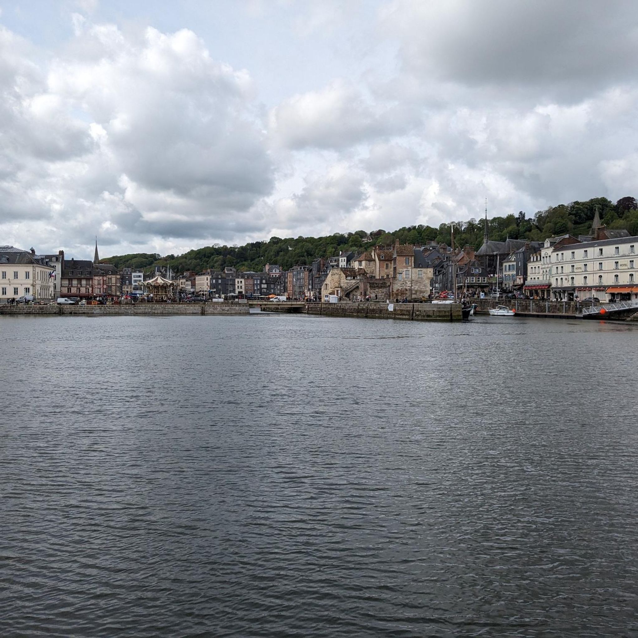
A port for numerous boats and a home port for many artists, the port of Honfleur is synonymous with Impressionism. It is also a place steeped in history, local produce, and traditions. Cyclists, stop and explore the surrounding area.
0
0

Sitting at this charming harbor and enjoying a good coffee, wonderful!
8
0

The Lieutenance is a historic building located at the entrance to the old harbor (Vieux Bassin). It is the only remaining part of the city's medieval fortifications. The building originally served as the residence of the Governor of Honfleur and later became the seat of the Lieutenant du Roi.
7
0

The place is simply magical. You should definitely stop by on your discovery tour.
0
0
The place is simply magical. You should definitely stop by on your discovery tour.
0
0


Honfleur is a very beautiful Norman town with beautiful houses, harbors, small alleys, and many fish restaurants. It's worth spending an extra day here.
0
0

The most beautiful view of Honfleur
1
0
Frequently Asked Questions
How many running routes are available in La Rivière-Saint-Sauveur?
There are 17 dedicated running routes around La Rivière-Saint-Sauveur, offering a variety of experiences for joggers. These routes are well-documented and frequently used by the komoot community.
What kind of landscapes can I expect while running in La Rivière-Saint-Sauveur?
Jogging in La Rivière-Saint-Sauveur offers diverse and scenic landscapes. You can expect waterside routes along the Orange river and the Baie de Saint-Sauveur, paths through the picturesque Seine estuary, and charming bocage landscapes. The area is also crisscrossed by waterways like the Canal de Retour d'Eau and the Morelle, providing varied and beautiful running environments with "majestic panoramas".
What do other runners say about the trails in La Rivière-Saint-Sauveur?
The running routes in La Rivière-Saint-Sauveur are highly rated by the komoot community, with an average score of 4.1 out of 5 stars from over 40 reviews. More than 900 runners have explored the varied terrain, often praising the scenic views and the diverse options available for different fitness levels.
Are there running routes suitable for beginners in La Rivière-Saint-Sauveur?
Yes, La Rivière-Saint-Sauveur offers 2 easy running routes that are perfect for beginners or those looking for a more relaxed jog. These paths often feature mostly paved surfaces and minimal elevation gain, making them accessible for all fitness levels.
Are there challenging running trails for experienced runners?
Absolutely. For experienced runners seeking a challenge, there are 15 moderate routes available. While there are no routes classified as 'difficult' in the immediate area, many moderate trails, like the Le bassin – Le Phare du Butin loop from Honfleur, feature significant elevation gains (up to 155 meters) and longer distances, providing a good workout.
What landmarks or points of interest can I see along the running routes?
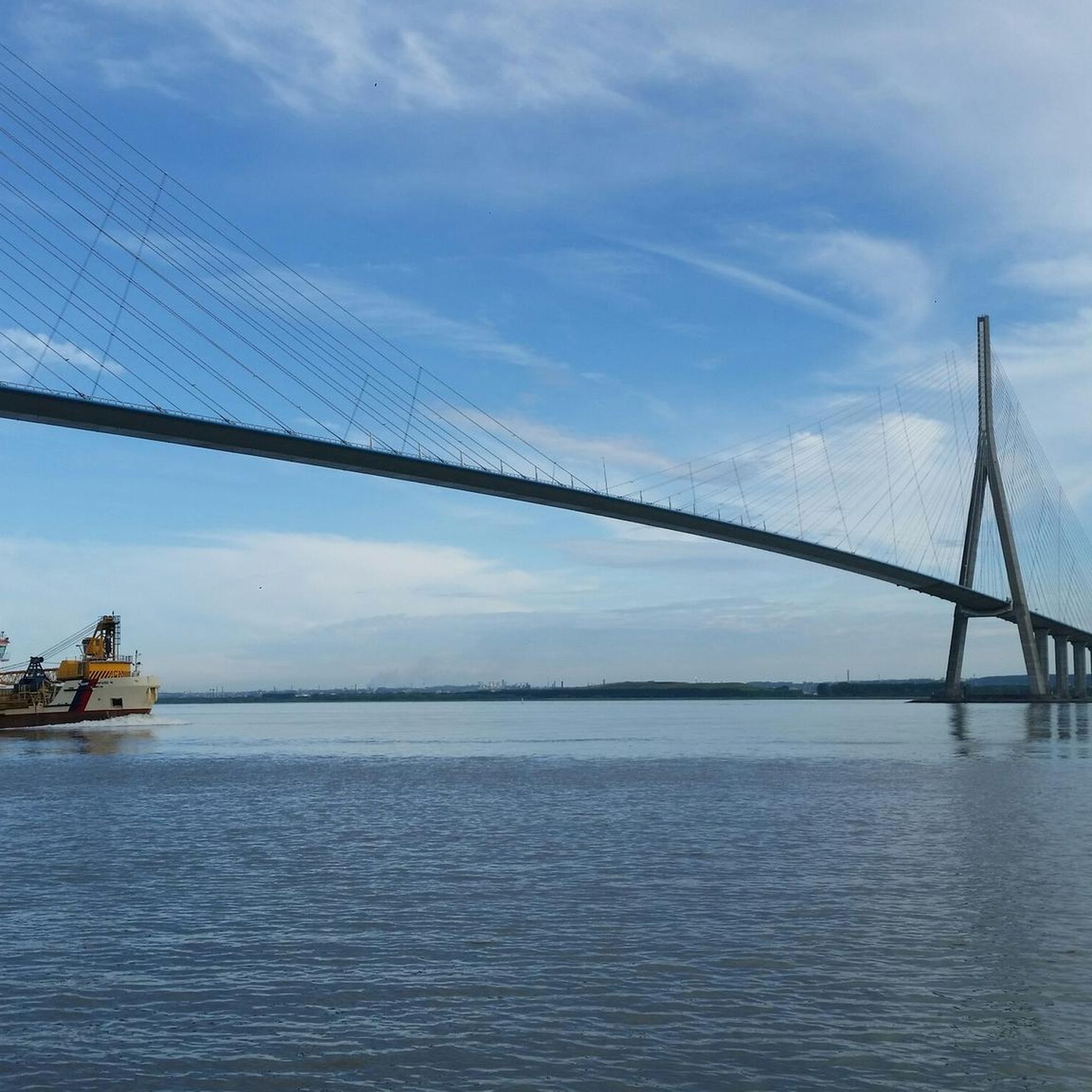
Many running routes in the area offer views of notable landmarks. For instance, the Le bassin – Le Phare du Butin loop from Honfleur connects to the historic Hospital Lighthouse. Other routes might offer glimpses of the town of Honfleur, its Old Harbour, or the impressive Pont de Normandie, as seen on the View of the Pont de Normandie loop from La Rivière-Saint-Sauveur.
Are there any circular running routes in La Rivière-Saint-Sauveur?
Yes, many of the running routes in La Rivière-Saint-Sauveur are circular, allowing you to start and end at the same point. Popular examples include the Le Jardien de Personnalités – Le bassin loop and the Le bassin loop, both starting from La Rivière-Saint-Sauveur.
Are the running routes in La Rivière-Saint-Sauveur family-friendly?
Yes, the region offers several family-friendly running options, particularly the easier, mostly paved paths. These routes are suitable for a leisurely jog with children or for those pushing a stroller, allowing families to enjoy the beautiful scenery together.
Are there dog-friendly running routes in the area?
Many of the trails in La Rivière-Saint-Sauveur are suitable for running with dogs, especially those that traverse natural landscapes and less populated areas. It's always recommended to keep your dog on a leash and be mindful of local regulations and other trail users.
Is public transport available to access the running trails?
While specific public transport links directly to every trailhead might vary, La Rivière-Saint-Sauveur is well-connected to nearby Honfleur, which serves as a hub. Many routes are accessible from central points within La Rivière-Saint-Sauveur or Honfleur, making them reachable by local transport options or a short walk from bus stops.
Are there cafes or pubs accessible from the running routes?
Given La Rivière-Saint-Sauveur's proximity to Honfleur (just 3 km away), many running routes can be planned to pass near or end in areas with cafes, pubs, and restaurants. This allows runners to enjoy refreshments or a meal after their activity, particularly if they choose routes that venture towards Honfleur's historic center or harbor.
What is the best time of year to go running in La Rivière-Saint-Sauveur?
The pleasant and green setting of La Rivière-Saint-Sauveur makes it enjoyable for running throughout much of the year. Spring and autumn offer mild temperatures and beautiful natural colors, while summer provides longer daylight hours. Even in winter, the trails can be accessible, though conditions might vary depending on weather.
Most popular routes around La Rivière-Saint-Sauveur
Most popular attractions around La Rivière-Saint-Sauveur

Get inspired with the komoot mobile app


Explore more
Browse the best Running Trails & Routes in other regions.
