The best running trails around Pléchâtel
4.3
(79)
3,178
runners
31
runs
Jogging routes around Pléchâtel are characterized by the scenic Vilaine Valley, offering diverse and well-maintained paths ideal for running. The area features a dedicated cycle path along the Vilaine River, providing continuous and picturesque routes. Runners can encounter varied terrain, including the unique Levée Shale Cliff with its carved grottoes and the elevated Uzel Rock, which offers expansive views over the valley.
Best jogging routes around Pléchâtel
- The most popular jogging route is View of Bain-de-Bretagne loop from La Gourdelais, a 9.7 miles (15.6 km) trail that takes 1 hour 49 minutes to complete. This route offers varied terrain typical of the Vilaine Valley.
- Another top favourite among local runners is View from the Rocher d'Uzel loop from Pléchâtel, a difficult 11.1 miles (17.9 km) path. This running route provides views from the historic Uzel Rock, dominating the Vilaine Valley.
- Local runners also love the Uzel Rock – Guipry-Messac Mill loop from Pléchâtel, a 10.6 miles (17.1 km) trail leading through the Vilaine Valley and past the Uzel Rock, often completed in about 1 hour 48 minutes.
- Jogging around Pléchâtel is defined by the picturesque Vilaine Valley, well-maintained riverside paths, and notable features like the Levée Shale Cliff and Uzel Rock. The network offers options for easy, moderate, and difficult running routes, catering to various ability levels.
- The routes in Pléchâtel are highly rated by the komoot community with an average score of 4.2 stars from over 70 reviews. More than 2800 runners have used komoot to explore Pléchâtel's varied terrain.
Last updated: October 5, 2026
5.0
(2)
91
runners
18.1km
02:11
320m
320m
Hard run. Very good fitness required. Mostly accessible paths. Some sure footedness required.
30
runners
17.1km
01:48
40m
40m
Hard run. Very good fitness required. Mostly paved surfaces. Suitable for all skill levels.

11
runners
5.51km
00:35
40m
40m
Moderate run. Good fitness required. Mostly paved surfaces. Suitable for all skill levels.
11
runners
6.17km
00:41
70m
70m
Moderate run. Good fitness required. Mostly paved surfaces. Suitable for all skill levels.
5.0
(1)
14
runners
7.03km
00:45
60m
60m
Moderate run. Good fitness required. Mostly paved surfaces. Suitable for all skill levels.
Get access to more routes and recommendations from other explorers.
Already have an account?
Our route recommendations are based on thousands of hikes, rides, and runs completed by other people on komoot.
Start today with a free account
Your next adventure awaits.

Tips from the Community

This former watermill, documented as early as 1089, was initially used as a fulling mill before being converted into a flour mill in the 19th century. Its operation ceased on December 31, 1974. Since then, the building has stood as a significant heritage landmark, marking the industrial and riverine history of the Vilaine Valley.
1
0

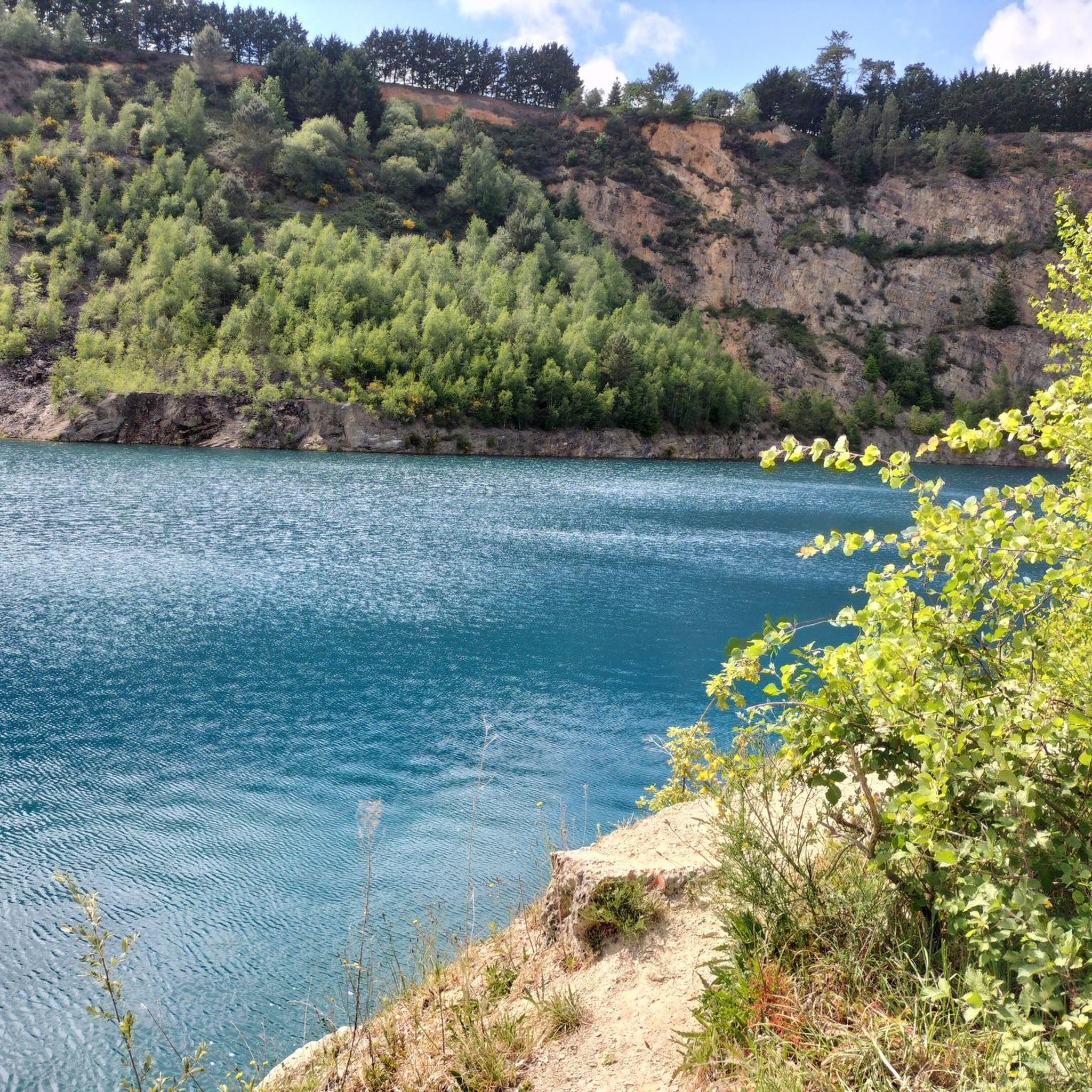
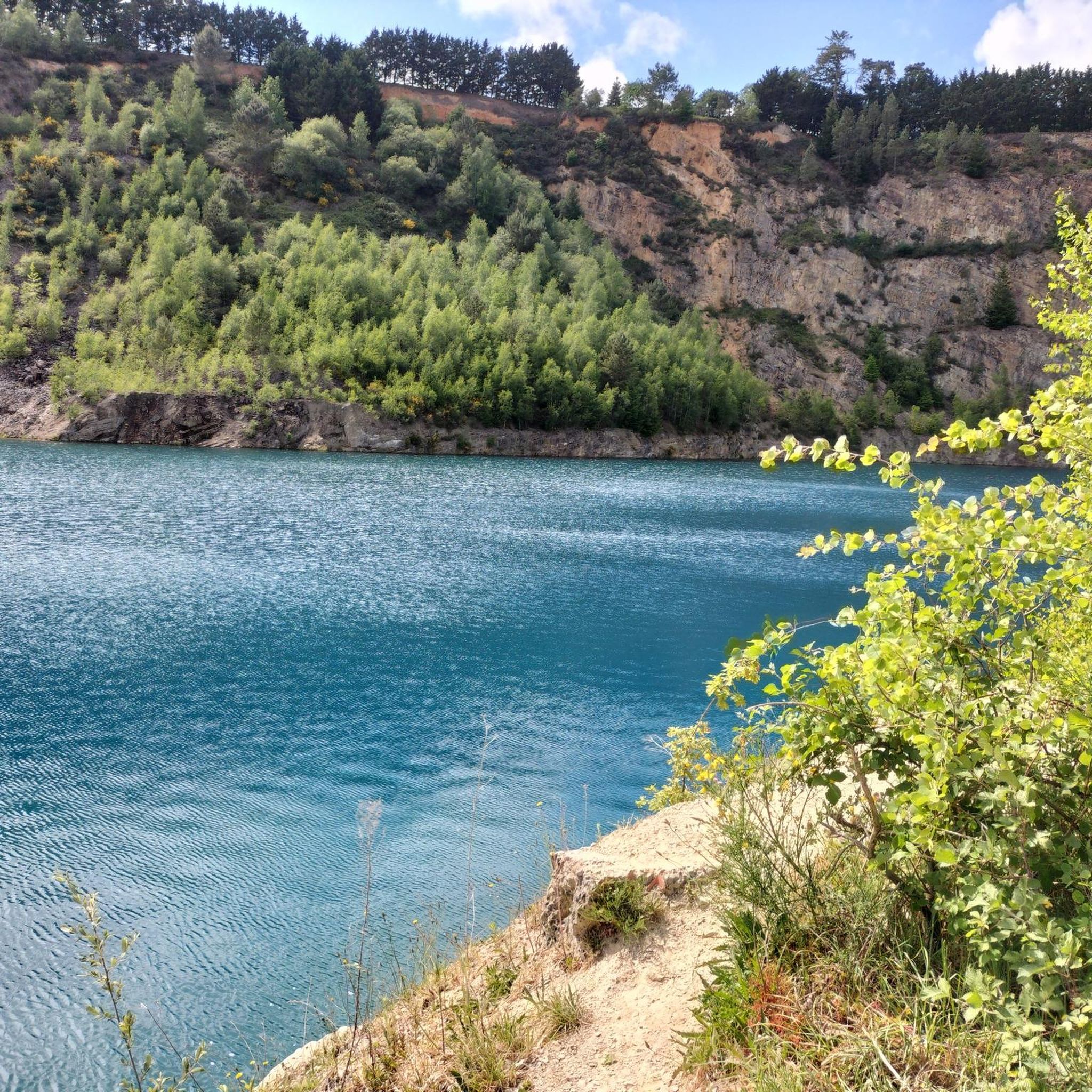
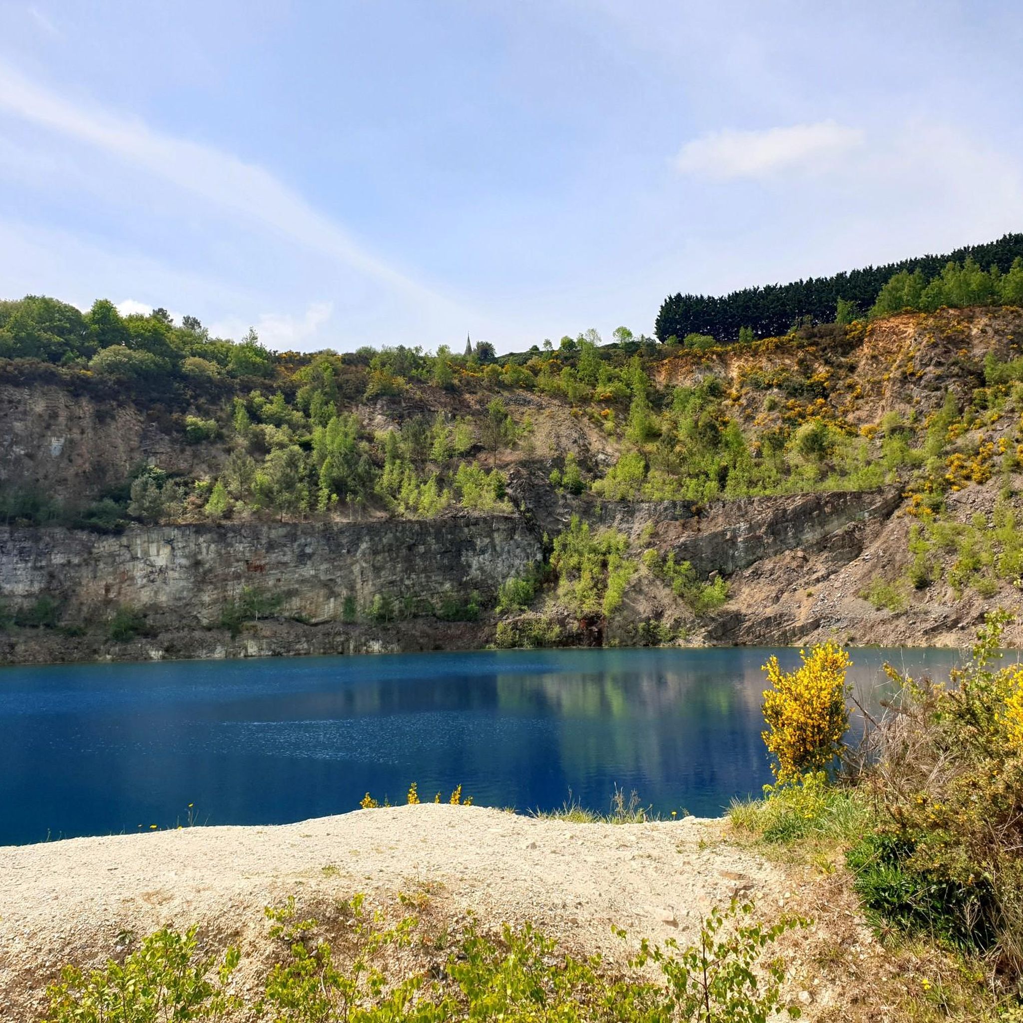
Very pretty for this turquoise blue water. But deadly for swimming.
1
0

Magnificent spot near Vilaine!! I highly recommend taking a break here!
0
0

Magnificent quarry which, preferably in sunny weather, shines with its blue water. Be careful, however, access is prohibited for swimming due to its very cold water and the risk of drowning.
1
0
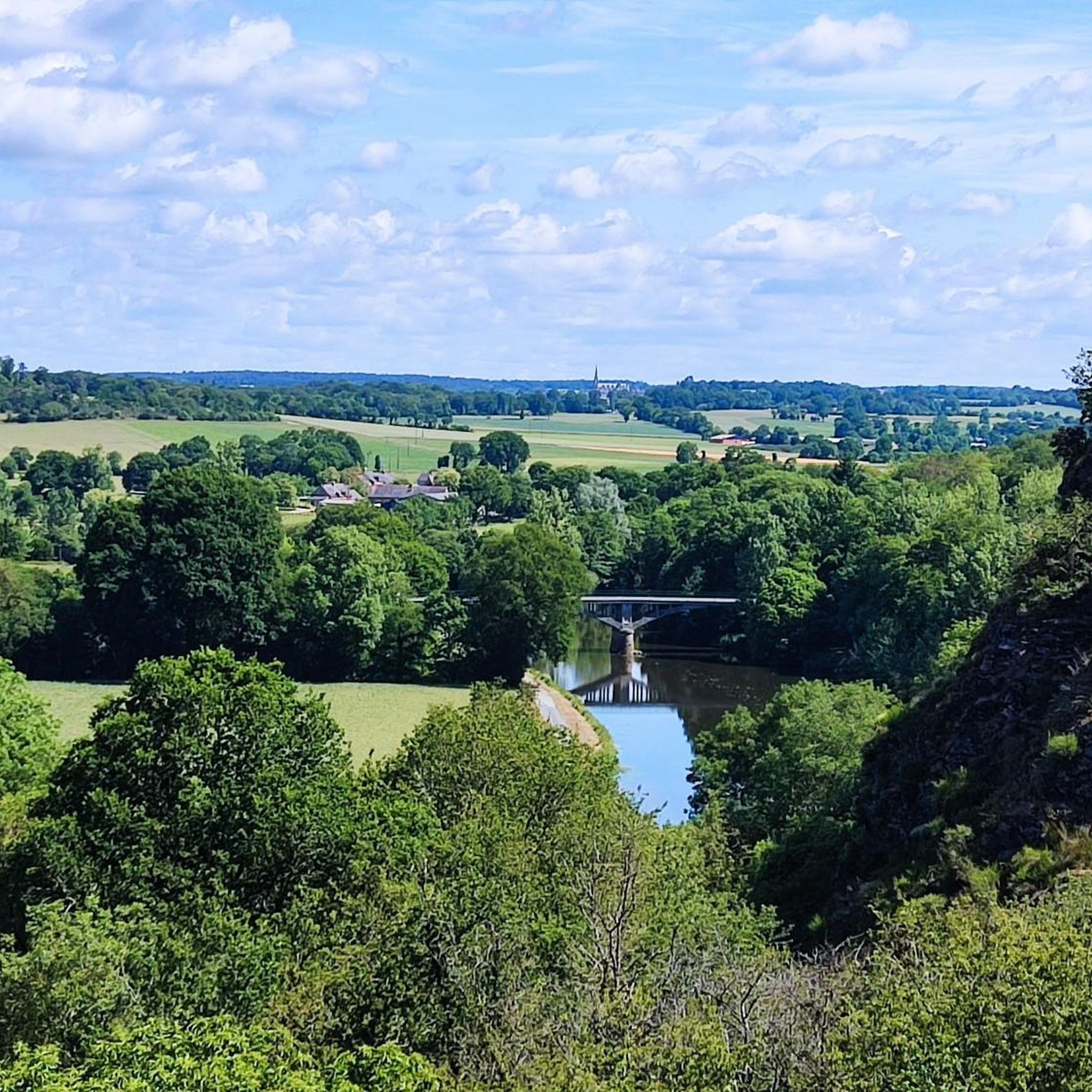
Magnificent view point on the banks of the Vilaine as well as Saint Malo de Phily. However, be careful with the descent following the GR which can be perilous in wet weather (Large difference in altitude)
0
0
Relax in the relaxing sounds of the Vilaine
0
0
La Minoterie Guipry Messac, a bistronomic restaurant, the magic of a place set in the peaceful course of time.
0
0
Frequently Asked Questions
How many running routes are available around Pléchâtel?
There are over 30 dedicated running routes around Pléchâtel, catering to various skill levels. The komoot community has explored more than 2,800 of these trails, highlighting the area's popularity for outdoor activities.
What kind of terrain can I expect on the jogging trails in Pléchâtel?
The jogging trails in Pléchâtel offer diverse terrain, primarily characterized by the scenic Vilaine Valley. You'll find well-maintained paths, including a dedicated cycle path along the Vilaine River, as well as more varied sections featuring unique geological formations like the Levée Shale Cliff with its carved grottoes and steps, and the elevated Uzel Rock.
Are there any easy running routes for beginners in Pléchâtel?
Yes, Pléchâtel offers several easy running routes suitable for beginners. Out of the over 30 routes available, 2 are specifically categorized as easy, providing a gentle introduction to the area's beautiful landscapes.
Can I find challenging running trails in Pléchâtel?
Absolutely. For those seeking a challenge, Pléchâtel has 6 difficult running routes. One such route is View of Bain-de-Bretagne loop from La Gourdelais, which covers 15.6 km with significant elevation changes. Another demanding option is View from the Rocher d'Uzel loop from Pléchâtel, an 17.9 km path offering panoramic views.
What are some scenic viewpoints or natural features to look out for on the running routes?
Pléchâtel's running routes are rich with scenic viewpoints and natural features. You can enjoy panoramic views over the Vilaine Valley from the Cambrée Bridge, or admire the confluence of the Vilaine and Semnon rivers from the Charrière Bridge. The Uzel Rock is a prominent high viewpoint dominating the valley, offering historical and geological interest with its natural caves. The Boël Mill, a 12th-century watermill, also provides beautiful panoramas from its surroundings.
Are there any long-distance running options around Pléchâtel?
Yes, Pléchâtel offers several longer running routes. For instance, the Chapelle de Montserrat – Clos Pointu Quarry loop from Pléchâtel is a challenging 23 km route. Many routes along the Vilaine River's towpath, which extends from Rennes to Redon, also provide excellent opportunities for extended runs.
What do other runners say about the trails in Pléchâtel?
The running trails in Pléchâtel are highly regarded by the komoot community, boasting an average rating of 4.2 out of 5 stars from over 70 reviews. Runners frequently praise the picturesque Vilaine Valley, the well-maintained riverside paths, and the diverse terrain that includes notable features like the Levée Shale Cliff and Uzel Rock.
Are there circular running routes available in Pléchâtel?
Yes, many of the running routes in Pléchâtel are circular, allowing you to start and finish at the same point. Examples include the Uzel Rock – Guipry-Messac Mill loop from Pléchâtel, which is 17.1 km, and the View of Bain-de-Bretagne loop from Poligné, a moderate 10.8 km option.
Is Pléchâtel suitable for family-friendly running or walking?
Pléchâtel's natural environment, particularly the well-maintained cycle path along the Vilaine River, makes it suitable for family-friendly activities. The
What is the best time of year to go running in Pléchâtel?
The Vilaine Valley offers beautiful scenery year-round. Spring and autumn generally provide the most comfortable temperatures for running, with vibrant foliage or blooming nature. However, the well-maintained paths along the river are accessible in most seasons. Always check local weather conditions before heading out.
Are there any specific projects or initiatives enhancing outdoor activities in Pléchâtel?
Yes, Pléchâtel is actively developing its "Pôle de pleine nature" (full nature hub) at the site of La Cassière. This project aims to integrate green tourism by creating dedicated spaces for sports, leisure, and nature-connected activities, further enhancing the area's appeal for outdoor enthusiasts, including runners.
Can I access the running routes using public transport?
While specific public transport details for each trailhead are not provided, the towpath along the Vilaine River, which passes through Pléchâtel, is a significant feature. For detailed public transport information to Pléchâtel itself, it's advisable to check regional transport services for connections from larger towns like Rennes.
Most popular attractions around Pléchâtel

Get inspired with the komoot mobile app


Explore more
Browse the best Running Trails & Routes in other regions.
