The best walks and hikes around Montbartier
4.6
(62)
704
hikers
55
hikes
Hiking around Montbartier offers diverse natural features, including forests, canals, and varied countryside. The region is characterized by a blend of wooded areas, flat towpaths along waterways, and open fields. Terrain ranges from gentle, level paths suitable for leisurely strolls to slightly more undulating routes through agricultural landscapes.
Best hiking trails around Montbartier
- The most popular hiking route is Montech Water Slope – Montech Canal loop from Montech, a 2.6 miles (4.1 km) easy trail that takes 1 hour…
Last updated: August 4, 2026
37
hikers
4.14km
01:03
10m
10m
Easy hike. Great for any fitness level. Easily-accessible paths. Suitable for all skill levels.
4.5
(2)
12
hikers
11.1km
02:48
30m
30m
Moderate hike. Good fitness required. Easily-accessible paths. Suitable for all skill levels.

Sign up for free
3.0
(1)
8
hikers
Moderate hike. Good fitness required. Easily-accessible paths. Suitable for all skill levels.
4.0
(2)
6
hikers
5.71km
01:26
10m
10m
Easy hike. Great for any fitness level. Easily-accessible paths. Suitable for all skill levels.
4
hikers
12.4km
03:09
30m
30m
Moderate hike. Good fitness required. Easily-accessible paths. Suitable for all skill levels.
Get access to more routes and recommendations from other explorers.
Sign up for free
Already have an account?
Our route recommendations are based on thousands of hikes, rides, and runs completed by other people on komoot.
Start today with a free account
Your next adventure awaits.
Login or Signup


Tips from the Community


Very smooth section of the canal with little traffic. Be careful of a section on the bridge with large cobblestones.
0
0

An original piece of technical history
2
0

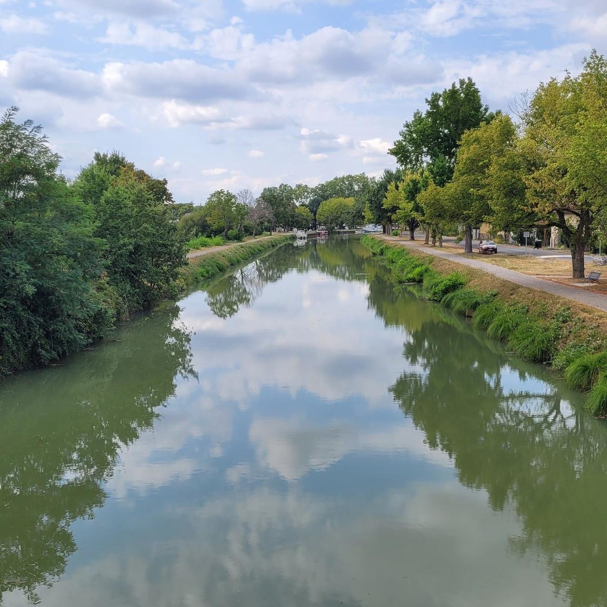
Very pretty canal, very bucolic, with pretty lock houses...
0
0
Montech is worth the stop and the visit for its rehabilitated industrial site and the historic center of Montauban is remarkable. Between the Toulouse-Bordeaux and Montauban-Auch routes, Montech experienced industrial growth. The site has been rehabilitated and developed for visits, starting from the Maison du site and the intercommunal Tourist Office. Panels have been installed to guide your visit. The water slope is a unique site for its time. It operated from 1974 to 2009 and allowed time to be saved without passing the 5 historic locks of the lateral canal. A concrete slope over 400 m long, 6 m wide and over 4 m deep, was built parallel to the canal. A mobile shield pushed by two wheeled locomotives allowed a large volume of water to be pushed where a barge floated.
2
0

The Montech Canal joins the lateral canal of the Garonne
1
0


Intersection between the Canal de Montech and the Canal de la Garonne.
0
0
Frequently Asked Questions
What kind of terrain can I expect on hikes around Montbartier?
The hiking terrain around Montbartier is quite varied, offering a mix of peaceful forest paths, flat canal-side routes, and trails through open countryside with fields and orchards. You'll find options ranging from gentle, level paths suitable for leisurely strolls to slightly more undulating routes through agricultural landscapes and wooded areas like the Forêt de Montech.
Are there challenging hikes or are they mostly easy?
Most of the hiking routes around Montbartier are classified as easy to moderate. Out of 43 available tours, 32 are easy and 11 are moderate, with no difficult trails. This makes the area very accessible for a wide range of hikers, from beginners to those looking for a pleasant day out.
What natural features can I expect to see on the trails?
You can expect to encounter diverse natural features. Many trails wind through the Forest of Montech, offering peaceful wooded environments. The Canal des Deux Mers (specifically the Montech Canal section) provides flat towpaths lined with century-old cedars. Beyond these, the countryside features fields, orchards, and occasionally small streams or hillside lakes. You might also spot local wildlife like roe deer.
Are there any specific landmarks or points of interest along the hiking routes?
Yes, several routes feature notable landmarks. For instance, the Montech Water Slope – Montech Canal loop from Montech follows the scenic Montech Canal and passes by the unique Montech Water Slope. The Lac de Camp de Motte loop from Finhan offers views of the tranquil lake itself.
Is parking available at the trailheads in Montbartier?
While specific parking details for every trailhead are not always listed, many popular starting points for hikes in the region, especially those near towns like Montech or access points to the Forest of Montech and the Canal des Deux Mers, typically offer designated parking areas. It's advisable to check local signage upon arrival.
Can I reach hiking trails in Montbartier using public transport?
Montbartier is a smaller commune, and direct public transport links to specific trailheads might be limited. However, major towns in the Tarn-et-Garonne department, such as Montauban or Montech, often have better public transport connections. From these points, you might need to consider a short taxi ride or cycling to reach the starting points of some trails. For broader regional information, you can check resources like tourisme-tarnetgaronne.fr.
What is the best time of year to go hiking in Montbartier?
The region around Montbartier is pleasant for hiking for much of the year. Spring and autumn offer mild temperatures and beautiful scenery, with blooming flowers or vibrant fall foliage. Summer can be warm, making early morning or late afternoon hikes along shaded forest paths or canal-side routes ideal. Winter hiking is also possible, especially on the flatter canal paths, though some forest trails might be muddy.
Are there family-friendly hiking options in Montbartier?
Absolutely. Many of the easy trails, particularly those along the Canal des Deux Mers or within the Forest of Montech, are well-suited for families. These routes often have minimal elevation gain and well-maintained paths. An example is the Montech Water Slope – Montech Canal loop from Montech, which is an easy 4.1 km route taking just over an hour.
Are dogs allowed on the hiking trails around Montbartier?
Generally, dogs are welcome on many hiking trails in the Montbartier area, especially on public paths through forests and along canals. However, it's always recommended to keep them on a leash, particularly in nature reserves, agricultural areas, or where wildlife might be present. Please ensure you clean up after your pet.
How long do the easy hikes typically take?
Easy hikes around Montbartier vary in length and duration. For example, the Montech Water Slope – Montech Canal loop from Montech is an easy 4.1 km route that typically takes about 1 hour and 3 minutes. Another easy option, the Canal de Montech loop from Montech, covers 5.7 km and takes around 1 hour and 26 minutes.
Are there many circular hiking routes available?
Yes, many of the hiking routes in Montbartier and the surrounding area are designed as circular loops, allowing you to start and end at the same point. This is convenient for those traveling by car. Examples include the Lac de Camp de Motte loop from Finhan and the Forêt domaniale d'Agre loop from Fédération Départementale de Pêche.
What do other hikers enjoy the most about hiking in Montbartier?
The area is highly rated by the komoot community, with an average score of 4.3 stars from over 45 reviews. Reviewers often praise the peaceful forest paths, the tranquil canal-side routes, and the varied countryside trails. Many appreciate the accessibility of the routes for different ability levels and the opportunity to explore natural features like the Montech Water Slope.
What kind of wildlife might I encounter while hiking?
The diverse landscapes around Montbartier, including forests, canals, and open fields, support various wildlife. While hiking, you might spot birds, small mammals, and potentially roe deer, especially in the quieter wooded areas like the Forest of Montech. The canal environments also host aquatic birds and insects.
Most popular attractions around Montbartier

Get inspired with the komoot mobile app


Explore more
Browse the best Hikes in other regions.
