The best road cycling routes around Nantillé
4.3
(12)
594
riders
229
rides
Road cycling routes around Nantillé traverse a landscape characterized by gently rolling terrain, agricultural fields, and river valleys. The region features a network of quiet country roads, often passing through vineyards and small villages. Elevation gains are generally moderate, with no significant peaks, making it suitable for various fitness levels. The area's physical features include the Charente River and its tributaries, along with historical sites like abbeys and ancient washhouses.
Best road cycling routes around Nantillé
- The most popular road…
Last updated: July 30, 2026
5.0
(1)
4
riders
42.3km
01:55
290m
290m
Easy road ride. Great for any fitness level. Mostly well-paved surfaces and easy to ride.
2
riders
96.2km
04:18
560m
560m
Moderate road ride. Good fitness required. Mostly well-paved surfaces and easy to ride.

Sign up for free
4.0
(1)
10
riders
61.2km
02:40
420m
420m
Moderate road ride. Good fitness required. Mostly well-paved surfaces and easy to ride.
10
riders
Moderate road ride. Good fitness required. Some segments of this route may be unpaved and difficult to ride.
5.0
(1)
5
riders
Moderate road ride. Good fitness required. Some segments of this route may be unpaved and difficult to ride.
Get access to more routes and recommendations from other explorers.
Sign up for free
Already have an account?
Our route recommendations are based on thousands of hikes, rides, and runs completed by other people on komoot.
Start today with a free account
Your next adventure awaits.
Login or Signup


Tips from the Community

Courcoury is a natural island surrounded by the Charente and Seugne rivers, giving it a unique landscape setting between marshes and waterways, conducive to biodiversity and outdoor activities. It is also the only village in Charente-Maritime to have been awarded 4 stars by the "Villes et villages étoilés" label, recognizing its efforts to reduce light pollution through intelligent and environmentally friendly public lighting.
1
0

The Abbaye-aux-Dames is built around the church of Sainte-Marie, built in the twelfth century. Famous for its facade and its characteristic "pinecone" bell tower, it is one of the emblematic monuments of Saintonge's Romanesque art. After several wars and fires, the place was restored in the 1970s and 1980s and is now a hotel. When you walk through the long corridors you feel like you have been transported back to the time when the abbey was still alive.
4
0

A former Benedictine abbey created in 1047, Abbaye-aux-Dames was the first women's monastery in Saintonge. These powerful women were nuns, that is to say, nuns living cloistered and having taken a vow of piety, occupying their lives in contemplation. They carried the crosier, in other words the pastoral staff of a bishop, and minted coins. Richly endowed, the abbey carried its influence well beyond the borders of the county and over time it became one of the most powerful women's monasteries in all of South-West France. With up to a hundred nuns at its peak, it was entrusted with the mission of instructing young girls, often from the French nobility, and counted among its most illustrious residents the future Marquise de Montespan, favorite of Louis XIV. The Abbaye-aux-Dames is structured around the Sainte-Marie church, built in the 12th century, famous for its facade and its characteristic “pine cone” bell tower. The premises were restored during the 1970s and 1980s and now house a Cité de la musique in which the Saintes Festival dedicated to classical music takes place each year. You can also stay in a wing of the building, the cells having been converted into hotel rooms, and leave your bike in a secure room.
0
0

The Garde-Épée dolmen is classified as a historic monument. It is made up of five slabs which delimit the room and slabs which cover it. The dolmen is five meters long and more than two meters high.
0
0
The Santons people occupied Saintonge during the Gallic era. The Romans conquered the region and settled on the banks of the Charente. The town of Saintes (then designated Mediolanum), located at the western end of the Via Agrippa which linked Lyon (capital of the Three Gauls) to the Atlantic coast, quickly became monumental. At the time of Augustus (27 BC – 14 AD), the city probably became the capital of the province of Greater Aquitaine (Aquitania). This then extended from the Loire to the Pyrenees. Mediolanum is endowed with important public monuments: the amphitheater, the arch of Germanicus, the thermal baths and the aqueduct are still partially visible today. At the time of its peak (end of the 1st century – beginning of the 2nd century), the city must have had several thousand inhabitants. The amphitheater of Mediolanum is one of the earliest in Gaul. It is estimated that its construction began during the reign of Tiberius (14 – 37 AD), and was completed during the reign of Claudius (41 – 54 AD). Like many amphitheaters of the Roman Empire, that of Saintes was located on the outskirts of the ancient city in a chosen and developed site: the “vallon des Arènes”. Thanks to a favorable topography, the builders were relieved of part of their work, the amphitheater resting on the slope of the valley. This elliptical monument, with imposing dimensions (126 meters long and 102 meters wide), made it possible to accommodate several thousand spectators around bloody and violent representations such as gladiator fights (munera) or animal hunts (venationes ). In the 3rd century, the city declined and was entrenched within an impressive rampart, built from the remains of public and funerary monuments from previous decades. The amphitheater is then no longer used. Since the Middle Ages, it has been used, among other things, as a stone quarry. It was classified as a Historic Monument in 1840. It was from this moment that it was gradually restored. Today, despite the disappearance of the superstructures, the remains provide a faithful image of what this monument could have been at the time of its splendor. The site welcomes visitors all year round. Certain objects found during various excavations in the amphitheater district are visible at the archaeological museum.
1
0
Located on a rocky spur overlooking the Charente, Taillebourg has one of the oldest castles in the province of Saintonge. It was also one of the most important in the region in the Middle Ages. This stronghold will allow the city to assert its power and prosper thanks to its port and control of trade throughout the Middle Ages. According to a chronicler, the Château de Taillebourg hosted the wedding night of Louis, future king of France under the name Louis VII, with Duchess Eleanor of Aquitaine. Louis IX (future Saint Louis) made the castle his fortress to launch the attack against the King of England, Henry III. This victorious battle of July 21, 1242 became famous and was represented several centuries later by Delacroix, whose painting can be seen in the Battles gallery at the Palace of Versailles. The castle which had endured all the sieges during the Hundred Years' War and the Wars of Religion was taken and destroyed during the Fronde in 1652. During the Revolution, it was sold in lots as national property. Having suffered from lack of maintenance, the building was the victim of a fire in 1822 and was largely destroyed. All that remains now are the ruins with the ramparts and a tower standing like an emaciated being. It now houses a park which is a haven of peace. To access it from the banks of the Charente, you have to take a small detour through the town.
0
0

Built in the 11th and 12th centuries, this church, listed as a historic monument in 1912, is a spectacular work of art. Well worth the drive past when crossing town!
0
0
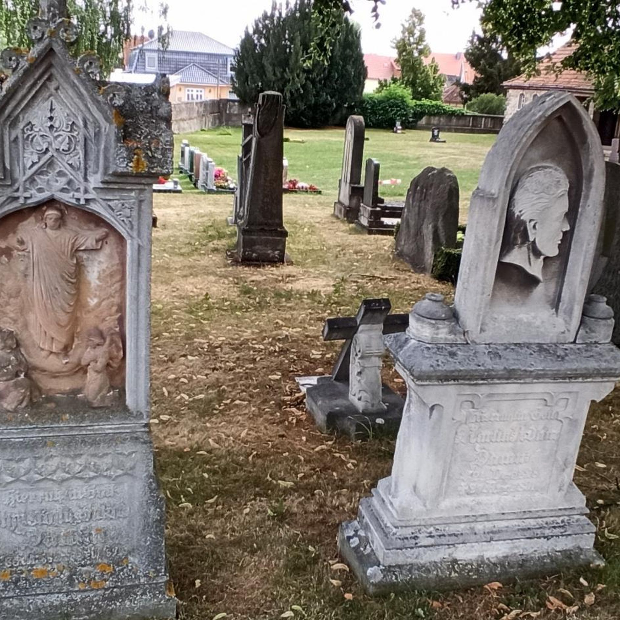
This small town of less than 400 inhabitants is located in a hilly and wooded area. It is part of one of the stages of the GR 360 long-distance footpath. It is worth going past the abbey and the church while crossing the town! Both were built at the beginning of the 12th century.
2
0
Frequently Asked Questions
How many road cycling routes are available around Nantillé?
There are over 200 road cycling routes around Nantillé documented on komoot, offering a wide variety of options for different preferences and fitness levels.
Are there easy road cycling routes suitable for beginners in Nantillé?
Yes, Nantillé offers several easy road cycling routes. One popular option is Nantillé, La-Chapelle-des-Pots et Saint-Bris-des-Bois in a loop, which is 26.3 miles (42.3 km) long and provides a gentle ride through the local countryside.
Can I find challenging road cycling routes in Nantillé?
While the region is generally characterized by gently rolling terrain, there are a few routes that offer more challenge. The area's moderate elevation gains mean that longer distances, such as the Tour of the Cognac Vineyards at 59.8 miles (96.2 km), can provide a good endurance test.
What is the best time of year for road cycling in Nantillé?
The region's agricultural landscape, particularly its vineyards, suggests that spring and autumn offer pleasant conditions with milder temperatures and beautiful scenery. Summer can also be enjoyable, though it may be warmer.
Are there circular road cycling routes around Nantillé?
Many routes in the Nantillé area are designed as loops, allowing you to start and end in the same location. An example is Nantillé, La-Chapelle-des-Pots et Saint-Bris-des-Bois in a loop, which offers a convenient circular journey.
What can I see along the road cycling routes in Nantillé?
Road cycling routes often pass through vineyards, small villages, and river valleys. You can also discover historical sites such as the Abbaye de Fontdouce or the Ruins of the Former Abbey of Saint-Jean-Baptiste, and ancient washhouses.
Are there routes that pass through vineyards?
Absolutely. The region is known for its extensive vineyard landscapes. The Tour of the Cognac Vineyards is a prime example, showcasing the area's rich agricultural heritage.
What do other road cyclists enjoy about the routes in Nantillé?
The routes in Nantillé are highly rated by the komoot community, with an average score of 4.6 stars from over 11 reviews. Cyclists often praise the quiet country roads, the scenic vineyard landscapes, and the charming river valleys.
Are there road cycling routes that follow river valleys?
Yes, the Charente River and its tributaries are prominent features of the landscape. Routes like the Abbaye aux Dames de Saintes – View of the Charente River loop from Saint-Hilaire-Brizambourg lead through picturesque river valleys.
Can I find less crowded road cycling options in Nantillé?
The Nantillé region is characterized by a network of quiet country roads, making it an excellent choice for those seeking a less crowded cycling experience away from heavy traffic.
Are there road cycling routes that include coffee shops or places to stop?
Many routes pass through small villages where you can often find local cafes or bakeries for a refreshment stop. While specific coffee shops aren't listed for every route, the rural nature of the area means you'll encounter opportunities to pause and enjoy local hospitality.
Can I do a full-day road cycling trip from Nantillé?
Yes, with routes extending up to nearly 60 miles (96 km), such as the Tour of the Cognac Vineyards, you can certainly plan a full-day road cycling adventure from Nantillé, exploring the wider region.
Most popular attractions around Nantillé

Get inspired with the komoot mobile app


Explore more
Browse the best Road cycling routes in other regions.
