The best walks and hikes around Carlencas-Et-Levas
4.3
(694)
3,378
hikers
140
hikes
Hiking around Carlencas-Et-Levas offers trails through varied landscapes, characterized by the geological features of the Permian basin and the river valleys of the Orb. The region features a mix of open terrain, agricultural areas, and wooded sections. Elevation changes are generally moderate, providing accessible paths for different fitness levels. These routes often connect small villages and offer views of the surrounding countryside.
Best hiking trails around Carlencas-Et-Levas
- The most popular hiking route is Permian basin – Brenas loop from Brenas…
Last updated: November 8, 2026
4.7
(3)
18
hikers
6.89km
02:03
210m
210m
Moderate hike. Good fitness required. Easily walkable paths.
4.1
(9)
22
hikers
10.3km
02:48
140m
140m
Moderate hike. Good fitness required. Easily walkable paths.

4.0
(1)
19
hikers
5.82km
01:48
200m
200m
Easy hike. Easily walkable paths.
4.7
(3)
9
hikers
8.30km
02:27
250m
250m
Moderate hike. Good fitness required. Easily walkable paths.
5.0
(3)
7
hikers
13.9km
04:11
420m
420m
Moderate hike. Good fitness required. Easily walkable paths.
Get access to more routes and recommendations from other explorers.
Already have an account?
Our route recommendations are based on thousands of hikes, rides, and runs completed by other people on komoot.
Start today with a free account
Your next adventure awaits.


Tips from the Community

This old well in Vanquières was once used for washing laundry
5
0

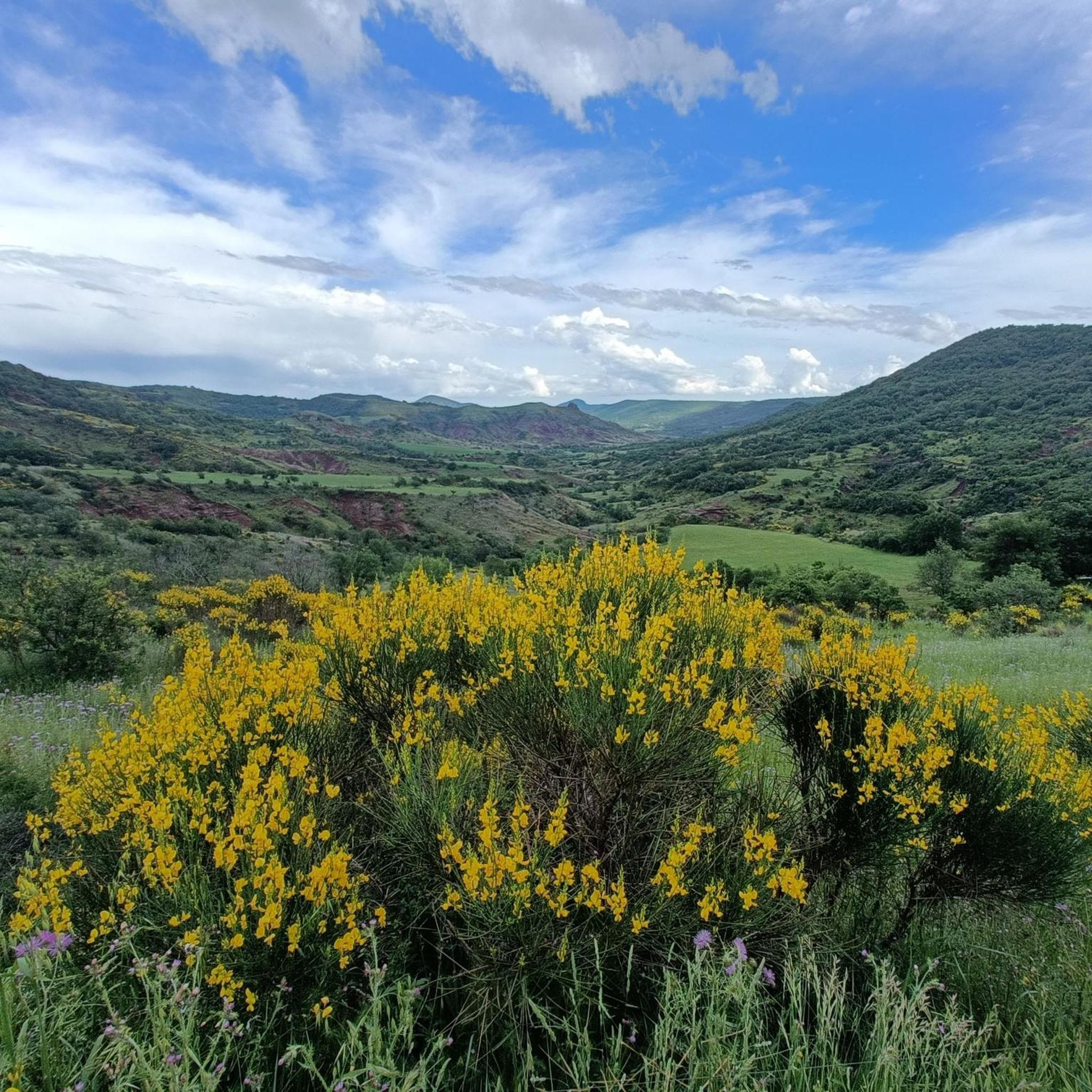
Brenas is a ‘special’ place, a hinge between the Monts d’Orb and the Salagou lake, with its incredible charm. The village overlooks the Salagou valley and its cattle and sheep farms that provide the milk for Roquefort cheese. The source of the Salagou river is located at the Col de la Merquière, the boundary of the commune with Dio Valquières and Carlencas. On the descent after Brenas and the Mas bas, an impressive viewpoint over a canyon of ruffes: in the background, the castellas de Mérifons, built on a volcanic peak. In spring, the contrasts of colours are striking. The bright yellow of the flowering broom mixes with the green of the holm oaks and the red of the ruffe: welcome to the Grand Site Salagou – Cirque de Mourèze!
0
0
A visual shock: you arrive in Dio! Sheltered by white limestone cliffs and emerging from the red earth characteristic of the surroundings of Lake Salagou, the village nestles under the imposing silhouette of its castle, a true legendary fortress. Its construction began in the 11th century to defend the border between Aquitaine, which had become a possession of the English, and Languedoc. The castle, renovated over the past twenty years by its current owner, hosts events and guided tours. The medieval hamlet is also currently being renovated and hosts several tourist accommodations. Friendly advice: stop off at Castelou, at Fred and Michel's... Passionate about the great outdoors, they are the perfect hosts!
0
0

This 11th and 14th century castle, somewhat isolated, is a medieval stronghold. It is classified as a historic monument and has benefited from several restorations in recent years.
3
0

A photo break before tackling the steep climb.
2
0


You can have a picknick here. Watch out for high waterflow in autumn and winter.
0
0

Exciting start. A winding tunnel without lighting, where you can not see the end at the beginning. That's not for everyone.
0
0
Frequently Asked Questions
How many hiking trails are available around Carlencas-Et-Levas?
There are over 125 hiking routes in the Carlencas-Et-Levas area, offering a wide range of options for different skill levels and preferences. This includes 38 easy routes, 81 moderate routes, and 6 more challenging trails.
Are there easy hiking trails suitable for beginners or families?
Yes, Carlencas-Et-Levas offers numerous easy hiking trails perfect for beginners or families. These routes typically feature moderate elevation changes and pleasant scenery. An example is the Brenas loop from Brenas, an easy 3.6-mile (5.8 km) trail that takes about 1 hour 48 minutes to complete through the local countryside.
What is the best time of year to go hiking in Carlencas-Et-Levas?
The best time for hiking in Carlencas-Et-Levas is typically during spring (April to June) and autumn (September to October). During these seasons, the weather is mild and pleasant, and the natural landscapes are particularly vibrant. Summers can be hot, making early mornings or late afternoons preferable for hiking.
Are the hiking trails in Carlencas-Et-Levas dog-friendly?
Most hiking trails in the Carlencas-Et-Levas region are dog-friendly, but it's always recommended to keep your dog on a leash, especially when passing through agricultural areas, near livestock, or in nature reserves. Always carry water for your pet, particularly during warmer months.
Are there any challenging hikes for experienced hikers?
While many routes are moderate, there are 6 more challenging trails available for experienced hikers seeking greater elevation gain and longer distances. These routes often explore more rugged terrain within the Permian basin landscape. An example of a moderate route with notable elevation is the Vanquières Village Fountain loop from Valquières, which covers 8.3 miles (13.4 km) with over 800 feet (249 m) of ascent.
What kind of views can I expect on the trails?
Hiking around Carlencas-Et-Levas offers diverse views, including the distinctive red rock formations of the Permian basin, rolling hills, agricultural landscapes, and scenic river valleys, particularly along the Orb river. Many trails provide panoramic vistas of the surrounding countryside.
Are there any interesting landmarks or attractions near the hiking routes?
Yes, the region boasts several interesting landmarks. You can explore historical sites like the Boussagues Medieval Village or the Château de Dio. Natural attractions include the striking Red Lands of Salagou and various lakes such as Lac de Vailhan.
Are most of the hiking trails circular routes?
Many of the hiking trails in Carlencas-Et-Levas are designed as circular routes, allowing you to start and end at the same point without needing to retrace your steps. This is convenient for exploring the varied landscapes. For instance, the Château de Dio – Dio Ridges Walk loop from Dio-et-Valquières is a popular circular option.
What do other hikers enjoy most about hiking in Carlencas-Et-Levas?
The area is highly rated by the komoot community, with an average score of 4.4 stars from over 400 reviews. Reviewers often praise the region's varied landscapes, from the unique geological features of the Permian basin to the tranquil river valleys, and the well-maintained paths that cater to different ability levels.
Can I find trails that follow rivers or have water features?
Yes, several trails in the region follow river valleys, offering scenic water features. The Tunnel – Along the Orb loop from Bédarieux is a prime example, following the Orb river and even passing through a tunnel, providing a unique riverside experience.
Is parking generally available at trailheads?
Parking is typically available in or near the villages where many trails begin. It's advisable to check specific route details on komoot for information on designated parking areas, especially for more remote trailheads.
Are there opportunities to see wildlife while hiking?
The diverse landscapes of Carlencas-Et-Levas, including wooded sections and open terrain, provide habitats for various local wildlife. Hikers may spot birds of prey, small mammals, and a variety of insects and reptiles, particularly in quieter areas away from villages.
Most popular routes around Carlencas-Et-Levas
Most popular attractions around Carlencas-Et-Levas

Get inspired with the komoot mobile app


Explore more
Browse the best Hikes in other regions.
