The best walks and hikes around Monsireigne
4.5
(231)
1,225
hikers
232
hikes
Hiking around Monsireigne offers a diverse landscape characterized by a mix of natural features and varied terrain. The region features the Grand Lay River, providing scenic views along its course, and includes hilly areas with elevations ranging from 45 to 137 meters. Woodlands such as the Bois des Jarries and the Bois de la Folie offer shaded paths, while the Barrage de Rochereau and its reservoir provide a distinct natural setting. These elements contribute to a range of hiking experiences…
Last updated: November 5, 2026
3.9
(10)
33
hikers
12.4km
03:18
120m
120m
Moderate hike. Good fitness required. Easily walkable paths.
3.8
(4)
21
hikers
4.49km
01:11
40m
40m
Easy hike. Easily walkable paths.

5.0
(2)
7
hikers
7.78km
02:05
90m
90m
Moderate hike. Good fitness required. Easily walkable paths.
5.0
(3)
11
hikers
15.2km
04:05
180m
180m
Moderate hike. Good fitness required. Easily walkable paths.
5.0
(1)
7
hikers
12.2km
03:16
140m
140m
Moderate hike. Good fitness required. Easily walkable paths.
Get access to more routes and recommendations from other explorers.
Already have an account?
Our route recommendations are based on thousands of hikes, rides, and runs completed by other people on komoot.
Start today with a free account
Your next adventure awaits.



Tips from the Community

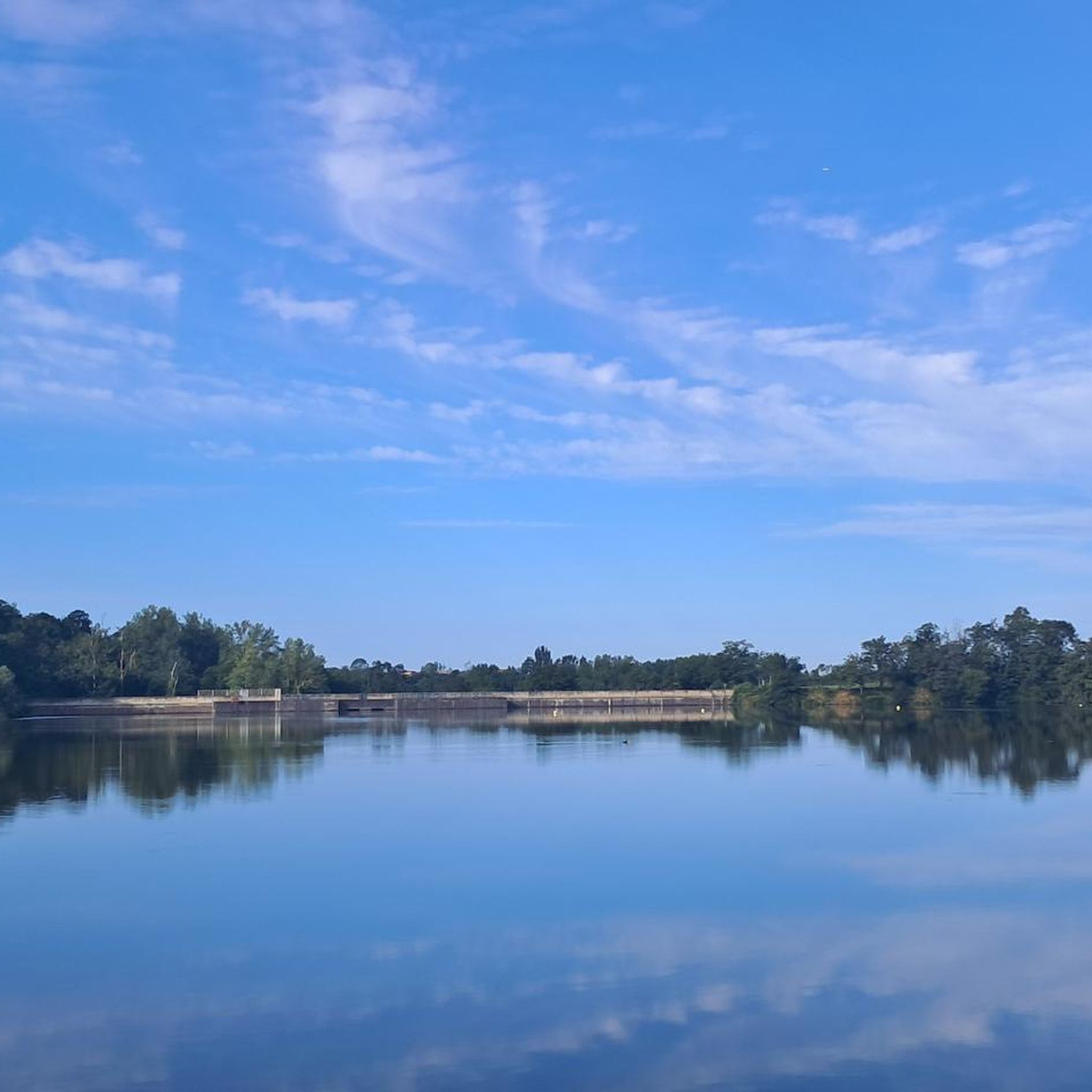
Rochereau Lake, with an area of 125 hectares, is the largest drinking water reserve in the Grand Lay Valley, fed by the Le Maine River. It has good fishing conditions and is home to a rich fish diversity in white fish, predatory fish and common and mirror carp of intermediate size.
1
0

It is a fun experience to walk on this floating bridge.
2
0
Frequently Asked Questions
How many hiking trails are available around Monsireigne?
There are over 200 hiking routes available around Monsireigne, catering to various preferences and skill levels. This includes 66 easy routes, 120 moderate routes, and 22 more challenging options.
Are there easy hiking options suitable for beginners in Monsireigne?
Yes, Monsireigne offers a good selection of easy hikes. For instance, the Floating Bridge loop from Barrage de Rochereau is an easy 4.5 km path that takes about 1 hour 11 minutes to complete, offering a pleasant stroll around the reservoir.
What kind of terrain can I expect on hikes around Monsireigne?
The terrain around Monsireigne is diverse, characterized by river valleys, woodlands, and gentle hills. You'll find paths along the Grand Lay River, through wooded areas like the Bois des Jarries, and around the Barrage de Rochereau. Elevations vary between 45 and 137 meters, providing varied experiences without extreme climbs.
Are there any circular hiking routes in Monsireigne?
Many of the hiking routes in Monsireigne are circular, allowing you to start and end at the same point. An example is the Floating Bridge – Lake Rochereau loop from Barrage de Rochereau, a 10.8 km trail that explores varied terrain around the lake.
What natural features or landmarks can I see while hiking in Monsireigne?
Hikers can enjoy various natural and historical landmarks. You'll encounter the Grand Lay River, the Barrage de Rochereau reservoir, and scenic woodlands. Historically, you might discover the ancient Menhir de la Chauvinière, also known as La Pierre-Folle, or the Romanesque Church of Notre-Dame-de-l'Assomption.
Are there any castles or historical sites to explore near the hiking trails?
Yes, the region around Monsireigne features several historical sites. You can visit Boistissandeau Castle, the Bazoges-en-Pareds Keep, or Pouzauges Castle, which are all within reach and offer a glimpse into the area's rich history.
What do other hikers enjoy most about hiking in Monsireigne?
The hiking experience in Monsireigne is highly rated by the komoot community, with an average score of 4.6 stars from over 200 reviews. Hikers often praise the well-maintained trails, the peaceful atmosphere of the woodlands, and the scenic views along the Grand Lay River and around the Barrage de Rochereau.
Are there any family-friendly hiking routes in Monsireigne?
Monsireigne offers several routes suitable for families. The easier trails around the Barrage de Rochereau are generally good options. For a moderate family adventure, consider the Floating Bridge loop from La Garneraie, which is 7.8 km long and takes around 2 hours 5 minutes.
Is parking available at the trailheads in Monsireigne?
Yes, parking is generally available near popular trailheads and attractions in the Monsireigne area, especially around the Barrage de Rochereau and in the villages. Specific parking details can often be found on individual route descriptions or local tourist information resources.
What is the best time of year to go hiking in Monsireigne?
Monsireigne is enjoyable for hiking throughout much of the year. Spring and autumn offer pleasant temperatures and vibrant scenery, with blooming wildflowers or colorful foliage. Summer provides warm weather, ideal for exploring shaded woodlands, though it's always wise to carry water. Winter hikes are also possible, offering a different, quieter perspective of the landscape.
Are there any longer, more challenging hikes for experienced hikers?
For those seeking a longer and more challenging experience, Monsireigne offers routes like the Lake Rochereau – Floating Bridge loop from Sigournais. This moderate route spans 15.3 km with an elevation gain of over 179 meters, typically taking around 4 hours 5 minutes to complete.
Can I bring my dog on the hiking trails in Monsireigne?
Generally, dogs are welcome on hiking trails in Monsireigne, especially in natural areas and woodlands. However, it's always recommended to keep them on a leash, particularly when passing through agricultural land or near livestock, and to respect local signage regarding pet access.
Most popular routes around Monsireigne
Most popular attractions around Monsireigne

Get inspired with the komoot mobile app


Explore more
Browse the best Hikes in other regions.
