The best MTB trails around Châteauvieux
4.3
(294)
1,963
riders
152
rides
Mountain bike trails around Châteauvieux are set within diverse landscapes, particularly in the Hautes-Alpes region, offering varied terrain for cyclists. The area features numerous paths that traverse natural areas, from open meadows to more challenging sections with significant elevation gains. Proximity to the Durance river and Serre-Ponçon lake adds to the scenic backdrop of many routes. This region provides mountain biking opportunities for various skill levels, from moderate rides to those requiring advanced skills.
Best mountain bike trails around Châteauvieux
…Last updated: October 12, 2026
4.3
(9)
33
riders
20.6km
02:02
560m
560m
Moderate mountain bike ride. Good fitness required. Advanced riding skills necessary.
4.0
(5)
28
riders
28.2km
02:32
680m
680m
Moderate mountain bike ride. Good fitness required. Suitable for all skill levels.

4.2
(6)
26
riders
14.3km
01:20
390m
390m
Moderate mountain bike ride. Good fitness required. Suitable for all skill levels.
3.0
(1)
16
riders
Hard mountain bike ride. Good fitness required. Advanced riding skills necessary. Some portions of the route may require you to push your bike.
6
riders
35.0km
02:58
810m
810m
Moderate mountain bike ride. Good fitness required. Suitable for all skill levels.
Get access to more routes and recommendations from other explorers.
Already have an account?
Our route recommendations are based on thousands of hikes, rides, and runs completed by other people on komoot.
Start today with a free account
Your next adventure awaits.


Tips from the Community

Very interesting point.With this board you can orient yourself.
13
0
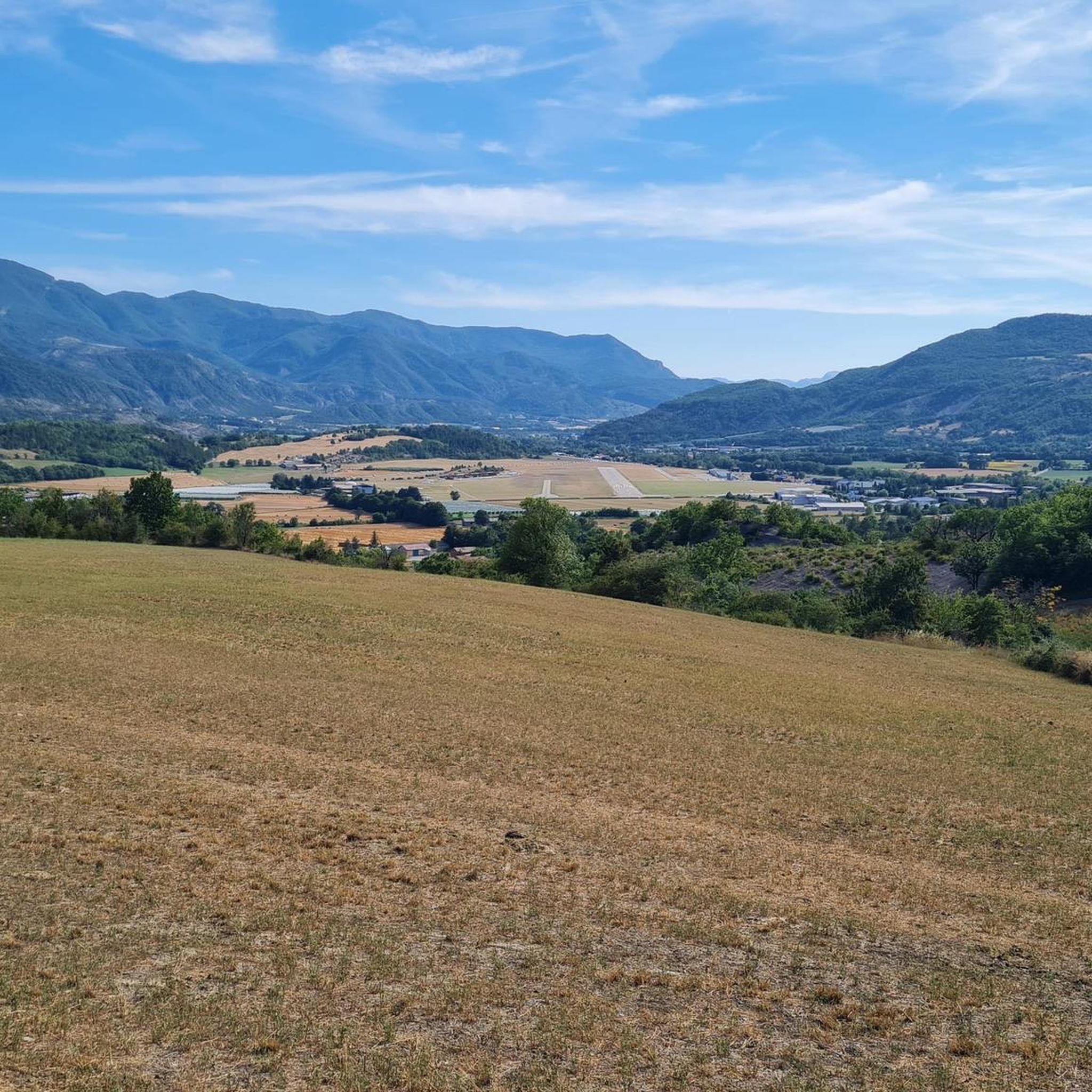
Tallard is a French commune with 1,996 inhabitants located in the Hautes-Alpes department in the Provence-Alpes-Côte d'Azur region. 570-1,121 m above sea level.
16
0
The Col de Foureyssasse from La Saulce is a climb located in the Hautes-Alpes region. This climb is 7 km long, with a total elevation gain of 461 m. The Col de Foureyssasse from La Saulce has an average gradient of 6.6%.
12
0


visit is of course subject to a fee
1
0

Beautiful panoramic view of Tallard
1
1
Frequently Asked Questions
How many mountain bike trails are available around Châteauvieux?
There are over 180 mountain bike trails around Châteauvieux. These routes cater to various skill levels, with 10 easy, 114 moderate, and 57 difficult trails available for exploration.
What kind of terrain will I encounter on mountain bike trails near Châteauvieux?
Mountain bike trails around Châteauvieux, particularly in the Hautes-Alpes region, offer diverse landscapes. You'll find paths traversing unspoiled natural areas, from flowery meadows to more challenging sections with significant elevation gains. The scenic backdrop often includes the Durance river and Serre-Ponçon lake, and some routes explore distinctive areas like the "Terres Noires".
Are there any easy mountain bike trails suitable for beginners in Châteauvieux?
Yes, there are 10 easy mountain bike trails around Châteauvieux. These routes are generally less strenuous and suitable for beginners or those looking for a more relaxed ride.
What are some of the more challenging mountain bike routes in Châteauvieux?
For experienced riders, Châteauvieux offers 57 difficult mountain bike trails. These routes often feature significant elevation gains and technical sections, demanding very good fitness and advanced skills. An example of a moderate route with notable elevation is Lake Pelleautier – Pelleautier Lake loop from Tallard, which covers 35.1 km with over 800 meters of ascent.
Are there any circular mountain bike routes in Châteauvieux?
Yes, many mountain bike routes around Châteauvieux are designed as loops. For instance, the popular Tallard Castle – Terres Noires de Tallard loop from Tallard is a 20.4 km moderate trail, and Tallard Castle – Tallard Castle loop from Tallard offers a 28.3 km ride with expansive views.
What can I see along the mountain bike trails around Châteauvieux?
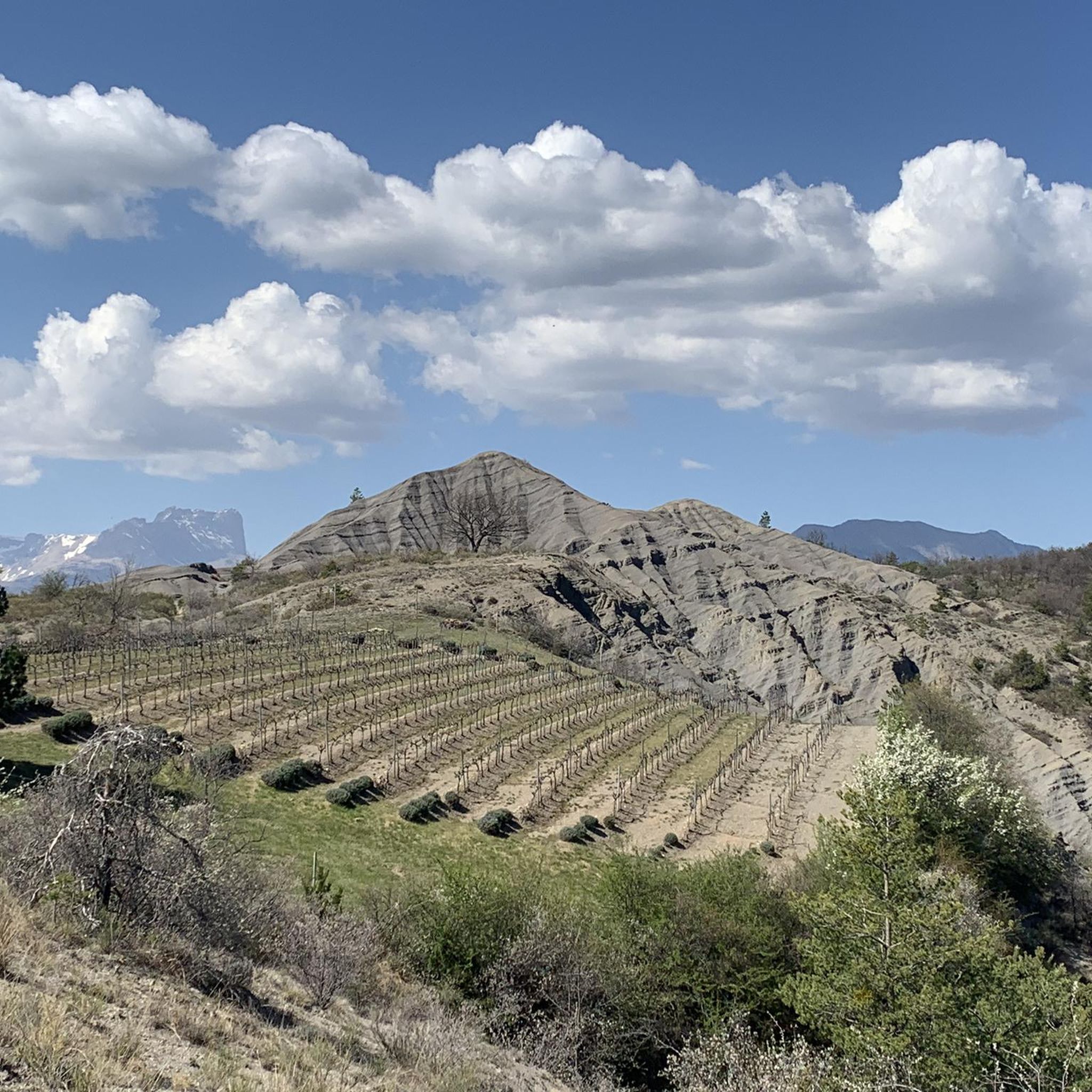
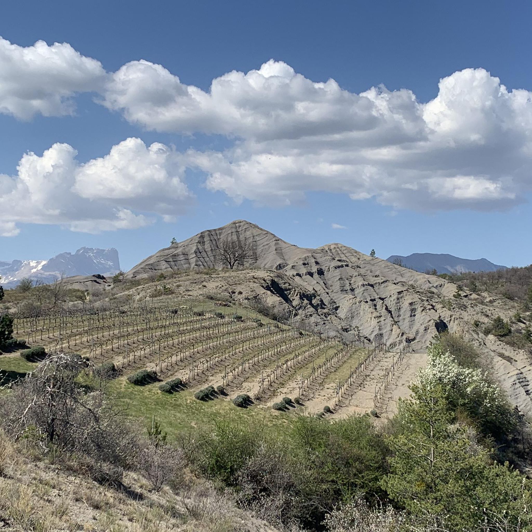
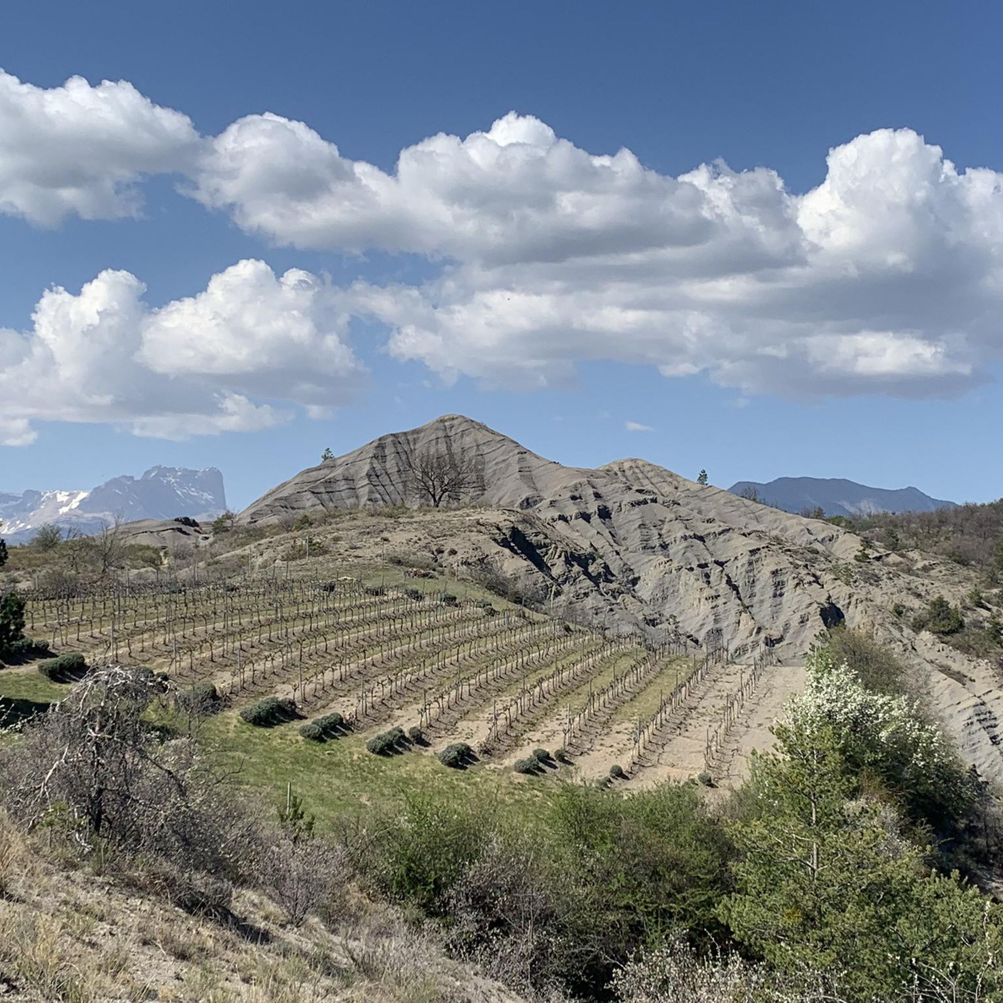
Many mountain bike trails offer scenic views and pass by interesting landmarks. You might encounter historical sites like Tallard Castle, or natural features such as the distinctive "Terres Noires" landscape. The region also features views of the Durance river and Serre-Ponçon lake, and you might pass through vineyards, as seen on The vineyards of Châteauvieux – Terres Noires de Tallard loop from Tallard.
When is the best time of year for mountain biking in Châteauvieux?
The Hautes-Alpes region, where many Châteauvieux trails are located, features landscapes ranging to snow-capped peaks. This suggests that spring through autumn would generally be the most favorable seasons for mountain biking, avoiding winter conditions that might make higher elevation trails inaccessible or challenging.
Are there family-friendly mountain bike trails in Châteauvieux?
While the guide highlights trails from moderate to difficult, the presence of 10 easy trails suggests there are options suitable for families or those with less experience. These easier routes would likely be found in less technical areas, possibly near the Durance river or through meadows.
What do other mountain bikers enjoy most about mountain biking in Châteauvieux?
The mountain biking experience in Châteauvieux is highly rated by the komoot community, with an average score of 4.3 stars from over 200 reviews. Riders often praise the diverse natural areas, varied elevation, and the network of trails that offer options for different ability levels.
Are there any mountain bike routes that pass through vineyards in Châteauvieux?
Yes, some routes offer the unique experience of riding through local vineyards. For example, The vineyards of Châteauvieux – Terres Noires de Tallard loop from Tallard takes you through the vineyards of Châteauvieux before exploring the Terres Noires.
How long do mountain bike routes around Châteauvieux typically take to complete?
The duration of mountain bike routes around Châteauvieux varies significantly based on distance and difficulty. For instance, a moderate 14.3 km trail like The vineyards of Châteauvieux – Terres Noires de Tallard loop from Tallard can be completed in about 1 hour 20 minutes, while longer routes such as Le Rousine Riverbank – The vineyards of Châteauvieux loop from Lotissement Le Pré du Château (27.8 km) might take around 2 hours 20 minutes.
Most popular routes around Châteauvieux
Most popular attractions around Châteauvieux

Get inspired with the komoot mobile app


Explore more
Browse the best MTB trails in other regions.
