The best walks and hikes around Marolles
4.4
(153)
1,147
hikers
131
hikes
Hiking around Marolles offers a diverse landscape characterized by gently rolling terrain, agricultural fields, and pockets of woodland. The region features a network of paths that traverse rural areas and connect small villages. Hikers can expect routes with minimal elevation changes, making them accessible for various fitness levels. The area provides opportunities for walks through forested sections and open countryside.
Best hiking trails around Marolles
- The most popular hiking route is Nécropole de la Grand Mesle loop from Marolles,…
Last updated: October 5, 2026
4.8
(4)
14
hikers
15.5km
04:13
230m
230m
Moderate hike. Good fitness required. Easily-accessible paths. Suitable for all skill levels.
5.0
(1)
17
hikers
24.6km
06:21
130m
130m
Hard hike. Very good fitness required. Easily-accessible paths. Suitable for all skill levels.

5.0
(1)
9
hikers
14.0km
03:43
140m
140m
Moderate hike. Good fitness required. Easily-accessible paths. Suitable for all skill levels.
4.0
(1)
6
hikers
12.9km
03:19
70m
70m
Moderate hike. Good fitness required. Easily-accessible paths. Suitable for all skill levels.
9
hikers
6.16km
01:36
40m
40m
Easy hike. Great for any fitness level. Easily-accessible paths. Suitable for all skill levels.
Get access to more routes and recommendations from other explorers.
Already have an account?
Our route recommendations are based on thousands of hikes, rides, and runs completed by other people on komoot.
Start today with a free account
Your next adventure awaits.

Tips from the Community

A noteworthy Gothic cathedral from the 16th century. The old stained glass windows are also great.
0
0

A short detour through old Blois, which is not lacking in character.
1
0

most beautiful view in the city
1
0
Blois is a very beautiful old town, with beautiful views everywhere. We were particularly surprised by the chateau, because when you stand in front of it, you really don't get a sense of its size. It's only when you're inside that you realize it.
1
1

Saint-Louis Cathedral (French: Cathédrale Saint-Louis de Blois, German: Cathedral of Blois) is a Catholic church building and the seat of the bishop of the Diocese of Blois. The cathedral has been a listed historic monument since 1906.
3
0

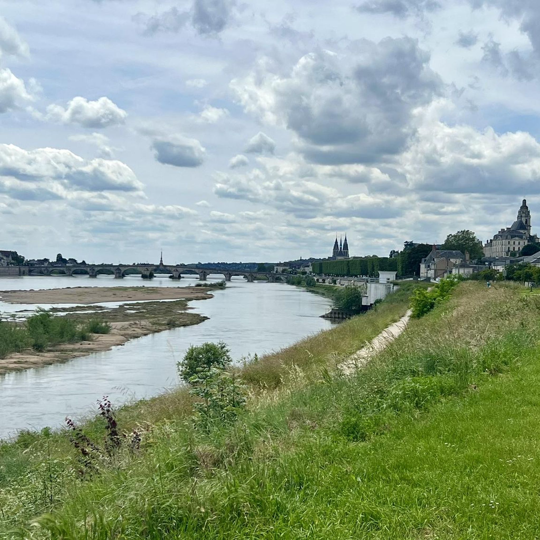
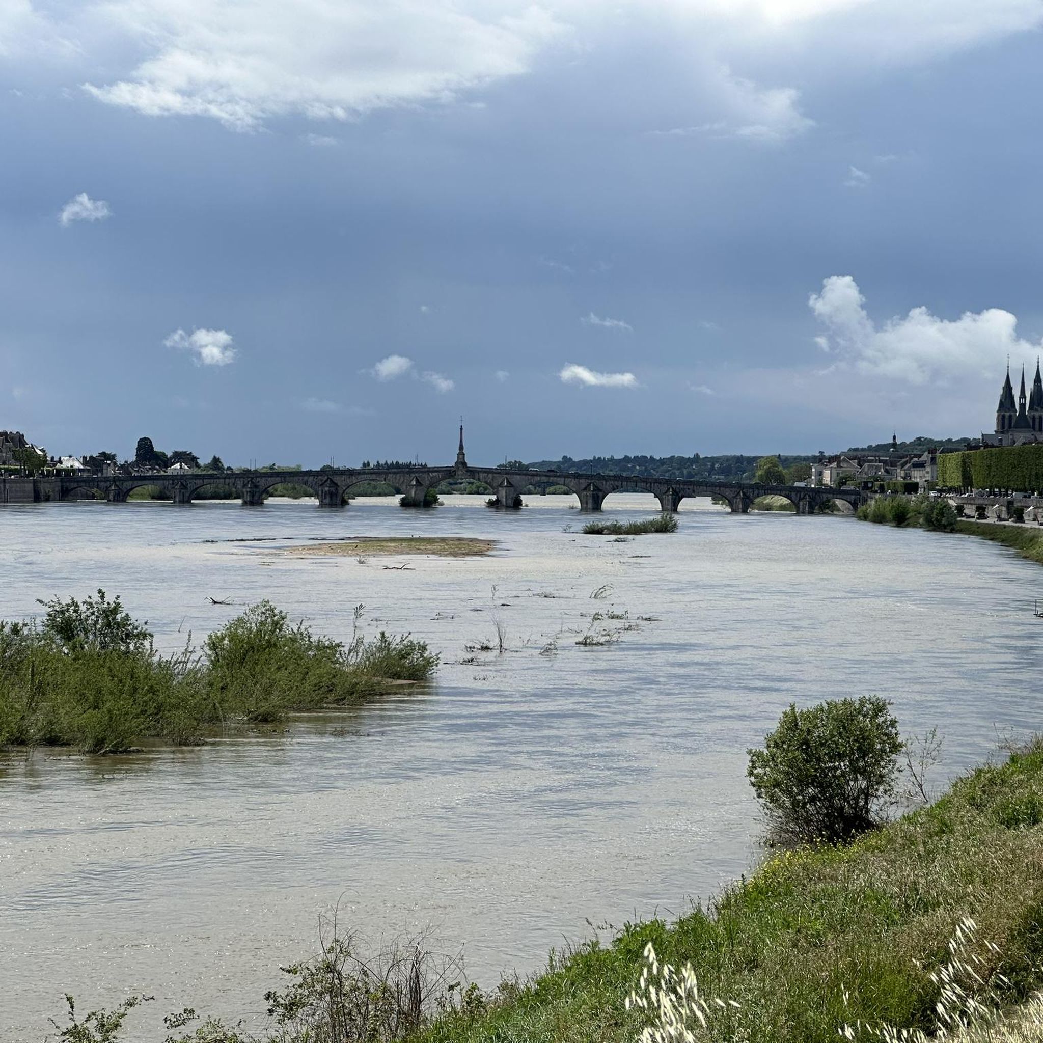
Great panorama with bridge & Blois
3
0
Historic bronze statue made by the New York foundry Roman Bronze Works in 1954 after they replaced the original statue.
2
0
Beautiful park on several levels, near the royal palace.
3
0
Frequently Asked Questions
How many hiking trails are available around Marolles?
There are nearly 150 hiking trails around Marolles listed on komoot. These include a wide variety of options, with over 70 easy routes, more than 60 moderate trails, and a few challenging paths for experienced hikers.
What kind of landscape can I expect when hiking around Marolles?
Hiking around Marolles offers a diverse landscape characterized by gently rolling terrain, agricultural fields, and pockets of woodland. You'll find routes that traverse rural areas, connect small villages, and provide opportunities for walks through forested sections and open countryside. The region's proximity to areas like Lac du Der-Chantecoq suggests potential for waterside walks, while other areas feature forests like the Forest of St. Vrain.
Are there easy hiking trails suitable for beginners or families in Marolles?
Yes, Marolles is an excellent destination for beginners and families. Over 70 of the trails are rated as easy, featuring minimal elevation changes and accessible paths. A great example is the Nécropole de la Grand Mesle loop from Marolles, an easy 5.3 km (3.3 miles) path that leads through local countryside.
Are there circular walks available in Marolles?
Many of the hiking routes around Marolles are circular, allowing you to start and end at the same point. For instance, the popular Hiking loop from La Chaussée-Saint-Victor is a moderate 13.1 km (8.2 miles) route that offers varied terrain through rural landscapes. Another option is the Nécropole de la Grand Mesle loop from Marolles, which is an easy 5.3 km (3.3 miles) circular path.
Can I bring my dog on the hiking trails in Marolles?
Generally, the rural paths and open countryside around Marolles are suitable for dogs. Most trails are not subject to specific restrictions, but it's always recommended to keep your dog on a leash, especially near agricultural fields or in areas where wildlife might be present. Always carry water for your pet and clean up after them.
What are some interesting landmarks or attractions to see along the hiking trails?
While hiking around Marolles, you can discover several historical and scenic points of interest. Notable attractions include the historic Jacques-Gabriel Bridge with views of Blois, the impressive Saint-Louis Cathedral in Blois, and the grand Blois Castle. Some routes, like the Old Washhouse – Cour-sur-Loire castle loop from La Chaussée-Saint-Victor, specifically lead past historical points.
Are there any challenging hikes for experienced hikers?
Yes, for those seeking a longer and more challenging experience, there are a few difficult routes available. An example is the Old Washhouse – Cour-sur-Loire castle loop from La Chaussée-Saint-Victor, a 24.6 km (15.3 miles) trail that leads through open fields and past historical points, typically taking over 6 hours to complete.
What do other hikers enjoy most about hiking in Marolles?
The hiking trails around Marolles are highly rated by the komoot community, with an average score of 4.4 stars from over 120 reviews. Hikers often praise the region's varied terrain, the peaceful rural paths, and the accessibility of routes for different ability levels. Over 1,100 hikers have used komoot to explore Marolles's diverse landscapes.
Are there any forest hikes in the Marolles region?
Yes, the Marolles region features pockets of woodland and forested sections, offering pleasant forest hikes. For example, the Blois Forest loop from Saint-Sulpice-de-Pommeray is a moderate 12.8 km (8 miles) route that takes you through the Blois Forest, providing a refreshing natural environment.
What is the best time of year to go hiking in Marolles?
The best time to hike in Marolles generally depends on your preference. Spring offers blooming landscapes, with areas like the Forest of St. Vrain known for daffodils in March. Summer provides warm weather for longer days on the trails. Autumn brings beautiful foliage, while winter can offer crisp, quiet walks, though some paths might be muddy. The region's generally mild elevation changes make it accessible for hiking throughout much of the year.
Are there any long-distance hiking options in Marolles?
While many routes are shorter, Marolles does offer options for longer-distance hikes. The Old Washhouse – Old Washhouse loop from La Chaussée-Saint-Victor is a moderate 15.7 km (9.8 miles) trail, and the Old Washhouse – Cour-sur-Loire castle loop from La Chaussée-Saint-Victor extends to 24.6 km (15.3 miles), providing a full day's adventure through the region's varied terrain.
Most popular attractions around Marolles

Get inspired with the komoot mobile app


Explore more
Browse the best Hikes in other regions.
