The best running trails around Lalley
4.7
(9)
363
runners
86
runs
Jogging around Lalley offers a variety of routes through a landscape characterized by ridges, cols, and significant elevation changes. The region features challenging terrain, with many routes traversing hills and offering extensive views. Runners can expect to encounter varied gradients, making it suitable for those seeking a more demanding experience.
Best jogging routes around Lalley
- The most popular jogging route is Running loop from Tréminis, a 6.4 miles (10.3 km) trail that takes 1 hour 48 minutes to complete.…
Last updated: November 1, 2026
10
runners
15.5km
02:32
720m
720m
Hard run. Very good fitness required. Sure-footedness, sturdy shoes and alpine experience required.
7
runners
25.8km
04:35
1,670m
1,670m
Hard run. Very good fitness required. Sure-footedness, sturdy shoes and alpine experience required.

5
runners
7.83km
00:54
180m
180m
Moderate run. Good fitness required. Mostly paved surfaces.
8
runners
40.4km
04:52
1,050m
1,050m
Hard run. Very good fitness required. Mostly paved surfaces.
5.0
(1)
7
runners
22.1km
03:24
1,010m
1,010m
Hard run. Very good fitness required. Sure-footedness, sturdy shoes and alpine experience required.
Get access to more routes and recommendations from other explorers.
Already have an account?
Our route recommendations are based on thousands of hikes, rides, and runs completed by other people on komoot.
Start today with a free account
Your next adventure awaits.

Tips from the Community

If you mean the Municipality of Mens, it is the village of Mens, located in the Isère region, within the historic Trièves area, at the foot of the Mont Aiguille massif.
8
0

We wanted to do this loop. But after the summit going towards the "Col de Seysse" we followed the Komoot route which directed us to the ridge. At one point the path got lost, and we would have had to go down very steep and very exposed ravines. We gave up and went back on our tracks. Another serpentine path, next to the ridge is closed because of the pasture. As a result this "Loop" is not recommended and should be removed from Komoot!
1
0

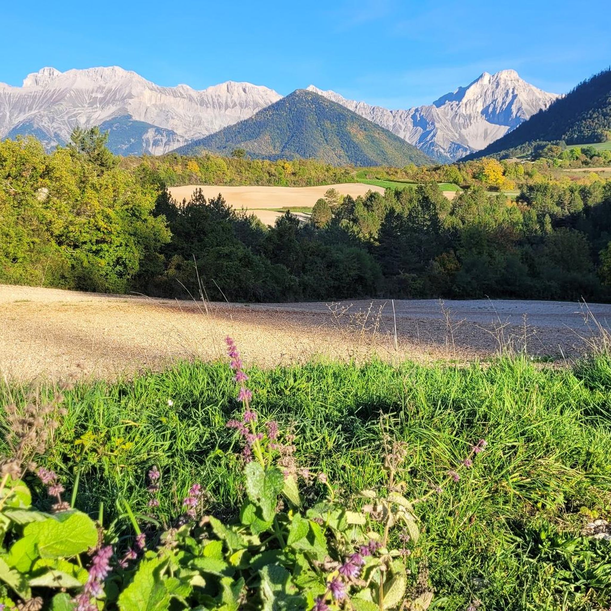
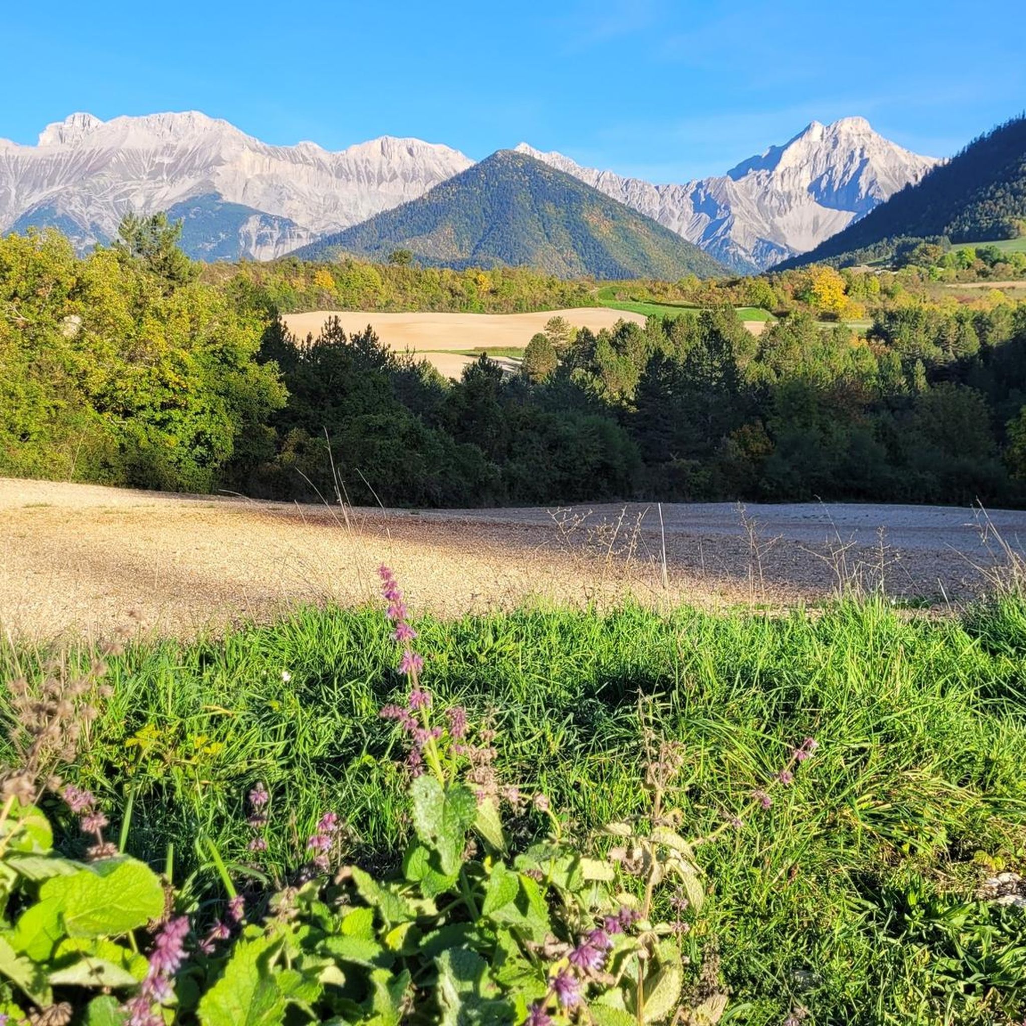
Flowers and pastures complete the views of the Col de Jiboui with breathtaking panoramas.
2
0
Once you reach the summit pastures, it offers magnificent views of the Trièves, the Vercors massif and the Dévoluy massif. On a clear day, you can see Mont Ventoux.
2
0
At 1903m, the summit of Mont Barral offers an excellent view of the Dévoluy massif with the Grand Ferrand and the Aiguilles de Lus in the foreground.
2
1

This mountain top is not so easy to reach, but gives you a fantastic view of the surroundings. https://www.youtube.com/watch?v=L77jAmX14XA
0
0

Nice view of the Grande Tête de l'Obiou and the surrounding mountains.
2
0

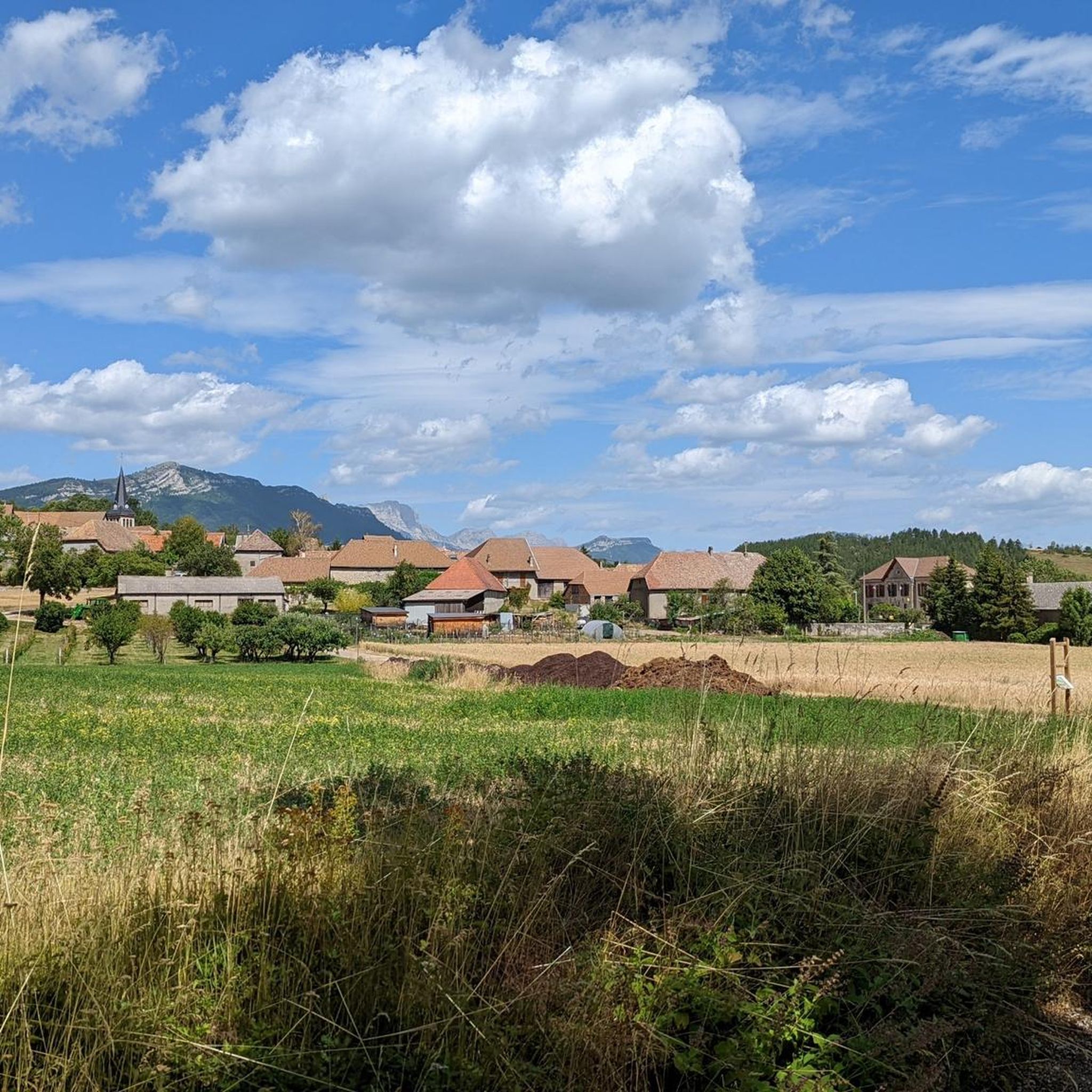
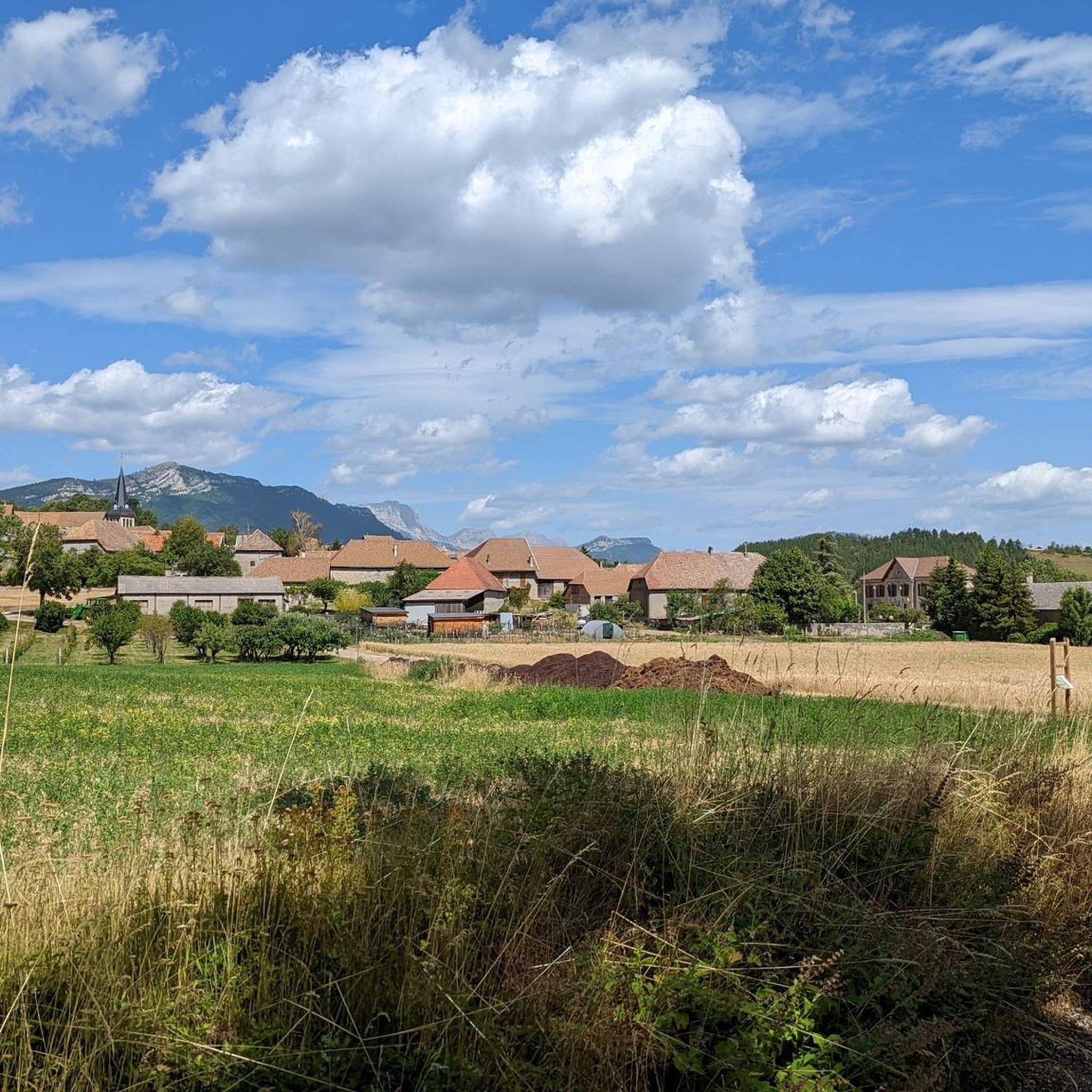
Mens is a small town with an important architectural heritage. In particular, there is a hall dating from the 15th century and listed in the register of historical monuments, like the Church of the Assumption of Mens, built in the 12th century. Several hamlets and farms are added to the main town. You will find a few shops and cafés in the town centre, as well as a campsite.
2
0
Frequently Asked Questions
Are there any easy running routes in Lalley suitable for beginners?
While Lalley is known for its challenging terrain, there are a few easier options. Out of 72 total routes, 5 are classified as easy. These routes typically feature less elevation gain, making them more accessible for those new to trail running or looking for a less demanding jog.
What kind of terrain can I expect on running trails around Lalley?
The running trails in Lalley are characterized by ridges, cols, and significant elevation changes. You can expect varied gradients and mountainous terrain, making it suitable for runners seeking a more demanding experience. Many routes traverse hills and offer extensive views.
Can I find circular running routes in Lalley?
Yes, many of the running routes in Lalley are circular, allowing you to start and finish at the same point. For example, the Running loop from Tréminis is a popular circular option, though it is considered difficult.
Are the running trails around Lalley dog-friendly?
Generally, dogs are welcome on trails in the Lalley region, especially if kept on a leash. However, it's always best to check local regulations for specific areas or nature reserves you plan to visit. Ensure your dog is fit for the challenging terrain and elevation changes.
Is parking available near the running trailheads in Lalley?
Parking availability varies by trailhead. Many routes, particularly those starting from villages or popular cols like Col de Menée or Col de Grimone, offer designated parking areas. It's advisable to check the route details on komoot for specific parking information before you go.
What natural attractions can I see while running in Lalley?
The Lalley region offers several natural attractions. You might encounter features like the Gorges des Gâts, the Lauzon Lake, or unique geological formations such as Les Sucettes de Borne. Some routes also pass by scenic mountain passes like the Col de Menée Vulture Observation Point.
Are there any longer running routes for endurance training in Lalley?
Yes, Lalley offers several longer routes suitable for endurance training. For instance, the Mont Barral – Jiboui Ridge loop from Col de Grimone is a substantial 16.1-mile (26.0 km) trail, and the Mens – Col de Cornillon (885 m) loop from Les Merlons extends over 40 km, both featuring significant elevation gain.
What is the best time of year for running in Lalley?
The best time for running in Lalley is typically from late spring to early autumn (May to October) when the weather is milder and trails are generally clear of snow. During winter, some higher elevation routes may be inaccessible or require specialized gear due to snow and ice.
Are there any running routes in Lalley with scenic viewpoints?
Absolutely. Given the region's mountainous character with ridges and cols, many running routes in Lalley offer extensive and breathtaking views. Trails often ascend to vantage points overlooking valleys and peaks, providing rewarding panoramas during your run.
What do other runners enjoy the most about jogging in Lalley?
The running routes in Lalley are highly rated by the komoot community, with an average score of 4.75 stars. Runners often praise the challenging terrain, the rewarding elevation gains, and the stunning, extensive views encountered along the trails.
Are there any family-friendly running routes in Lalley?
While many routes in Lalley are classified as difficult due to significant elevation, there are a few easier options that might be suitable for families with older children or those accustomed to some uphill sections. Look for the 5 routes classified as 'easy' on komoot for less strenuous options.
What should I wear for running on Lalley's trails?
Given the varied and often challenging terrain with significant elevation changes, it's recommended to wear appropriate trail running shoes with good grip. Layered clothing is advisable, as weather conditions can change quickly in mountainous areas. Always carry water and a map or GPS device.
Can I find running routes that pass through towns or villages in Lalley?
Some routes may start or pass near settlements like Mens, Chichilianne, or Clelles, offering opportunities to explore these areas or find amenities. However, the primary focus of most routes is the natural, mountainous landscape.
Most popular attractions around Lalley

Get inspired with the komoot mobile app


Explore more
Browse the best Running Trails & Routes in other regions.
