The best walks and hikes around Baltschieder
4.6
(3297)
21,988
hikers
10
hikes
Hiking around Baltschieder offers diverse landscapes within the Swiss canton of Valais, situated on the southern flank of the Rhône Valley. The region features a transition from cultivated slopes to dramatic rocky ridges and high-alpine environments, including the Baltschieder Glacier. It encompasses parts of a UNESCO World Heritage site, with the Baltschieder Valley noted for its untouched natural character. Many trails provide views of the Rhône Valley, set amidst varied Alpine and Mediterranean vegetation.
Best hiking trails around Baltschieder
- The most popular hiking route is Bisse de Savièse – Suonen Water Channel loop from Baltschieder, a 7.2 miles (11.7 km) trail that takes 3 hours 54 minutes to complete. This route follows a historic irrigation channel, offering insights into the region's heritage.
- Another top favourite among local hikers is Lower Baldschieder Valley – View of Visp loop from Baltschieder, a moderate 7.1 miles (11.5 km) path. This trail provides views across the lower Baltschieder Valley towards Visp.
- Local hikers also love the View of Baltschieder – Baltschieder Village Center loop from Baltschieder, a 3.8 miles (6.1 km) trail leading through the village surroundings, often completed in about 1 hour 56 minutes.
- Hiking around Baltschieder is defined by its UNESCO World Heritage landscapes, dramatic Rhône Valley views, and access to high-alpine environments and glaciers. The extensive network offers options for easy strolls, moderate day hikes, and more challenging alpine routes.
- The routes in Baltschieder are highly rated by the komoot community with an average score of 4.7 stars from over 2,800 reviews. More than 20,000 hikers have used komoot to explore Baltschieder's varied terrain.
Last updated: September 30, 2026
5.0
(3)
12
hikers
11.9km
04:01
590m
590m
Moderate hike. Good fitness required. Easily-accessible paths. Suitable for all skill levels.
5.0
(1)
17
hikers
6.12km
01:56
230m
230m
Easy hike. Great for any fitness level. Easily-accessible paths. Suitable for all skill levels.

5.0
(2)
15
hikers
11.5km
03:41
420m
420m
Moderate hike. Good fitness required. Mostly accessible paths. Sure-footedness required.
10
hikers
3.50km
00:53
10m
10m
Easy hike. Great for any fitness level. Easily-accessible paths. Suitable for all skill levels.
5.0
(1)
15
hikers
Moderate hike. Good fitness required. Easily-accessible paths. Suitable for all skill levels.
Get access to more routes and recommendations from other explorers.
Already have an account?
Our route recommendations are based on thousands of hikes, rides, and runs completed by other people on komoot.
Start today with a free account
Your next adventure awaits.
Tips from the Community


Not far from the train station, this modern bridge spans the Vispa. It connects the two banks for pedestrians and cyclists, while trains of the Matterhorn-Gotthard-Bahn and SBB run immediately next to it. From here, there is a beautiful view of the milky-turquoise glacial water of the Vispa, which flows into the Rhône (also called Rotten in Upper Valais) just a few hundred meters further on. The bridge is a striking crossing between the train station, the residential areas, and the riverside paths along the Vispa.
0
0
The Kleegärten-Nord roundabout immediately catches the eye with its modern art installation. A filigree, red-lacquered steel structure encloses a central pillar and forms a striking eye-catcher in the industrial area of Visp. The facility is complemented by lovingly maintained planting and decorative figures. Those travelling from the train station towards the Vispa and further to the mouth of the Rotten will pass this roundabout on their way through the industrial area. It sets a modern design accent and shows that even traffic structures in Visp can be attractively designed with art and greenery.
0
0
The roundabout at Kleegärtnerstrasse is adorned by a striking sculpture featuring several leopards. Surrounded by flowers and greenery, the colorful animal group stands out clearly from the nearby traffic artery and the Valaisian mountain backdrop. The distinctive roundabout is located on the path from the train station through the industrial area towards Visp and the confluence into the Rotten.
0
0
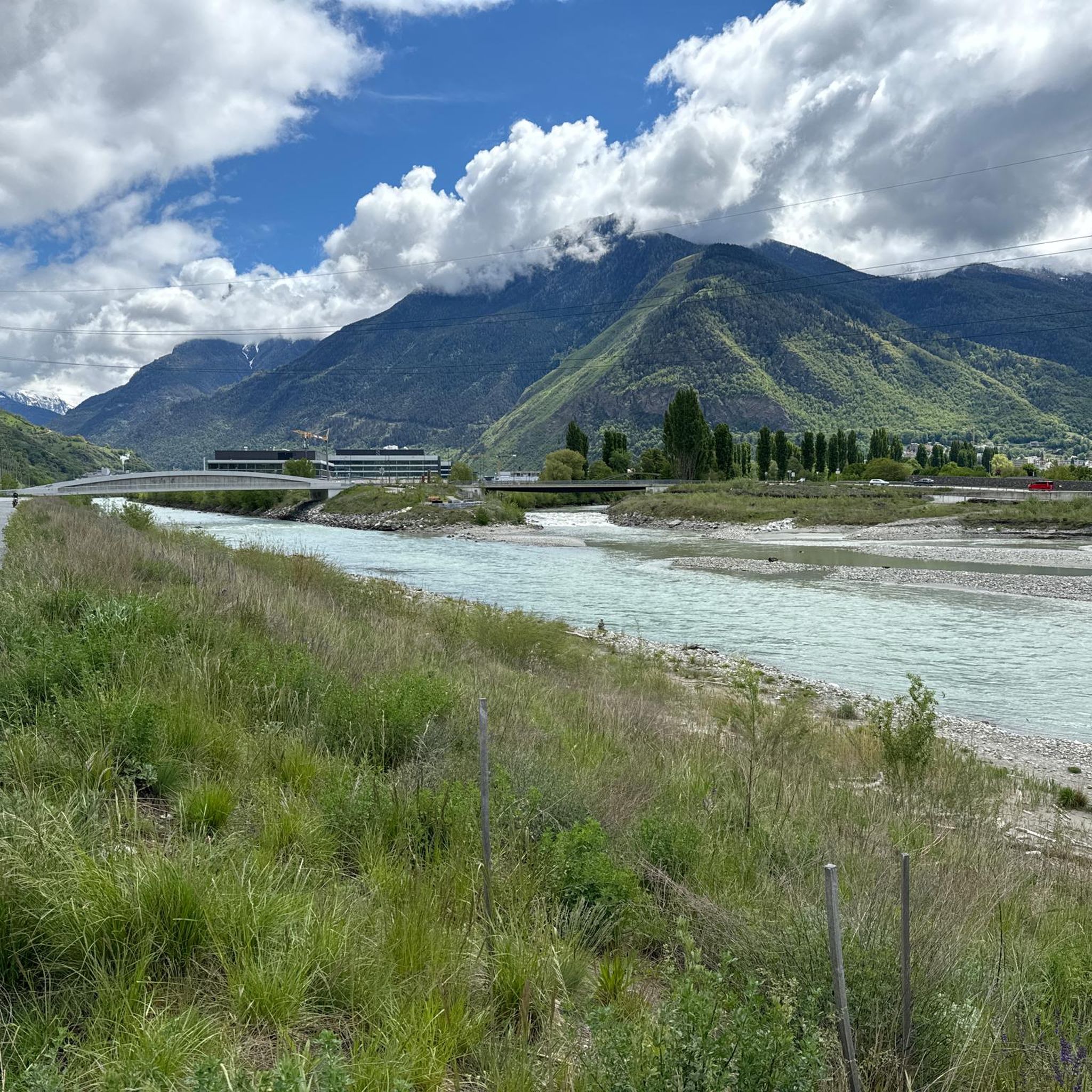
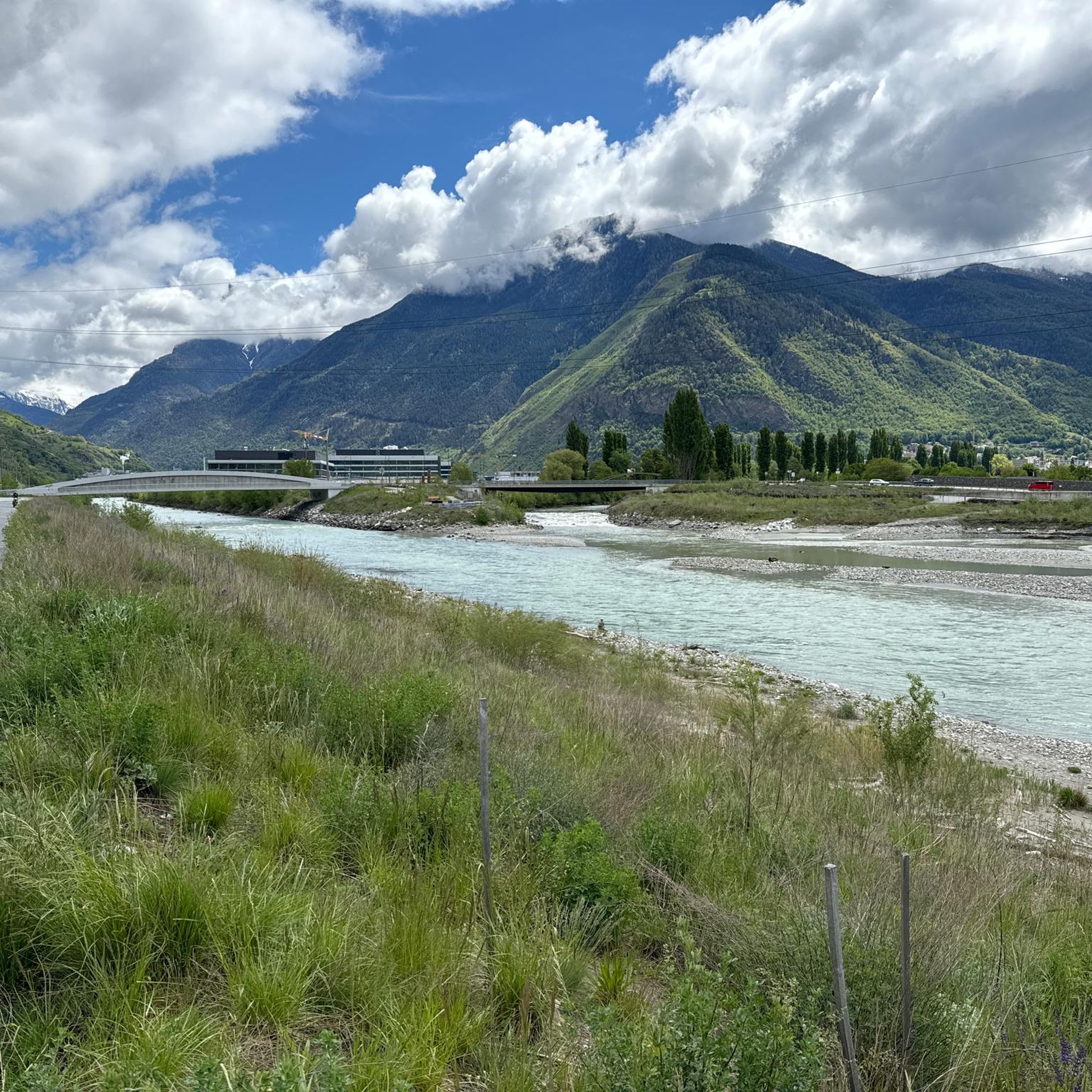
The modern bridge over the Rotten connects the two banks of the Rhône valley and, in addition to the roadway, has a separate cycle path and footpath. From here, a wide view opens up downstream. On the left bank, the Vispa flows into the Rotten, bringing the milky-turquoise glacier water from the Mattertal and Saas valley into the largest river in Wallis. The surrounding mountains and the broad Rhône valley shape the landscape. Despite the nearby traffic and commercial facilities, this viewpoint impressively conveys the vastness of the main Wallis valley and the confluence of two important Alpine rivers.
0
0
Visp train station is one of the most important transport hubs in Valais. Here, trains from the Lötschberg and Simplon lines meet the Matterhorn Gotthard Bahn, which takes travelers on to Zermatt, Brig, or Andermatt. Since the opening of the Lötschberg Base Tunnel in 2007, the modernly designed station has gained considerable importance. Thanks to the fast connections, Visp is now the central gateway for visitors to the Mattertal, Saastal, and many other Valaisan alpine regions. For me, the station was both the starting and ending point of my multi-day stay in Valais – the journey towards Zermatt began here and ended here after unforgettable days around the Matterhorn.
0
0
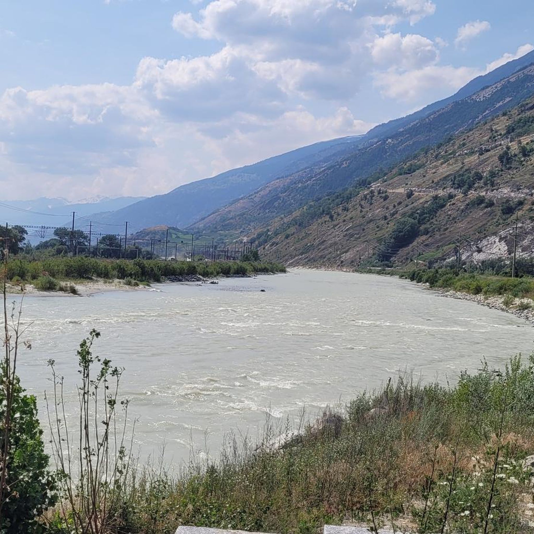
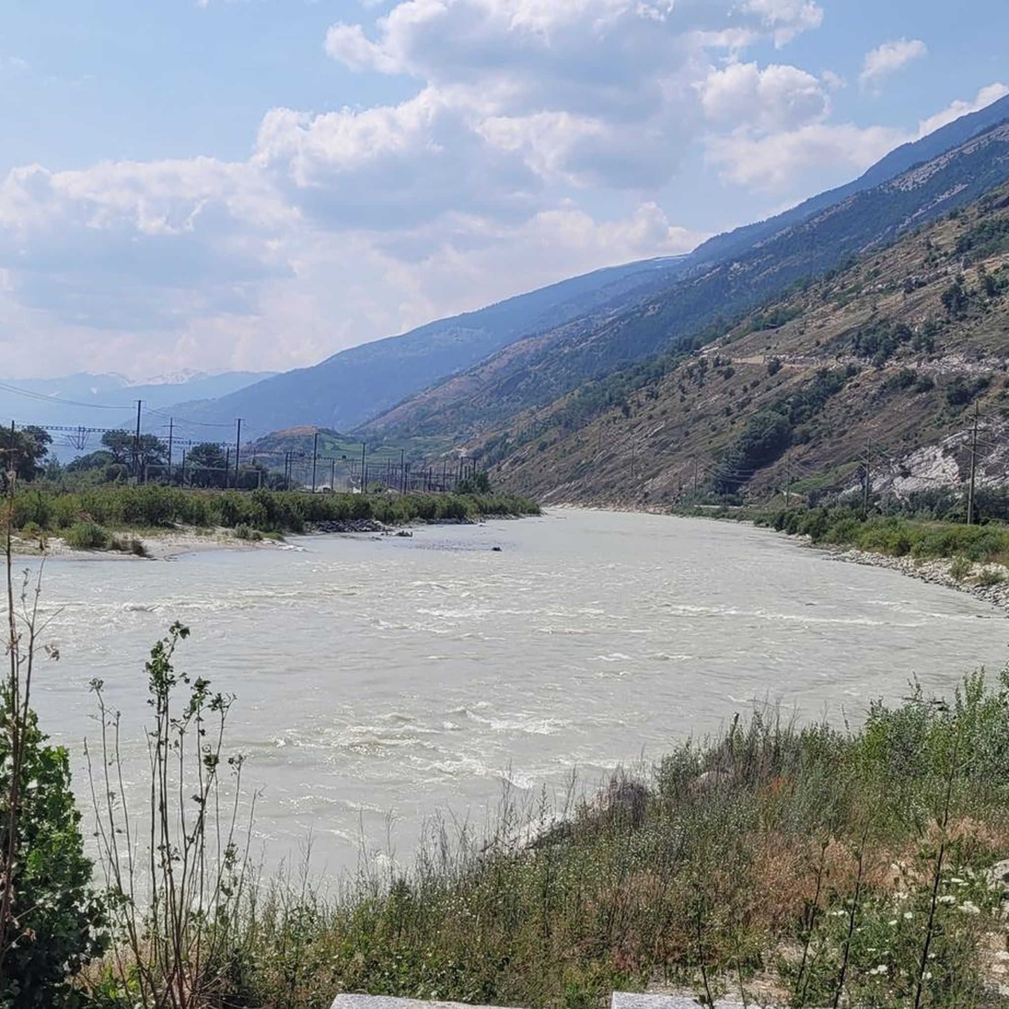
West of Visp station, the Vispa flows into the Rhône, which in German-speaking Upper Valais is traditionally called the Rotten. The approximately 8.5-kilometer-long Vispa is formed in Stalden by the confluence of the Mattervispa from the Mattertal valley and the Saaservispa from the Saas valley. Both tributaries carry milky-turquoise water from the glacier-covered high mountain regions around Zermatt and Saas-Fee. After its short course through the Vispertal valley, the Vispa finally joins the significantly wider Rotten. From here, the water continues its journey through the Valais and Lake Geneva, before the Rhône flows on through France to the Mediterranean Sea. The confluence is also a beautiful viewpoint and a fitting place to say goodbye to the Valais once more after a hike through the mountain world around Zermatt. It impressively shows how the water from the Valais Alps shapes the valleys and landscapes far beyond the high mountains.
0
0

The station is located on the Lötschberg mountain line and offers hourly connections towards Spiez - Bern as well as towards Brig.
0
0
Frequently Asked Questions
How many hiking trails are available around Baltschieder?
Baltschieder offers a diverse network of trails for hikers. There are currently 11 recorded hiking routes, with options ranging from easy strolls to more challenging alpine paths. Specifically, you'll find 5 easy, 5 moderate, and 1 difficult trail to explore.
Are there any easy or family-friendly hiking routes in Baltschieder?
Yes, Baltschieder has several easy routes suitable for families or those seeking a relaxed walk. An excellent option is the View of Baltschieder – Baltschieder Village Center loop from Baltschieder, which is 3.8 miles (6.1 km) long and takes approximately 2 hours. This trail leads through the village surroundings, offering gentle terrain.
What kind of natural features or landmarks can I expect to see on hikes in Baltschieder?
Baltschieder is rich in natural beauty and unique landmarks. Many trails offer spectacular views of the Rhône Valley, transitioning from cultivated slopes to dramatic rocky ridges. You can also explore the historic Bisse de Savièse – Suonen Water Channel, an ancient irrigation system. The region is part of a UNESCO World Heritage site, encompassing pristine valleys like Baltschiedertal, and provides access to the impressive Baltschieder Glacier and views of the Bietschhorn Massif.
Are there any circular hiking routes in the Baltschieder area?
Yes, many of the trails around Baltschieder are designed as loops, allowing you to start and end in the same location. For example, the popular Lower Baldschieder Valley – View of Visp loop from Baltschieder is a moderate 7.1-mile (11.5 km) path that offers views across the lower Baltschieder Valley towards Visp.
What do other hikers enjoy most about the trails in Baltschieder?
The hiking trails in Baltschieder are highly regarded by the komoot community, with an average rating of 4.7 out of 5 stars from over 2,800 reviews. Hikers frequently praise the diverse landscapes, from the serene Baltschiedertal to the panoramic views of the Rhône Valley, and the well-maintained network of trails that cater to various skill levels.
Can I hike to any lakes or mountain passes from Baltschieder?
While Baltschieder itself is not directly on a major lake, the wider region offers access to beautiful alpine lakes and mountain passes. Notable nearby lakes include Schwarzsee (Lötschental) and Lüsger Lake. For mountain passes, you can explore areas like Moosalp South Ascent or Gibidum Pass, which offer stunning high-alpine scenery.
What is the best time of year to go hiking in Baltschieder?
The best time for hiking in Baltschieder is generally from spring through autumn, when the trails are clear of snow and the weather is most favorable. This period allows you to fully appreciate the varied topography, from the Alpine flora to the dramatic mountain views. Some higher-altitude routes, especially those near the Baltschieder Glacier, are best tackled in late summer.
Are there any trails that offer views of the Baltschieder Glacier?
Yes, for experienced hikers, routes that lead towards the Baltschiederjoch and the Bietschhorn can provide access to the impressive Baltschieder Glacier. These trails offer breathtaking southward views, and on clear days, you might even see the distant Mischabel mountainous ridge. These are typically more demanding high-alpine routes.
Is public transport available to reach hiking trailheads in Baltschieder?
Baltschieder is situated in the Swiss canton of Valais, which generally has good public transport connections. While specific bus routes to every trailhead might vary, the region is accessible, and many trails can be reached from local villages or train stations like Ausserberg, which is a starting point for routes to the Bietschtal Bridge.
Are there any hikes that pass through or near the village of Baltschieder itself?
Yes, some routes are designed to explore the immediate surroundings of the village. The View of Baltschieder – Baltschieder Village Center loop from Baltschieder is a prime example, offering a pleasant walk that starts and ends in the village, allowing you to experience the local atmosphere and views.
What is the 'Lötschberg South Ramp Route' and can I access it from Baltschieder?
The Lötschberg South Ramp Route is a classic high-level trail, approximately 20 kilometers long, running between Hohtenn and Brig. It's renowned for its stunning views and diverse vegetation. While not starting directly in Baltschieder, the region's extensive trail network means you can often connect to or access sections of such significant routes from nearby points, making it a highlight for hikers in the wider Valais area.
Most popular routes around Baltschieder
Most popular attractions around Baltschieder

Get inspired with the komoot mobile app


Explore more
Browse the best Hikes in other regions.
