The best road cycling routes around Saint-Éloy-La-Glacière
4.5
(19)
825
riders
77
rides
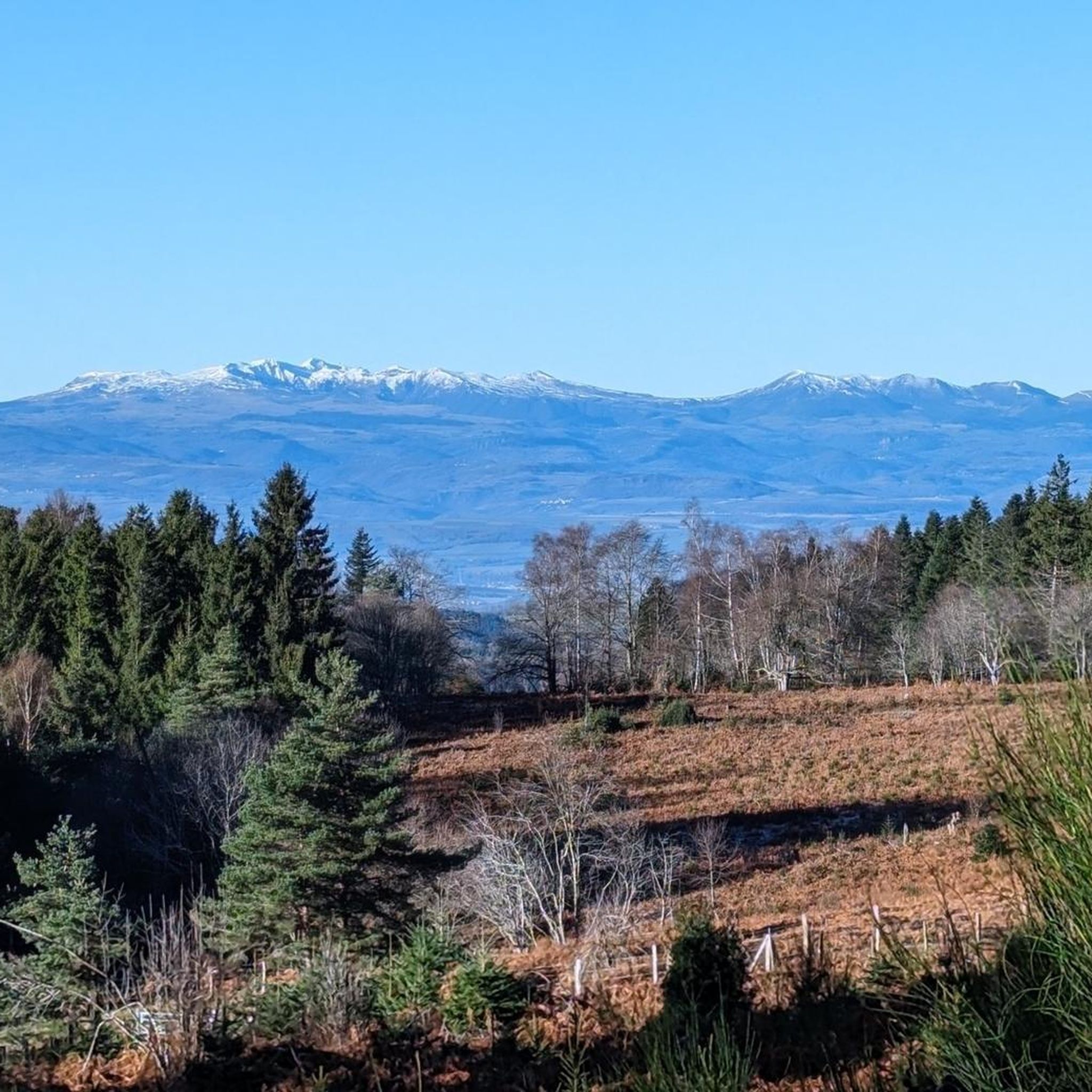
Road cycling routes around Saint-Éloy-La-Glacière traverse the elevated terrain of the Livradois plateau, with elevations ranging from 854 to 1,118 meters. The region is characterized by significant climbs and descents, including mountain passes like the Col des Fourches. Cyclists encounter diverse landscapes within the Parc naturel régional Livradois-Forez, featuring forested areas and panoramic viewpoints. This environment provides varied road cycling opportunities.
Best road cycling routes around Saint-Éloy-La-Glacière
- The most popular road cycling route is Fourches Pass - 970 m –…
Last updated: May 18, 2026
5.0
(3)
246
riders
87.9km
04:19
1,220m
1,220m
Hard road ride. Very good fitness required. Some segments of this route may be unpaved and difficult to ride.
25
riders
55.6km
02:52
850m
850m
Moderate road ride. Good fitness required. Some segments of this route may be unpaved and difficult to ride.

Sign up for free
13
riders
47.3km
02:37
870m
870m
Moderate road ride. Good fitness required. Some segments of this route may be unpaved and difficult to ride.
3.0
(1)
15
riders
82.2km
04:42
1,850m
1,850m
Hard road ride. Very good fitness required. Mostly well-paved surfaces and easy to ride.
5.0
(1)
19
riders
58.0km
02:47
790m
790m
Moderate road ride. Good fitness required. Some segments of this route may be unpaved and difficult to ride.
Get access to more routes and recommendations from other explorers.
Sign up for free
Already have an account?
Our route recommendations are based on thousands of hikes, rides, and runs completed by other people on komoot.
Start today with a free account
Your next adventure awaits.
Login or Signup



Tips from the Community

A breathtaking view of the Forez Mountains. A site that's well worth the effort...
0
0

A breathtaking view that is worth the effort and wild landscapes! What a natural spectacle, wow! Undeniably one of the places not to be missed in Auvergne.
1
0
Charming mountain village with a lovely view of the surrounding hills.
0
0
Picturesque medieval village with splendid landscapes!
1
0


Small wooded road, few cars, with a pleasant slope to climb.
0
0

The Col de la Dételée is 18.85 km long with a total drop of 606 m. The average gradient is 3.2% with maximum gradients of 9%.
1
0
The Saint-Jean church is a catholic church in Ambert. It was built between 1471 and 1518. It is classified as a historical monument.
2
0
Frequently Asked Questions
How many road cycling routes are available around Saint-Éloy-La-Glacière?
There are over 70 road cycling routes around Saint-Éloy-La-Glacière, offering a wide range of options for different skill levels. You'll find 3 easy routes, 39 moderate routes, and 34 difficult routes, ensuring there's something for every cyclist.
What kind of terrain can I expect on road cycling routes in Saint-Éloy-La-Glacière?
The region is characterized by the elevated terrain of the Livradois plateau, with significant climbs and descents. Elevations range from 854 to 1,118 meters. You'll encounter mountain passes like the Col des Fourches and diverse landscapes within the Parc naturel régional Livradois-Forez, including forested areas and panoramic viewpoints.
Are there challenging road cycling routes for experienced riders?
Yes, Saint-Éloy-La-Glacière offers numerous challenging routes. For instance, the Route forestière Fournols – Col de la Dételée loop from Fournols is a difficult 110.1 km path with extensive riding through forested areas and challenging ascents. Another demanding option is the Fourches Pass - 970 m – Saint-Jean Church, Ambert loop from Fournols, which covers 88.3 km and features the notable Col des Fourches.
Can I find family-friendly or beginner road cycling routes in the area?
While the region is known for its elevated and challenging terrain, there are a few easier options available. The guide lists 3 easy routes, which are generally shorter and have less demanding climbs, suitable for families or those new to road cycling. These routes allow you to enjoy the scenic beauty without extreme difficulty.
What are some scenic viewpoints or landmarks I can see along the routes?
Many routes offer stunning views. You can pass by the Deux Frères Viewpoint, perched on the edge of the Livradois plateau, offering expansive panoramas. The Fourches Pass - 970 m and Toutée Pass (996 m) are also notable points. Additionally, you might encounter traditional granite block farms and a typical Romanesque church, adding cultural charm to your ride.
Are there any circular road cycling routes available?
Yes, many of the road cycling routes around Saint-Éloy-La-Glacière are designed as loops. For example, the Cascade de Sauxillanges – Col de la Dételée loop from Fournols is a 55.6 km trail that brings you back to your starting point. The Ambert – Saint-Jean Church, Ambert loop from Fournols is another popular circular option.
What do other road cyclists enjoy most about cycling in Saint-Éloy-La-Glacière?
The area is highly rated by the komoot community, with an average score of 4.6 stars from over 10 reviews. Cyclists often praise the diverse landscapes, the challenge of the climbs and descents, and the preserved natural environment within the Parc naturel régional Livradois-Forez. The panoramic views from elevated points are also frequently highlighted.
Where can I find parking for road cycling routes?
While specific parking areas for each route are not detailed, many routes start from towns like Fournols, which typically offer public parking facilities. Given the region's focus on outdoor activities, you can generally find parking in the main villages or near popular trailheads.
Is public transport available to reach Saint-Éloy-La-Glacière for cycling?
Saint-Éloy-La-Glacière is a commune nestled in a rural area. While direct public transport options might be limited, the nearby town of Ambert (12.8 km away) serves as a regional hub and may offer more connections. It's advisable to check local bus or train schedules for services to Ambert and then consider cycling or a short taxi ride to Saint-Éloy-La-Glacière.
Are there any long-distance road cycling routes in the vicinity?
Yes, the region offers several longer routes. The Route forestière Fournols – Col de la Dételée loop from Fournols, at 110.1 km, is a significant long-distance option. These routes often traverse the Livradois plateau, connecting various villages and natural features, providing extensive riding opportunities.
What is the typical duration for road cycling routes in this area?
Route durations vary significantly based on distance and difficulty. For example, a moderate route like the Cascade de Sauxillanges – Col de la Dételée loop from Fournols (55.6 km) typically takes around 2 hours 52 minutes. More difficult and longer routes, such as the Fourches Pass - 970 m – Saint-Jean Church, Ambert loop from Fournols (88.3 km), can take approximately 4 hours 20 minutes.
Are there places to stop for refreshments or accommodation along the routes?
While specific cafes or pubs are not listed for every route, the region includes charming villages and towns. Ambert, just 12.8 km away, is a hub for cycling events and offers amenities like the "Maison de la Fourme d'Ambert et des fromages d'Auvergne," suggesting places for cultural stops and refreshments. Smaller villages along the routes may also have local establishments.
Most popular routes around Saint-Éloy-La-Glacière
Most popular attractions around Saint-Éloy-La-Glacière

Get inspired with the komoot mobile app


Explore more
Browse the best Road cycling routes in other regions.
