The best running trails around Saint-Martin-En-Haut
4.3
(156)
3,667
runners
27
runs
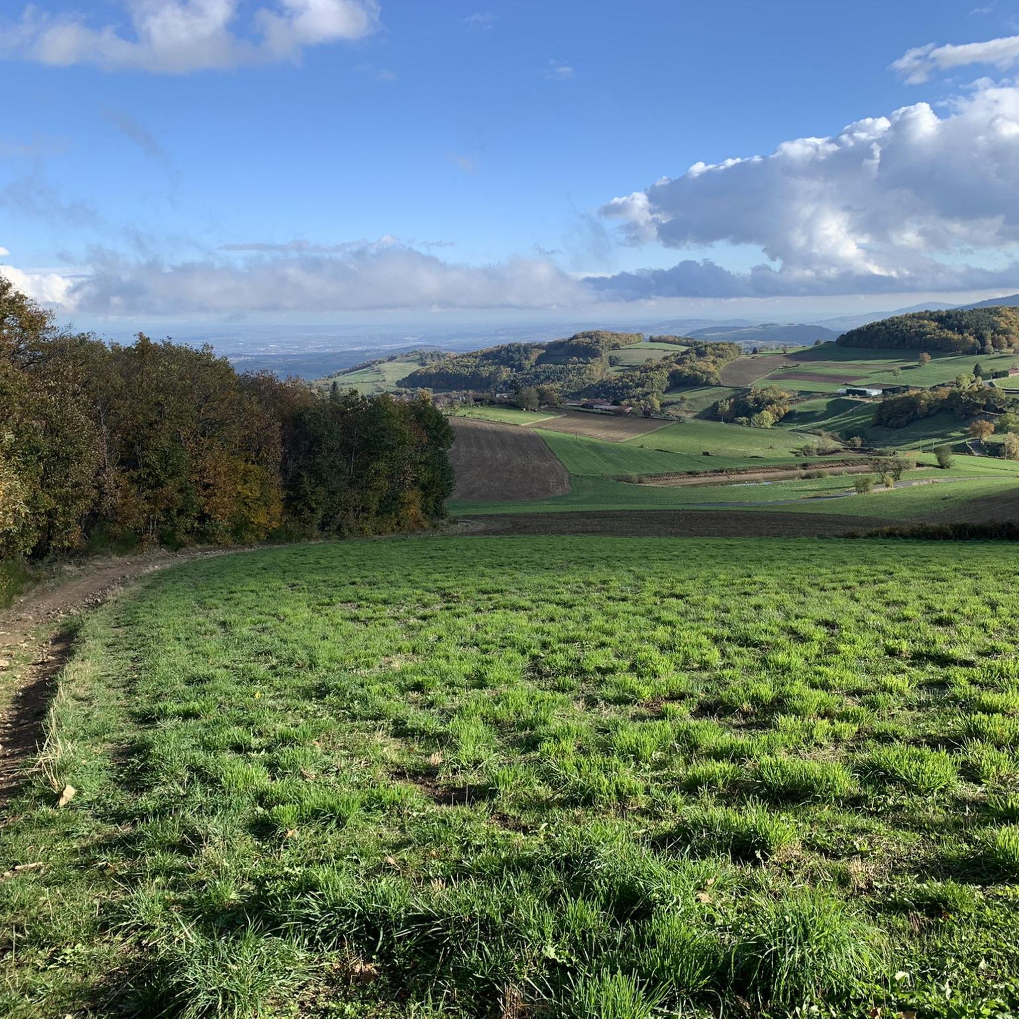
Jogging around Saint-Martin-En-Haut offers a diverse landscape characterized by undulating terrain and scenic viewpoints. The region features a mix of woodlands, open areas, and routes that provide panoramic views, including some towards Lyon. Running routes here often involve varied elevation, making them suitable for those seeking a challenge.
Best jogging routes around Saint-Martin-En-Haut
- The most popular jogging route is Le Signal de Saint André – Le Signal loop from Saint-Martin-en-Haut, an 8.8 miles (14.1 km) trail that takes 1…
Last updated: May 24, 2026
4.7
(3)
155
runners
14.1km
01:43
410m
410m
Hard run. Very good fitness required. Mostly paved surfaces. Suitable for all skill levels.
33
runners
Hard run. Very good fitness required. Mostly paved surfaces. Suitable for all skill levels.

Sign up for free
5.0
(1)
12
runners
6.17km
00:46
180m
180m
Moderate run. Good fitness required. Mostly paved surfaces. Suitable for all skill levels.
3.3
(3)
11
runners
Moderate run. Good fitness required. Mostly paved surfaces. Suitable for all skill levels.
10
runners
Moderate run. Good fitness required. Mostly paved surfaces. Suitable for all skill levels.
Get access to more routes and recommendations from other explorers.
Sign up for free
Already have an account?
Our route recommendations are based on thousands of hikes, rides, and runs completed by other people on komoot.
Start today with a free account
Your next adventure awaits.
Login or Signup

Tips from the Community

Beautiful walk with friends, in the freshness of May
0
0

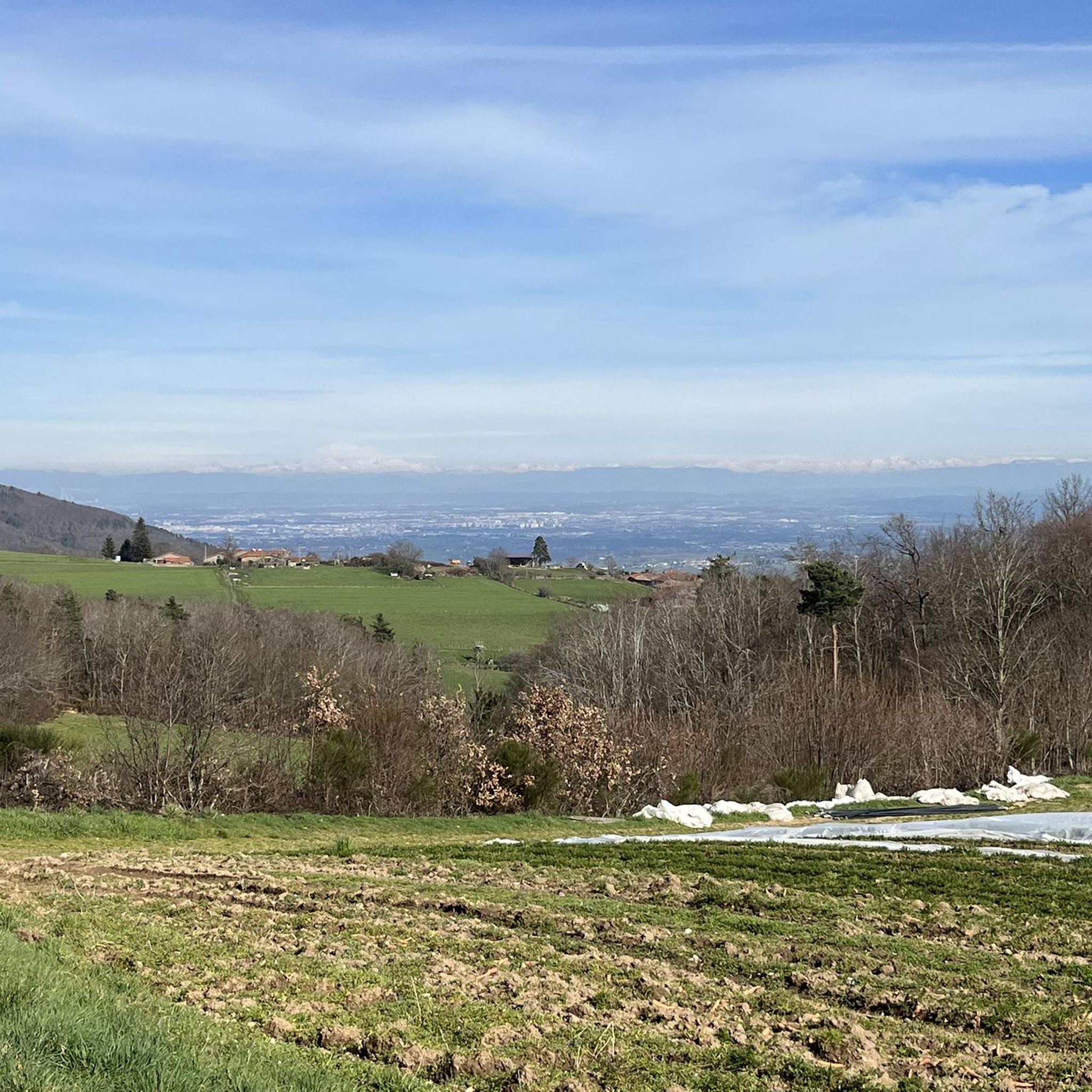
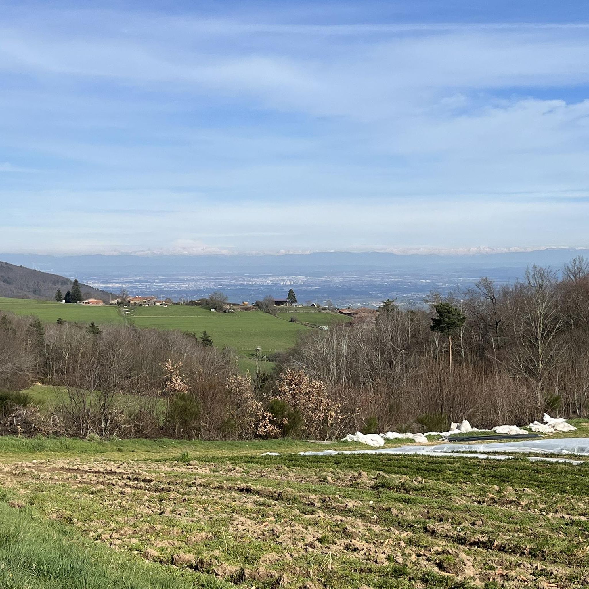
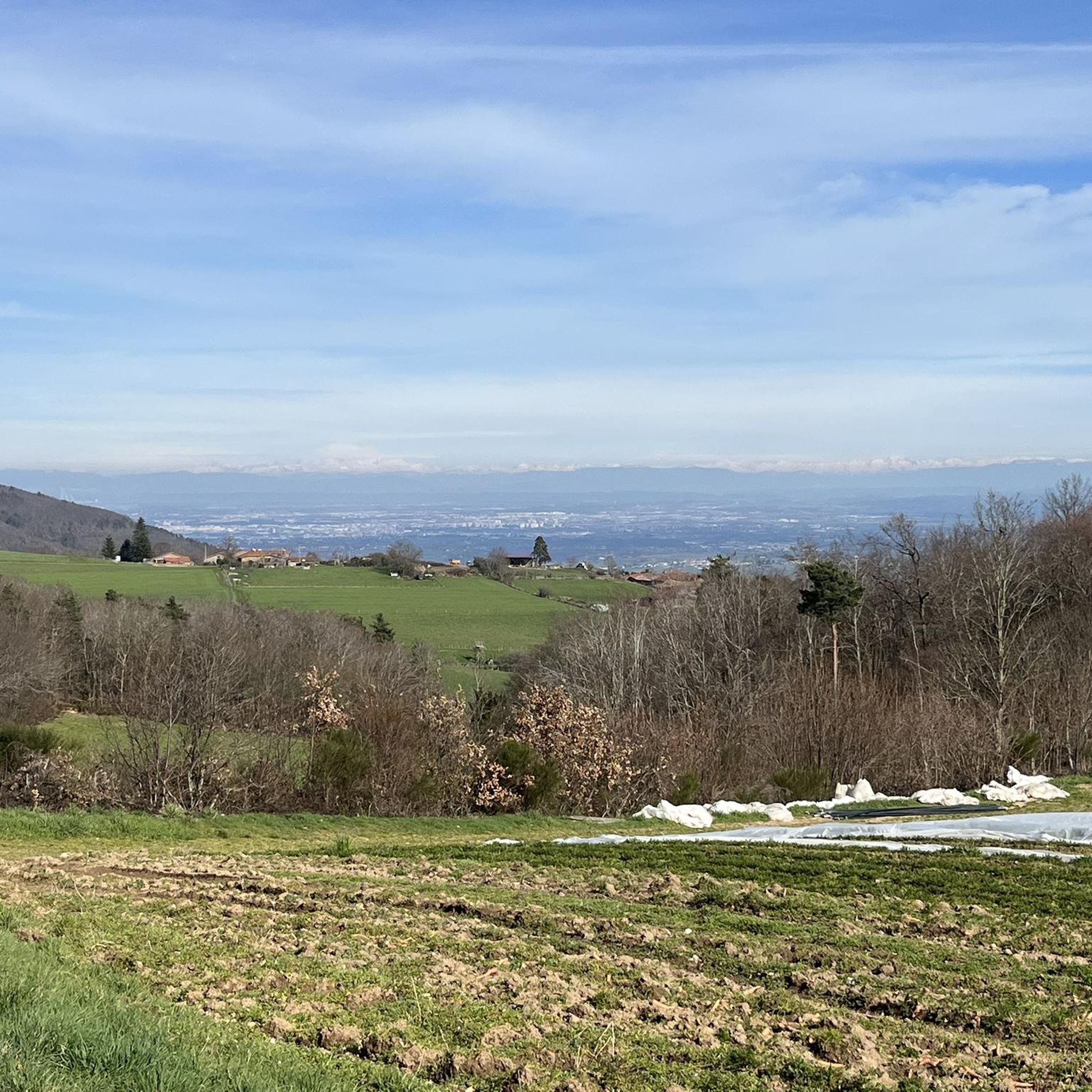
The hamlet of Rochefort, a medieval site including a Romanesque chapel and the remains of a keep. Panoramic views of the Alps and Lyon, with a viewpoint indicator along the path.
0
0

Small town in the Monts du Lyonnais located 30 km from Lyon, beautiful view of the Lyon metropolitan area on a clear day. See the medieval site of Rochefort
0
0

The Signal site, an emblematic highest point in the Monts du Lyonnais, located at 934 meters, equipped with a belvedere and an orientation table.
0
0
Interesting is the Cassini terminal, where the first surveys were carried out in 1758 to draw up the map of Lyon, a moment in history.
0
0
The 2 orientation tables at the Signal de St-André (at 934m) offer a panorama of the Rhône valley and the Metropolis of Lyon, and on clear days as far as the Alps.
0
0

Landscaped summit (accessible on foot) commemorating the locations of the geographer César-François Cassini de Thury between 1758 and 1761.
0
0
Peaceful place on this Sunday, suitable for a break.
1
0
Frequently Asked Questions
How many running routes are available in Saint-Martin-En-Haut?
There are over 25 dedicated running routes around Saint-Martin-En-Haut, offering a variety of distances and difficulty levels. The komoot community has explored these trails over 3,500 times, providing an average rating of 4.4 stars.
What kind of terrain can I expect on the running trails around Saint-Martin-En-Haut?
The running trails in Saint-Martin-En-Haut feature a diverse landscape, characterized by the undulating topography of the Monts du Lyonnais. You'll encounter a mix of forest paths, open terrains, and routes with significant elevation changes, providing both moderate and difficult challenges. Many routes offer panoramic views of the mountains, Lyon, and on clear days, even the Alps.
Are there any scenic viewpoints or landmarks to discover along the jogging routes?
Yes, many routes offer stunning views and pass by notable landmarks. The Le Signal de Saint André – Le Signal loop, for instance, ascends to the highest point in the Monts du Lyonnais, offering extensive panoramic views. You might also encounter the serene Artilla valley or the Crêt de la Poipe. For specific points of interest, consider routes that pass near Col de la Luère or Saint Vincent Chapel.
Are there running routes suitable for beginners or those looking for an easier jog?
While many routes feature significant elevation, there are moderate options available. The Étang de Quéser loop from Saint-Martin-en-Haut is a moderate 3.8-mile (6.2 km) trail that leads through varied terrain around the pond, offering a less strenuous option compared to some of the more challenging climbs.
Are there any circular running routes in the area?
Yes, many of the running routes in Saint-Martin-En-Haut are designed as circular loops, allowing you to start and finish at the same point. Examples include the Le Signal de Saint André – Le Signal loop and the Étang de Quéser loop, providing convenient options for exploration.
What do other runners say about the trails in Saint-Martin-En-Haut?
The running routes in Saint-Martin-En-Haut are highly rated by the komoot community, with an average score of 4.4 stars from over 140 reviews. Runners frequently praise the varied terrain, the challenging elevation changes, and the rewarding panoramic views, especially from spots like the Signal Saint-André.
Are there specific routes recommended for more challenging trail running?
For those seeking a more demanding trail running experience, the region is well-suited. The "Trail de St-Martin-en-Haut à Yzeron" is specifically recommended as an excellent training ground, featuring demanding sections alongside enjoyable stretches. You can find more information about this trail on the Monts du Lyonnais Tourisme website.
Can I find routes that incorporate historical sites?
Absolutely. Some routes allow you to integrate cultural and historical elements into your run. For example, the Medieval Site of Rochefort – Saint-Martin-en-Haut loop passes by the medieval hamlet of Rochefort, where you can see remnants of a keep and a 13th-century chapel. You might also find segments of trails tracing the ancient Gallo-Roman aqueduct of Yzeron.
Are there any routes that pass by water features like lakes or dams?
Yes, the region features several picturesque water elements. The Étang de Quéser loop explores the area around a pond. You can also find routes that pass near the serene Lac du Ronzey or the hidden Thurins Dam, offering beautiful natural backdrops for your run.
Where can I park my car when starting a run in Saint-Martin-En-Haut?
Many routes conveniently start from a leisure park in Saint-Martin-en-Haut, which typically offers accessible entry points and parking facilities. It's always a good idea to check the specific starting point of your chosen route for detailed parking information.
What is the best time of year to go jogging in Saint-Martin-En-Haut?
Saint-Martin-En-Haut offers enjoyable running conditions across multiple seasons. Spring and autumn provide pleasant temperatures and vibrant scenery, while summer mornings or evenings can be ideal. Winter runs are also possible, though some higher elevation paths might require more suitable gear due to potential snow or ice.
Are dogs allowed on the running trails in Saint-Martin-En-Haut?
Generally, dogs are welcome on many of the outdoor trails in the Monts du Lyonnais region, including those around Saint-Martin-En-Haut. However, it's always recommended to keep your dog on a leash, especially in areas with livestock or near protected natural zones, and to check for any specific local regulations or signage on individual trails.
Most popular routes around Saint-Martin-En-Haut
Most popular attractions around Saint-Martin-En-Haut

Get inspired with the komoot mobile app


Explore more
Browse the best Running Trails & Routes in other regions.
