The best walks and hikes around Sankt Nabor
4.4
(1064)
5,313
hikers
29
hikes
Hiking around Sankt Nabor offers diverse landscapes, characterized by rolling hills, dense Vosges forests, and the scenic Moselle valley. The region features notable rock formations and elevated viewpoints, including those around Mont Sainte-Odile. Trails often traverse natural spaces rich in biodiversity.
Best hiking trails around Sankt Nabor
- The most popular hiking route is Circuit of the Five Castles, a 8.6 miles (13.8 km) trail that takes 4 hours 19 minutes to complete. This difficult route explores historical castle ruins. …
Last updated: November 7, 2026
4.6
(146)
626
hikers
13.8km
04:19
520m
520m
4.8
(56)
142
hikers
11.3km
03:43
520m
520m
Moderate hike. Good fitness required. Easily walkable paths.

4.3
(14)
119
hikers
15.7km
04:59
620m
620m
Moderate hike. Good fitness required. Mostly walkable paths. Sure-footedness required.
4.5
(11)
94
hikers
6.62km
02:23
410m
410m
Moderate hike. Good fitness required. Easily walkable paths.
4.2
(13)
47
hikers
7.48km
02:20
280m
280m
Moderate hike. Good fitness required. Easily walkable paths.
Get access to more routes and recommendations from other explorers.
Already have an account?
Our route recommendations are based on thousands of hikes, rides, and runs completed by other people on komoot.
Start today with a free account
Your next adventure awaits.

Tips from the Community

Beautiful view into the Rhine plain 😍
0
0

Striking rock with a view of the Rhine valley and the Black Forest
0
0
In contrast to the younger, Gallo-Roman chamber towers of the Heidenmauer, the Köberle-Tor is very simply constructed. It uses a natural fault in the sandstone. The passage is narrow and presumably served as a sally port.
0
0
The Heidenmauer (French: Mur Païen) is a monumental, eleven-kilometer-long fortification from the early Middle Ages that encloses the high plateau of the Odilienberg in Alsace. The imposing structure has fascinated archaeologists and visitors alike for centuries with its sheer dimension and construction. Around 300,000 irregularly hewn sandstone blocks were piled up without mortar to form a dry stone wall up to two meters wide. To give the huge blocks stability, the builders connected them with swallowtail-shaped wooden clamps made of oak. This extraordinary technique secured the structure against the shifting of stones in the steep forest terrain. For a long time, the structure was surrounded by a great mystery. Due to the name Pope Leo IX gave the wall in the 11th century, its origin was suspected to be from prehistoric, Celtic, or Roman times. Modern scientific investigations finally brought clarity: With the help of dendrochronology (tree-ring analysis), the wooden connecting wedges could be precisely dated to the late 7th or early 8th century AD. The wall thus originated in the Merovingian era. To this day, research puzzles over the exact purpose of this gigantic structure. The most likely theory is that the wall served as a mighty refuge for the population in times of political unrest. At the same time, the monumental structure demonstrated the claim to power and prestige of the then Dukes of Alsace, to whose family Saint Odilia also belonged. Today, the Heidenmauer is a protected cultural monument and a popular destination for hikers. A well-signposted
0
0
Odilienberg Monastery: Alsace's most important pilgrimage site at an altitude of 763 m. Free entry. Basilica of St. Mary of the Assumption: Built 1687–1692 on medieval foundations, elevated to a basilica minor in 2006. Home to the famous wooden inlay Way of the Cross by Charles Spindler.
0
0
The tomb of Saint Odilia (French: Tombeau de Sainte Odile) is the spiritual heart of the entire monastery complex on Mont Sainte-Odile and the destination for hundreds of thousands of pilgrims every year. The Tomb Chapel (Chapelle du Tombeau) The tomb is located in its own, protected chapel, directly adjacent to the monastery church (Basilica). The Sarcophagus: In the middle of the chapel stands a monumental, simple sarcophagus made of red Vosges sandstone from the 8th century. Inside, in a reliquary shrine, lie the remains of Saint Odilia, the patron saint of Alsace and of eyesight. The Tomb Monument: An ornate structure rises above the sarcophagus. On the sides are reliefs and sculptures depicting the life of the saint and her miracles. Pilgrims traditionally touch the sarcophagus while asking for protection or healing for their eyes.
0
0
The monumental ceramic Way of the Cross on Mont Sainte-Odile (French: Chemin de Croix du Mont Sainte-Odile) was created between 1933 and 1935 by the renowned Alsatian artist and master ceramicist Léon Elchinger (1871–1942). From an art historical perspective, it is considered one of the most significant and ambitious masterpieces of sacred ceramic art in Alsace.
1
0
The Maennelstein (Männelstein) is a striking, 817-meter-high Bunter Sandstone rock formation on the southern edge of Odilienberg (Mont Sainte-Odile) in Alsace. It is considered one of the most beautiful viewpoints in the region and offers a wide panoramic view over the Rhine plain, the Black Forest, and on clear days even as far as the Alps.
0
0
Frequently Asked Questions
How many hiking trails are available around Sankt Nabor?
There are over 19 hiking trails in the Sankt Nabor area, catering to various skill levels. This includes 8 easy routes, 10 moderate routes, and 1 difficult route.
Are there easy hiking trails suitable for families or beginners in Sankt Nabor?
Yes, Sankt Nabor offers 8 easy hiking routes perfect for families or those seeking a relaxed walk. These trails often traverse natural spaces rich in biodiversity, providing pleasant experiences for all ages.
Can I find circular hiking routes in Sankt Nabor?
Many trails in Sankt Nabor are designed as loops, offering convenient circular walks. For example, the Oberkirch Rock – Mount Sainte-Odile loop from Saint-Nabor is a moderate 5.3-mile path, and the St. Nicolas – Truttenhausen Abbey loop from Saint-Nabor is a 4.7-mile trail through forested areas.
Are there any trails with waterfalls in the Sankt Nabor area?
Yes, the region boasts natural attractions including waterfalls. You can explore the Hohwald waterfall, which is a notable natural monument in the area. The Fossard Forest, particularly in the Vosges region, also features the Miraumont waterfall.
What kind of natural attractions or landmarks can I see while hiking in Sankt Nabor?
Hiking in Sankt Nabor allows you to discover diverse natural and historical landmarks. Highlights include the impressive rock formations like Rocher des Géants and the Verlorenes Eck Stone Circle. You can also visit Saint Odile's Spring and the historic Heidenmauer (Mur Païen).
Are the hiking trails in Sankt Nabor dog-friendly?
Many trails in the Sankt Nabor region are suitable for hiking with dogs, especially those traversing the dense Vosges forests and open natural spaces. It's always recommended to keep dogs on a leash and check specific trail regulations for any restrictions.
What is the best time of year to go hiking in Sankt Nabor?
Sankt Nabor offers appealing hiking opportunities throughout the year. Spring and autumn are particularly beautiful, with vibrant foliage in the forests and comfortable temperatures. The panoramic views from sites like Tête des Cuveaux are especially stunning in autumn.
Are there any challenging hikes for experienced hikers in Sankt Nabor?
Yes, for experienced hikers seeking a challenge, Sankt Nabor offers more difficult routes. The Circuit of the Five Castles is a difficult 8.6-mile trail that explores historical castle ruins and involves significant elevation changes.
What do other hikers say about the trails in Sankt Nabor?
The hiking routes in Sankt Nabor are highly rated by the komoot community, with an average score of 4.4 stars from over 750 reviews. Hikers often praise the varied terrain, from dense forests to scenic valleys, and the well-maintained paths that lead to historical sites and impressive viewpoints.
Is there public transport access to the hiking areas around Sankt Nabor?
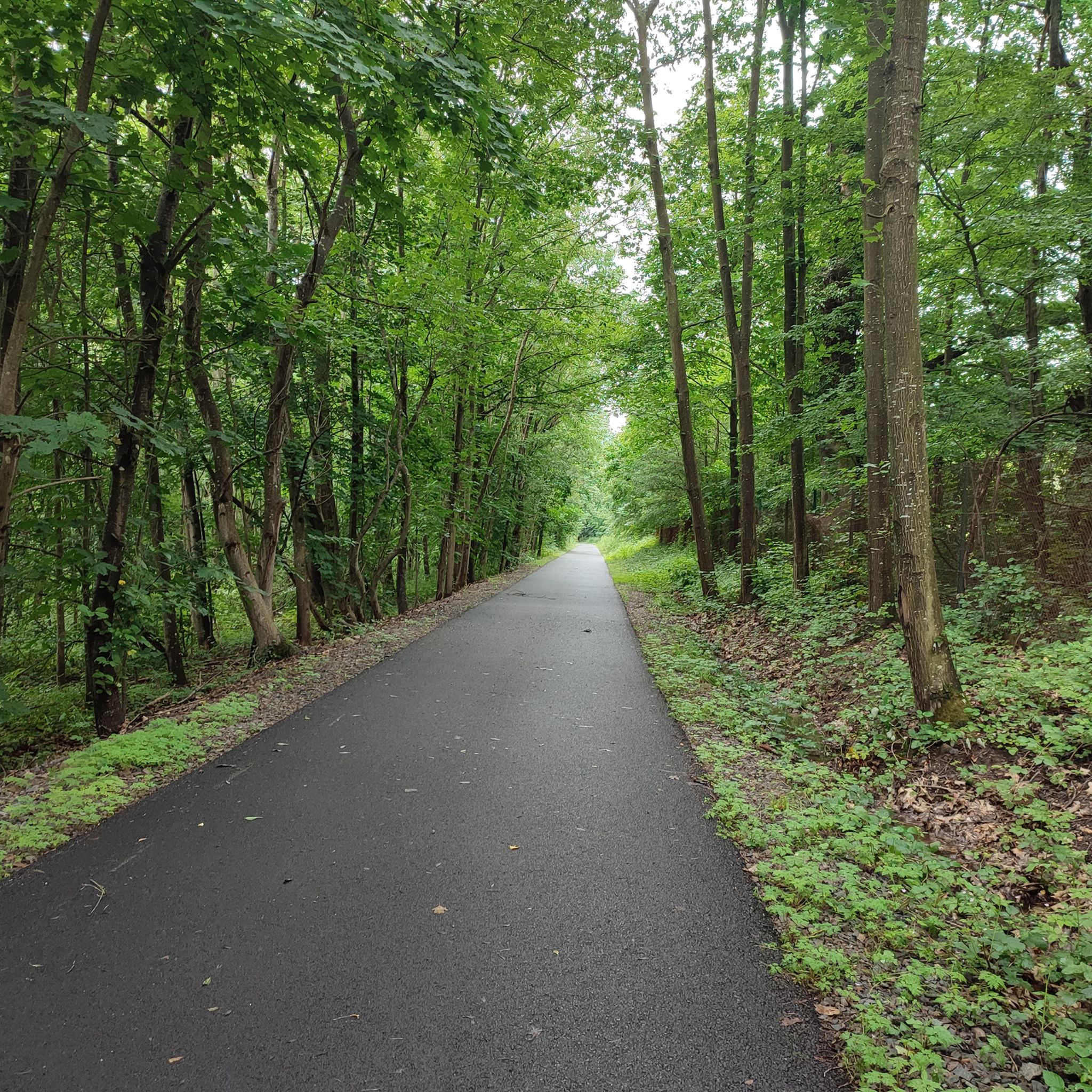
While specific public transport options vary by starting point, the region around Sankt Nabor, particularly the Bas-Rhin area, is known for routes like the "GreenWay - Portes Bonheur," which connects Rosheim to Saint-Nabor along an old railway line, potentially offering accessible points. It's advisable to check local transport schedules for specific trailheads.
Are there any specific trails that offer panoramic views?
Absolutely. The region is known for its elevated viewpoints. The Tête des Cuveaux in the Vosges offers magnificent panoramic views, especially in autumn, from its 9-meter-high wooden promontory. The Saint-Mont esplanade in Fossard Forest also boasts a 360° panorama of the Moselle and Moselotte valleys.
Can I explore historical sites while hiking in Sankt Nabor?
Yes, many trails in Sankt Nabor lead past significant historical sites. The Circuit of the Five Castles explores historical castle ruins. Additionally, the Fossard Forest contains the historic Chapelle du Vieux Saint-Amé, and the Heidenmauer (Mur Païen) is a notable ancient historical site.
What is the 'GreenWay - Portes Bonheur' and where can I find more information?
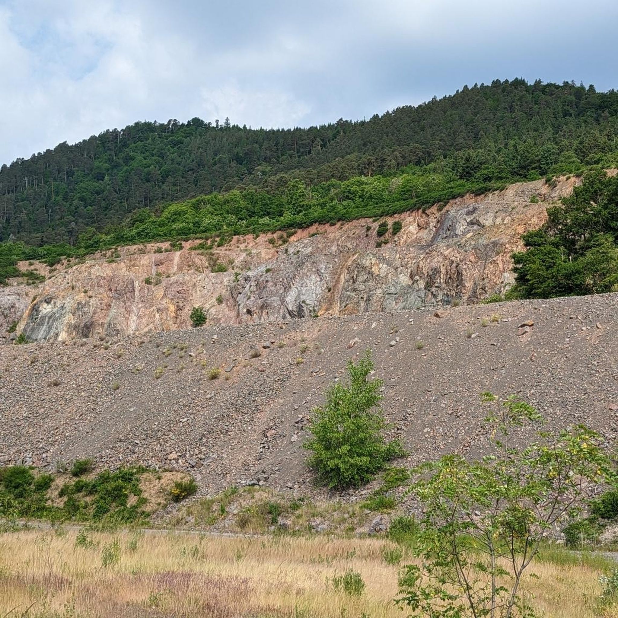
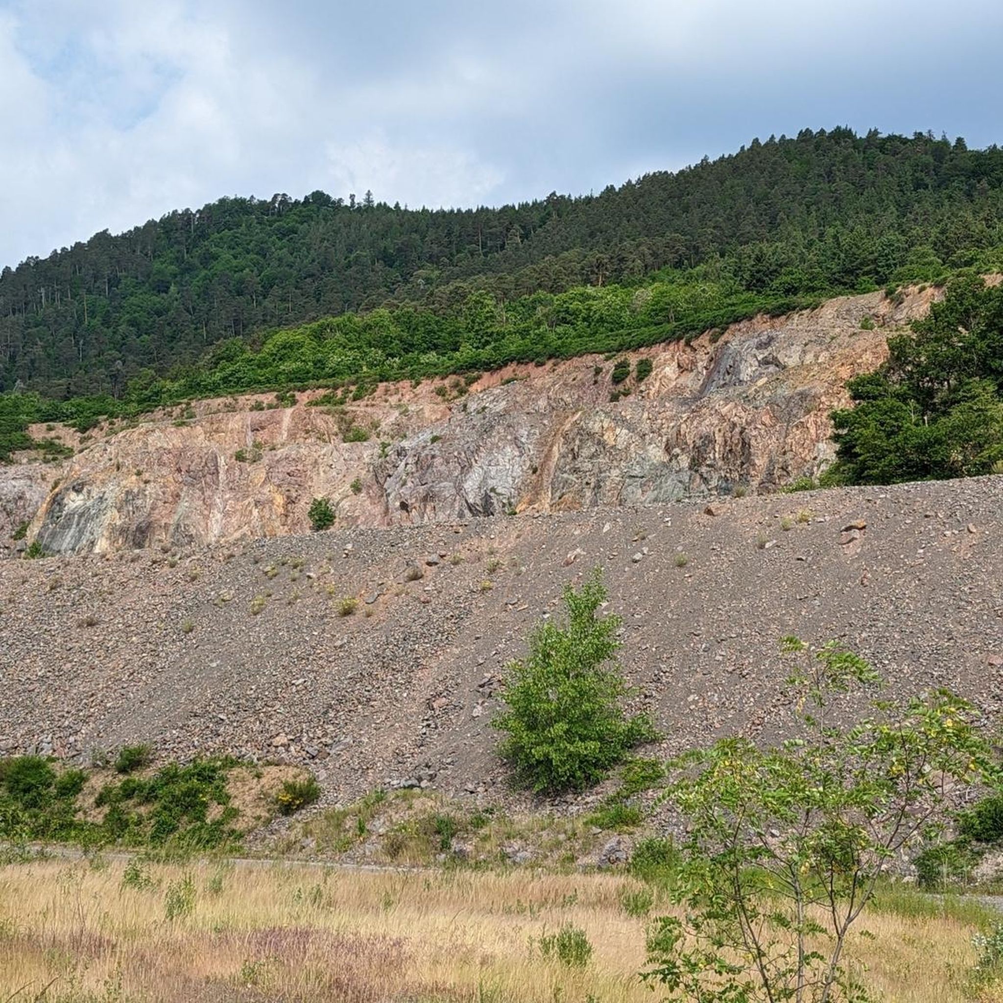
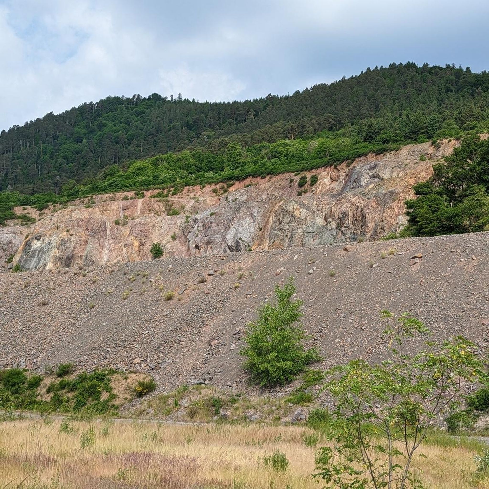
The 'GreenWay - Portes Bonheur, the lane to Saint Nabor quarry' is an 11-kilometer route along an old railway line connecting Rosheim to Saint-Nabor at the foot of Mont Sainte-Odile. It offers scenic views, biodiversity, and contemporary art installations. You can find more information about this route on the mso-tourisme.com website.
Most popular routes around Sankt Nabor
Most popular attractions around Sankt Nabor

Get inspired with the komoot mobile app


Explore more
Browse the best Hikes in other regions.
