Top 20 Mountain Passes around Claveisolles
Mountain passes around Claveisolles are located in the green Beaujolais region of France, a mid-mountain village in the Rhône department. The area features altitudes ranging from 394 meters to 886 meters. This landscape provides various elevated viewpoints and mountain passes popular for outdoor activities. The region is characterized by its natural beauty and offers routes for both hiking and cycling.
Best mountain passes around Claveisolles
- The most popular mountain passes is Le relais du Parasoir, a restaurant and viewpoint.…
Last updated: July 23, 2026
Col de Saint-Bonnet
Highlight • Mountain Pass
Showing Translation
Tip by

Le relais du Parasoir
Highlight • Restaurant
Translated by Google •
Tip by

Sign up now to discover places like this
Get recommendations on the best single tracks, peaks, & plenty of other exciting outdoor places.
Sign up for free
Cambuse Pass
Highlight • Mountain Pass
Translated by Google •
Tip by
Croix d'Ajoux
Highlight • Religious Site
Translated by Google •
Tip by

Croix Papin Pass
Highlight • Mountain Pass
For the record, it took me 3 attempts to complete the entire route, the first having been …
Translated by Google •
Tip by

Sign up for free to discover even more mountain passes around Claveisolles.
Sign up for free
Already have an account?
Start today with a free account
Your next adventure awaits.
Login or Signup
Other adventures around Claveisolles

Tips from the Community


The Col de Saint-Bonnet, located in the heart of the Alps, offers a spectacular panorama of the surrounding mountains and green valleys. This pass, perched at an altitude of 1,499 metres, is a favourite passage for hikers and cyclists in search of magnificent landscapes. As you climb the slopes of the pass, the view gradually opens up onto the Alpine peaks, forests and flowery meadows.
0
3

For a little refreshing break between 2 passes
0
0

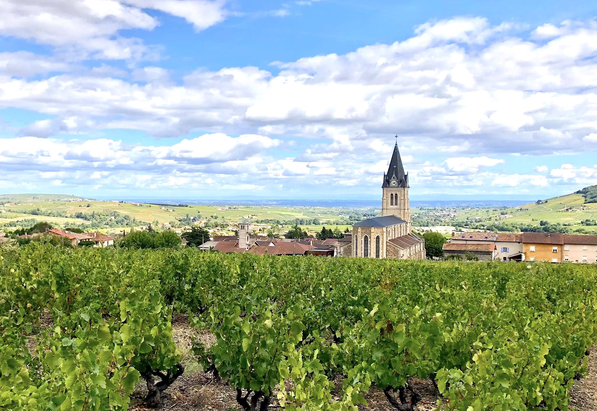
The Col de Saint-Bonnet is a beautiful pass in Beaujolais, culminating at 646 meters. The two main ascents are from Salles-Arbuissonas or Rivolet. Without great difficulty from Salles, it offers very beautiful panoramas of Beaujolais. Via Rivolet, the gradients are steeper in some sections, but the climb is short. You can then reach the Parasoir via the Col de la Vieille Morte, almost without any climbing.
2
0

“Each of these crosses can tell its own story and what prompted people to erect “their” cross at this point. (...) These wayside crosses were erected as visible signs and attract the attention of many people. The cross is a symbol of life. It stands as a sign of our Christian hope and wants to direct our gaze to Jesus Christ, who has overcome death (...). The cross is part of our life as it was in the life of Jesus. So I wish that many people … visit the crosses, whether as places of stillness and breathing space before God, whether as places for community gatherings, prayer and praise to God.” (Text source: Dean Rainald M. Ollig in: “Crossroads. Small sacred monuments as a sign of popular piety")
3
1
To do from Chambost-Allières, Rivolet. In the fog, the climb seemed very long to me. The percentages are low but the climb is quite long, 7 km at 4.5%. At the top you can go for a walk in St Cyr le Chatoux, take your gravel or mountain bike to go on the paths, go climb the Pyramid, eat and drink at the restaurant, continue on the ridge road which goes to the North by chaining the collars.
1
0
Nice pass to do from: Chambost-Allières, Chamelet, Létra, La Saule d'Oingt in the extension of the Col du Chêne. Nice percentages on the Chamelet side, Létra and in the beginning of the ascent from Chambost, at the end the slope flattens out. From Chambost, we climb in a beautiful semi-mountain atmosphere. The connection from the Col du Chêne to the Joncin offers a magnificent view all along over the Azergues. It is the starting point of a beautiful forest trail in the Cantinière forest, to be done in gravel, and mountain bike trails.
0
0
3 or even 5 possible climbs: from Azergues via Grandris 3: the main one, a small annex in less good condition from Grandris Haut and a terrible variant via Gondras with passages at 25% from Grandris bas. They all return to the main road before the pass. The main road and on a road in fairly good condition, little gradient 3/4% for about 9 km with beautiful landscapes and quite a few clear views. On the Rhine valley side, you can climb from Cublize (approximately 5% average but much shorter) or from Magny via Meaux la Montagne. On the latter the climb to Meaux is quite steep at 7/8% then after Meaux the slope is gentle not far from 2/3%. On these faces the landscapes are less clear but still appreciable. In summer be careful because good parts of the pass especially from the Rhine are in full dodger for quite a long time.
2
0
Frequently Asked Questions
What are some notable mountain passes and high points in the Claveisolles region?
Beyond the most popular passes, the Claveisolles region offers several other significant mountain passes and elevated viewpoints. These include Cambuse Pass, known for its multiple ascent options and gentle gradients, and Col de Saint-Bonnet, which provides beautiful panoramas over the Beaujolais. Other passes like Col de la Casse Froide, Col de la Croix Rosier, Col de la Croix Marchampt, and Col de la Croix des Brosses are popular for hiking and cycling, offering diverse landscapes and rewarding views. High points such as La Roche d'Ajoux and Croix de Rochefort also provide expansive vistas.
Are there family-friendly mountain passes or viewpoints around Claveisolles?
Yes, the region offers options suitable for families. Le relais du Parasoir is categorized as family-friendly, offering a restaurant and breathtaking views of the Beaujolais vineyards and Saône valley. Many of the passes feature routes with varying difficulty, allowing families to choose paths that match their comfort level, such as the moderate loop to Col de la Casse Froide.
What outdoor activities can I do near the mountain passes of Claveisolles?
The mountain passes around Claveisolles are ideal for various outdoor activities. You can enjoy extensive hiking, with routes like the 'Col de Casse Froide – Marchampt loop' or the 'Claveisolles – Chemin des Brosses loop'. For cyclists, there are numerous road cycling routes, including the 'Tour of the Beaujolais Passes' and challenging climbs like the Col de la Croix Rosier. Mountain biking is also popular, with trails such as the 'Ferme Sainte-Marie – Morillon Ridge loop'. You can find more details on these activities in the dedicated guides for Hiking around Claveisolles, Road Cycling Routes around Claveisolles, and MTB Trails around Claveisolles.
What kind of views can I expect from the mountain passes in Claveisolles?
The mountain passes and high points in Claveisolles offer diverse and stunning panoramas. From Le relais du Parasoir, you can see the Beaujolais vineyards and the Saône valley. Col de Saint-Bonnet provides broad views over the Beaujolais region. From Croix de Rochefort, you can enjoy a superb panorama of the Beaujolais mountains, the Monts d'Or, Mont Brouilly, the Lyonnais mountains, and even the Alps on clear days. La Roche d'Ajoux, the second-highest summit, offers expansive views of the upper Azergues valley.
Are there any cafes or restaurants near the mountain passes?
Yes, Le relais du Parasoir is a restaurant and viewpoint perched at 656 meters altitude, offering a perfect spot for a snack break with magnificent views from its terrace. Additionally, Croix Papin Pass features a picnic area, making it a convenient stop for a packed meal.
What is the best time to visit the mountain passes around Claveisolles?
The region is beautiful throughout the year, but the best time for hiking and cycling is typically from spring to autumn when the weather is mild and trails are clear. Summer offers lush green landscapes, though some areas can be exposed to the sun. For specific routes, it's always advisable to check local conditions, especially for higher passes or during winter months when snow or ice might affect accessibility.
Are there challenging routes for experienced hikers or cyclists?
Absolutely. For cyclists, the Col de la Croix Rosier is a category 3 pass with a 5.7% average gradient over 5.5 kilometers, offering a significant climb. The 'Tour of the Beaujolais Passes' is a difficult road cycling route spanning over 72 kilometers. For mountain bikers, the 'Ferme Sainte-Marie – Morillon Ridge loop' is a challenging 31 km route. Some ascents to Cambuse Pass also feature steep variants with passages up to 25%.
What are the typical distances and difficulties of hiking trails near Claveisolles mountain passes?
Hiking trails around Claveisolles vary in length and difficulty. You can find easy loops like the 'Claveisolles loop' at around 4.7 km. Moderate options include the 'Col de Casse Froide – Marchampt loop' (13.2 km with 490m elevation gain) and the 'Claveisolles – Chemin des Brosses loop' (7.8 km). These trails showcase the natural beauty of the area and provide diverse experiences for different fitness levels.
Are there any historical or cultural points of interest near the passes?
While the primary focus of the passes is natural beauty and outdoor activities, some locations like Croix d'Ajoux, a religious building, offer a glimpse into local traditions. Many of the 'Croix' (crosses) found at high points, such as Croix de Rochefort and Croix des Forces, are significant local landmarks that reflect the region's heritage and offer beautiful viewpoints.
What do visitors particularly enjoy about the mountain passes in Claveisolles?
Visitors appreciate the diverse landscapes, from vineyards to forests, and the stunning panoramic views offered by the passes. Many enjoy the challenging climbs for cyclists and hikers, as well as the opportunities for peaceful walks. The presence of amenities like the restaurant at Le relais du Parasoir and picnic areas at Croix Papin Pass also enhance the experience, making these spots perfect for enjoying nature and outdoor activities.
Is parking available at the mountain passes?
While specific parking details for every pass are not always highlighted, many popular trailheads and passes in the region, such as those leading to Col de la Casse Froide or starting points for loops around Claveisolles, typically have designated parking areas. It's advisable to check specific route descriptions or local signage upon arrival for the most accurate information.
Are permits required to access the mountain passes or trails?
Generally, no special permits are required to access the mountain passes or public hiking and cycling trails in the Claveisolles region. The area is known for its open access to natural landscapes. However, always respect private property and follow local regulations, especially concerning protected areas or specific events.
Most popular attractions around Claveisolles

Get inspired with the komoot mobile app


Explore more
See even more epic mountain passes by checking out these guides around Claveisolles:
