The best MTB trails around Écoche
4.2
(43)
265
riders
50
rides
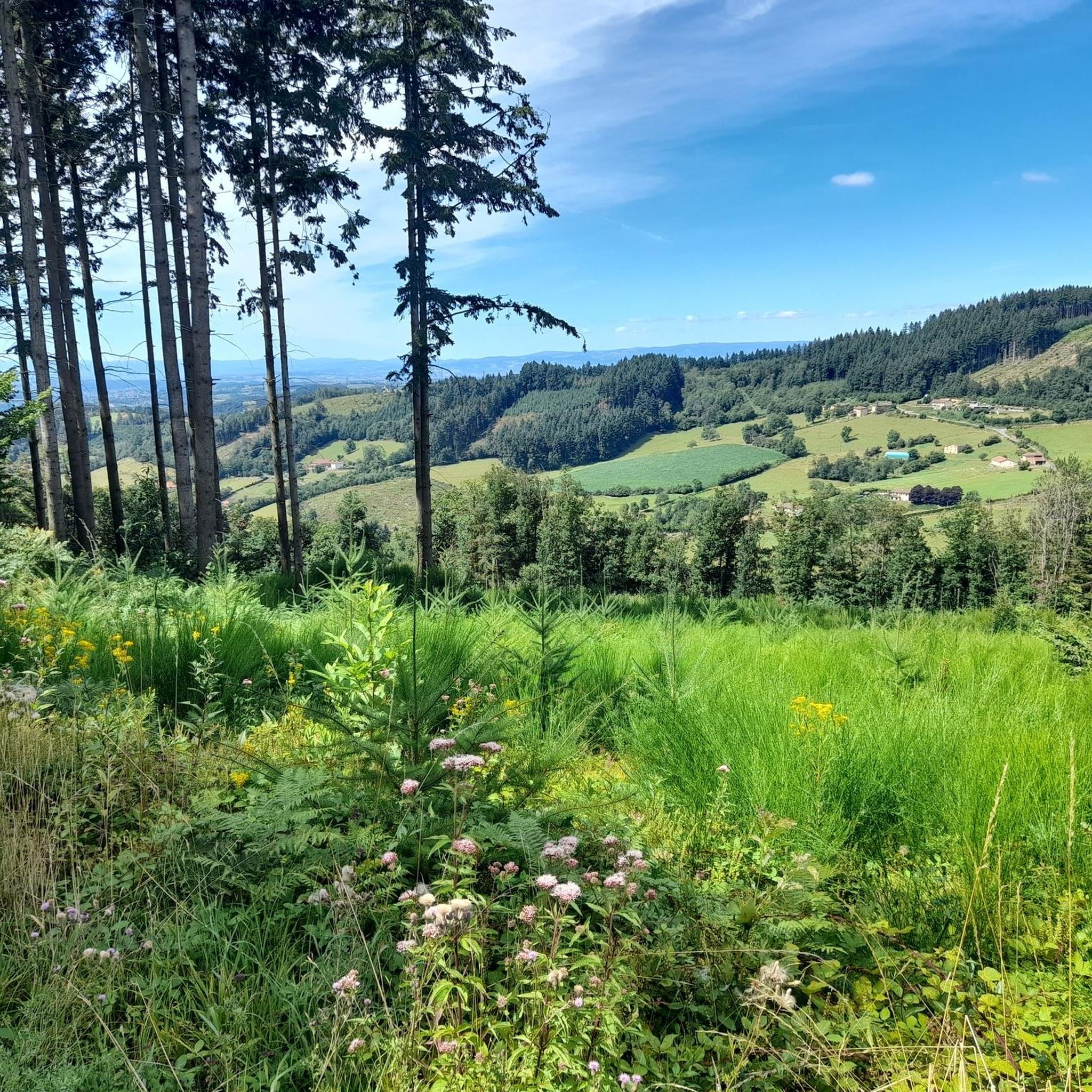
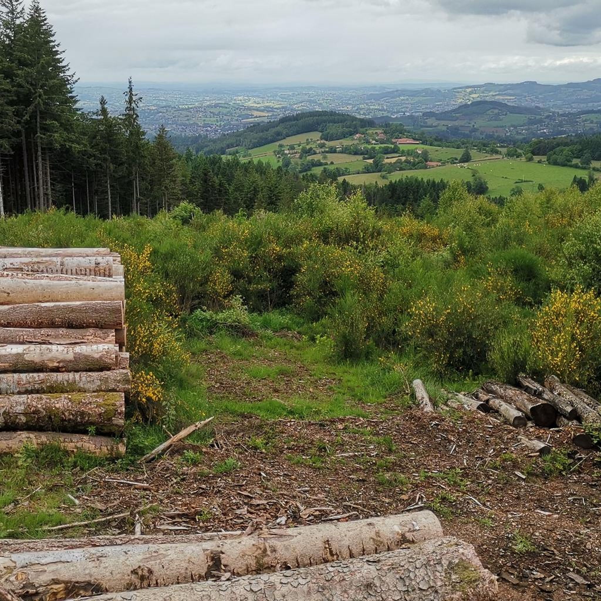
Mountain biking around Écoche offers a diverse landscape characterized by its "moyenne montagne" (medium mountain) terrain, with altitudes ranging from approximately 370 meters to 790 meters. This varied topography provides a natural mix of ascents and descents suitable for mountain biking. The region features extensive forested zones and undulating terrain, which contribute to a network of paths and tracks. These natural features create an environment for exploring the countryside on two wheels.
Best mountain bike trails around Écoche
- The most…
Last updated: November 1, 2026
5.0
(2)
14
riders
38.4km
03:52
1,030m
1,030m
Hard mountain bike ride. Very good fitness required.
4.5
(2)
11
riders
33.5km
03:08
790m
790m
Moderate mountain bike ride. Good fitness required.

10
riders
36.9km
03:42
1,010m
1,010m
Hard mountain bike ride. Very good fitness required.
5.0
(1)
10
riders
42.3km
04:14
1,020m
1,020m
Hard mountain bike ride. Very good fitness required. Advanced riding skills necessary.
8
riders
Moderate mountain bike ride. Good fitness required. Advanced riding skills necessary.
Get access to more routes and recommendations from other explorers.
Already have an account?
Our route recommendations are based on thousands of hikes, rides, and runs completed by other people on komoot.
Start today with a free account
Your next adventure awaits.
Tips from the Community

The white stone cross stands out well against the beautiful landscape. This small sacred monument rests on a gray base, above which rise the cross's longitudinal and transverse beams. It does not depict the body of Christ. A special feature is the design of the crossing point: there, another cross is engraved, surrounded by rays. This type of depiction is very rare.
0
0

Wonderful stage stop on my Camino https://huettemann.eu/de/2023/10/von-cluny-an-die-loire-berndscamino/
0
0
Wonderful stage stop on my Camino https://huettemann.eu/de/2023/10/von-cluny-an-die-loire-berndscamino/
0
0

Nice place for a picnic break. The place is covered and offers protection from sun and rain, and you also have some views.
1
0

Col de Favardy alt 856m Departure from many trails
0
0
Rest area for hikers
7
0

The pass of the pavilion culminates at 755 meters above sea level. The view of the western slope is quite unobstructed. I recommend a stop at the Le Pavillon hostel-hotel, which offers good food and allows you to take a break after climbing the pass.
0
0

Nice first view of Charlieu coming from the Croix de Foupeysson. But it's still a long way to get there.
3
1
Frequently Asked Questions
How many mountain bike trails are available around Écoche?
There are 45 mountain bike trails around Écoche, offering a variety of options for different skill levels. The komoot community has explored these routes over 200 times, contributing to an average rating of 4.3 stars.
What kind of terrain can I expect on mountain bike trails in Écoche?
Écoche is characterized by its 'moyenne montagne' (medium mountain) terrain, with altitudes ranging from approximately 370 meters to 790 meters. This varied topography provides a natural mix of ascents and descents, extensive forested zones, and undulating terrain, creating a diverse environment for mountain biking.
Are there mountain bike trails suitable for beginners or families in Écoche?
Yes, while many routes offer moderate to difficult challenges, there are 2 easy mountain bike trails available around Écoche. These routes are generally shorter and have less elevation gain, making them suitable for beginners or families looking for a more relaxed ride.
What are some notable landmarks or viewpoints I can discover while mountain biking in Écoche?
The region offers several interesting points. You can pass through mountain passes like Col de Favardy (862 m) or Col du Pavillon. Other attractions include Mount Dun, the Blue Cross and Picnic Area, and the Chapel of Fatima. The 'Creux des Fées' (Fairies' Hollow) is also a local legend worth exploring.
Are there any circular mountain bike routes in Écoche?
Yes, many of the mountain bike trails around Écoche are designed as loops, allowing you to start and finish at the same point. For example, the difficult Descente gaz – Our Lady of Fatima loop from Écoche covers over 42 km, and the moderate Descente gaz loop from Coublanc is another popular option.
What do other mountain bikers enjoy most about the trails in Écoche?
The trails in Écoche are highly rated by the komoot community, with an average score of 4.3 stars. Riders often praise the varied altitudes, extensive forests, and undulating terrain that provide a good mix of challenges and scenic views. The network of paths offers options for different ability levels, from moderate to difficult.
Is Écoche suitable for mountain biking with dogs?
While specific regulations for dogs on mountain bike trails are not detailed, the region's extensive forests and natural paths suggest a dog-friendly environment. It's always recommended to keep dogs under control, especially in forested areas, and to check local signage for any specific rules regarding pets.
Where can I find parking for mountain bike trails in Écoche?
While specific parking areas for mountain biking are not explicitly listed, Écoche is a commune with various access points. Many trails start from villages like Le Cergne or Cours-la-Ville, where public parking is generally available. The 'Plan d'eau de la Quichère' also offers a leisure area with facilities, which might include parking suitable for accessing nearby routes.
Are there places to eat or stay near the mountain bike trails in Écoche?
Écoche and its surrounding villages offer local cafes and restaurants where you can refuel after your ride. For accommodation, you can find options such as bed and breakfasts or gites in Écoche and nearby communities, providing a comfortable base for exploring the region.
What is the best time of year for mountain biking in Écoche?
The 'moyenne montagne' climate of Écoche generally makes spring, summer, and early autumn ideal for mountain biking. These seasons offer pleasant temperatures and drier trail conditions. While trails may be open year-round, winter conditions can bring mud, ice, or snow, making some routes more challenging or impassable.
Can I reach Écoche by public transport with my mountain bike?
Information on specific public transport options with bike carriage directly to Écoche is not readily available. It is advisable to check regional bus or train services that connect to the Loire department or nearby larger towns, and then inquire about their bike transport policies. Often, local transport might be limited, making a car the most convenient option for accessing trailheads.
Are there any particularly challenging mountain bike routes in the Écoche area?
Yes, Écoche offers several difficult mountain bike routes for experienced riders. For instance, the Our Lady of Fatima – Favardy Pass loop from Le Cergne is a 38.8 km difficult route with over 1000 meters of elevation gain, taking nearly 4 hours to complete. Another challenging option is the Descente gaz loop from Cours-la-Ville, which also features significant climbs.
Most popular attractions around Écoche

Get inspired with the komoot mobile app


Explore more
Browse the best MTB trails in other regions.
