The best walks and hikes around Dragey-Ronthon
4.6
(2582)
26,744
hikers
227
hikes
Hiking around Dragey-Ronthon offers diverse landscapes within the Manche department of Normandy, characterized by its coastal scenery and proximity to the Bay of Mont-Saint-Michel. The region features varied terrain, including easily accessible paths and more challenging routes, with five kilometers of coastline. Hikers can explore historic pathways, such as sections of the GR 223, and enjoy panoramic views across the bay. The area also includes picturesque features like the Lude Valley, providing a range of natural environments for exploration.
Best…
Last updated: October 8, 2026
4.8
(101)
338
hikers
14.3km
03:54
210m
210m
Moderate hike. Good fitness required. Easily-accessible paths. Suitable for all skill levels.
4.5
(2)
22
hikers
23.9km
06:03
40m
40m
Hard hike. Very good fitness required. Easily-accessible paths. Suitable for all skill levels.

5.0
(1)
16
hikers
25.2km
06:24
60m
60m
Hard hike. Very good fitness required. Easily-accessible paths. Suitable for all skill levels.
4.8
(5)
23
hikers
27.7km
07:16
220m
220m
Hard hike. Very good fitness required. Easily-accessible paths. Suitable for all skill levels.
4.7
(3)
21
hikers
17.2km
04:22
50m
50m
Moderate hike. Good fitness required. Easily-accessible paths. Suitable for all skill levels.
Get access to more routes and recommendations from other explorers.
Already have an account?
Our route recommendations are based on thousands of hikes, rides, and runs completed by other people on komoot.
Start today with a free account
Your next adventure awaits.

Tips from the Community

The Sentiero dei Doganieri between Carolles, the Valle del Lude and Saint-Jean-le-Thomas (in the Manche department, Normandy) is a coastal and nature route of about 6-6.3 km, which can be walked in about 1 hour and 40 minutes.
0
0

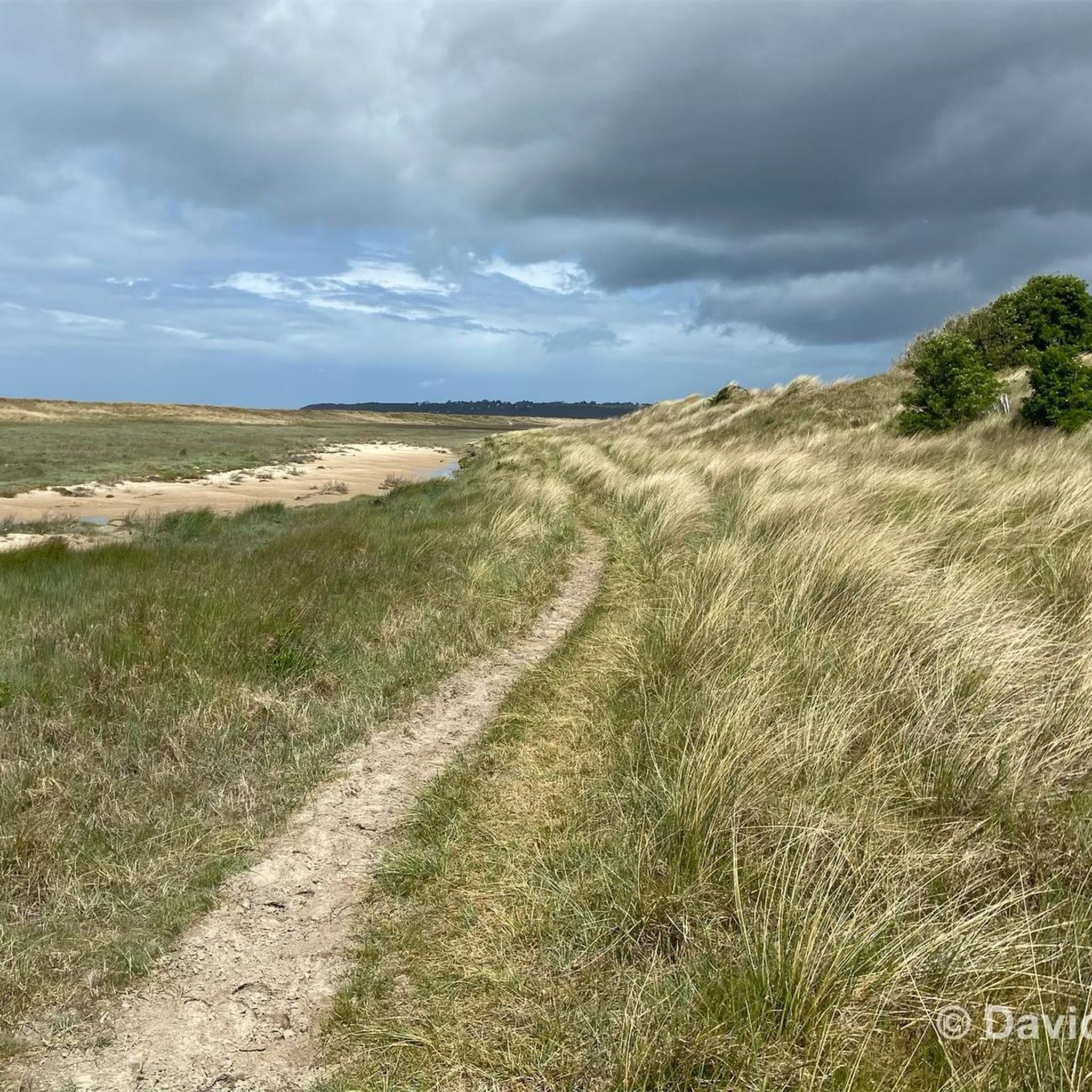
This walk, with sea views from the top of the cliffs, is simply magnificent. The cliff-edge path is quite steep in places. The loop also goes through the woods, along the stream.
1
0

The Vallée du Lude near Carolles is a protected coastal valley. A small stream winds its way through the green valley, eventually flowing into the English Channel at an idyllic pebble bay. The hiking trail leads through a varied landscape with steep cliffs, dense vegetation, and beautiful views of the coast – a peaceful natural spot that can be ideally combined with the Zöllnerpfad along the cliffs.
29
0

The documentary film "Border Paths – The Customs Officers' Trail" is described on its website as follows: "The historic Customs Officers' Trail begins at the famous pilgrimage site of Mont Saint-Michel and is now one of France's most popular hiking trails. Along its 1,700 kilometers, between Mont Saint-Michel in the north and Saint-Nazaire in the south of the Breton peninsula, hikers can discover impressive landscapes with a rich diversity of flora and fauna. Passing rugged cliffs, expansive dunes, and seemingly endless beaches, hikers become border crossers on a floating border that shifts with the rhythm of the tides." ``` The video about the "Sentier des Douaniers" (duration: 43 minutes / language: German) in the ARD media library can be accessed via the following link =>> https://www.ardmediathek.de/video/grenzwege-der-zoellnerpfad/grenzwege-der-zoellnerpfad/mdr/Y3JpZDovL21kci5kZS9zZW5kdW5nLzI4MjA0MC81MjE2OTktNTAxNzM2
2
0
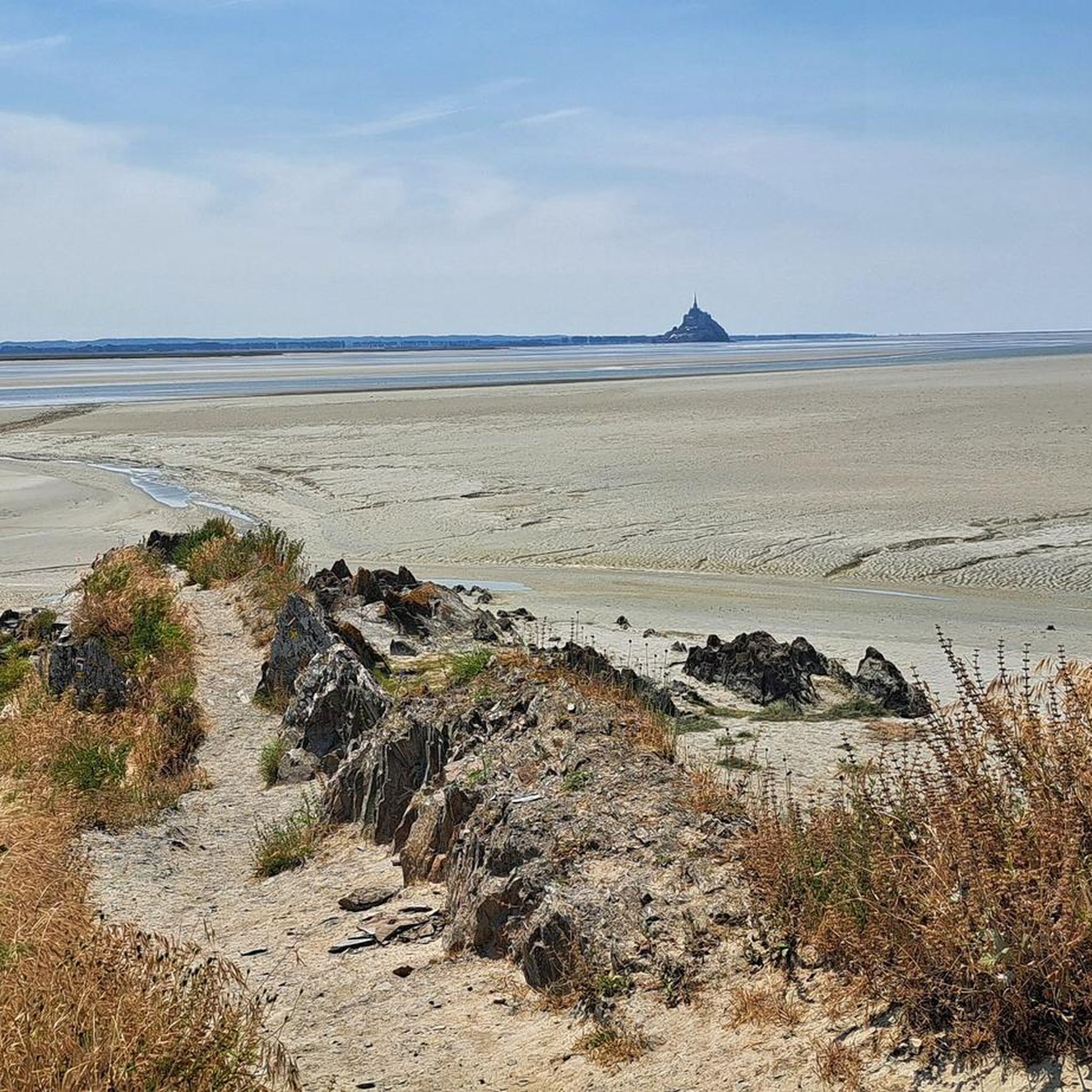
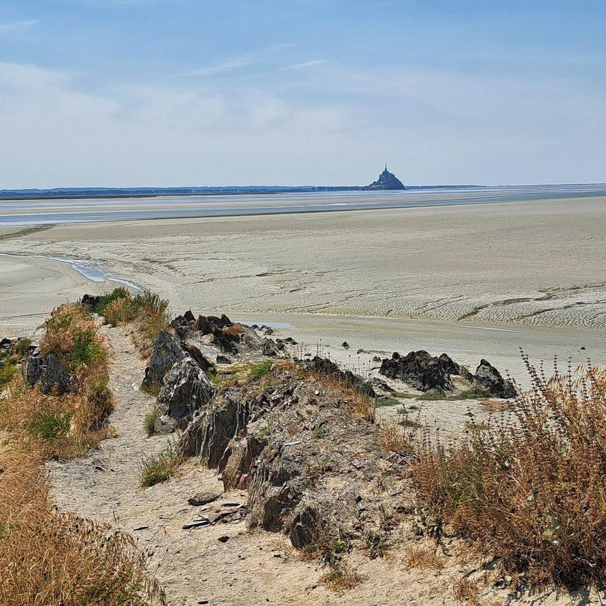
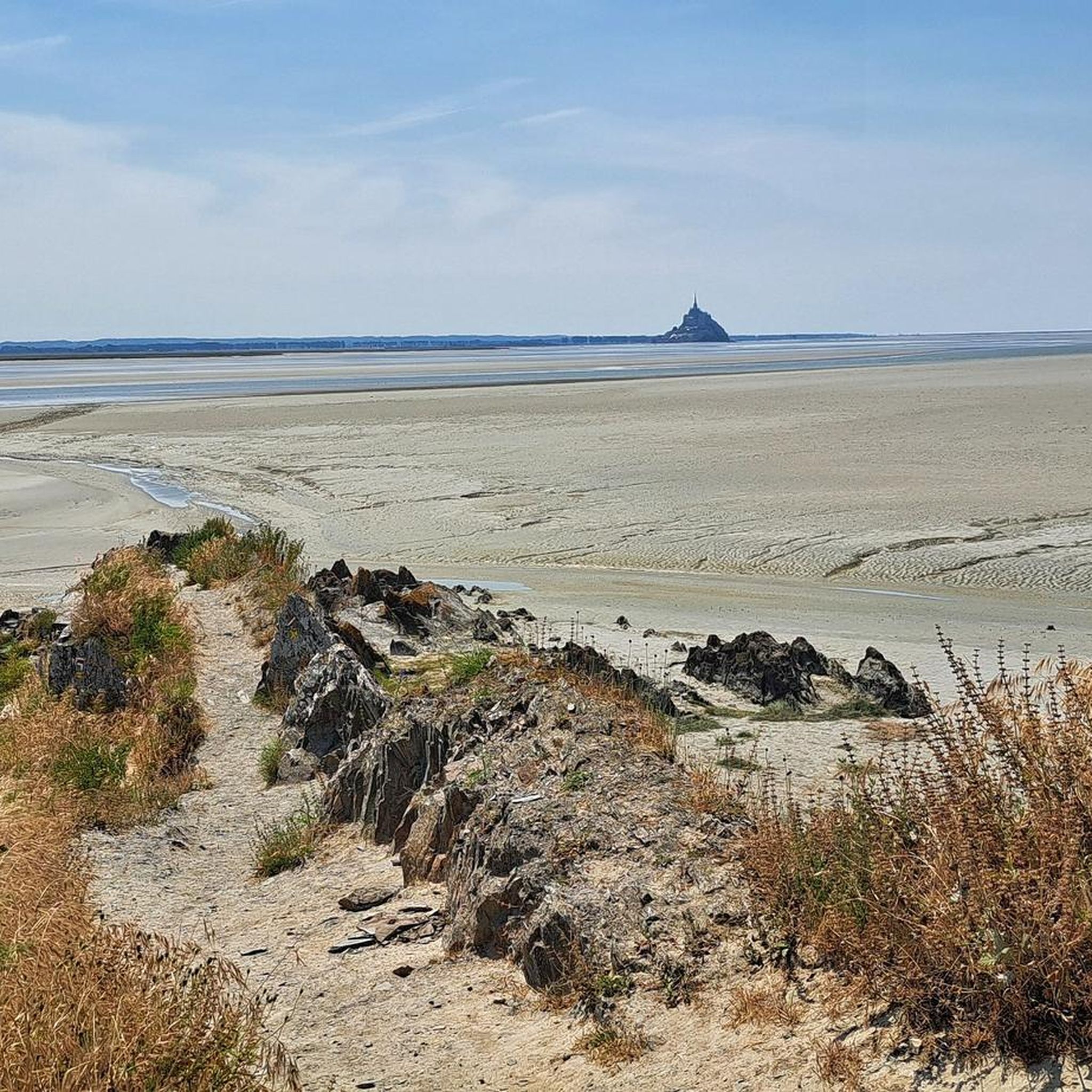
Below the Route des Falaises, on the historic Customs Officers' Path (Sentier des Douaniers), a beautiful view of Mont Saint-Michel Bay opens up. From here, the bay stretches out wide and tranquil—a fascinating interplay of sea, sand, and light that changes with every tide. On a clear day, Mont Saint-Michel rises majestically from the mudflats in the distance, surrounded by shimmering sand and the steady rhythm of the tides.
29
0
Perched high above the coast of Saint-Jean-le-Thomas, with breathtaking views of the Bay of Mont Saint-Michel, stands the Cabane Vauban – a silent witness to a bygone era. This small stone hut dates back to the 17th century and was built during the reign of the great fortress builder Vauban. It once served as a watchtower, monitoring the coast and controlling smuggling.
28
0
The Cabane Vauban de Champeaux (= Fotopoint) is a small 17th-century guard and observation hut on the cliffs of Champeaux. It is part of a defense network established by fortress architect Vauban under Louis XIV to monitor the coast. Later, customs officers used the hut to control smugglers and ships. Today, it is accessible via the GR 223 (Sentier des Douaniers) and offers spectacular views of the bay of Mont-Saint-Michel.
28
0
Between Carolles and Saint-Jean-le-Thomas, beaches, steep coasts, and the picturesque Lude valley alternate. From the valley, the Rocher du Sard and the historic Cabane Vauban offer spectacular views of the Mont-Saint-Michel bay. Part of the route follows the historic customs path, where guards and customs officers once patrolled and monitored the coast. The flat sandy beaches and tidal flats at low tide invite leisurely walks, and the GR 223 combines history and coastal panorama into a charming hike.
30
0
Frequently Asked Questions
How many hiking trails are available around Dragey-Ronthon?
There are over 230 hiking routes around Dragey-Ronthon, offering a wide variety of options for all skill levels. These trails are highly rated by the komoot community, with an average score of 4.6 stars from over 2,200 reviews.
What kind of landscapes can I expect to see while hiking in Dragey-Ronthon?
Hiking in Dragey-Ronthon offers a diverse range of landscapes. You'll encounter stunning coastal scenery, including dunes, beaches, and cliffs, particularly along the Bay of Mont-Saint-Michel. Inland, the trails wind through picturesque bocage countryside, marshlands, and the scenic Lude Valley, providing a mix of wooded and maritime environments.
Are there easy or family-friendly hiking options in Dragey-Ronthon?
Yes, Dragey-Ronthon offers many easy paths suitable for families and those seeking a less strenuous walk. Out of the over 230 routes, 137 are classified as easy. An example is the Saint-Jean Vauban Hut – Sol Roc loop from Saint-Jean-le-Thomas, which is 6.2 km long and takes about 2 hours to complete.
What are some notable landmarks or viewpoints along the hiking trails?
Many trails offer spectacular views of the Bay of Mont-Saint-Michel. Key landmarks include the historic Vauban Hut at Carolles, which provides panoramic vistas. You can also find routes that offer views of the iconic Mont Saint-Michel itself, especially from areas like Le Bec d'Andaine or Pointe du Minihic.
Are there any long-distance hiking trails accessible from Dragey-Ronthon?
Yes, the renowned GR 223, also known as the Sentier des Douaniers (Customs Officers' Path), is easily accessible from Dragey-Ronthon. This long-distance trail follows the Cotentin coast and descends towards Mont-Saint-Michel Bay, offering a combination of nature, history, and coastal panoramas through beaches, cliffs, and valleys.
Can I find circular hiking routes in the area?
Many of the hiking routes around Dragey-Ronthon are designed as circular loops, allowing you to start and end at the same point. For example, the challenging Vauban Hut at Carolles – Lude Valley loop from Saint-Jean-le-Thomas is a 29.6 km circular route that explores both coastal views and the Lude Valley.
What is the best time of year to go hiking in Dragey-Ronthon?
The region's diverse landscapes, from coastal paths to inland valleys, make it suitable for hiking throughout much of the year. Spring and autumn generally offer pleasant temperatures and fewer crowds, while summer provides longer daylight hours for extended coastal walks. Always check local weather conditions before heading out.
Are there any specific routes that offer views of Mont-Saint-Michel?
Absolutely. Several routes are specifically known for their views of Mont-Saint-Michel. A challenging option is the View on Mt Saint Michel – Le Bec d’Andaine loop from Genêts, a 24 km path that provides extensive views of the iconic landmark across varied coastal terrain.
What are the general difficulty levels of hikes in Dragey-Ronthon?
The hiking trails in Dragey-Ronthon cater to a wide range of abilities. Out of the 235 available routes, 137 are easy, 87 are moderate, and 11 are considered difficult. This variety ensures there's a suitable trail whether you're looking for a leisurely stroll or a more demanding adventure.
Are there any natural features to explore besides the coastline?
Beyond the stunning coastline, the region features the picturesque Lude Valley, located between Carolles and Saint-Jean-le-Thomas, which offers a different natural environment for hikers. The broader Manche department also boasts a dense freshwater network winding through bocage countryside and marshlands.
Where can I find more information about the natural sites in the Manche department?
For additional details on the natural sites and diverse landscapes of the wider Manche department, you can visit the official tourism website: manche-tourism.com.
Most popular routes around Dragey-Ronthon
Most popular attractions around Dragey-Ronthon

Get inspired with the komoot mobile app


Explore more
Browse the best Hikes in other regions.
