The best road cycling routes around Rueil-La-Gadelière
4.7
(63)
499
riders
206
rides
Road cycling around Rueil-La-Gadelière, situated in the Eure-et-Loir department of the Centre-Val de Loire region, presents diverse landscapes for cyclists. The area is characterized by tranquil countryside, verdant woodlands, and small waterways, offering mostly paved surfaces suitable for road bikes. Routes vary in length and elevation, providing options for different fitness levels.
Best road cycling routes around Rueil-La-Gadelière
- The most popular road cycling route is Bois Francs Greenway loop from Verneuil-sur-Avre, an 8.9 miles (14.4 km) trail that takes…
Last updated: May 21, 2026
4.5
(2)
20
riders
14.4km
00:33
50m
50m
Easy road ride. Great for any fitness level. Mostly well-paved surfaces and easy to ride.
4.8
(4)
15
riders
Moderate road ride. Good fitness required. Mostly well-paved surfaces and easy to ride.

Sign up for free
4.5
(2)
12
riders
73.7km
03:12
330m
330m
Moderate road ride. Good fitness required. Mostly well-paved surfaces and easy to ride.
4.0
(2)
12
riders
59.1km
02:23
280m
280m
Moderate road ride. Good fitness required. Some segments of this route may be unpaved and difficult to ride.
17
riders
63.5km
02:50
310m
310m
Moderate road ride. Good fitness required. Mostly well-paved surfaces and easy to ride.
Get access to more routes and recommendations from other explorers.
Sign up for free
Already have an account?
Our route recommendations are based on thousands of hikes, rides, and runs completed by other people on komoot.
Start today with a free account
Your next adventure awaits.
Login or Signup


Tips from the Community

very beautiful section of greenway in very good condition and shaded thanks to a beautiful forest.
0
0

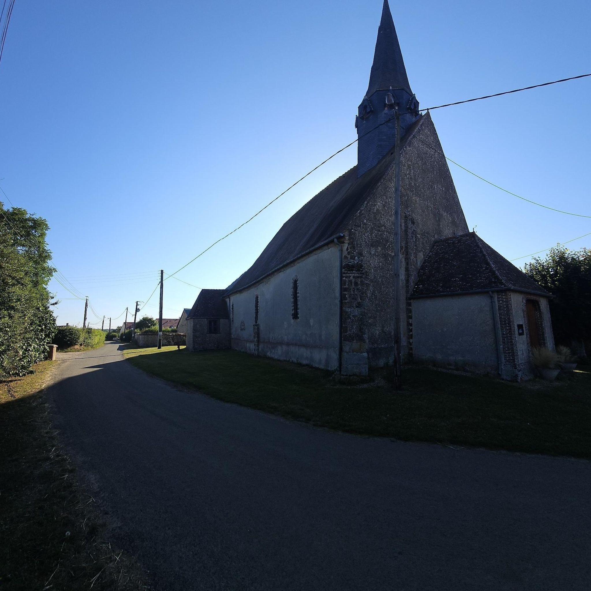
Located in the center of the village, it is dedicated to two twin brothers, Saint Gervais and Saint Protais, who were martyred in the 2nd century in Milan. Its construction dates from the 12th century. At that time, it included the flat-saddle nave and the choir. In the 15th and 16th centuries, it was completed by the south aisle and the ceiling covering. The south aisle was listed in July 1932, and the entire church has been listed since September 2011.
0
0

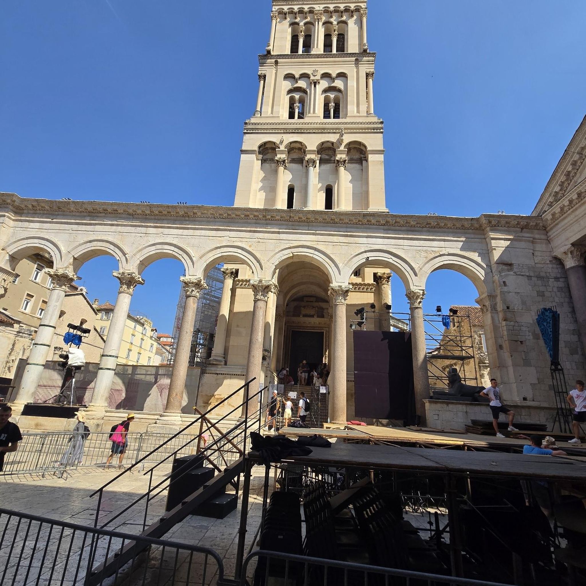
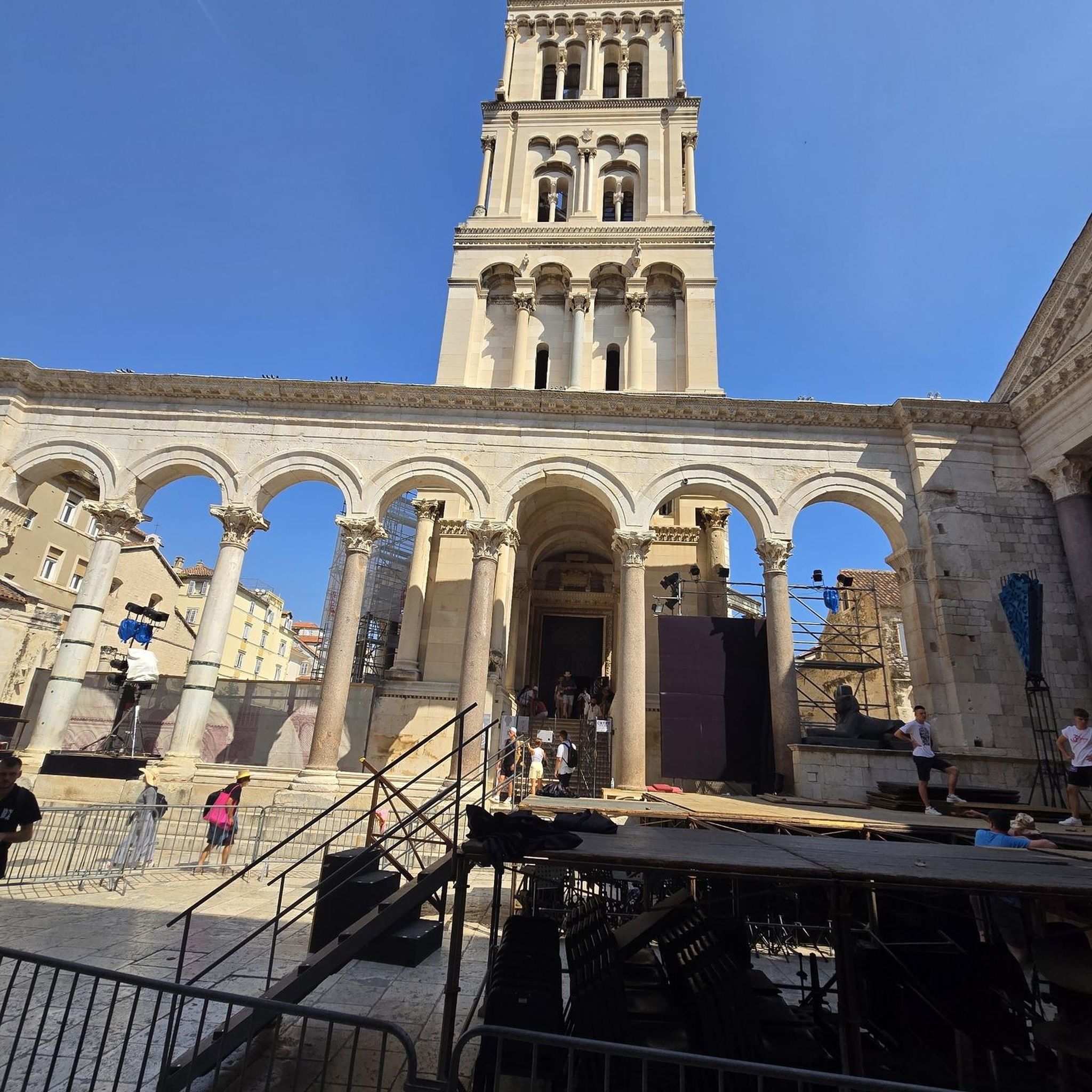
Église Saint Madeleine is a church where beautiful various statues of Saints, famous and less famous. The reason for so many different statues is that the school of sculpture was established here.
0
0

CHURCH SAINT NICOLAS (17th century) The town of La Ferté-Vidame takes its name from the Latin Firmitas Castrum which means the fortified villa belonging to the vidame'. Its primitive church existed from the 12th century. We find it mentioned in a charter dated 1136 under the name “Ecclesia Sancti Nicolai de Firmitate”. Under the Ancien Régime, the rectory which was at the disposal of the abbot of Saint-Vincent-des-Bois became an annex of the parish of Lamblore. This particular situation of a chief town of a castellany belonging to a rural parish is explained by the detachment of the original parish from the territory around the castle. Successor to the Huguenot heirs, Claude de Rouvroy de Saint-Simon, proclaimed by the grace of Louis XIII duke and peer of France, acquired the La Ferté estate in 1632. In order to erase all traces of Protestantism, of which the church had become over the centuries a very active platform, the Duke of Saint-Simon ordered in 1658 the demolition of the original church to replace it on the same site with the current building. The work was carried out promptly. On November 1, 1659, the Saint-Nicolas church was blessed by Messire Louis Oudard de Germens, canon priest of Chartres. Classic in style with its homogeneous and ordered composition, the church was built according to a plan in the shape of a Latin cross. Its construction was inspired by the drawings of the famous Italian architect, Andrea di Pietro Palladio, whose sketches Duke Saint-Simon had brought back from Spain. The architecture remains faithful to the marriage of stone and brick while giving this alternation a fanciful touch. Very majestic, the facade is built according to the Italian pattern (bossed pilasters, superposition of orders, pediment, volutes), a style also in vogue in France since 1630. The arms of the Saint-Simon family were engraved on a stone at the pediment of the portal and on two others on either side of the portal. They were burned during the Revolution. Today, only the date engraved on the frieze remains: 1659. 16 59 Square in plan, the bell tower, which adjoins the church in the northern part, is topped with a dome surmounted by a lantern. Two bells are housed in the bell tower: one dates from 1762, the second from 1813. The history of the church is closely intertwined with that of the lords of the parish, including the families Saint-Simon, Laborde, Bourbon-Penthievre and Bourbon-Orléans remain the most famous. Grandstands accessible from the outside and opening onto the side chapels recall their presence. In 1743, at the request of Louis de Saint-Simon, a great memoirist, the family vault was built in the Chapel of the Resurrection. A slab on the ground marks the location of the grave. Unfortunately, during the Revolution, the tombs were desecrated, the bones of the benefactors were extracted from the vault and scattered in a common grave dug at the apse of the church. The church was the subject of significant restorations at the end of the 18th century and the beginning of the 19th century, including the interior ornamentation of the building which is a manifestation of the neo-classical style.
2
0

The castle park is a great spot for a break. Access to the park is free.
0
0


A beautiful church to visit.
0
0
A war memorial not great...
0
0
Frequently Asked Questions
How many road cycling routes are available around Rueil-La-Gadelière?
There are over 200 road cycling routes in the Rueil-La-Gadelière area, offering a wide range of options for different skill levels. You'll find 67 easy routes, 142 moderate routes, and a few more challenging options.
What is the typical terrain and elevation for road cycling in this area?
The terrain around Rueil-La-Gadelière is characterized by mostly paved surfaces, making it ideal for road cycling. Routes generally feature gentle rolling hills with moderate elevation gains, typically around 100-300 meters for longer rides. For example, the Menhir de Gargantua – View of Château de l’Hermite loop has an elevation gain of about 230 meters over nearly 60 km.
What landmarks or scenic views can I expect to see on road cycling routes?
Road cycling routes often pass through verdant countryside and woodlands, offering picturesque views. You might encounter historical sites such as the Ruins of the Château de La Ferté-Vidame or the Bois Francs Castle. The area is also drained by small waterways like the Avre, providing scenic sections along riverbanks.
Are there family-friendly road cycling options in Rueil-La-Gadelière?
Yes, the region offers several easy road cycling routes suitable for families. These routes typically feature mostly flat or gently undulating terrain on paved surfaces, allowing for a relaxed pace. The Bois Francs Greenway loop from Verneuil-sur-Avre is an easy 14.4 km ride that is popular for its pleasant countryside cycling.
What do other cyclists say about road cycling in Rueil-La-Gadelière?
The road cycling routes in Rueil-La-Gadelière are highly rated by the komoot community, with an average score of 4.7 stars from over 50 reviews. Cyclists often praise the tranquil countryside, the well-maintained paved surfaces, and the variety of routes suitable for different fitness levels.
Are there any historical sites along the cycling paths?
Yes, the area is rich in history. Many routes pass by or near historical landmarks. For instance, you can cycle past the La Madeleine Church in Verneuil-d'Avre-et-d'Iton or the Gray Tower of Verneuil-sur-Avre. The historic Château de la Gadelière, dating back to 1342, is also a notable feature in the commune.
What are the parking options for cyclists in Rueil-La-Gadelière?
While specific dedicated cyclist parking facilities are not detailed, starting points for many routes, particularly those originating from nearby towns like Verneuil-sur-Avre, typically offer public parking options. It's advisable to check local parking availability at your chosen starting point.
Is public transport accessible for cyclists in the Rueil-La-Gadelière area?
Information on specific public transport options for cyclists directly in Rueil-La-Gadelière is limited. However, the broader Eure-et-Loir department is cycling-friendly, and regional train services in France often accommodate bicycles, though it's best to verify specific routes and times with the transport provider.
Are there routes that follow waterways or through forests?
Yes, the region's landscape includes several small waterways, such as the Avre and the ruisseau de Lamblore, which contribute to scenic routes. Additionally, the presence of 'Bois Francs' in several route names, like the Ferté-Vidame Castle – Bois Francs Greenway loop, indicates beautiful woodland sections that offer shaded and picturesque cycling experiences.
Can I find routes that are part of longer-distance cycling networks?
Yes, the Eure-et-Loir department, where Rueil-La-Gadelière is located, is part of longer-distance routes such as the Veloscenic. This itinerary connects Paris to Mont Saint-Michel, offering a variety of scenery through patchwork countryside, quaint villages, and historic towns. You can find more information on the Veloscenic route on the Tourisme28 website.
What is the best time of year for road cycling in Rueil-La-Gadelière?
The spring, summer, and early autumn months generally offer the most pleasant conditions for road cycling in Rueil-La-Gadelière. During these seasons, the weather is typically mild, and the countryside is at its most vibrant. Always check the local weather forecast before heading out.
Are there places to eat or stay for cyclists in the area?
While Rueil-La-Gadelière is a small commune, nearby towns like Verneuil-sur-Avre offer various amenities including cafes, pubs, and accommodation options that cater to visitors. These towns serve as convenient bases for exploring the surrounding cycling routes.
Are there longer, more challenging road cycling routes available?
Yes, for cyclists seeking longer distances and more varied terrain, there are moderate routes available. For example, the Conturbie Pond – Tour Grise loop from Verneuil-sur-Avre covers over 74 km with an elevation gain of approximately 335 meters, providing a more extensive ride.
Most popular routes around Rueil-La-Gadelière
Most popular attractions around Rueil-La-Gadelière

Get inspired with the komoot mobile app


Explore more
Browse the best Road cycling routes in other regions.
