The best road cycling routes around Bréhain
5.0
(1)
122
riders
30
rides
Road cycling routes around Bréhain are situated in the Meurthe-et-Moselle department of the Grand Est region in northeastern France. The commune features an undulating landscape with elevations ranging from 339 to 441 meters, providing varied terrain for road cyclists. The area is characterized by a mix of forests and countryside, offering both shaded routes and open stretches with expansive views. This diverse topography supports routes with ascents and descents.
Best road cycling routes around Bréhain
- The most popular road cycling route is Étang de Welschhof – Lower Hoste Pond loop from Morhange, a 46.3 miles (74.5 km) trail that takes 3 hours 9 minutes to complete. This moderate route features an elevation gain of over 500 meters.
- Another top favourite among local road cyclists is War Memorial and Clock Tower – Book Cabin of Suisse loop from Morhange, a moderate 23.5 miles (37.8 km) path. This route offers varied terrain through the local countryside.
- Local road cyclists also love the Montdidier – Denkmal für die Gefallenen 🕊️ loop from Morhange, a 34.6 miles (55.7 km) trail leading through the region's diverse landscape, often completed in about 2 hours 28 minutes.
- Road cycling around Bréhain is defined by undulating terrain, forests, and countryside, with varied elevation. The network offers options for different ability levels, from easy loops to more challenging moderate routes.
- The routes in Bréhain are highly rated by the komoot community with an average score of 5.0 stars. More than 100 road cyclists have used komoot to explore Bréhain's varied terrain.
Last updated: May 8, 2026
10
riders
73.2km
03:08
510m
510m
Moderate road ride. Good fitness required. Mostly well-paved surfaces and easy to ride.
7
riders
37.8km
01:40
310m
310m
Moderate road ride. Good fitness required. Mostly well-paved surfaces and easy to ride.

Sign up for free
6
riders
55.8km
02:29
550m
550m
Moderate road ride. Good fitness required. Mostly well-paved surfaces and easy to ride.
7
riders
31.2km
01:20
230m
230m
Easy road ride. Great for any fitness level. Mostly well-paved surfaces and easy to ride.
9
riders
47.7km
02:07
400m
400m
Moderate road ride. Good fitness required. Mostly well-paved surfaces and easy to ride.
Get access to more routes and recommendations from other explorers.
Sign up for free
Already have an account?
Our route recommendations are based on thousands of hikes, rides, and runs completed by other people on komoot.
Start today with a free account
Your next adventure awaits.
Login or Signup

Tips from the Community

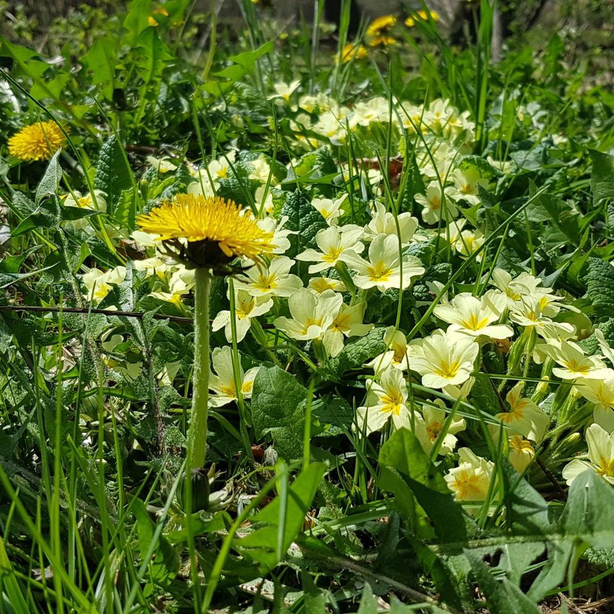
The Hoste Bas pond borders the Hoste Haut pond. It was part of the Maginot Line defense system. Today, they are home to numerous species of fish, much to the delight of anglers.
0
1

Historic site with well-preserved bunkers and tracked vehicle🐯🚴
0
0

Memorial to the fallen of the two world wars 🕊️
0
0
A subtle hint about the distance if you are planning a longer bike tour 😉
0
0
Memorial to the fallen of the two world wars 🕊️
0
0


Beautiful little metal figures along the roadside.
1
0
Frequently Asked Questions
What kind of terrain can I expect when road cycling around Bréhain?
The area around Bréhain-la-Ville is characterized by an undulating landscape with elevations ranging from 339 to 441 meters. You'll find a mix of forests and open countryside, offering both shaded routes and expansive views. This diverse topography provides opportunities for routes with varied ascents and descents, catering to different fitness levels.
How many road cycling routes are available in the Bréhain area?
There are over 30 road cycling routes available around Bréhain, offering a wide range of options for cyclists. These routes are highly rated by the komoot community, with an average score of 5.0 stars.
Are there easy road cycling routes suitable for beginners or families near Bréhain?
Yes, among the 31 routes in the area, 8 are classified as easy, making them suitable for beginners or those looking for a more relaxed ride. For example, the Bus stop loop from Lesse is an easy option, covering about 31 km with moderate elevation gain.
What are some longer road cycling options for experienced riders?
For experienced riders seeking longer distances and more elevation, routes like the Étang de Welschhof – Lower Hoste Pond loop from Morhange offer a substantial challenge. This route is 74.5 km long with over 500 meters of elevation gain. Another good option is the Montdidier – Denkmal für die Gefallenen 🕊️ loop from Morhange, which is 55.7 km.
Can I access major cycling networks from Bréhain-la-Ville?
Absolutely. Bréhain-la-Ville's strategic location provides excellent access to extensive regional cycling networks. You can easily reach the Moselle Cycle Route, which follows the Moselle River, or explore the 85 km Moselle Loop (Boucle de la Moselle) with its greenways and rich heritage. The Meurthe-et-Moselle department also boasts 600 km of cycle paths, including the 'Voie Bleue' along rivers and canals.
Are there any scenic viewpoints or landmarks along the road cycling routes?
While specific highlights are not detailed for every route, the region's blend of forests and countryside ensures scenic backdrops. The wider Moselle Loop offers experiences rich in heritage, local gastronomy, and bucolic landscapes, including historical sites and the Côtes de Toul vineyard area. Routes like the War Memorial and Clock Tower – Book Cabin of Suisse loop from Morhange pass through varied terrain that often includes local points of interest.
What is the best time of year for road cycling in Bréhain?
The Grand Est region, where Bréhain is located, generally offers pleasant cycling conditions from spring through early autumn. These seasons provide comfortable temperatures and vibrant natural scenery, making them ideal for exploring the undulating terrain and diverse landscapes.
Are there any challenging road cycling routes in the vicinity of Bréhain?
Yes, beyond the local moderate routes, Bréhain's proximity to the Mullerthal Region in Luxembourg (often called 'Luxembourg's Little Switzerland') offers more challenging road biking. This area is known for its unique rock formations, deep forests, and constant alternations of steep ascents and fast descents on less frequented roads, providing a more arduous excursion for advanced cyclists.
What do other road cyclists enjoy most about the routes around Bréhain?
The road cycling routes around Bréhain are highly rated by the komoot community, with an average score of 5.0 stars. Cyclists often praise the varied terrain, which includes both challenging ascents and rewarding descents, as well as the scenic blend of forests and open countryside that provides diverse backdrops for their rides.
Are the road cycling routes around Bréhain mostly circular?
Many of the routes listed in the area are designed as loops, offering convenient circular journeys. For instance, the Étang de Welschhof – Lower Hoste Pond loop from Morhange and the Route Through the Fields – Bus stop loop from Lesse are examples of circular routes that allow you to start and finish at the same point.
What kind of road surfaces can I expect on the routes?
The road cycling routes around Bréhain primarily utilize paved roads suitable for road bikes. When connecting to wider networks like the Moselle Loop, you may encounter well-maintained greenways and small shared roads, ensuring a smooth cycling experience.

Get inspired with the komoot mobile app


Explore more
Browse the best Road cycling routes in other regions.
