The best road cycling routes around Mont-Cauvaire
4.4
(51)
2,125
riders
253
rides
Road cycling routes around Mont-Cauvaire offer varied terrain within the Seine-Maritime department of Normandy, France. The region features rolling landscapes, with Mont-Cauvaire itself being the second highest point in Seine-Maritime at 184 meters. Cyclists can expect a mix of agricultural fields, tranquil river valleys like the Seine, and access to the dramatic chalk cliffs of the Côte d'Albâtre further afield. This diverse topography provides both challenging inclines and scenic, flatter sections.
Best road cycling routes around Mont-Cauvaire
- The most popular…
Last updated: May 20, 2026
4.7
(3)
61
riders
104km
04:29
790m
790m
Moderate road ride. Good fitness required. Mostly well-paved surfaces and easy to ride.
5.0
(1)
59
riders
102km
04:17
700m
700m
Moderate road ride. Good fitness required. Mostly well-paved surfaces and easy to ride.

Sign up for free
43
riders
57.3km
02:29
400m
400m
Moderate road ride. Good fitness required. Some segments of this route may be unpaved and difficult to ride.
3.0
(1)
43
riders
88.6km
03:49
720m
720m
Moderate road ride. Good fitness required. Mostly well-paved surfaces and easy to ride.
16
riders
72.3km
03:02
490m
490m
Moderate road ride. Good fitness required. Some segments of this route may be unpaved and difficult to ride.
Get access to more routes and recommendations from other explorers.
Sign up for free
Already have an account?
Our route recommendations are based on thousands of hikes, rides, and runs completed by other people on komoot.
Start today with a free account
Your next adventure awaits.
Login or Signup


Tips from the Community

Clères is a French commune with 1,380 inhabitants in the Seine-Maritime department in the Normandy region. It belongs to the arrondissement of Rouen and the canton of Bois-Guillaume.
0
0

A small bridge provides access to the Source campsite, and the "La Scie" River also passes through it. It is located very close to the Véloroute du Lin (about 50 meters away) in "Le Plessis" (municipality of Hautot-sur-Mer). You can also use it to reach the Canadian Cemetery, which is 1.5 kilometers from the bridge. Several picnic tables are located around the bridge.
1
0

Taking tours of the park with a naturalist’s commentary is fantastic!
0
0

This Saint-Crespin church is tiny for a tiny village. The town hall is tiny too. They are located right next door, like a vestige of blessed times gone by.
1
0
Church with an elongated plan. A single nave. Bell tower crowned with a polygonal spire. On an older structure, the church was rebuilt in the 18th century.
0
0
Saint-Valery was built by the chamberlain of the kings of France Charles VIII and Louis XII, Jacques de Moy. The work was continued at the end of the 15th century by the lord of Estouville. Before its reconstruction following the disaster of the Hundred Years' War (1328-1456) it was dedicated to Saint Ripert. From 1694, the parish belonged to the Count of Ausmonville and was located two leagues from Dieppe, or in the weight and measure used in Normandy about five kilometers from the city of Dieppe. The ordinance of May 31, 1733 of King Louis XV ordered that the parishes of the admiralty of Barfleur on which Saint-Valery then depended as an exception be exempt from timber cutting tax. It should be noted, however, that at the time, Anneville-en-Scere was spelled and not Annville-sur-Scie. The 19th century was the century of vacations and literary tourism. Maupassant was born in the nearby village of La Tourvile sur Arc. Many sources relating to parish life in the 19th century in Anneville-sur-Scie are provided by the journal Les Études normandes which devoted an issue to the ecclesiastical history of the diocese of Rouen in 1955.
1
0
The first stone of the Saint-Rémy church was laid by Thomas Bouchard, alderman and treasurer of the city, in 1522. However, its construction lasted more than 100 years and was completed in 1643. The work was interrupted for several decades because of the conflicts of the Wars of Religion opposing Catholicism and Protestantism. The Saint-Rémy church illustrates the establishment of the Counter-Reformation movement in Dieppe. Indeed, faced with the influence of Protestantism which aimed for a sobriety of worship, the Catholic power aimed to attract and control the faithful. In the 17th century, a baroque altarpiece was built which helped to establish a sensitive relationship with the sacred, visible in the chapel of the Virgin. In the 18th century, the Parisot organ exalts the prayers of the parishioners. Listed as a Historic Monument in 1910, the Saint-Rémy church underwent a series of restorations from the 19th century. Since 1990, several restoration campaigns have been undertaken. In 2022, the black ambulatory was inaugurated after more than a year of work. The interior and exterior have been reconstructed, including gargoyles sculpted by Morgan Roulland.
0
0
Frequently Asked Questions
How many road cycling routes are available around Mont-Cauvaire?
There are over 250 road cycling routes around Mont-Cauvaire listed on komoot, offering a wide range of options for different skill levels and preferences. The region's diverse topography, from rolling agricultural fields to river valleys, provides varied cycling experiences.
What kind of terrain and elevation can I expect on road cycling routes near Mont-Cauvaire?
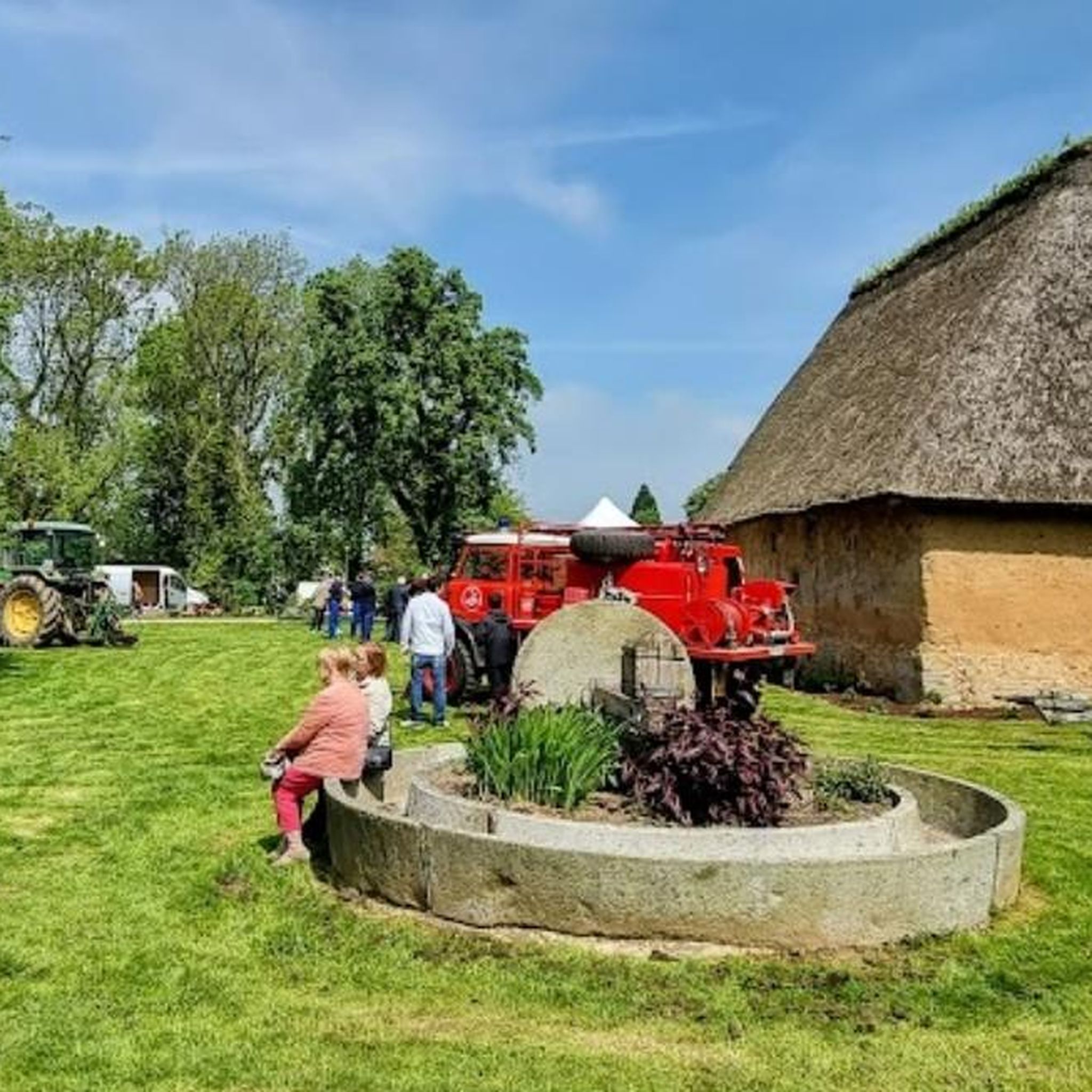
Mont-Cauvaire, being the second highest point in Seine-Maritime, offers varied terrain with both inclines and descents. You can expect rolling landscapes, agricultural fields, and tranquil river valleys. Routes can range from moderate loops with around 400 meters of elevation gain, like the Clères Zoological Park – Renault 8 carcass loop from Montville, to more challenging rides with over 700 meters of ascent, such as the Clères Zoological Park – Small bridge over the Scie loop from Montville.
Are there any family-friendly road cycling routes around Mont-Cauvaire?
While specific 'family-friendly' road cycling routes are not explicitly detailed in the guide, the broader Seine-Maritime region is known for its extensive cycling networks, including routes suitable for families. The regional cycling network includes options that cater to a range of abilities. Look for routes with lower elevation gain and shorter distances if cycling with children.
What are some notable landmarks or attractions I can see along road cycling routes?
Many routes offer opportunities to pass by interesting landmarks. For instance, the Imbleville Castle – Small bridge over the Scie loop from Montville route takes you past Imbleville Castle. Other routes may lead you near the Clères Zoological Park or the charming Clères Village. The region also boasts historical sites like Jumièges Abbey and the city of Rouen, which can be incorporated into longer rides.
What is the best time of year for road cycling in Mont-Cauvaire?
The Seine-Maritime region generally offers pleasant cycling conditions from spring through autumn. The varied landscapes, from coastal views to inland valleys, are particularly beautiful during these seasons. Always check local weather forecasts before heading out, as conditions can vary.
Are there circular road cycling routes available?
Yes, many of the road cycling routes around Mont-Cauvaire are designed as loops, allowing you to start and finish at the same point. Examples include the Clères Zoological Park – The Buchy Market Halls loop from Clères, which is a moderate 91 km ride, and the Clères Zoological Park – Château d'Arques-la-Bataille loop from Clères, covering 83 km.
What do other road cyclists enjoy most about road cycling in Mont-Cauvaire?
The area is highly rated by the komoot community, with an average score of 4.37 stars from over 50 reviews. Cyclists often praise the varied terrain, which offers a good mix of challenges and scenic sections, as well as the peaceful agricultural fields and access to river valleys.
Can I find places to eat or stay that are cyclist-friendly in the Mont-Cauvaire area?
The broader Seine-Maritime region is committed to cycling tourism, evidenced by the 'Accueil Vélo' label. This label indicates accommodations, bike repair shops, and tourist sites that provide quality services tailored to cyclists' needs. While specific establishments in Mont-Cauvaire are not listed, looking for 'Accueil Vélo' certified places in nearby towns will likely yield cyclist-friendly options for cafes, restaurants, and accommodation.
What are some longer road cycling routes for experienced riders?
For experienced riders seeking longer distances, routes like the Imbleville Castle – Small bridge over the Scie loop from Montville offer a moderate challenge over 108 km with significant elevation. The region also connects to major itineraries like the Avenue Verte London-Paris, La Seine à Vélo, and the Vélomaritime (EuroVelo 4), which provide extensive long-distance options.
Are there options for public transport with bikes to reach Mont-Cauvaire?
While direct public transport options specifically for bikes to Mont-Cauvaire are not detailed, the Seine-Maritime department has a well-developed transport network. It's advisable to check with local transport providers regarding their policies on carrying bicycles, especially for regional trains or buses that might serve the area or nearby larger towns like Rouen.
Where can I find parking for road cycling routes in Mont-Cauvaire?
Many routes, particularly those starting from towns like Montville or Clères, will have designated parking areas. For example, routes like the Clères Zoological Park – Small bridge over the Scie loop from Montville often begin from locations with accessible parking. It's recommended to check the specific route details on komoot for suggested starting points and parking information.
Most popular attractions around Mont-Cauvaire

Get inspired with the komoot mobile app


Explore more
Browse the best Road cycling routes in other regions.
