The best running trails around Blausasc
4.5
(362)
33,239
runners
375
runs
Jogging around Blausasc offers diverse landscapes, from valleys to mountainous terrain, providing a variety of running experiences. The region is characterized by an extensive network of trails, including paths through the Forêt Domaniale du Paillon and routes ascending prominent peaks. These running routes often feature varied terrain, catering to different fitness levels and offering panoramic views of the surrounding Alpes-Maritimes region.
Best jogging routes around Blausasc
- The most popular jogging route is Baudon Summit – Cima di Saudo loop from…
Last updated: August 9, 2026
56
runners
12.5km
01:55
690m
690m
Hard run. Very good fitness required. Sure-footedness, sturdy shoes and alpine experience required.
40
runners
23.3km
03:25
1,220m
1,220m
Hard run. Very good fitness required. Mostly accessible paths. Some sure footedness required.

Sign up for free
42
runners
14.0km
02:07
740m
740m
Hard run. Very good fitness required. Mostly paved surfaces. Suitable for all skill levels.
27
runners
18.0km
02:42
960m
960m
Hard run. Very good fitness required. Mostly accessible paths. Some sure footedness required.
16
runners
5.58km
01:08
460m
460m
Hard run. Very good fitness required. Sure-footedness, sturdy shoes and alpine experience required.
Get access to more routes and recommendations from other explorers.
Sign up for free
Already have an account?
Our route recommendations are based on thousands of hikes, rides, and runs completed by other people on komoot.
Start today with a free account
Your next adventure awaits.
Login or Signup

Tips from the Community

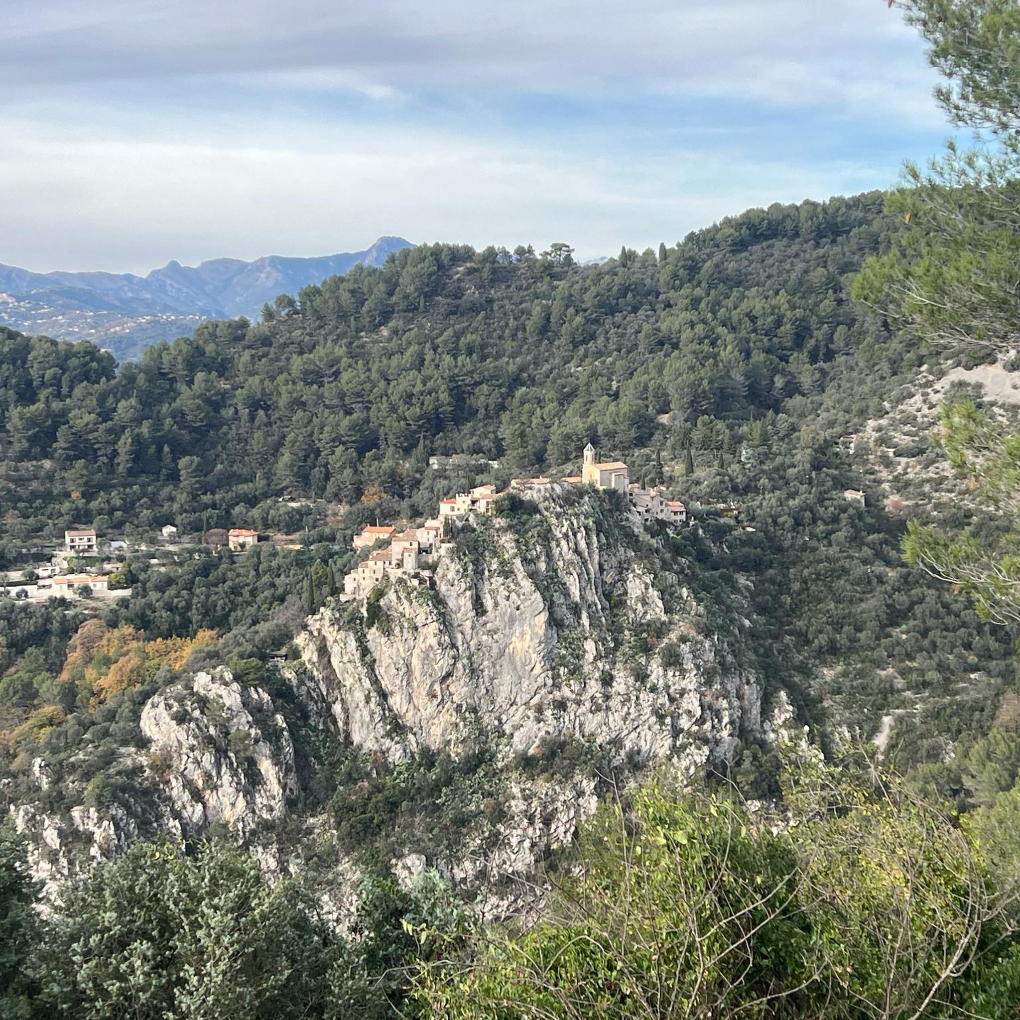
Because it is located at an altitude of 630 metres, equidistant from Nice and Monaco, Peille can be seen from the summit of La Madone. Its chapels, converted into a town hall or a bakery, set the tone: the medieval heritage is still inhabited. Léo Ferré liked to stay there and dedicated a song to it.
0
0


Frequently Asked Questions
How many running trails are available around Blausasc?
Blausasc offers an extensive network of over 350 running routes, catering to various preferences and fitness levels. These include a mix of easy, moderate, and challenging trails.
What kind of terrain can I expect on the running routes in Blausasc?
The running routes around Blausasc feature diverse terrain, ranging from paths through the shaded Forêt Domaniale du Paillon to mountainous ascents. You'll encounter valleys, forested sections, and trails leading to prominent peaks, offering a varied running experience.
Are there running routes suitable for beginners or those looking for an easy jog?
Yes, Blausasc has options for all abilities. There are 24 easy running routes, perfect for beginners or those seeking a more relaxed jog. Additionally, 136 moderate routes provide a good balance for intermediate runners.
What do other runners say about the trails in Blausasc?
The running routes in Blausasc are highly rated by the komoot community, with an average score of 4.5 stars from over 300 reviews. More than 31,000 runners have explored the varied terrain, often praising the stunning panoramic views and the diverse landscapes.
Are there challenging trail running options for experienced runners?
Absolutely. For experienced trail runners, Blausasc offers 197 difficult routes. These often involve significant elevation gain and provide a demanding workout with rewarding vistas. A challenging option is the Mount Macaron loop from Drap - Cantaron, which features a substantial ascent.
Can I find routes that pass by natural attractions like waterfalls?
Yes, some routes in the broader region offer glimpses of natural attractions. For example, you might find trails that lead near the Castle Waterfall, providing a scenic break during your run.
Are there family-friendly jogging routes in Blausasc?
While many routes in Blausasc involve mountainous terrain, there are easier and moderate options that could be suitable for families, depending on their fitness level. Look for routes with less elevation gain and shorter distances for a more family-friendly experience.
Are there circular running routes available?
Yes, many of the running routes in Blausasc are circular, allowing you to start and finish at the same point. For instance, the Running loop from L'Escarène is a popular circular option, often completed in about 51 minutes.
What are some notable landmarks or points of interest I might see while running?
Beyond the natural beauty, you might encounter historical elements or charming settlements. Some trails offer views towards Èze Village or pass by significant natural features like the Col d'Eze Ascent or the famous Nietzsche Path.
What is the best time of year to go running in Blausasc?
Blausasc offers beautiful running conditions throughout the year. Spring brings wild flowers, autumn showcases vibrant leaves, and even winter can be appealing with occasional snow on higher peaks. The varied terrain means you can find suitable routes in most seasons, though summer can be hot, making early morning or late evening runs preferable.
Is parking available near the running routes?
Yes, parking is generally available in the villages and starting points of many trails around Blausasc and its neighboring communities like Peille and L'Escarène, providing convenient access to the running routes.
How accessible are the running trails by public transport?
While Blausasc is a smaller commune, some starting points for running routes, especially in nearby larger towns like Drap or L'Escarène, may be accessible by local public transport. It's advisable to check local bus schedules for specific route access.
Are the running trails in Blausasc dog-friendly?
Many natural trails in the Blausasc region are generally dog-friendly, allowing you to enjoy a run with your canine companion. However, it's always recommended to keep dogs on a leash, especially in protected areas or near livestock, and to check for any specific local regulations.
Most popular attractions around Blausasc

Get inspired with the komoot mobile app


Explore more
Browse the best Running Trails & Routes in other regions.
