The best road cycling routes around Villers-Chief
4.3
(30)
634
riders
73
rides
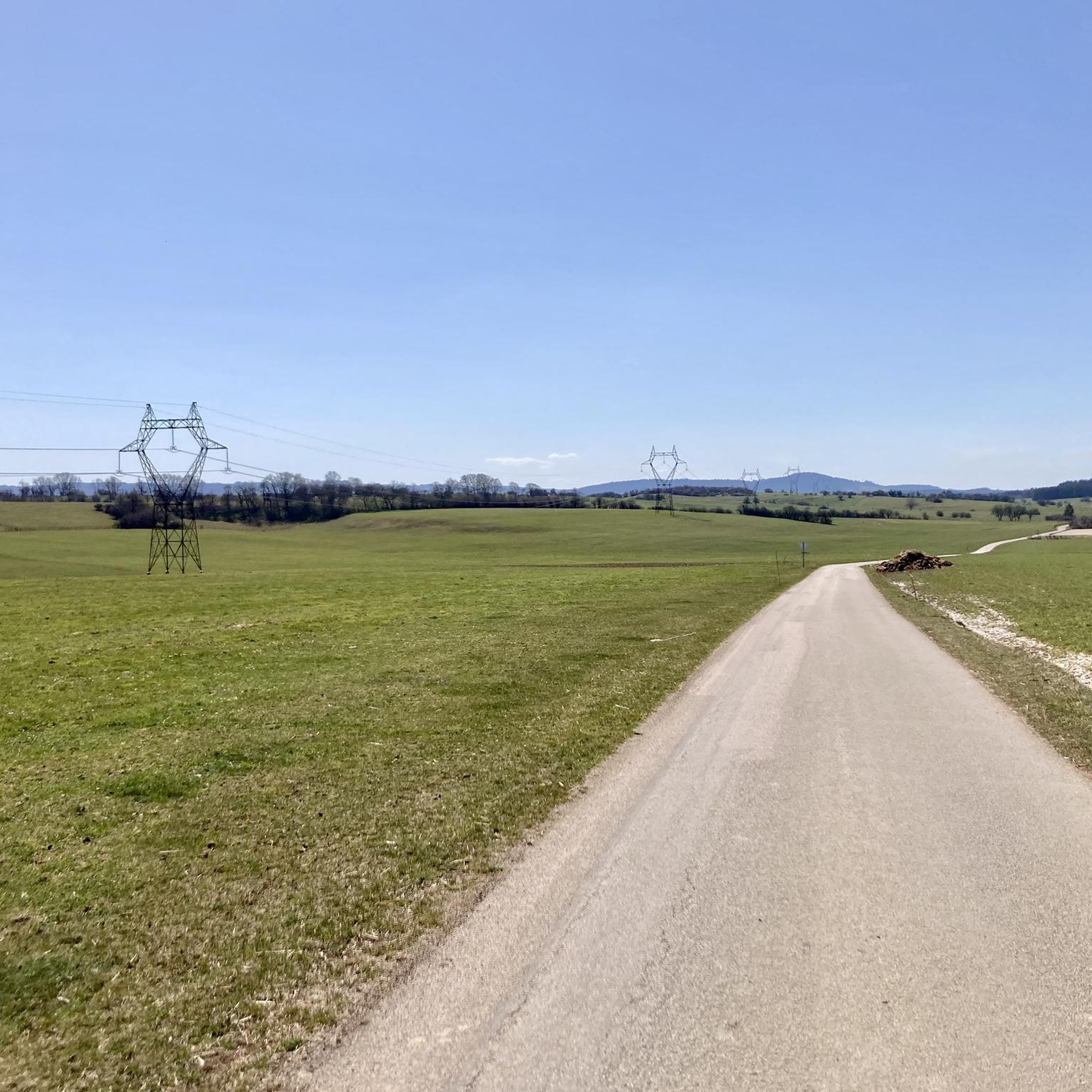
Road cycling routes around Villers-Chief are situated in the Doubs department, within France's Jura Mountains, offering varied topography for cyclists. The region features a mix of agricultural land, extensive forests, and quiet roads, providing diverse visual experiences. Elevations range from 547 to 773 meters, ensuring a dynamic landscape with both rolling hills and more challenging climbs. The proximity to the Audeux river and the scenic Doubs Valley further enhances the cycling environment.
Best road cycling routes around Villers-Chief
- The most popular road cycling route is Abbaye de la Grâce-Dieu – Abbaye de la Grâce-Dieu loop from Orsans, a 31.8 miles (51.1 km) trail that takes 2 hours 17 minutes to complete. This moderate route offers a scenic loop through the rural landscapes surrounding Orsans.
- Another top favourite among local road cyclists is Saint-Hippolyte Town Centre – Goumois Corniche loop from Landresse, a difficult 75.4 miles (121.3 km) path. This longer route features significant elevation gains and panoramic views, characteristic of the Jura region.
- Local road cyclists also love the Beautiful path on the plateau loop from Vercel-Villedieu-le-Camp, a 16.6 miles (26.6 km) trail leading through open plateau landscapes, often completed in about 1 hour 12 minutes.
- Road cycling around Villers-Chief is defined by its quiet roads, varied topography of the Jura Mountains, and a blend of agricultural fields and forests. The network offers options for easy rides on plateaus as well as more challenging routes with significant climbs.
- The routes in Villers-Chief are highly rated by the komoot community with an average score of 4.1 stars from over 30 reviews. More than 500 road cyclists have used komoot to explore Villers-Chief's varied terrain.
Last updated: May 11, 2026
42
riders
51.4km
02:18
450m
450m
Moderate road ride. Good fitness required. Some segments of this route may be unpaved and difficult to ride.
5.0
(2)
23
riders
121km
06:22
2,050m
2,050m
Hard road ride. Very good fitness required. Mostly well-paved surfaces and easy to ride.

Sign up for free
6
riders
26.6km
01:12
300m
300m
Easy road ride. Great for any fitness level. Mostly well-paved surfaces and easy to ride.
3
riders
34.3km
01:44
460m
460m
Moderate road ride. Good fitness required. Mostly well-paved surfaces and easy to ride.
3
riders
46.7km
02:16
510m
510m
Moderate road ride. Good fitness required. Some segments of this route may be unpaved and difficult to ride.
Get access to more routes and recommendations from other explorers.
Sign up for free
Already have an account?
Our route recommendations are based on thousands of hikes, rides, and runs completed by other people on komoot.
Start today with a free account
Your next adventure awaits.
Login or Signup



Tips from the Community


and the waterfall 600m towards Orsans
0
0

With a beautiful picnic area nearby
0
0


Nestled in the Doubs Valley, Saint-Hippolyte is a charming village in Franche-Comté. With its ancient streets and Romanesque church, it offers a peaceful break by the water, surrounded by the lush green landscapes of the Jura.
1
1

Saint-Hippolyte is a French commune with 962 inhabitants in the Haut-Rhin department in the European territorial community of Alsace and the Grand Est region. The municipality is a member of the Communauté de communes du Pays de Ribeauvillé.
3
1

Very authentic place. It's really busy during the day. But early in the morning you can still enjoy the quiet atmosphere.
0
0
Memorial to the fallen of the two world wars 🕊️
0
0
Frequently Asked Questions
How many road cycling routes are available around Villers-Chief?
There are over 70 road cycling routes around Villers-Chief listed on komoot, offering a wide range of options for different skill levels and preferences. These routes are highly rated by the komoot community, with an average score of 4.1 stars.
What is the best time of year for road biking in Villers-Chief?
The Jura Mountains, where Villers-Chief is located, are generally best for road cycling from spring through autumn. During these seasons, you can expect pleasant weather for exploring the varied terrain, from rolling hills to more challenging climbs. Winter conditions can be challenging due to snow and ice at higher elevations.
What kind of terrain can I expect on road cycling routes near Villers-Chief?
Road cycling around Villers-Chief offers diverse terrain characteristic of the Jura Mountains. You'll find a mix of agricultural land, extensive forests, and quiet roads. Elevations range from 547 to 773 meters, providing both rolling hills and sections with significant climbs. The proximity to the Audeux river and the scenic Doubs Valley also offers picturesque, varied landscapes.
Are there routes suitable for beginner road cyclists in Villers-Chief?
Yes, there are routes suitable for beginners. Out of the over 70 routes, 6 are classified as easy. An example is the Beautiful path on the plateau loop from Vercel-Villedieu-le-Camp, which is 16.6 miles (26.6 km) long and leads through open plateau landscapes, often completed in about 1 hour 12 minutes.
Are there challenging routes for advanced road cyclists?
Absolutely. For experienced road cyclists seeking a challenge, there are 9 difficult routes available. A notable option is the Saint-Hippolyte Town Centre – Goumois Corniche loop from Landresse, a demanding 75.4 miles (121.3 km) path featuring significant elevation gains and panoramic views typical of the Jura region.
Can I find loop routes for road cycling around Villers-Chief?
Many of the road cycling routes around Villers-Chief are designed as loops, allowing you to start and finish at the same point. For instance, the popular Abbaye de la Grâce-Dieu – Abbaye de la Grâce-Dieu loop from Orsans is a 31.8 miles (51.1 km) moderate trail offering a scenic circular journey through rural landscapes.
What scenic viewpoints can I discover along the road cycling routes?
The region around Villers-Chief offers several rewarding viewpoints. The 'trois croix' (three crosses) is known as the highest point in the village, providing superb panoramic views. Additionally, the Roche Barchey viewpoint is a highlight that can be incorporated into your rides, offering captivating vistas of the surrounding Jura landscape.
What attractions or landmarks can I see near the road cycling routes?
While cycling, you can explore several interesting points. The Sainte-Radegonde Chapel and Saint-Ermenfroi Chapel offer glimpses into local heritage. Natural features like the Cusancin spring and La Source bleue provide beautiful natural stops. The Doubs Valley itself is a 'real green lung' with wooded slopes and rocky ridges.
Are there cafes or places to stop for refreshments along the routes?
The region around Villers-Chief is characterized by charming villages. While specific cafes aren't listed for every route, passing through these villages often provides opportunities to find local establishments for refreshments and a taste of the rural ambiance.
What do other road cyclists enjoy most about road cycling in Villers-Chief?
Road cyclists frequently praise the quiet roads and varied topography of the Jura Mountains. The blend of agricultural fields and forests provides diverse visual experiences, and the network offers options for both easy rides on plateaus and more challenging routes with significant climbs. The komoot community has rated the routes with an average of 4.1 stars, highlighting the overall enjoyable experience.
How can I find parking for road biking trails in Villers-Chief?
While specific parking areas for each trail are not detailed, Villers-Chief and the surrounding villages are generally sparsely populated. You can typically find suitable parking in or near the starting points of the routes, especially in village centers or designated public parking areas.
Are there any routes that follow rivers or valleys?
Yes, the region benefits from the Audeux river flowing through Villers-Chief and its proximity to the Doubs Valley. Cycling alongside rivers often provides picturesque and relatively flatter routes, offering a pleasant contrast to the hillier sections of the Jura Mountains. The Doubs Valley is known for its scenic loops and natural beauty.
Most popular attractions around Villers-Chief

Get inspired with the komoot mobile app


Explore more
Browse the best Road cycling routes in other regions.
