The best MTB trails around Meyrieu-Les-Étangs
4.5
(456)
1,500
riders
179
rides
Mountain bike trails Meyrieu-Les-Étangs traverse a varied landscape of hills, valleys, and plateaus, with altitudes ranging from 401 to 522 meters. This undulating terrain provides diverse gradients suitable for mountain biking. The region is characterized by numerous ponds, extensive chestnut forests, and a mix of cultivated fields, offering scenic routes and shaded paths.
Best mountain bike trails around Meyrieu-Les-Étangs
- The most popular mountain bike trail is Madone de Beauvoir de Marc loop from Crachier, a 22.2 miles (35.7 km)…
Last updated: October 5, 2026
4.8
(4)
30
riders
29.5km
02:31
520m
520m
Moderate mountain bike ride. Good fitness required. Advanced riding skills necessary.
4.1
(7)
23
riders
35.4km
02:49
520m
520m
Moderate mountain bike ride. Good fitness required. Advanced riding skills necessary.

5.0
(2)
9
riders
46.6km
03:54
740m
740m
Moderate mountain bike ride. Good fitness required. Suitable for all skill levels.
4.6
(8)
13
riders
32.6km
02:32
470m
470m
Moderate mountain bike ride. Good fitness required. Suitable for all skill levels.
5.0
(2)
13
riders
29.7km
02:19
510m
500m
Moderate mountain bike ride. Good fitness required. Suitable for all skill levels.
Get access to more routes and recommendations from other explorers.
Already have an account?
Our route recommendations are based on thousands of hikes, rides, and runs completed by other people on komoot.
Start today with a free account
Your next adventure awaits.



Tips from the Community

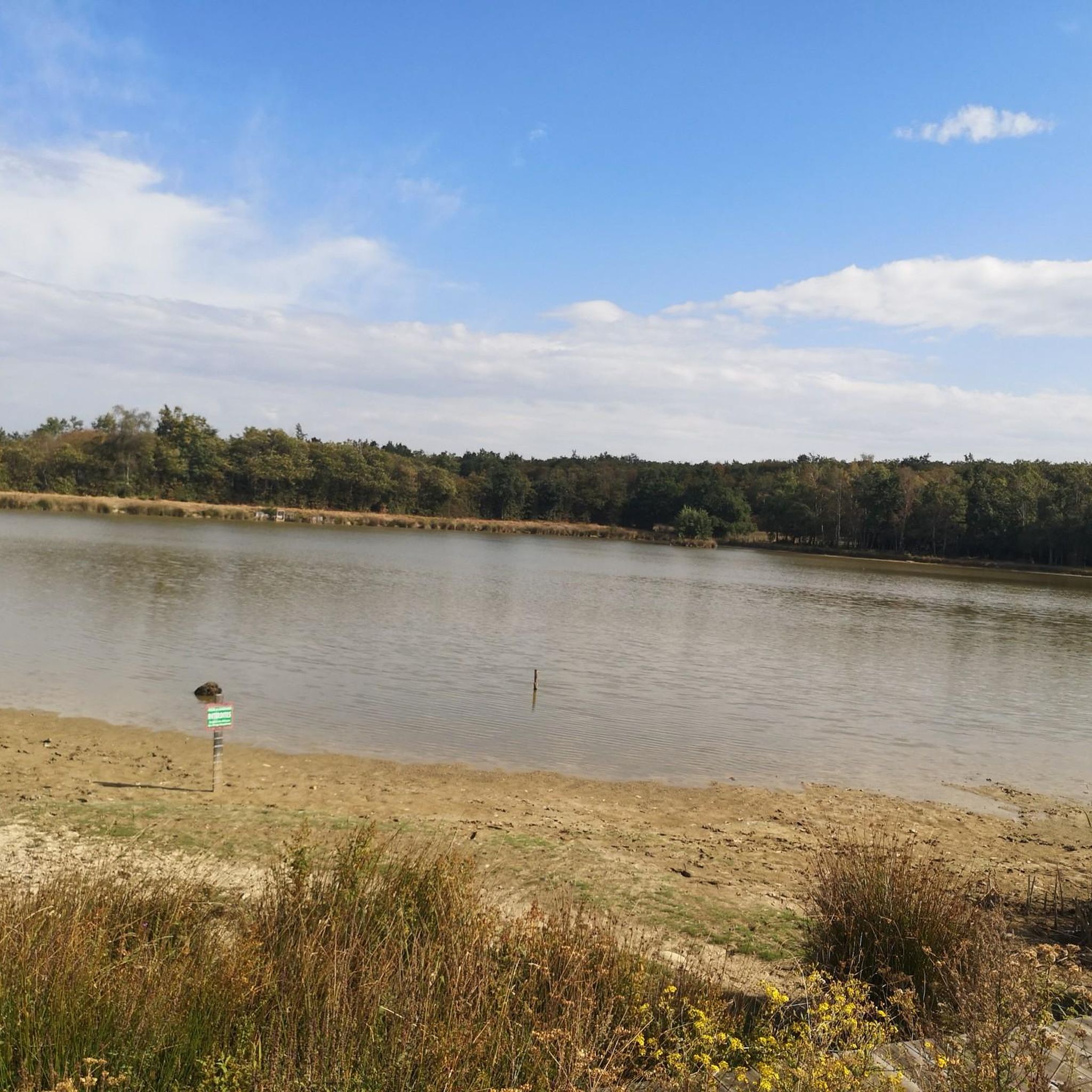
The étang Bideau is a wild and peaceful body of water nestled in the heart of the countryside. Fed and connected to other bodies of water by the river la Gervonde, this pond is a true haven of freshness enveloped by woods. The Haute Gervonde valley is home to a bucolic walking circuit particularly appreciated for its aquatic flora and shaded areas. An easy loop of approximately 3.1 km (called the Boucle des étangs Bidau-Bussin-Neuf) allows you to follow the stream and stroll along these different bodies of water.
0
0
L'étang Bideau is a wild and peaceful body of water nestled in the heart of the countryside. Fed and connected to other bodies of water by the Gervonde river, this pond is a true haven of freshness surrounded by woods. The Haute Gervonde valley is home to a bucolic walking circuit particularly appreciated for its aquatic flora and shaded areas. An easy loop of about 3.1 km (called the Boucle des étangs Bidau-Bussin-Neuf) allows you to follow the stream and stroll along these different bodies of water.
0
0
The existence of the church is formally attested from 1113 in the cartulary of the temple of Vaulx. It initially served as a parish church. Labelled «Patrimoine en Isère», it is today a major venue for artistic and cultural exhibitions managed by a local association.
0
0

A pretty chapel, with a water point. A deceased woman, born in 1795, is buried there
0
0
The PR crosses this pretty property, a fountain, curiosities, a magnificent garden. To discover with respect for the owners of the place, hunters it seems.
0
0
Several caves set up at the bottom of a very steep slope
0
0
Recently reopened 😋😃
0
0
offers a view of the surrounding area
0
0
Frequently Asked Questions
How many mountain bike trails are available around Meyrieu-Les-Étangs?
There are over 170 mountain bike trails in the Meyrieu-Les-Étangs area, offering a wide range of options for different skill levels and preferences. You'll find routes traversing hills, valleys, and plateaus, often passing by scenic ponds and through extensive forests.
What kind of terrain can I expect on mountain bike trails in Meyrieu-Les-Étangs?
The terrain around Meyrieu-Les-Étangs is quite varied, featuring a 'bumpy' relief with hills, valleys, and plateaus. Altitudes range from 401 to 522 meters, providing natural gradients for mountain biking. You'll ride through cultivated fields, bocages (hedged farmlands), and extensive chestnut forests, with many routes offering pleasant passages along the numerous ponds.
Are there mountain bike trails suitable for beginners or families in Meyrieu-Les-Étangs?
Yes, while many routes are moderate, there are approximately 30 easy mountain bike trails available, making them suitable for beginners or families looking for a less challenging ride. These trails often feature gentler gradients and scenic paths through the varied landscape.
What are some popular circular mountain bike routes in the area?
Many of the mountain bike trails around Meyrieu-Les-Étangs are circular. A popular option is the Madone de Beauvoir de Marc loop from Crachier, a moderate 35.7 km trail. Another well-liked route is the Walking in the woods loop from Saint-Jean-de-Bournay, which is 31.4 km and leads through beautiful forested areas.
What can I see along the mountain bike trails in Meyrieu-Les-Étangs?
The trails often lead past the region's defining feature: its numerous ponds, such as the scenic Étang de la Rosière. You might also encounter historical sites like Bonnevaux Castle or Arzay Castle. Elevated areas, like the Plateau du Terrier, offer splendid panoramic views of the Alpine foothills and the valleys dotted with ponds. The Orientation table at the summit of Chèzeneuve is another great viewpoint.
Are there any long-distance mountain bike routes or greenways nearby?
While Meyrieu-Les-Étangs offers many local trails, you can also connect to longer cycling paths. The Bourbre Greenway is a nearby cycle path that could be incorporated into longer rides or used for a more relaxed cycling experience.
What do other mountain bikers say about the trails in Meyrieu-Les-Étangs?
The mountain bike trails in Meyrieu-Les-Étangs are highly rated by the komoot community, with an average score of 4.4 stars from over 330 reviews. Reviewers often praise the varied terrain, the beauty of the numerous ponds, and the extensive forested sections that provide shaded paths and a refreshing environment.
What is the best time of year for mountain biking in Meyrieu-Les-Étangs?
The diverse terrain and extensive forests make Meyrieu-Les-Étangs suitable for mountain biking across multiple seasons. Spring and autumn offer pleasant temperatures and vibrant scenery. During warmer months, the shaded paths through the chestnut forests provide a refreshing environment. Even in winter, some trails along the ponds might be accessible, though conditions should be checked.
Are there any challenging mountain bike trails for experienced riders?
Yes, for experienced riders seeking more challenge, there are approximately 25 difficult mountain bike trails in the area. These routes often feature more significant elevation changes and technical sections. For example, the View of the Plain – View of the Château de Septème loop from Crachier is a longer, moderate route that covers 48.1 km and includes substantial elevation gain, offering a good workout.
Can I find routes that offer panoramic views?
Absolutely. The 'bumpy' relief of Meyrieu-Les-Étangs means many routes include ascents to elevated areas. The 'Plateau du Terrier' is known for offering splendid panoramic views of the surrounding Alpine foothills and the valleys dotted with ponds. Look for routes that pass through higher elevations to enjoy these vistas.
Are there mountain bike routes that focus on the region's famous ponds?
Yes, the region is named 'Meyrieu-les-Étangs' (Meyrieu of the Ponds) for a reason, with approximately thirty ponds. Many routes are designed to showcase these aquatic features. For example, the Beautiful discovery – Difficult bump even on foot loop from Culin provides views of the surrounding countryside and ponds, offering tranquil spots for breaks during your ride.
What is the longest mountain bike trail in the immediate area?
Among the listed routes, the View of the Plain – View of the Château de Septème loop from Crachier is one of the longest, covering 48.1 km. This moderate trail offers a substantial ride with notable elevation changes.
Most popular routes around Meyrieu-Les-Étangs
Most popular attractions around Meyrieu-Les-Étangs

Get inspired with the komoot mobile app


Explore more
Browse the best MTB trails in other regions.
