The best road cycling routes in the Aquarius Plateau
5.0
(8)
138
riders
9
rides
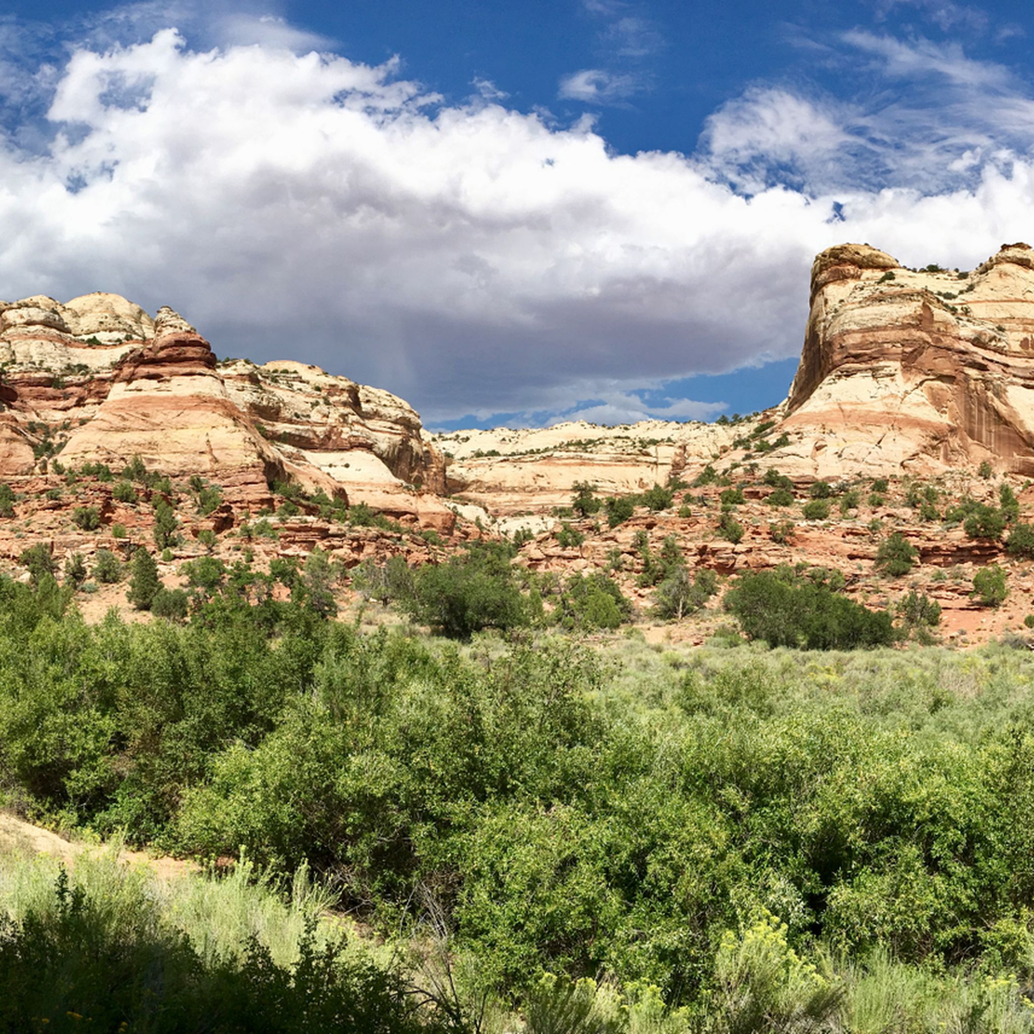
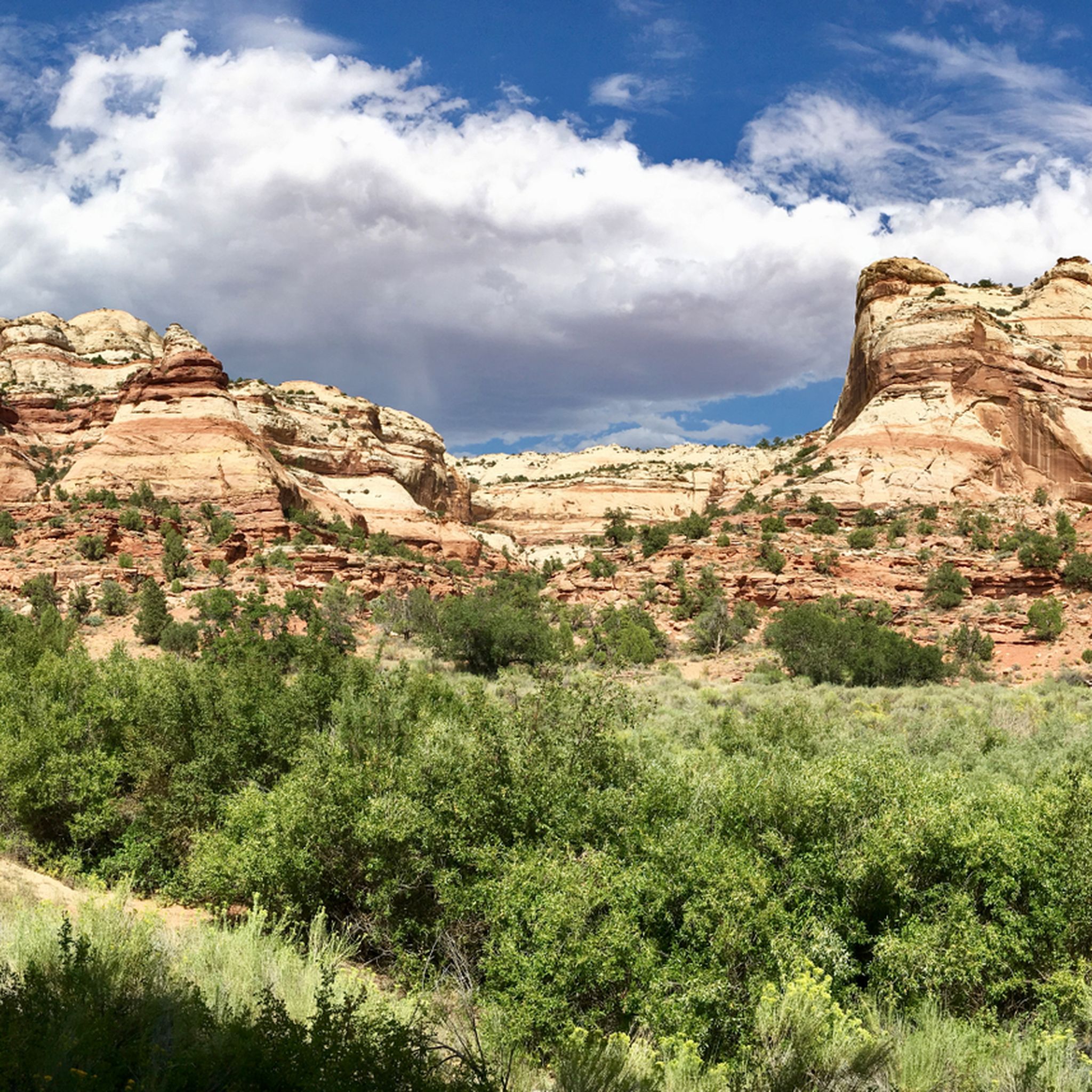
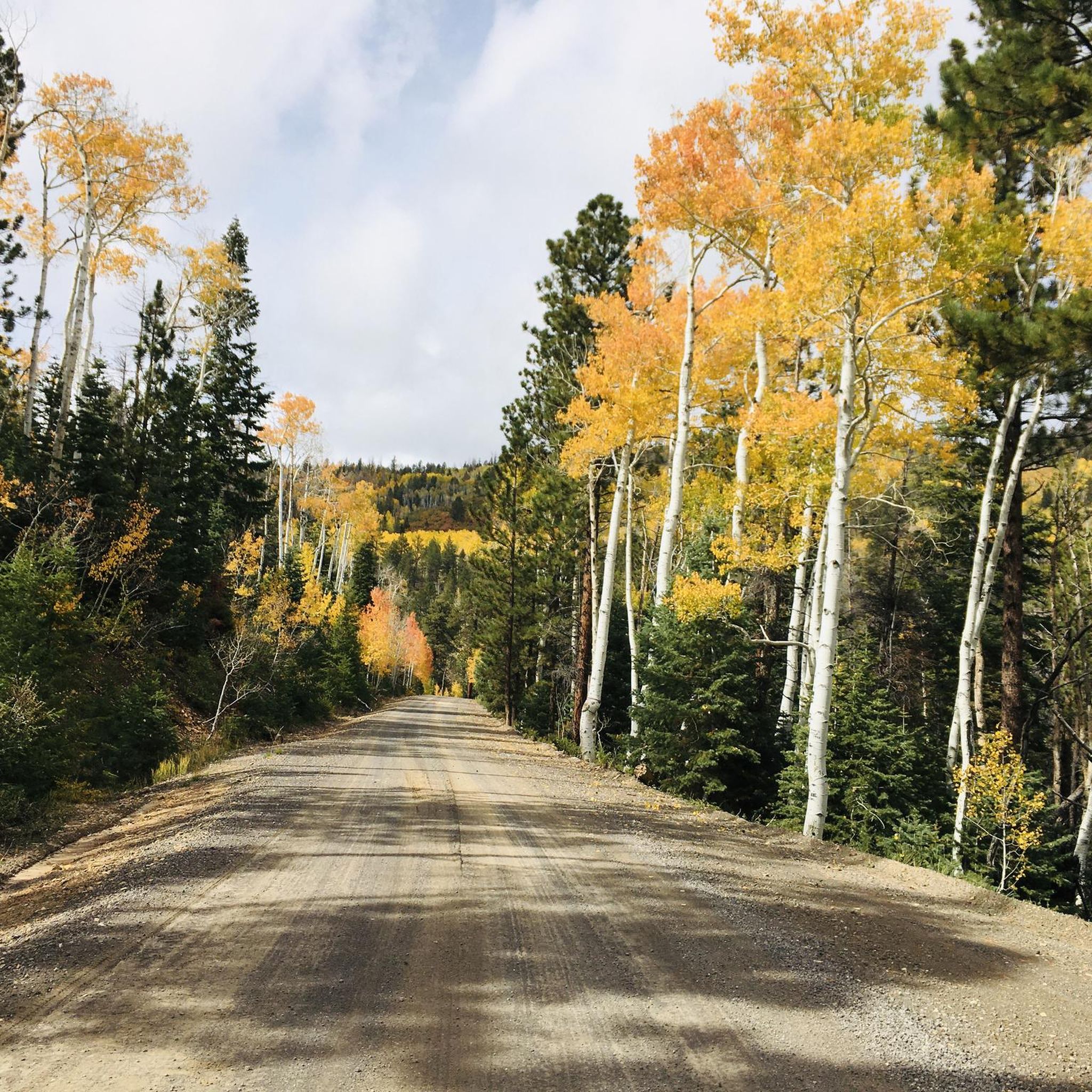
Road cycling routes in the Aquarius Plateau traverse diverse landscapes, from high alpine forests to red rock formations. This region, recognized as the highest timbered plateau in North America, features significant elevation changes and varied terrain. Cyclists encounter dense forests of fir, spruce, and aspen at higher elevations, transitioning to ponderosa pine and pinyon-juniper at lower altitudes. The plateau also includes vast meadows, numerous small lakes, and dramatic river-carved landscapes, offering a range of road cycling experiences.
Best road cycling…
Last updated: May 13, 2026
5.0
(6)
50
riders
57.1km
02:29
520m
520m
Moderate road ride. Good fitness required. Mostly well-paved surfaces and easy to ride.
5.0
(1)
22
riders
54.9km
02:50
950m
950m
Hard road ride. Very good fitness required. Mostly well-paved surfaces and easy to ride.

Sign up for free
17
riders
23.2km
01:09
280m
280m
Easy road ride. Great for any fitness level. Mostly well-paved surfaces and easy to ride.
12
riders
26.0km
01:16
350m
350m
Moderate road ride. Good fitness required. Mostly well-paved surfaces and easy to ride.
5.0
(1)
10
riders
109km
05:59
2,250m
2,250m
Hard road ride. Very good fitness required. Some segments of this route may be unpaved and difficult to ride.
10
riders
52.0km
02:37
790m
790m
Moderate road ride. Good fitness required. Mostly well-paved surfaces and easy to ride.
4
riders
33.2km
01:35
440m
440m
Moderate road ride. Good fitness required. Mostly well-paved surfaces and easy to ride.
7
riders
22.6km
01:04
250m
250m
Easy road ride. Great for any fitness level. Mostly well-paved surfaces and easy to ride.
6
riders
51.4km
02:39
910m
910m
Hard road ride. Very good fitness required. Mostly well-paved surfaces and easy to ride.
Our route recommendations are based on thousands of hikes, rides, and runs completed by other people on komoot.
Start today with a free account
Your next adventure awaits.
Login or Signup
Tips from the Community


Lower Inspiration Point is a fantastic spot over Bryce Amphitheater, with views of the dense clusters of hoodoos known as the Silent City. The short, unpaved trail from the parking area leads to a fenced overlook with sweeping views to the north. It’s a quieter alternative to the park’s busier viewpoints and is especially stunning at sunrise or after dark under the starry sky.
0
0
The Anasazi State Park Museum preserves the ruins of an ancient Ancestral Puebloan village once home to nearly 200 people. You can explore a life-sized replica of a six-room pueblo and walk among partially excavated structures dating back to A.D. 1050–1200. The museum showcases over 1,000 artifacts that paint a picture of the daily life and craftsmanship of the Anasazi people.
0
0
The Long Canyon Overlook is a fantastic spot with incredible sweeping views of the Circle Cliffs and the Henry Mountains in the distance. The overlook is typically quiet, with minimal traffic—making it a perfect spot to take a break in solitude and enjoy the beauty of Grand Staircase-Escalante.
0
0

The Bryce Canyon Multi-use Path is an 18-mile path that connects the hoodoos of Red Canyon with Inspiration Point. The trail is fully paved and popular with walkers, runners, and cyclists.
0
0

This multi-use path runs from Bryce Canyon City to Inspiration Point, offering an easy ride with amazing views of the park. The trail is family-friendly and a great way to explore away from the main roads.
0
0

We reach the spectacular Bryce Canyon. The bizarre rock formations ("hoodoos") are just as characteristic of Bryce Canyon as its forests. The combined forces of wind, water and ice have created a landscape of rock pillars in strange shapes and sizes. These rock formations are also called hoodoos. The hoodoos create a labyrinth of constantly changing shapes and colors from bright orange to pale pink or ochre. Here we take the opportunity to descend into the canyon. The change of perspective makes us really aware of the size of the individual rock formations. We see several chipmunks that are far too quick for my camera.
2
0
The magic of this landscape, which has always inspired people's imagination, is described in a legend of the Paiute Indians. According to it, a long time ago the Legend People lived in a wonderful city that Coyote had built for them. When the Legend People began to behave ungratefully and badly towards Coyote, he turned them into immovable rocks as punishment. And so today, on hikes through the valley, we encounter curious-looking stone figures at every turn.
3
0
Frequently Asked Questions
How many road cycling routes are available in the Aquarius Plateau?
The Aquarius Plateau offers a diverse selection of road cycling routes. Our guide features 8 distinct routes, ranging from easy to difficult, allowing cyclists to explore the region's unique landscapes.
Are there easy road cycling routes suitable for beginners in the Aquarius Plateau?
Yes, the Aquarius Plateau has several easy routes perfect for beginners or those seeking a more relaxed ride. For instance, the Bryce Point – Trailhead Peekaboo Loop loop from Bryce Canyon City is an easy 14.4-mile route, and the Lower Inspiration Point loop from Bryce Canyon City offers another accessible option.
Where can I find challenging road cycling routes in the Aquarius Plateau?
For experienced cyclists looking for a challenge, the Aquarius Plateau provides routes with significant elevation gains. Consider the Head Of The Rocks Overlook – Calf Creek Viewpoint loop from Escalante, a difficult 57.0-mile path with over 4,400 feet of climbing. Another demanding option is the Long Canyon Overlook loop from Boulder, which covers 34.1 miles with nearly 3,100 feet of ascent.
What natural attractions can I see while road cycling in the Aquarius Plateau?
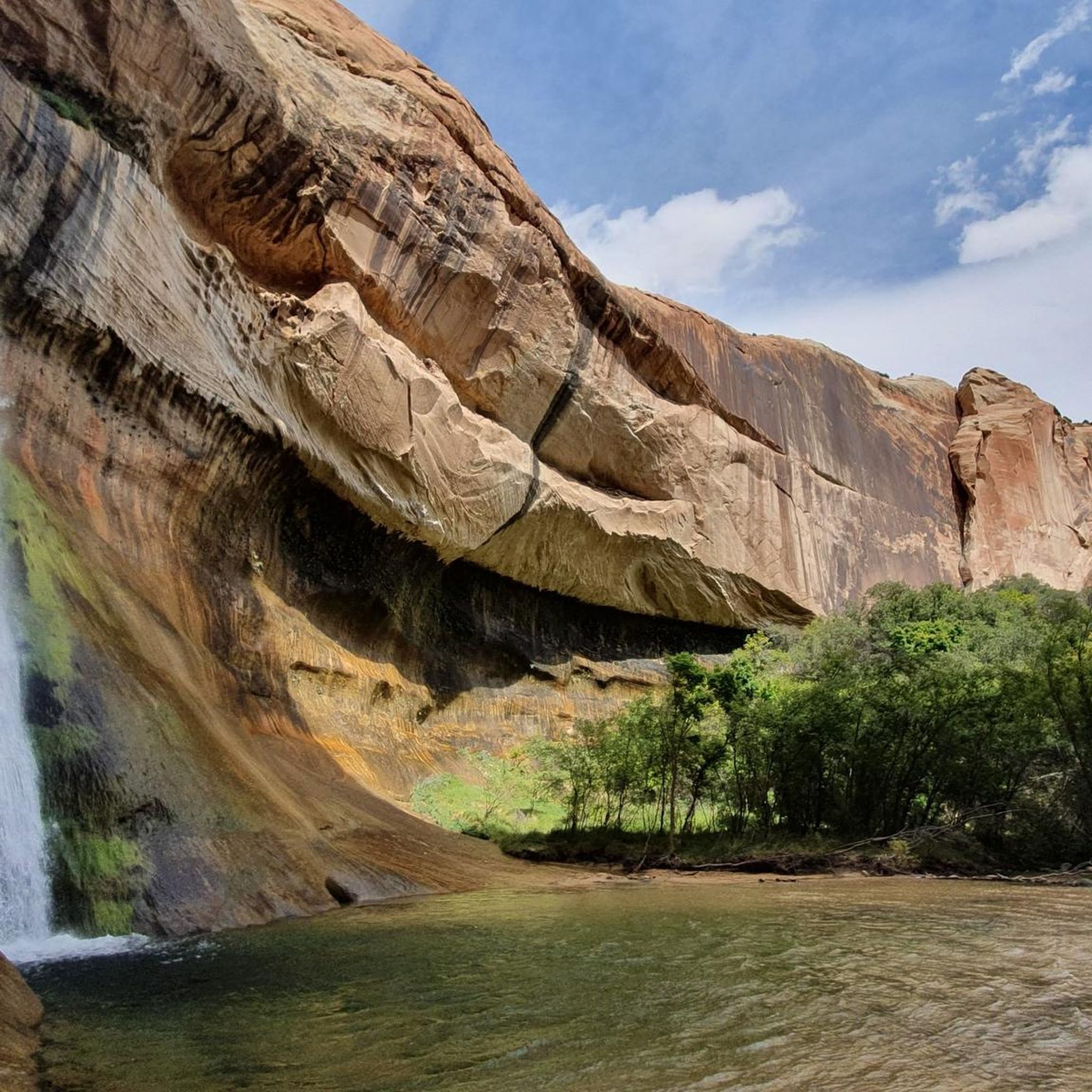
The Aquarius Plateau is rich in natural beauty. Many routes offer views of red rock formations, dense forests, and vast meadows. You can cycle near attractions like the Capitol Reef National Park, or pass by viewpoints such as Long Canyon Overlook and Escalante Overlook. Some routes also provide access to areas with waterfalls like Lower Calf Creek Waterfall Trail or Upper Calf Creek Falls.
Are there circular road cycling routes in the Aquarius Plateau?
Yes, many of the road cycling routes in the Aquarius Plateau are designed as loops, offering varied scenery without retracing your path. Examples include the popular Red Canyon Tunnels - Gateway to Natural Wonders – Red Canyon Arch loop from Bryce Canyon City and the Capitol Reef National Park – Chimney Rock Trail loop from Torrey.
What is the best time of year for road cycling in the Aquarius Plateau?
The Aquarius Plateau, being the highest timbered plateau in North America, experiences varied weather. Generally, late spring through early fall (May to October) offers the most favorable conditions for road cycling, with warmer temperatures and less chance of snow at higher elevations. Always check local weather forecasts before heading out, especially for routes that reach over 11,000 feet.
What do other road cyclists enjoy about the Aquarius Plateau?
The Aquarius Plateau is highly rated by the komoot community, with an average score of 5.0 stars from over 13 reviews. Cyclists frequently praise the region's diverse landscapes, from high alpine forests and vast meadows to dramatic red rock formations, and the challenging yet rewarding elevation changes.
Are there road cycling routes that offer scenic viewpoints?
Absolutely. The Aquarius Plateau is renowned for its stunning vistas. Routes like the Larb Hollow Overlook loop from Torrey provide expansive views of the Waterpocket Fold and Henry Mountains. The region's diverse terrain ensures many opportunities for breathtaking panoramas, including from points like Powell Point and Bluebell Knoll.
Can I road cycle near national parks or forests in the Aquarius Plateau region?
Yes, the Aquarius Plateau is encompassed by Dixie National Forest and is close to major attractions like Bryce Canyon National Park and Capitol Reef National Park. Many road cycling routes offer views of or access to these areas, allowing you to combine your ride with visits to these iconic natural wonders.
Are there options for longer road cycling tours in the Aquarius Plateau?
For those seeking longer rides, the Aquarius Plateau offers routes that can be combined or extended. The Head Of The Rocks Overlook – Calf Creek Viewpoint loop from Escalante is one of the longer single routes at 57.0 miles. The region is also known for multi-day bikepacking adventures like the Aquarius Trail Hut System, which spans approximately 190 to 200 miles, though this includes mixed terrain.
Are the road cycling routes in the Aquarius Plateau primarily on paved roads?
While many scenic drives and main roads in the Aquarius Plateau are paved, some cycling opportunities, especially those associated with bikepacking systems like the Aquarius Trail, may include sections of double-track or even technical single-track. For dedicated road cycling, focus on routes that specify paved surfaces, often found along scenic byways like Scenic Byway 12.
Most popular routes in the Aquarius Plateau
Most popular attractions in the Aquarius Plateau

Get inspired with the komoot mobile app


Explore more
Browse the best Road cycling routes in other regions.
