The best walks and hikes around Andiast
4.6
(2244)
16,964
hikers
396
hikes
Hiking around Andiast, located in Switzerland's Surselva region, offers diverse landscapes for outdoor activities. The area is characterized by a wide, open high plateau, majestic mountain panoramas, and picturesque high valleys. Hikers can explore trails across alpine pastures, through ancient spruce forests, and past scenic natural monuments. The region features numerous lakes, canyons, and mountain passes, providing varied terrain for exploration.
Best hiking trails around Andiast
- The most popular hiking route is Andiast, village with a church – Cuolm d’Andiast…
Last updated: August 3, 2026
4.7
(30)
155
hikers
8.94km
02:50
260m
260m
Moderate hike. Good fitness required. Mostly accessible paths. Sure-footedness required.
4.9
(20)
184
hikers
4.29km
01:17
80m
80m
Moderate hike. Great for any fitness level. Mostly accessible paths. Sure-footedness required.

Sign up for free
4.5
(39)
202
hikers
13.1km
03:59
410m
410m
Moderate hike. Good fitness required. Mostly accessible paths. Sure-footedness required.
4.1
(10)
44
hikers
7.83km
02:17
200m
190m
Moderate hike. Good fitness required. Mostly accessible paths. Sure-footedness required.
5.0
(6)
37
hikers
15.3km
04:49
600m
600m
Moderate hike. Good fitness required. Mostly accessible paths. Sure-footedness required.
Get access to more routes and recommendations from other explorers.
Sign up for free
Already have an account?
Our route recommendations are based on thousands of hikes, rides, and runs completed by other people on komoot.
Start today with a free account
Your next adventure awaits.
Login or Signup

Other adventures around Andiast

Tips from the Community

The Flem is an approximately 16-kilometer-long mountain stream in the Surselva region. It originates in the Crap Grond area at an altitude of around 2,540 m above sea level and flows through the Val Frisal and the municipality of Breil/Brigels. On its way, the Flem also feeds the Lag da Breil, the Brigelsersee, before continuing downstream and finally flowing into the Schmuér stream. The stream, with its watercourses and gorges, shapes the landscape around Brigels. The Flem is particularly impressive in the upper valley area around Val Frisal, where an original alpine landscape with valuable moorland and floodplain areas is located.
0
0
Above Brigels lies the small pilgrimage chapel Sogn Sievi, dedicated to Saint Eusebius. Its history dates back a long way: it was first mentioned in documents as early as 1185. The striking Romanesque tower dates from the 11th/12th century. Particularly worth seeing is the late Gothic winged altarpiece from 1486, created by the Memmingen master Ivo Strigel. In the 17th century, Sogn Sievi was a popular place of pilgrimage, especially for sick people. A quiet, historically rich place above Brigels, which offers a beautiful insight into the long religious history of the region.
0
0
In the middle of Brigels, by the Pradas Resort, lies the naturally landscaped swimming lake. The small lake is a maximum of 1.60 m deep and is pre-warmed to a pleasant 20–22 °C by solar collectors. Admission is free. Around the lake, there is a sunbathing lawn, a barbecue area with seating, as well as showers, changing rooms, and toilets. For families, there is also a paddling pool and various play and leisure facilities. A nice way to cool off on warm days after a hike – although the swimming lake, due to its location near the resort, already seems quite touristy and family-oriented.
0
0
Brigels, in Romansh Breil, lies on a sunny terrace at around 1,300 m above sea level and, with its old houses around the parish church, has certainly retained its original village character. However, I also noticed today that Brigels is significantly more tourist-oriented than I had expected. Numerous holiday apartments, hotels, and tourist facilities are located around the village. As a result, the place sometimes seems less quiet and original than one might expect from a mountain village. Nevertheless, Brigels is beautifully situated in terms of landscape and offers a good starting point for hikes in the Surselva.
0
0
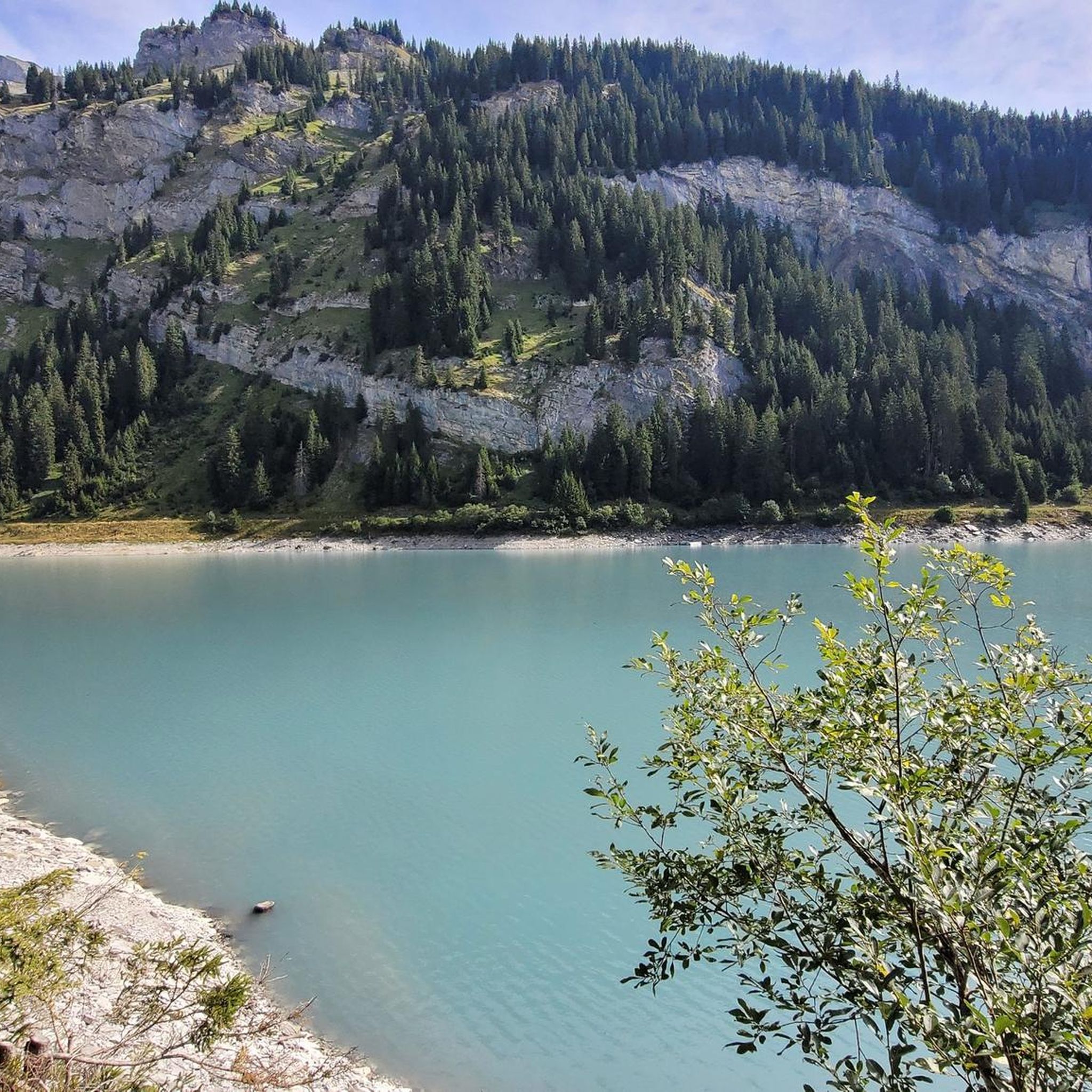
The Lag da Breil, in German Brigelsersee, lies at around 1,255 m above sea level, directly above Brigels. The lake, approximately 500 meters long and up to 140 meters wide, was created as a reservoir in 1946 and is used for energy production. The lake is fed and drained by the Flem. Despite its function as a reservoir, the Lag da Breil appears very idyllic and blends beautifully into the landscape around Brigels. A pleasant walking path leads all the way around the lake. Important: Swimming is not permitted in the reservoir.
0
0
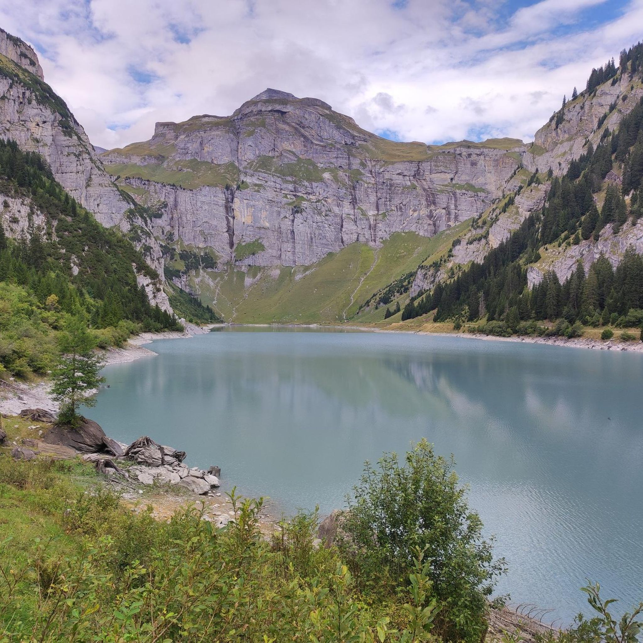
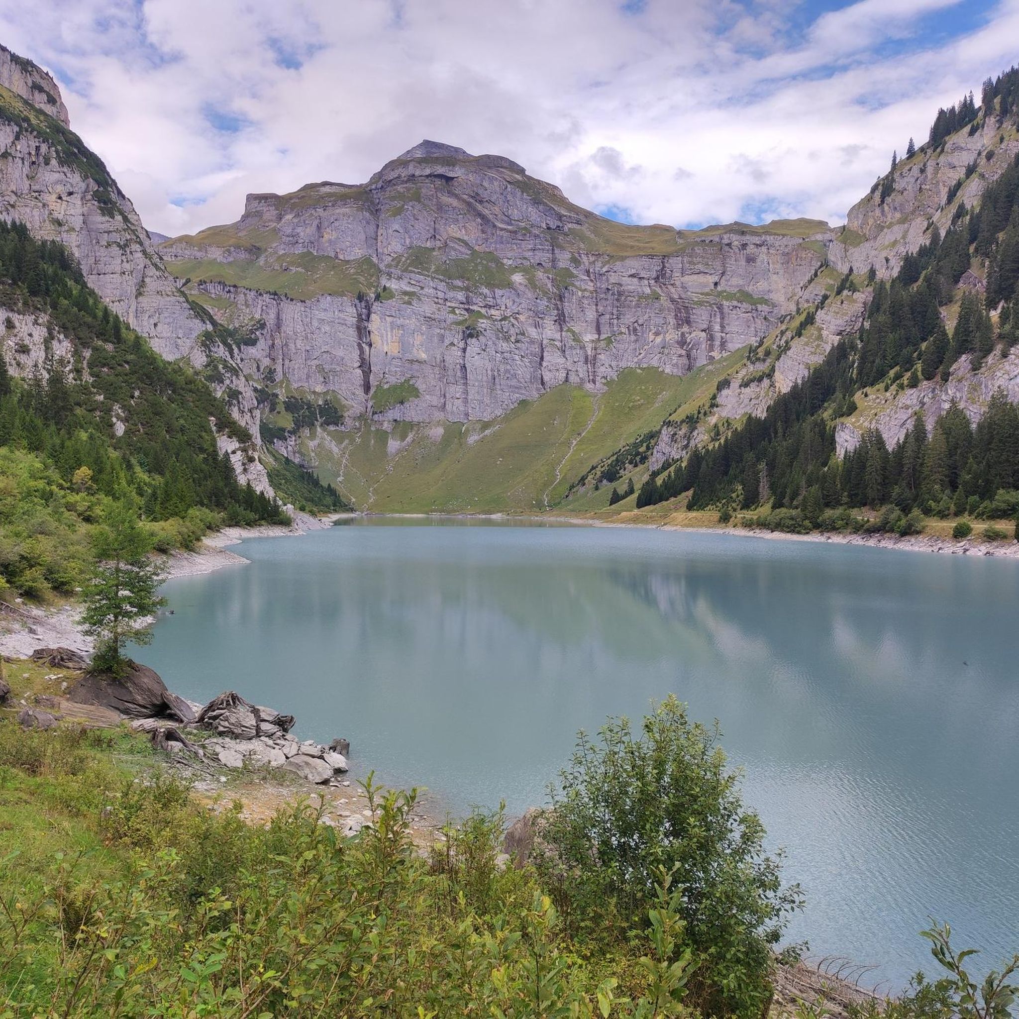
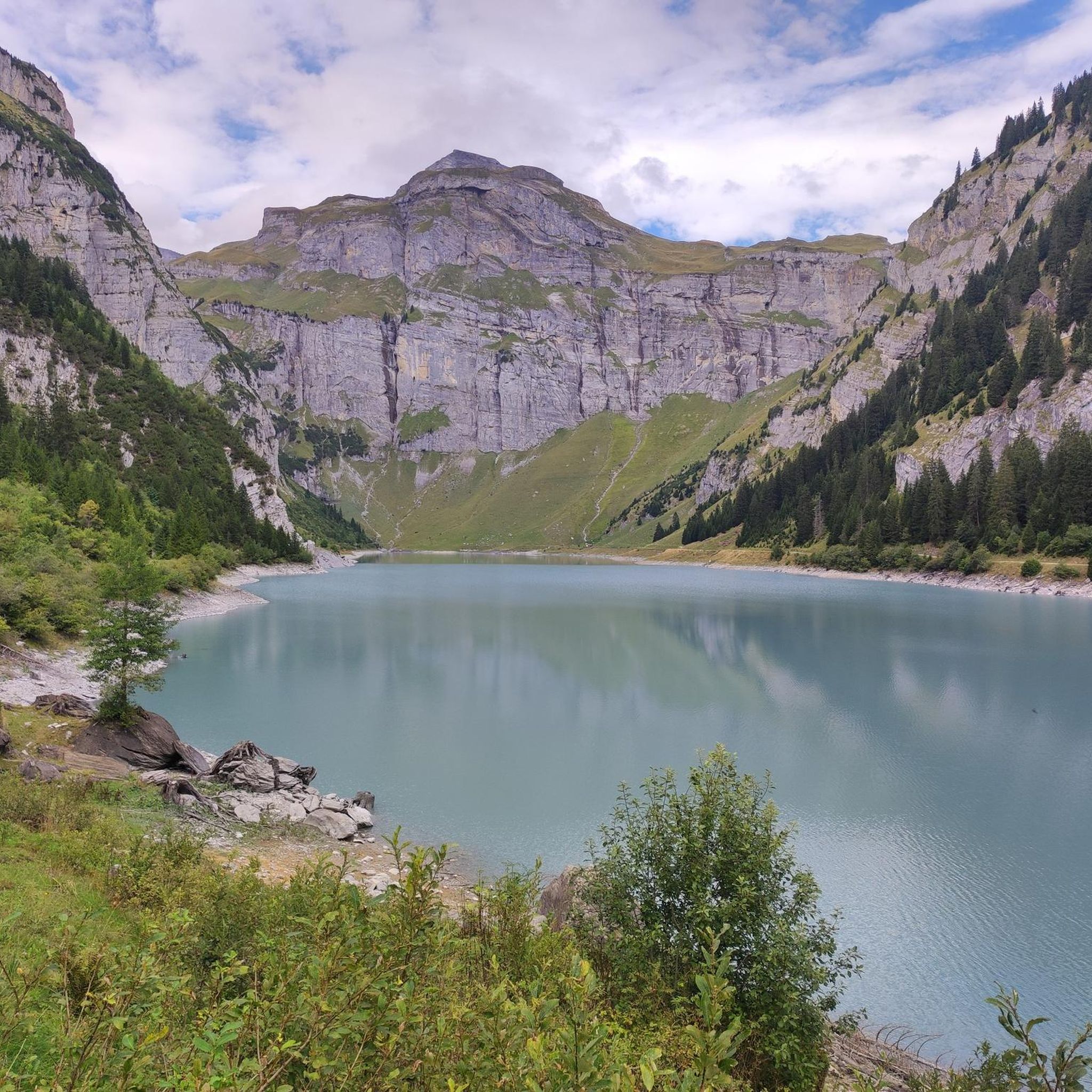
Der Lag da Pigniu, also known as Panixersee, lies beautifully nestled in an impressive alpine mountain landscape. The turquoise reservoir, the steep rock faces and the imposing waterfalls at the rear end of the lake make this place a special hiking destination. At the second, rear waterfall, a path also leads directly to it, so you can observe it up close and feel the water. At the waterfalls, there is a beautiful barbecue and picnic area with tables and benches – ideal for a cozy break in the middle of nature. Important: One side of the path around the lake is currently closed. Therefore, a complete circuit is not currently possible. The closure must be strictly observed. Despite the restriction, the excursion to Panixersee is worthwhile. Especially the waterfalls and the quiet, impressive mountain scenery make the visit rewarding.
0
0
The Lag da Pigniu, also known as Panixersee, is beautifully nestled in an impressive alpine mountain landscape. The turquoise reservoir, the steep rock faces, and the imposing waterfalls at the far end of the lake make this place a special hiking destination. At the second, rear waterfall, a path also leads directly to it, allowing you to observe it up close and feel the water. Near the waterfalls, there is a beautiful barbecue and picnic area with tables and benches – ideal for a cozy break in the middle of nature. Important: One side of the path around the lake is currently closed. Therefore, a complete circuit is not possible at the moment. The closure must be strictly observed. Despite the restriction, the trip to the Panixersee is worthwhile. Especially the waterfalls and the quiet, impressive mountain scenery make the visit rewarding.
0
0
A beautifully located fire pit directly at the waterfalls at the back of Lag da Pigniu. With tables and benches, as well as a well, the spot offers ideal conditions for a cozy barbecue and picnic break – accompanied by the impressive view of the waterfalls and the surrounding rock faces.
0
0
Frequently Asked Questions
What is the difficulty level of hiking trails around Andiast?
The Andiast region offers a wide range of trails catering to all levels. You'll find easy paths suitable for beginners, moderate routes for those seeking a bit more challenge, and difficult trails requiring good fitness and sure-footedness, especially in higher alpine areas. Overall, there are 3 easy, 5 moderate, and 3 difficult routes listed in the area.
Are there easy hiking options suitable for beginners in Andiast?
Yes, Andiast has several easy hiking options perfect for beginners or those looking for a relaxed walk. These paths often traverse the wide, open high plateau, offering gentle gradients and beautiful views. For example, the Andiast, village with a church – Cuolm d’Andiast loop is a moderate route that is relatively short and offers pleasant views of the village and surrounding hills.
Are there family-friendly hiking trails in Andiast?
Andiast is an excellent destination for families, with many trails suitable for all ages. The region's serene, almost car-free environment on the high plateau makes for a safe and enjoyable experience. Look for the easier routes that offer gentle terrain and opportunities to explore the natural surroundings without excessive challenge.
Can I bring my dog on hikes in Andiast?
Generally, dogs are welcome on hiking trails in the Andiast region. It's always a good idea to keep your dog on a leash, especially in areas with livestock or wildlife, and to ensure you clean up after them. The diverse landscapes, from alpine pastures to forests, provide plenty of varied terrain for you and your canine companion to enjoy.
Are there circular hiking routes available in Andiast?
Yes, Andiast features several appealing circular hiking routes. These loops allow you to start and end in the same location, often passing through villages, across mountain pastures, or to scenic viewpoints. Examples include the Andiast Village Center – Tschess Pass (1433 m) loop, which offers significant elevation gain and panoramic views, and the Reformed Church of Waltensburg – Andiast Village Center loop, which connects local villages.
What natural attractions or landmarks can I see while hiking in Andiast?
Andiast is rich in natural beauty and landmarks. You can explore majestic mountain panoramas, including views of Pez Tumpiv and Kistenstöckli. The Muttsee Reservoir is a notable scenic lake, and the region boasts 20 natural monuments. The Val Frisal Plateau, with its vast floodplain and ancient Scatlé spruce forest, is also considered one of the most beautiful high valleys in the Alps.
Are there any hikes that feature waterfalls or lakes?
Yes, the region around Andiast offers hikes that include stunning water features. The Muttsee Reservoir is a prominent lake and natural highlight. You can also find other lakes like Lake Brigels and Lag da Pigniu Dam. For waterfalls, the Berglistüber Waterfall is a notable attraction in the wider area.
What is the best time of year to go hiking in Andiast?
The best time for hiking in Andiast is typically from late spring to early autumn (May to October), when the weather is mild, and the trails are clear of snow. During these months, you can fully enjoy the lush alpine pastures, vibrant flora, and accessible mountain paths. Some trails may be suitable for snowshoeing or winter hiking in colder months, but conditions can vary.
How accessible is Andiast by public transport, and is parking available?
Andiast is well-connected and accessible. You can reach the village by post bus, making it convenient for hikers who prefer not to drive. For those traveling by car, parking is generally available, with many attractions and trailheads within walking distance of the village center. This accessibility enhances the appeal of Andiast as an outdoor activity hub.
What do hikers generally appreciate most about the trails in Andiast?
Hikers consistently praise the diverse landscapes and stunning natural beauty of Andiast. The komoot community rates the trails highly, with an average score of 4.6 stars from over 900 reviews. Many appreciate the majestic mountain panoramas, the serene high plateaus, and the unique Val Frisal with its ancient spruce forest. The well-maintained network of trails catering to various abilities is also a frequently highlighted positive aspect.
Are there any long-distance hiking trails that pass through Andiast?
Yes, Andiast serves as a significant point for popular long-distance hikes. The renowned Senda Sursilvana passes through the region, with Stage 4/5 offering a culturally rich journey past historical sites. Additionally, Stage 11/11 of the ViaSuworow features attractive churches and chapels as it descends towards Ilanz, making Andiast a great base for exploring these extensive routes.
How many hiking trails are available in the Andiast region?
The Andiast region boasts an impressive network of over 150 kilometers of walking and hiking trails. Komoot lists 11 distinct hiking routes in the immediate area, providing a wide variety of options for exploration, from short loops to more challenging day hikes.
Are there any unique landscapes or natural features to explore?
Absolutely. One of the most unique features is the Val Frisal Plateau, lauded as one of the most beautiful high valleys in the Alps. It's characterized by a vast floodplain with branching rivers and the ancient Scatlé spruce forest, offering a truly distinctive hiking backdrop. Beyond this, you'll find majestic mountain panoramas, numerous lakes, canyons, and diverse natural monuments.
Most popular routes around Andiast
Most popular attractions around Andiast

Get inspired with the komoot mobile app


Explore more
Browse the best Hikes in other regions.
