The best running trails around Sennwald
4.8
(4)
201
runners
21
runs
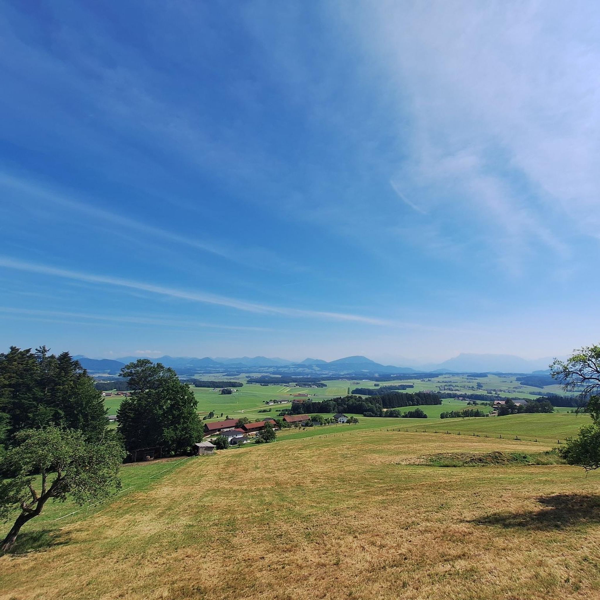
Jogging around Sennwald offers diverse terrain, from the expansive Rhine plains to the challenging mountain panoramas of the Chrüzbergen, Stauberen, and Hohem Kasten peaks. The region, bordering Liechtenstein, features woodlands and wetlands along the Rhine, providing accessible paths for running. Higher elevations offer more demanding routes amidst the Alpstein area. This blend of flat riverside paths and elevated mountain trails caters to various running preferences.
Best jogging routes around Sennwald
- The most popular jogging route is Alpeek Peak – Saxerlücke…
Last updated: September 29, 2026
5.0
(1)
34
runners
18.4km
03:38
1,430m
1,430m
Hard run. Very good fitness required. Sure-footedness, sturdy shoes and alpine experience required.
4.0
(1)
30
runners
18.6km
03:34
1,360m
1,360m
Hard run. Very good fitness required. Sure-footedness, sturdy shoes and alpine experience required.

21
runners
15.5km
03:32
1,390m
1,390m
Hard run. Very good fitness required. Sure-footedness, sturdy shoes and alpine experience required.
14
runners
9.97km
01:02
30m
30m
Moderate run. Good fitness required. Mostly paved surfaces. Suitable for all skill levels.
7
runners
37.9km
04:00
100m
100m
Hard run. Very good fitness required. Mostly paved surfaces. Suitable for all skill levels.
Get access to more routes and recommendations from other explorers.
Already have an account?
Our route recommendations are based on thousands of hikes, rides, and runs completed by other people on komoot.
Start today with a free account
Your next adventure awaits.
Popular around Sennwald

Lake and Alps Adventure – explore 100 dreamy places in our cycling region!
Castles, wine and three-country views – Rhine Valley High Trail
Hiking around Sennwald
MTB Trails around Sennwald
Cycling around Sennwald

Road Cycling Routes around Sennwald

Mountain Hikes around Sennwald
Gravel biking around Sennwald


Tips from the Community

The Saxer Lücke (approx. 1,670 m above sea level) is a striking rocky notch in the Alpstein between the cantons of Appenzell Innerrhoden and St. Gallen. It is one of the best-known viewpoints in Eastern Switzerland and offers a spectacular view of the jagged rock peaks, the Rhine Valley, and the Vorarlberg Alps. The Saxer Lücke is accessible via well-maintained mountain hiking trails, including from the Staubern mountain inn or from Frümsel. The traverse between Staubern and Hohen Kasten is particularly popular. In summer, the impressive landscape and alpine flora are a draw, while in autumn, seas of fog in the Rhine Valley often create unforgettable panoramas.
6
1


Fun for young and old... Families can discover numerous bird species here for free... You can refresh yourself at the neighboring kiosk. https://www.mauren.li/vogelparadies-birka-
2
3

Mega view, all along the ridge
0
0


Description: A relatively easy trail with a few sections that require caution, both during the ascent and the descent. It’s a nice route for those who enjoy moderate hiking without technical difficulties, but attention is needed in some steeper or uneven parts. Ideal for a short adventure close to nature. Why I recommend it: This route is perfect for beginners or casual hikers who want a bit of challenge without being overwhelmed. The views are rewarding, and the trail offers a nice balance between ease and small moments of focus.
0
0

Border crossing for bicycles and pedestrians.
8
0

actually worth a photo for me too
0
0
Frequently Asked Questions
How many running routes are available in Sennwald?
There are over 25 running routes around Sennwald, with more than 200 runners having explored them using komoot. The network includes options for easy, moderate, and difficult runs.
What kind of terrain can I expect on running trails in Sennwald?
Sennwald offers a diverse landscape for runners, ranging from the flat, expansive Rhine plains to the more challenging mountain panoramas of the Chrüzbergen, Stauberen, and Hohem Kasten peaks. You'll find routes through woodlands, wetlands, and along the Rhine embankment, catering to various fitness levels.
Are there any easy or beginner-friendly running paths in Sennwald?
Yes, Sennwald offers several easy routes. For a gentle run, consider the Rhine Embankment loop from Bendern, which is a moderate 6.2-mile (10.0 km) trail leading through the flat Rhine plains, perfect for a relaxed jog.
What are some challenging running routes for experienced runners?
For those seeking a challenge, Sennwald provides demanding mountain trails. The View of Sämtisersee – Rock Tunnel loop from Frümsen is a difficult 11.3-mile (18.2 km) route with significant elevation gain, offering a rewarding experience amidst stunning scenery.
Are there any running routes with scenic viewpoints or landmarks?
Many routes in Sennwald offer breathtaking views. Trails in the Alpstein area provide panoramic vistas of the Chrüzbergen, Stauberen, and Hohem Kasten peaks. You might also encounter landmarks like the ruins of Hohensax Castle along the Rheintaler Höhenweg, or enjoy the serene beauty of Fählensee.
Can I find circular running routes in Sennwald?
Yes, many of the running routes in Sennwald are designed as loops. For example, the Saxerlücke – Alpeek Peak loop from Frümsen is a challenging 9.8-mile (15.8 km) circular route that takes you through mountainous terrain.
What do other runners enjoy the most about jogging in Sennwald?
The running routes in Sennwald are highly rated by the komoot community, with an average score of 4.4 stars. Runners often praise the diverse terrain, from the peaceful Rhine plains to the dramatic mountain landscapes, and the well-maintained paths suitable for various running preferences.
Are there any natural attractions to see along the running trails?
Absolutely. Along the running routes, you can discover several natural attractions. Highlights include the beautiful mountain lake Fählensee, the impressive Säntis Summit (2,502 m), and the picturesque Seealpsee. The Saxer Lücke mountain pass also offers stunning views.
Is Sennwald suitable for family-friendly running or walking?
Yes, the flat and accessible paths along the Rhine plains are ideal for family-friendly running or walking. These areas offer gentle terrain and scenic views without significant elevation changes, making them enjoyable for all ages.
What is the best season for running in Sennwald?
Sennwald offers great running opportunities throughout the year. Spring and autumn provide pleasant temperatures and vibrant scenery. Summer is excellent for higher mountain trails, while the Rhine plains can be enjoyed even in winter, offering a different kind of serene beauty.
Are there options for longer distance running trails near Sennwald?
Yes, for longer runs, you can explore routes like the View of Saxerlücke – Saxerlücke loop from Frümsen, which is a difficult 11.4-mile (18.3 km) path featuring substantial climbs and panoramic views. The region's extensive network allows for combining trails for even greater distances.
Most popular routes around Sennwald
Most popular attractions around Sennwald

Get inspired with the komoot mobile app


Explore more
Browse the best Running Trails & Routes in other regions.
