The best running trails around Udligenswil
4.5
(687)
33,655
runners
10
runs
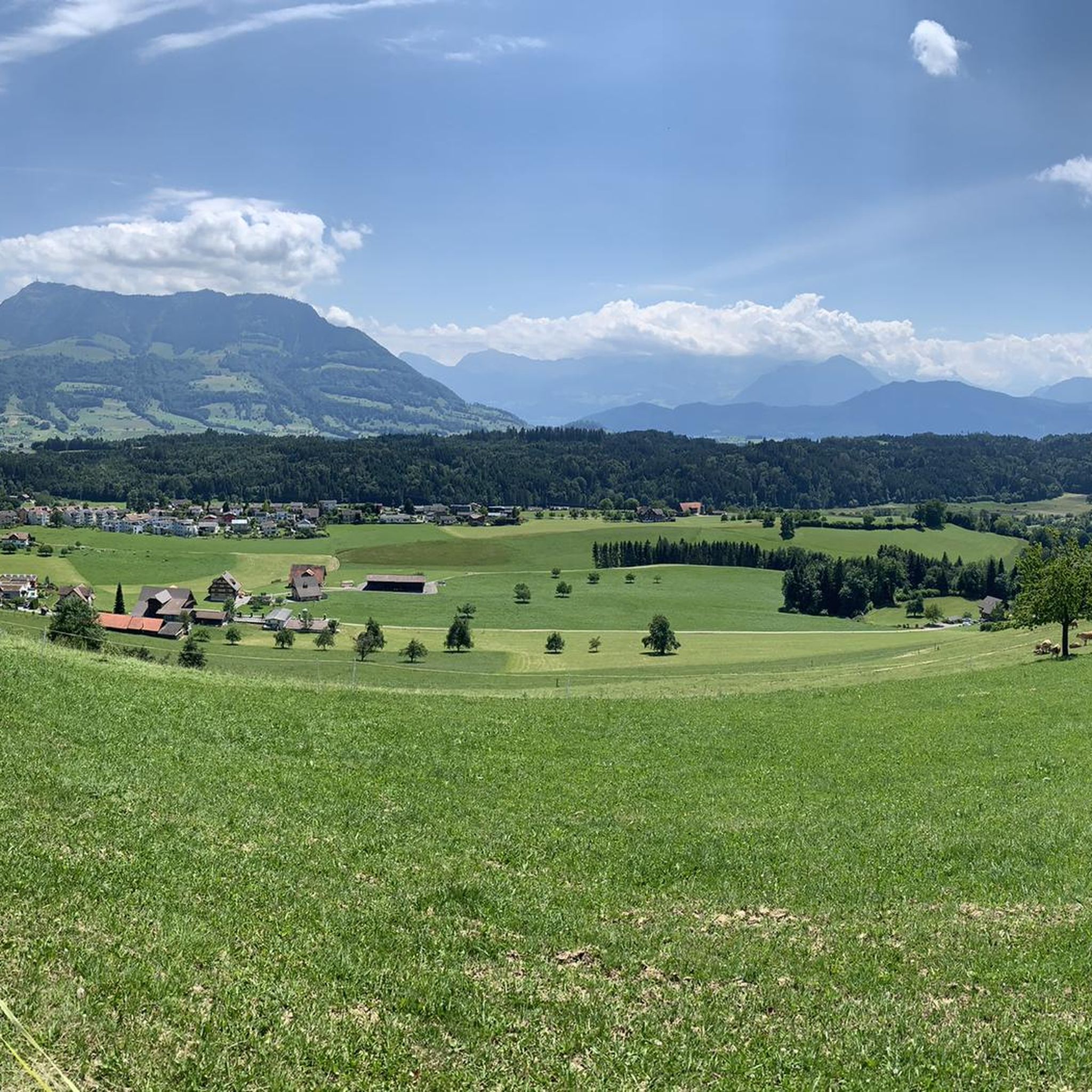
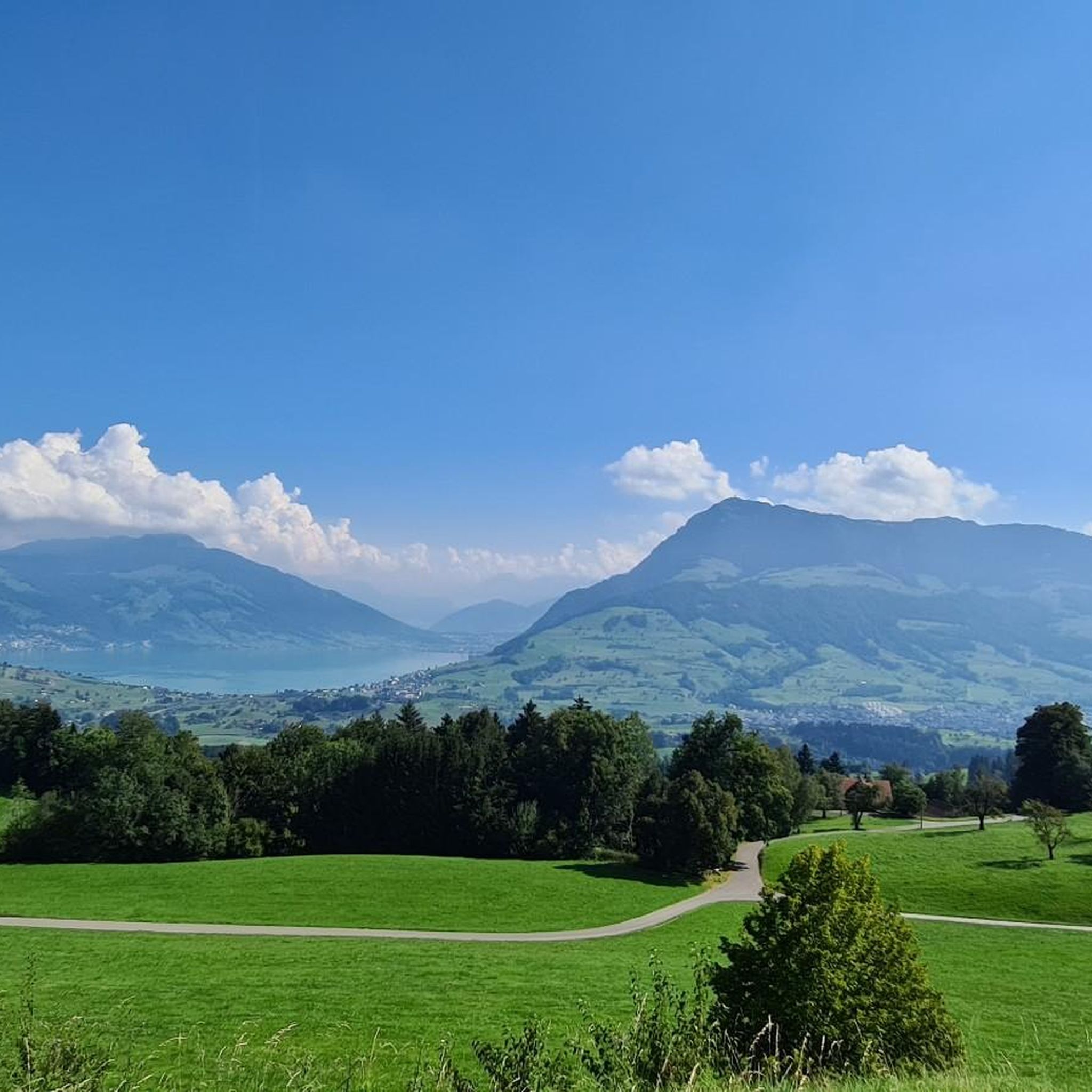
Jogging routes around Udligenswil offer a diverse landscape characterized by hilly and varied terrain, encompassing charming fields and extensive forest sections like the Meggerwald. From its elevated position, the region provides panoramic views of the Swiss Alps, Zugersee, and Lake Lucerne. Water features such as the Würzenbach and the idyllic Wagemoos nature reserve add to the scenic beauty of the running trails.
Best jogging routes around Udligenswil
- The most popular jogging route is St. Jost Chapel – View of Mount…
Last updated: September 30, 2026
13
runners
8.23km
00:57
200m
210m
Moderate run. Good fitness required. Mostly paved surfaces. Suitable for all skill levels.
4.5
(2)
9
runners
10.6km
01:08
170m
180m
Moderate run. Good fitness required. Mostly paved surfaces. Suitable for all skill levels.

10
runners
9.88km
01:05
160m
160m
Moderate run. Good fitness required. Mostly paved surfaces. Suitable for all skill levels.
6
runners
8.69km
01:01
260m
260m
Moderate run. Good fitness required. Mostly paved surfaces. Suitable for all skill levels.
4
runners
5.92km
00:42
200m
200m
Moderate run. Good fitness required. Mostly paved surfaces. Suitable for all skill levels.
Get access to more routes and recommendations from other explorers.
Already have an account?
Our route recommendations are based on thousands of hikes, rides, and runs completed by other people on komoot.
Start today with a free account
Your next adventure awaits.

Tips from the Community

Gravel road, completely unsuitable for bicycles
0
0

Near Lucerne, this spot is perfect for mountain biking at reasonable altitudes, around 800 meters, while admiring the Pilatus massif on the horizon. The climbs are present, but not too steep to be able to start the outing in the valley.
0
0

The chapel in honor of St. Catherine was built in 1636 and is located in the hamlet of Hiltikon ob. Küssnacht am Riggi.
2
0

With enough power, this trail is also a pleasure uphill
0
0

You have to stop here and enjoy the view!
0
0


The S1 ascent can be quite overgrown with wild blackberries in summer: Long pants prevent scratched legs.
0
0

Nice tour with a unique view. In late autumn, the route from Udligenswil to Götzental was almost impossible to drive. It leads through a trampled cattle pasture with deep holes. In addition, the journey was made difficult by thick pipes along the way.
1
3
Frequently Asked Questions
How many running routes are available around Udligenswil?
There are over 640 running routes around Udligenswil, offering a wide variety of options for all fitness levels. This includes 52 easy routes, 491 moderate routes, and 102 difficult routes for more experienced runners.
What kind of terrain can I expect on the running trails in Udligenswil?
The region around Udligenswil is characterized by an undulating, varied landscape with charming fields and extensive forest sections, such as the Meggerwald. This diverse topography provides engaging and dynamic routes, ensuring a varied experience for runners.
Are there easy or beginner-friendly running paths in Udligenswil?
Yes, Udligenswil offers 52 easy running routes perfect for beginners or those looking for a less strenuous run. These paths often feature gentler inclines and well-maintained surfaces.
Can I find circular running routes in Udligenswil?
Many of the running routes in Udligenswil are circular, allowing you to start and finish at the same point. An example is the Running loop from Udligenswil, which covers nearly 10 km.
Are there running trails with scenic viewpoints in the area?
Absolutely. Udligenswil's elevated position provides stunning panoramic views of the Swiss Alps and surrounding lakes. The St. Jost Chapel – View of Mount Pilatus loop from Udligenswil offers vistas towards Mount Pilatus. You can also find breathtaking views over Lake Lucerne and the Alpine chain from the Känzeli Viewpoint.
Are there any running routes that pass by water features or nature reserves?
Yes, the region features beautiful water elements and protected areas. The Würzenbach originates within the municipality, and the idyllic Wagenmoos Pond, a nature reserve with moors of national importance, offers a serene spot. The Wagenmoos Pond loop from Küssnacht is a moderate 13 km route that explores this area.
What do other runners enjoy most about jogging in Udligenswil?
The running routes in Udligenswil are highly rated by the komoot community, with an average score of 4.5 stars from over 490 reviews. Runners often praise the diverse landscape, the extensive forests, and the panoramic views of the Swiss Alps and surrounding lakes.
Are there any dedicated fitness trails or exercise areas in Udligenswil?
Yes, Udligenswil features a 'Trimm Dich Pfad' (fitness trail). This dedicated area offers various stations for physical activity and bodyweight workouts, complementing the natural running routes.
How long are the running paths typically in Udligenswil?
The running paths vary greatly in length. You can find shorter routes like the St. Jost Chapel – View of Mount Pilatus loop from Udligenswil at 8.2 km, up to longer, more challenging runs such as the Sunset Bar – Lake Lucerne Lakeside Pathway loop from Adligenswil, which is 30 km long.
What are some notable landmarks or attractions near the running routes?
Beyond the stunning natural scenery, you can find landmarks like the Känzeli Viewpoint with its views over Lake Lucerne. For more ambitious excursions, the iconic Rigi Kulm summit is accessible via various beautiful hiking trails in the broader region.
Is the area suitable for running during different seasons?
Udligenswil's varied terrain and extensive forests make it suitable for running in many seasons. The forests provide shade in summer, while the undulating landscape can offer beautiful, crisp runs in autumn and spring. For winter running, it's advisable to check local conditions for snow and ice, especially on higher trails.
Most popular routes around Udligenswil
Most popular attractions around Udligenswil

Get inspired with the komoot mobile app


Explore more
Browse the best Running Trails & Routes in other regions.
