The best running trails around Ciral
4.5
(14)
497
runners
93
runs
Jogging around Ciral offers a variety of routes through its diverse landscape. The region features a mix of open countryside, such as the Pré-en-Pail area, and dense woodlands like the Forêt de Multonne. Runners can expect trails with varying elevation profiles, from gentle undulations to more challenging ascents, providing options for different fitness levels.
Best jogging routes around Ciral
- The most popular jogging route is Pré-en-Pail loop from Lalacelle, a 9.8 miles (15.8 km) trail that takes 1 hour…
Last updated: August 5, 2026
27
runners
15.8km
01:39
110m
110m
Hard run. Very good fitness required. Mostly paved surfaces. Suitable for all skill levels.
11
runners
13.6km
01:43
360m
360m
Hard run. Very good fitness required. Mostly paved surfaces. Suitable for all skill levels.

Sign up for free
5.0
(1)
6
runners
9.10km
01:01
150m
150m
Moderate run. Good fitness required. Mostly paved surfaces. Suitable for all skill levels.
4
runners
12.2km
01:18
130m
130m
Moderate run. Good fitness required. Mostly paved surfaces. Suitable for all skill levels.
4
runners
9.75km
01:02
150m
150m
Moderate run. Good fitness required. Mostly paved surfaces. Suitable for all skill levels.
Get access to more routes and recommendations from other explorers.
Sign up for free
Already have an account?
Our route recommendations are based on thousands of hikes, rides, and runs completed by other people on komoot.
Start today with a free account
Your next adventure awaits.
Login or Signup



Tips from the Community

Riding up there by bike was quite strenuous, but the view from the top was worth the effort. It was well worth it.
0
0

An endless false flat. Remember to carry water because there's nothing to refuel.
0
0

Beautiful 360 degree view
1
0

Located in Mayenne, Mont des Avaloirs is the highest point of the Armorican massif. It is part of the Normandy-Maine Regional Natural Park and enjoys the status of a Global Geopark. The belvedere, built in 1994 and covered with a magnificent colorful fresco, painted in 2019 by the Franco-British artist Seb Toussaint. It offers a 360° view of all the surrounding forests and peaks.
0
0

The Multonne forest is a forest which extends over two regions of France: Mayenne and Orne. This forest is part of the Normandy-Maine regional natural park and the Armorican Massif, a mountain range dating from the Paleozoic era. You can enjoy the panorama from Mont des Avaloirs, the highest point in the forest and in the west of France, at an altitude of 416 meters1. The forest is also home to many species of birds and plants, some of which are protected by the Natura 2000 network. The Multonne Forest is a privileged place to discover the natural and cultural heritage of France.
2
0

From its height of 416 meters, Mont des Avaloirs is the highest point of the Armorican Massif. At the top there is a belvedere which offers a 360 degree panorama.
2
0

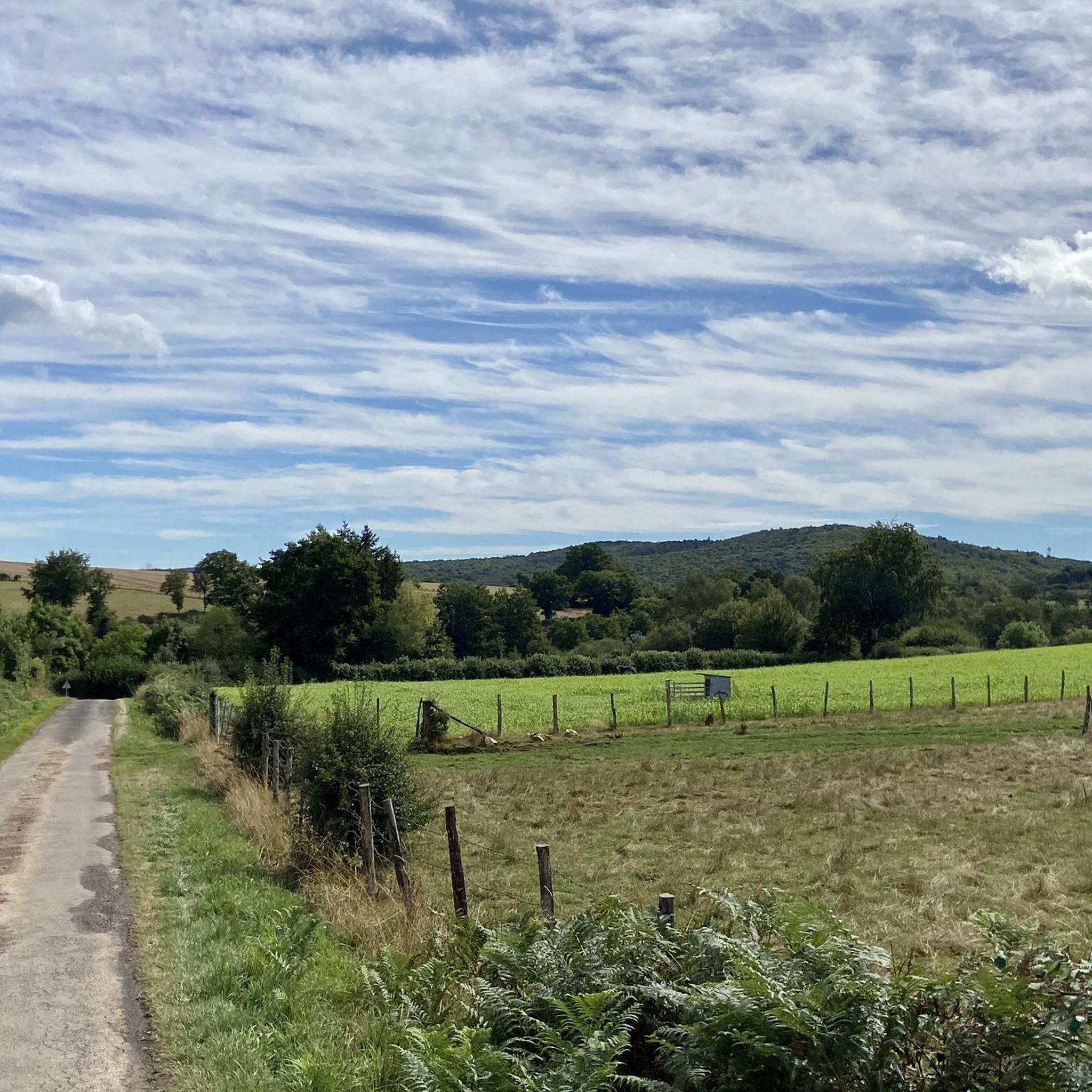
Pré-en-Pail is a charming village in the Mayenne. Nestled in the heart of beautiful green countryside, it offers a peaceful and welcoming atmosphere. With its traditional stone houses and picturesque church, Pré-en-Pail exudes authenticity. Here you pedal between preserved nature and gentle tranquility.
0
0

Alencon is an excellent place to drive on the former railway line. You can also continue along the path towards la Mele-sur-Sarthe. The track is absolutely flat, with firm gravel and plenty of shade. Ideal when the sun burns down from above in summer.
2
0
Frequently Asked Questions
How many running routes are available around Ciral?
Ciral offers a wide selection of running routes, with over 80 trails available for exploration. These range from easy paths to more challenging runs through varied terrain.
Are there easy running routes suitable for beginners in Ciral?
Yes, Ciral has options for beginners. While many routes are moderate to difficult, there is at least one easy running route available. These trails typically feature gentler elevation changes and shorter distances, perfect for those new to running or looking for a relaxed jog.
What kind of terrain can I expect on the jogging trails in Ciral?
The jogging trails around Ciral offer a diverse landscape. You can expect a mix of open countryside, such as the Pré-en-Pail area, and dense woodlands like the Forêt de Multonne. The routes feature varying elevation profiles, from gentle undulations to more challenging ascents.
Are there any circular running routes in the Ciral area?
Many of the running routes in Ciral are circular, offering convenient starting and ending points. For example, the Pré-en-Pail loop from Lalacelle and the Forêt de Multonne loop from Lalacelle are popular circular options, allowing you to return to your starting point without retracing your steps.
What are the typical distances and elevations for running routes in Ciral?
Running routes in Ciral vary significantly in distance and elevation. You'll find trails ranging from around 6 miles (10 km) to over 16 miles (26 km). Elevation gains can range from approximately 100 meters on flatter routes to over 400 meters on more challenging forest trails, catering to different fitness levels.
Are there any viewpoints or scenic spots along the running trails in Ciral?
Yes, the region offers scenic spots. For a notable viewpoint, consider visiting the Mont des Avaloirs viewpoint, which provides expansive views of the surrounding landscape. While not directly on every running route, it's a significant natural attraction in the wider Ciral area.
What are some interesting landmarks or attractions near the running routes?
Beyond the trails, the Ciral area is home to several interesting landmarks. You could explore Carrouges Castle, a historical site, or the tranquil Notre-Dame de Lourdes chapel in Lignières-la-Doucelle. These offer cultural points of interest to complement your outdoor activities.
Is Ciral a good place for family-friendly running or walks?
While many routes are rated moderate to difficult, the presence of easier trails means families can find suitable options for running or walking together. Look for routes with less elevation gain and shorter distances for a more enjoyable family outing.
What do other runners say about the trails in Ciral?
The running trails in Ciral are highly regarded by the komoot community, boasting an average rating of 4.5 stars from numerous reviews. Runners often praise the varied terrain, the mix of open fields and forested areas, and the challenging yet rewarding nature of the routes.
Are the running routes in Ciral suitable for dogs?
Generally, rural running routes in Ciral are dog-friendly, but it's always best to keep your dog on a leash, especially when passing through agricultural areas or near livestock. Be mindful of local regulations and ensure your dog is well-behaved around other trail users and wildlife.
What is the best time of year to go running in Ciral?
Spring and autumn are often considered the best times for running in Ciral, offering pleasant temperatures and beautiful scenery as the landscape changes. Summer can be warm, especially in open areas, while winter runs might require appropriate gear for colder or potentially wet conditions.
Are there any moderate difficulty running routes in Ciral?
Yes, Ciral offers a significant number of moderate difficulty running routes, with nearly 70 such trails available. These routes provide a good balance of challenge and accessibility, often featuring varied terrain and moderate elevation changes suitable for regular runners. An example is the CP5 - MAISON M&J BAKERY – Carrouges loop from Carrouges.
Where can I find parking for the running trails in Ciral?
While specific parking details vary by trailhead, most rural starting points for running routes in Ciral, especially those near villages like Lalacelle or La Roche-Mabile, typically offer roadside parking or small designated parking areas. It's advisable to check the route details on komoot for specific recommendations for each trail.
Most popular attractions around Ciral

Get inspired with the komoot mobile app


Explore more
Browse the best Running Trails & Routes in other regions.
