The best mountain hikes around Grandvillard
4.5
(6)
100
hikers
11
hikes
Mountaineering routes around Grandvillard are set within the picturesque Gruyère mountains of Switzerland, offering a diverse pre-Alpine landscape. This region is characterized by impressive mountain peaks and deep valleys, providing varied terrain for outdoor enthusiasts. It also serves as a gateway to the Gruyère Pays-d'Enhaut Regional Natural Park and the Vanil-Noir Nature Reserve, known for unique geological features and rich biodiversity.
Best mountaineering routes around Grandvillard
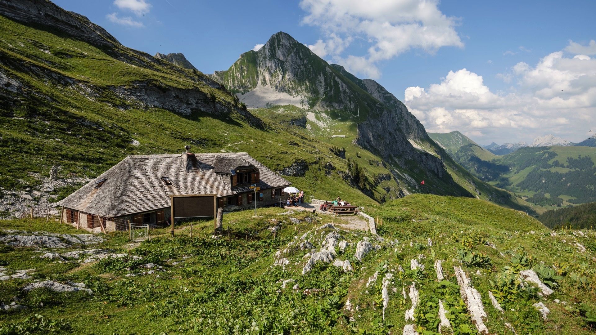
- The most popular mountaineering route is Bounavaux Hut – Tête de l'Herbette loop from…
Last updated: October 1, 2026
19
hikers
5.30km
03:11
510m
510m
Hard mountaineering route. Good fitness required. Sure-footedness, sturdy shoes and alpine experience required.
4.5
(2)
16
hikers
Hard mountaineering route. Very good fitness required. Mostly accessible paths. Sure-footedness required.

8
hikers
1.74km
01:12
130m
130m
Hard mountaineering route. Great for any fitness level. Sure-footedness, sturdy shoes and alpine experience required.
11
hikers
9.19km
04:53
860m
860m
Hard mountaineering route. Good fitness required. Sure-footedness, sturdy shoes and alpine experience required.
4.0
(1)
9
hikers
10.5km
04:39
730m
730m
Hard mountaineering route. Good fitness required. Sure-footedness, sturdy shoes and alpine experience required.
Get access to more routes and recommendations from other explorers.
Already have an account?
Our route recommendations are based on thousands of hikes, rides, and runs completed by other people on komoot.
Start today with a free account
Your next adventure awaits.

Other adventures around Grandvillard

Tips from the Community

The striking rocky summit of Le Rubli (2,285 m above sea level) above the La Videmanette mountain station near Rougemont is an absolute Eldorado for mountain enthusiasts and via ferrata fans in the Pays-d'Enhaut! 🧗♂️🏔️ The chalk-white rock faces rise spectacularly above the high valley, offering three different via ferratas (Via Ferrata Voie 1, 2, and 3) with varying degrees of difficulty – from sporty and achievable to extremely airy and demanding. Pro-Tip: Take the mountain railway from Rougemont up to La Videmanette – an ideal starting point! 🚠✨ Those who climb the summit of Le Rubli will be rewarded with a fantastic panoramic view of the Vaudois and Bernese Alps 📸🌄 Don't forget your via ferrata set (equipment can be rented in the valley) and enjoy a cool drink on the sunny terrace of the mountain station after your descent! ☕🧀
0
0
The 360-degree panorama From the summit, you can enjoy a gigantic panoramic view: To the north: The glittering Lake Geneva and the entire Mittelland region up to the Jura. To the south & east: The mighty peaks of the Mont Blanc massif and the Bernese Alps. 🍴 Gastronomy & Observatory Summit restaurant: The modern restaurant Le Sommet is located directly next to the mountain station. It offers a large sun terrace and local specialities (such as real Gruyère fondue). 🚡 Ways to the summit The comfortable option (train): From Moléson-Village with the funicular to Plan-Francey, then change to the large cable car, which takes you directly to the summit. The sporty option (hiking trails): Via the west flank: A beautiful, classic mountain hiking trail from Plan-Francey (approx. 1 hour 45 minutes, T2). Via ridge paths: Those who ascend via the via ferratas (Le Pilier or La Face) reach the main summit after exiting via a magnificent, secured ridge path in approx. 20 minutes.
1
0
Two legendary routes lead directly through the striking north face. Both start from the Mittelstation Plan-Francey (25 min approach) and end at the Vorgipfel. 🔵 Via Ferrata "Le Pilier" (K4 / C-D) Character: Sporty, sunny pleasure route over the northeast pillar. Requirement: Varied with steep steps and ledges. Perfect for experienced via ferrata climbers. 🔴 Via Ferrata "La Face" (K5 / D-E) Character: extremely exposed and very athletic directly through the wall. Requirement: Requires a lot of arm strength! At the end, a key section awaits: Either the bypass (K4+) or the strenuous overhang (K5+). 💡 Short Info: Equipment: Rental directly at the Mittelstation Plan-Francey possible. Fee: CHF 4.– for the maintenance of the facility. Descent: Float comfortably back to the Mittelstation with the cable car from the summit. Important: As it is a north face, only enter in absolutely dry conditions!
0
0

A lovely hike with a fair amount of climbing. Upon reaching the top, you climb the ridge to the summit. Magnificent view ♡ People with a fear of heights should avoid! This hike is not ideal for those with a dog or walking poles.
1
0

Friendly welcome, excellent meal and reasonable price
0
0

A light-filled sun terrace at the La Videmanette mountain restaurant and alpine views of the Gstaad Dolomites: everything your heart desires when you've reached this high altitude.
1
0

La Cabane de La Videmanette is an unguarded refuge, open only to club members, flanked by the mountain. It is the starting point of the Via Ferrata at Rubli. There is a fountain 50m east of the cabin, on the way to the restaurant.
0
0

The grassy summit of Mys Derrey sits 1863 meters above sea level and offers stunning views of the surrounding mountains and valleys. The best time to visit this peak is from May to October, when the wildflowers are in bloom and the weather is pleasant. You may also spot wildlife along the path, such as marmots and deer. Mys Derrey is an ideal destination for adventurous hikers.
2
0
Frequently Asked Questions
What types of mountaineering routes can I find around Grandvillard?
Grandvillard offers a diverse range of mountaineering routes, from moderate ascents to demanding mountain hikes. The region is characterized by its impressive pre-Alpine landscapes and peaks like Le Moléson Summit, which provides panoramic views, and the more challenging Vanil Noir Summit. There are currently 17 routes available, with 7 moderate and 10 difficult options.
Are there any circular mountaineering routes in the Grandvillard area?
Yes, many of the mountaineering routes around Grandvillard are circular, allowing you to start and end at the same point. For example, you could try the Bounavaux Hut – Tête de l'Herbette loop from Gruyère Pays-d'Enhaut Regional Nature Park, a difficult 9.6 km route, or the moderate Le Moléson Summit loop from Plan-Francey, which is 11.1 km long.
What are some notable natural attractions or viewpoints along the mountaineering routes?
The region is rich in natural beauty and offers several stunning viewpoints and attractions. You can reach the Le Moléson Summit for panoramic views, or explore the area around the Montsalvens Dam with its expansive lake views. The Turrian Suspension Bridge offers a thrilling experience over gorges and near the Ramaclé waterfall. Additionally, the Moléson Botanical Trail provides a chance to discover local flora.
Are there any family-friendly hiking options or attractions near Grandvillard?
While many mountaineering routes are challenging, the Grandvillard area does offer options suitable for families. The Pont Turrian is part of a 6.2 km loop ideal for family hikes, offering views of the Ramaclé waterfall. The Grandvillard waterfall, formed by the Taouna river, is also a natural curiosity that families can visit. For a less strenuous experience, the funicular and cable car to Le Moléson Summit make it accessible for all ages to enjoy the views.
What is the best time of year for mountaineering in Grandvillard?
The best time for mountaineering in Grandvillard is generally during the warmer months, from late spring to early autumn, when trails are clear of snow and ice. However, the region also transforms in winter, offering opportunities for ski mountaineering and snowshoeing for those with appropriate experience and gear. Always check local conditions and weather forecasts before heading out, especially for higher or more exposed routes.
What do other mountaineers say about the routes in Grandvillard?
The mountaineering routes around Grandvillard are highly regarded by the komoot community, with an average rating of 4.8 out of 5 stars from over 15 reviews. Nearly 200 mountaineers have used komoot to explore the varied terrain, often praising the stunning pre-Alpine landscapes and the diverse challenges offered by the peaks.
Are there any specific permits required for mountaineering in the Grandvillard region?
The Grandvillard area is part of the Gruyère Pays-d'Enhaut Regional Natural Park and is strategically located at the west entrance of the Vanil-Noir Nature Reserve. While general hiking and mountaineering typically do not require specific permits for access to trails, it's always advisable to check with local authorities or park management for any specific regulations, especially if you plan to venture into sensitive nature reserve areas or undertake activities requiring specialized equipment.
Can I access the mountaineering trailheads using public transport?
Grandvillard is a well-situated base for exploring the region. While specific public transport links to every trailhead may vary, Switzerland has an excellent public transport network. It is recommended to research local bus or train schedules to nearby villages or starting points for the routes you plan to undertake. Some popular areas like Le Moléson Summit are accessible via funicular and cable car, which can be reached by public transport to their base stations.
What other outdoor activities can I enjoy in Grandvillard besides mountaineering?
Beyond mountaineering, Grandvillard offers a wealth of outdoor pursuits. You can find numerous hiking trails for all fitness levels, from easy walks to strenuous alpine expeditions. The area is also popular for mountain biking, with diverse trails and sections of the Alpine Panorama Route. Trail running is another popular activity, and during winter, the region is ideal for ski mountaineering, snowshoeing, and sledding.
Are dogs allowed on the trails in the Gruyère Pays-d'Enhaut Regional Nature Park?
Generally, dogs are allowed on trails within the Gruyère Pays-d'Enhaut Regional Natural Park, but they must be kept on a leash, especially in nature reserves like Vanil-Noir, to protect wildlife and livestock. Always ensure your dog is well-behaved and that you clean up after them. Specific restrictions might apply in certain areas or during particular seasons, so it's best to check local signage or park regulations.
What is the highest peak accessible for mountaineering in the Grandvillard area?
The highest peak in the Fribourg Prealps, Vanil Noir Summit, is a significant draw for experienced mountaineers in the Grandvillard area. The common route from Grandvillard to the Col de Bounavaletta and then to the north ridge is classified as a demanding mountain hike (T4+), featuring exposed sections secured with steel cables and chains, and requires good physical condition, sure-footedness, and experience in alpine terrain.
Are there any less crowded mountaineering routes or areas to explore?
While popular peaks like Le Moléson Summit can attract many visitors, the extensive network of trails in the Gruyère Pays-d'Enhaut Regional Natural Park and the Vanil-Noir Nature Reserve offers opportunities for quieter exploration. Routes leading to peaks like Vanil du Van or the ridge hike of Les Merlas, which offers views of Gruyères Castle and the Vanil Noir massif, might provide a more serene experience. Exploring routes during off-peak hours or weekdays can also help avoid crowds.
Most popular routes around Grandvillard
Most popular attractions around Grandvillard

Get inspired with the komoot mobile app


Explore more
Browse the best Mountain Hikes & Routes in other regions.
