The best mountain hikes around Grüsch
4.8
(271)
2,068
hikers
61
hikes
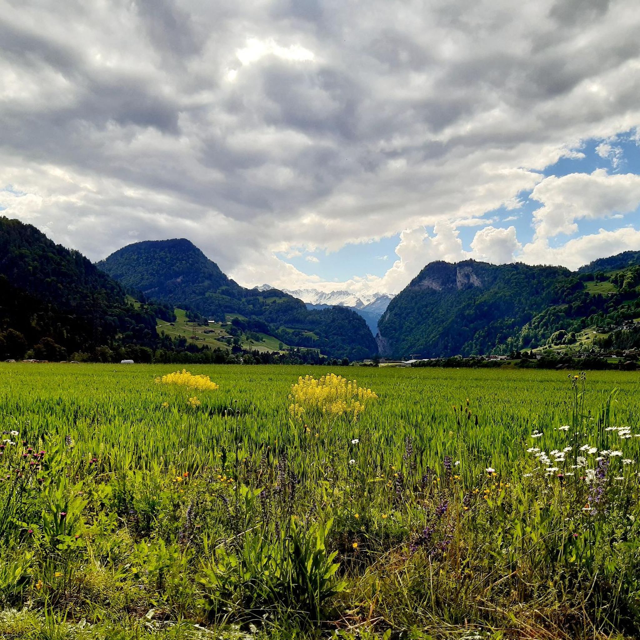
Mountaineering around Grüsch is centered in the picturesque Prättigau region of Graubünden, Switzerland, offering diverse alpine landscapes. The area is characterized by the majestic Rätikon and Silvretta mountain ranges, featuring impressive limestone walls often referred to as the "Bündner Dolomites." From the Grüsch-Danusa high plateau, mountaineers can access routes with panoramic views of the surrounding Alps, including the Prättigau and Rhine valleys. This high-altitude environment provides varied terrain for ascents and treks, from challenging peaks to high-alpine loops.
Best mountaineering…
Last updated: September 27, 2026
4.8
(52)
372
hikers
14.2km
08:11
1,350m
1,350m
Hard mountaineering route. Very good fitness required. Sure-footedness, sturdy shoes and alpine experience required.
4.9
(40)
252
hikers
12.7km
07:22
1,060m
1,060m
Hard mountaineering route. Very good fitness required. Sure-footedness, sturdy shoes and alpine experience required.

4.8
(17)
70
hikers
14.7km
06:50
960m
960m
Hard mountaineering route. Very good fitness required. Sure-footedness, sturdy shoes and alpine experience required.
4.6
(12)
75
hikers
9.98km
05:05
810m
810m
Hard mountaineering route. Very good fitness required. Sure-footedness, sturdy shoes and alpine experience required.
5.0
(5)
33
hikers
8.12km
04:32
750m
750m
Hard mountaineering route. Good fitness required. Sure-footedness, sturdy shoes and alpine experience required.
Get access to more routes and recommendations from other explorers.
Already have an account?
Our route recommendations are based on thousands of hikes, rides, and runs completed by other people on komoot.
Start today with a free account
Your next adventure awaits.
Tips from the Community

Unfortunately, not much snow and ice is visible anymore. The view is still impressive, though. Anyone who gets up here needs the appropriate equipment. Shoes, clothing, backpack with water, etc.
0
0

Along the atmospheric hiking trail near the Lünersee and the Schafgafall, you will encounter the impressive Witzani Hans memorial. This special memorial cross commemorates the mountaineer Hans Witzani, who died in an avalanche on the south slope of the Schafgafall in January 1938. Did you know that this spot has been a popular resting place for mountain hikers in the Rätikon mountains for decades? While you pause here to reflect on the impressive history and the forces of alpine nature, you are simultaneously rewarded with a beautiful panorama of the surrounding mountain peaks and the sparkling reservoir!
0
0
The fairytale-like Lünersee is also known as the pearl of the Rätikon mountains and is hidden at an altitude of no less than 1,970 meters between the steep alpine peaks. Did you know that this magical turquoise lake was originally one of the largest natural mountain lakes in the Eastern Alps until a dam was built in 1958 for hydropower? Today, you can walk a magnificent loop around the water in about two hours, while the mighty Schesaplana – at 2,965 meters, the highest mountain in the Rätikon – proudly towers above you. Thanks to the convenient Lünerseebahn, you can float from the valley to this alpine paradise in a few minutes, where the crystal-clear meltwater seems to glow on sunny days!
0
0

At the beginning of the ascent T2/T3. Later it becomes rockier, steeper and more exposed. Difficulty from approx. halfway up T3+, later T4- with light climbing sections, partly secured with ropes. The last 250 vertical meters are sweat-inducing, but you are rewarded with a dream panorama.
0
0
At the foot of the mountain, a still quite easy ascent T2/T3. Later it becomes rockier, steeper and more exposed with some light climbing, partly secured by ropes, difficulty T3+/T4-. The last 250m are quite sweaty. The ascent is definitely worth it and at the top you will be rewarded with a dream panorama.
1
0

Lünersee was once a natural mountain lake. By building a dam in 1959, the lake became a reservoir with a capacity of 78.3 million m3. When the lake is full, it is 139 m deep. The circular path around the lake is largely family-friendly and easy to walk.
8
0

You can have a good snack here.
0
0

In June, take the cable car up at 9:00 AM - Magical in sunshine
0
0
Frequently Asked Questions
How many mountaineering routes are available around Grüsch?
There are over 60 mountaineering routes around Grüsch, offering a wide range of experiences. While many are challenging, there are also moderate and a few easier options available for those looking for a less strenuous adventure.
What is the best time of year for mountaineering in Grüsch?
The summer months are generally ideal for mountaineering in Grüsch, offering the most accessible conditions for high-alpine routes. However, the region also provides panoramic winter hiking trails for those who enjoy exploring snow-covered landscapes.
Are there options for beginners or less experienced mountaineers?
Yes, while many routes are challenging, Grüsch does offer some options suitable for beginners or those with less alpine experience. There are 2 easy and 10 moderate routes available, allowing you to enjoy the stunning alpine scenery without tackling the most demanding ascents.
What kind of challenges can I expect on advanced mountaineering trails?
Advanced mountaineering trails around Grüsch, particularly in the Rätikon and Silvretta ranges, often involve significant elevation gain, rocky terrain, and require sure-footedness and alpine experience. Routes like the Lake Lüner – Schesaplana Summit loop from Lünersee, for example, involve over 1,300 meters of ascent.
Are there any circular mountaineering routes in the Grüsch area?
Yes, many routes around Grüsch are designed as loops, allowing you to start and end at the same point. Examples include the challenging View of the Lünersee – Lünersee loop from Lünersee or the high-alpine Cavelljoch (Gafalljoch) – Lake Lüner loop from Lünersee.
Can I find routes with impressive views or natural features?
Absolutely. The Grüsch-Danusa high plateau offers 360-degree panoramic views of the surrounding Alps, including the Prättigau and Rhine valleys. The Rätikon mountains, often called the 'Bündner Dolomites,' provide dramatic limestone walls and spectacular scenery. Many routes, such as the View of the Lünersee – Lünersee loop from Lünersee, specifically highlight these vistas.
Are there any routes that pass by mountain huts or places to rest?
Yes, several mountaineering routes in the Grüsch area offer opportunities to stop at mountain huts. For instance, the Lake Lüner – Totalp Hut loop from Lünersee passes by the Totalp Hut. Other notable huts in the region include the Douglass Hut at Lake Lünersee and the Carschina Hut.
How can I access the mountaineering routes around Grüsch using public transport?
Grüsch is part of the well-connected Graubünden region. While specific route access points vary, public transport options like trains and post buses often serve the valleys and main villages, providing starting points for many trails. It's advisable to check local timetables for the most convenient connections to your chosen trailhead.
Is parking available near the trailheads?
Parking facilities are generally available at popular starting points for mountaineering routes in the Grüsch area, especially near cable car stations or major access roads. However, during peak season, these can fill up quickly, so arriving early is recommended.
What do other mountaineers enjoy the most about mountaineering in Grüsch?
The mountaineering routes around Grüsch are highly rated by the komoot community, with an average score of 4.8 stars from over 260 reviews. Users frequently praise the dramatic alpine scenery, the challenging yet rewarding ascents, and the panoramic views from high-altitude plateaus.
Are there any specific peaks or summits I can aim for?
Yes, the region offers several prominent peaks for mountaineers. The Schesaplana Summit is a popular goal, as seen in routes like the Schesaplana Summit – View of the Brandner Glacier loop from Schesaplana. Other notable summits include Sulzfluh Summit and Pizalun Summit and Viewpoint.
Can I spot any wildlife while mountaineering in Grüsch?
The diverse alpine environment around Grüsch provides habitats for various wildlife. While specific sightings are never guaranteed, keen observers might spot chamois, ibex, marmots, or various bird species, especially in quieter, higher-altitude areas away from busy trails.
Most popular attractions around Grüsch

Get inspired with the komoot mobile app


Explore more
Browse the best Mountain Hikes & Routes in other regions.
