The best running trails around Larbont
4.0
(17)
407
runners
36
runs
Jogging around Larbont offers a variety of routes through the natural landscapes of the Pyrénées Ariégeoises. The region is characterized by rolling hills, dense woodlands, and river valleys, providing diverse terrain for runners. Trails often feature moderate elevation changes, with some more challenging ascents. The area's natural park setting ensures a scenic backdrop for running activities.
Best jogging routes around Larbont
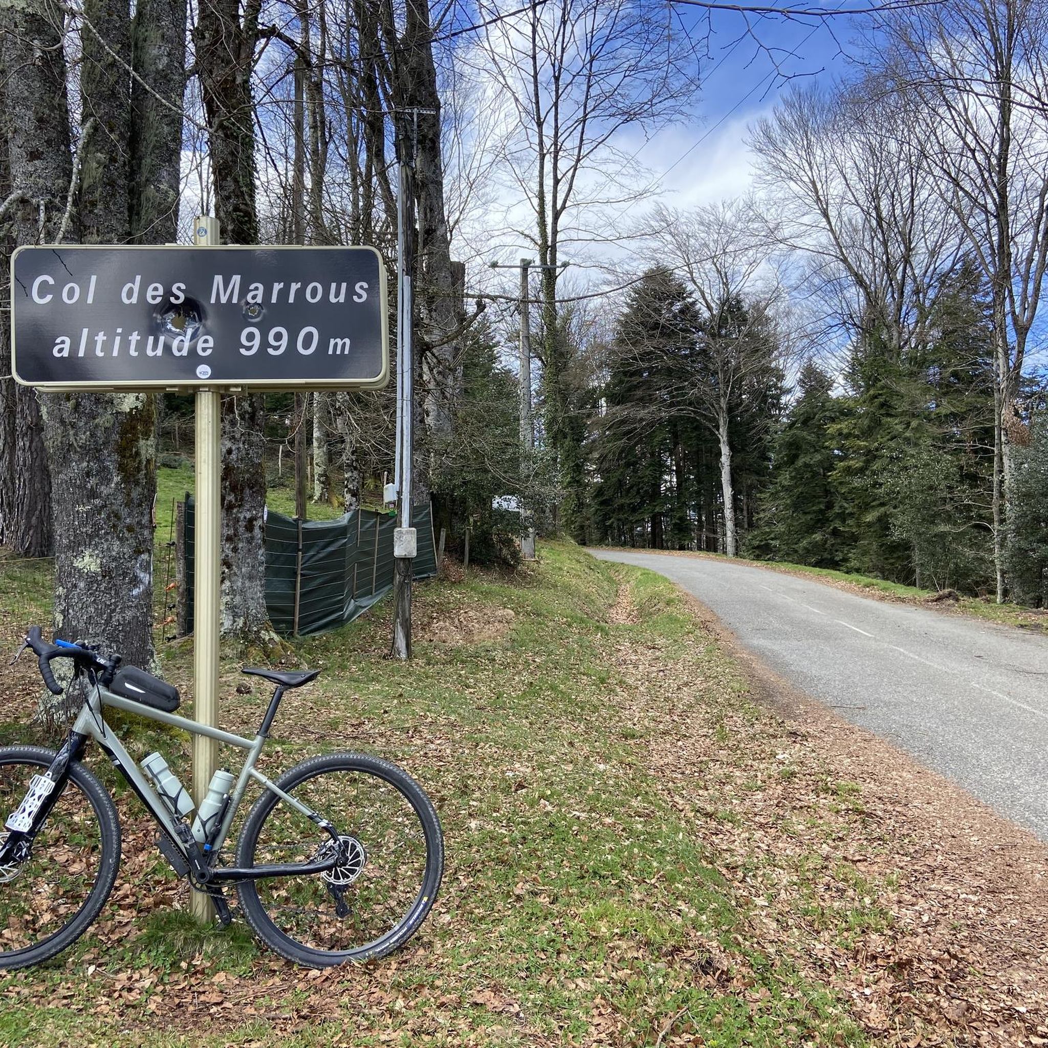
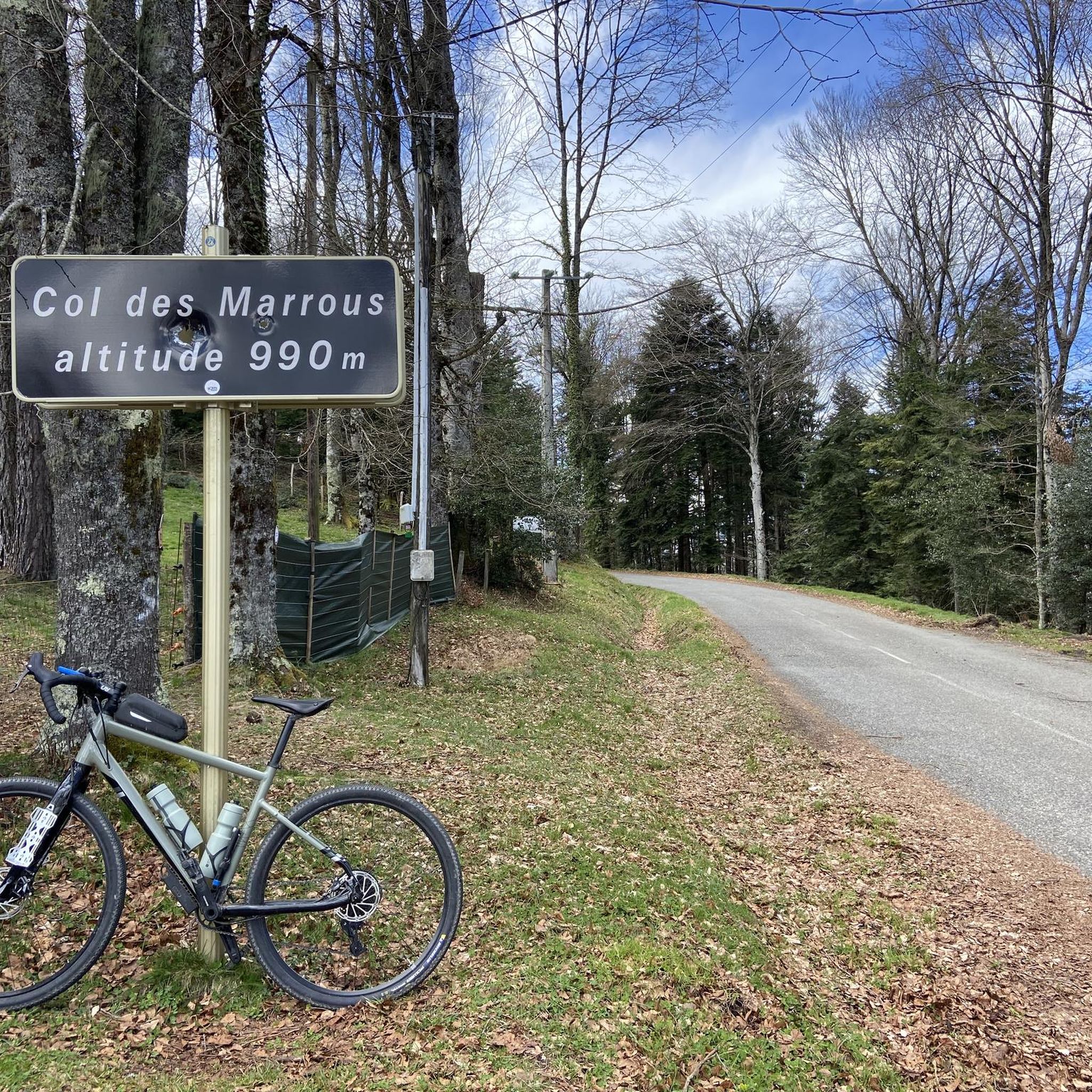
- The most popular jogging route is Le cap du Carmil – trail starting from Col des Marrous – Parc…
Last updated: November 3, 2026
24
runners
Hard run. Very good fitness required. Mostly paved surfaces.
5.0
(1)
104
runners
17.6km
02:18
560m
560m
Hard run. Very good fitness required. Mostly paved surfaces.

3.0
(1)
46
runners
8.59km
01:06
260m
260m
Moderate run. Good fitness required. Mostly paved surfaces.
6
runners
6.55km
00:49
190m
190m
Moderate run. Good fitness required. Mostly paved surfaces.
4.5
(2)
6
runners
15.5km
01:40
230m
230m
Hard run. Very good fitness required. Mostly paved surfaces.
Get access to more routes and recommendations from other explorers.
Already have an account?
Our route recommendations are based on thousands of hikes, rides, and runs completed by other people on komoot.
Start today with a free account
Your next adventure awaits.

Tips from the Community

From the Cap du Carmil, enjoy an exceptional panorama of the Ariège Pyrenees and the surrounding valleys. A viewpoint that is well worth the climb. At the summit, your gaze extends far over the mountains and forests of Ariège. An unmissable spot for lovers of wide-open spaces.
1
0

Superb hilly loop, first few kilometers difficult, magnificent landscape, return by the greenway going down.👍
0
0

Magnificent site with a 360° panorama of the cross-border chain and valleys.
1
0

Pleasant track which allows you to avoid the main road. Be careful though, the surface is not tar, but more packed gravel and on a road bike it is not always pleasant.
0
0

I went there yesterday.... Saint-Girons-Foix ..... round trip is 88 kms
0
0

Magnificent panorama from a summit of Cap du Carmil
1
0
The ascent to Cap de Carmil offers beautiful views of its rounded summit.
1
1
Magnificent panorama from a very accessible summit via the Col de Péguère.
1
1
Frequently Asked Questions
How many running routes are available around Larbont?
Larbont and its surroundings offer a diverse network of nearly 40 running routes. These include 1 easy, 24 moderate, and 12 difficult trails, catering to various fitness levels.
Are there any easy or beginner-friendly jogging routes in Larbont?
Yes, there is at least one easy running route available. While many trails feature moderate elevation changes, beginners can find suitable paths. For a moderate option that's not overly long, consider the Running loop from Durban-sur-Arize, which is 8.6 km.
Can I find circular jogging routes in the Larbont area?
Absolutely. Many of the running paths around Larbont are designed as loops, allowing you to start and finish at the same point. Examples include the moderate Running loop from Durban-sur-Arize and the more challenging Le Pouech loop from Castelnau-Durban.
What kind of scenery can I expect on the running trails near Larbont?
The routes in Larbont traverse the natural landscapes of the Pyrénées Ariégeoises, offering rolling hills, dense woodlands, and picturesque river valleys. You'll often find scenic backdrops and opportunities for viewpoints, especially on trails with higher elevation.
Are there any interesting natural landmarks or attractions along the running routes?
Yes, the region is rich in natural beauty. While running, you might pass by areas close to highlights like the impressive Grotte du Mas-d'Azil or the serene Lac de Mondély. The Cap du Carmil is also a notable summit in the area.
What is the best time of year for running in Larbont?
The Pyrénées Ariégeoises offer good running conditions through much of the year. Spring and autumn provide pleasant temperatures and vibrant scenery. Summer is also popular, though some higher elevation trails might be warmer. Winter running is possible, but be prepared for colder conditions and potentially snow on higher paths.
Are the running trails around Larbont suitable for families?
While many routes feature moderate elevation changes, families can find suitable options. Look for the 'easy' or 'moderate' graded routes, especially those that are shorter in distance, such as the Running loop from La Bastide-de-Sérou (6.5 km), which offers a good introduction to the local countryside.
Are there any running routes with good viewpoints in Larbont?
Given the region's rolling hills and mountainous terrain, many routes offer excellent viewpoints. Trails like Le cap du Carmil – trail starting from Col des Marrous, with its significant elevation gain, are likely to reward runners with panoramic vistas of the Parc naturel régional des Pyrénées Ariégeoises.
What do other runners say about the trails in Larbont?
The running routes in Larbont are highly regarded by the komoot community, with an average score of 4.3 stars from numerous reviews. Runners often praise the varied terrain, the natural park setting, and the scenic backdrop for their activities.
Are there any greenway or flatter options for running in the area?
Yes, for a relatively flatter and longer option, consider the Greenway of Montels loop from La Bastide-de-Sérou. This moderate 14.5 km route follows a greenway, offering a different running experience through the local landscape.
Is public transport available to access the jogging trails in Larbont?
While Larbont is a rural area within a natural park, public transport options might be limited directly to trailheads. It's advisable to check local bus schedules for connections to nearby towns like Castelnau-Durban or Durban-sur-Arize, from where some routes, such as the Le Pouech loop or the Running loop from Durban-sur-Arize, begin.
Where can I find parking for the running routes around Larbont?
Parking is generally available in the villages and towns where many routes start, such as Castelnau-Durban, Durban-sur-Arize, or La Bastide-de-Sérou. For routes starting from specific points like Col des Marrous, there are often designated parking areas for hikers and runners.
Most popular attractions around Larbont

Get inspired with the komoot mobile app


Explore more
Browse the best Running Trails & Routes in other regions.
