The best walks and hikes around Chaudeyrolles
4.6
(561)
4,140
hikers
15
hikes
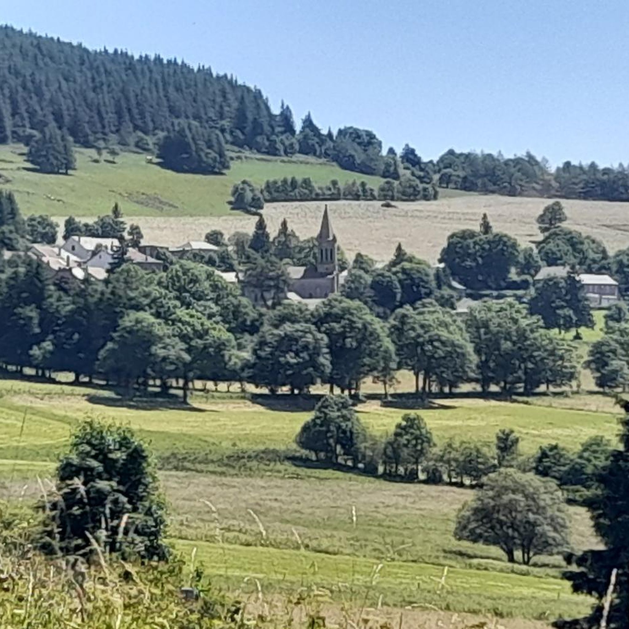
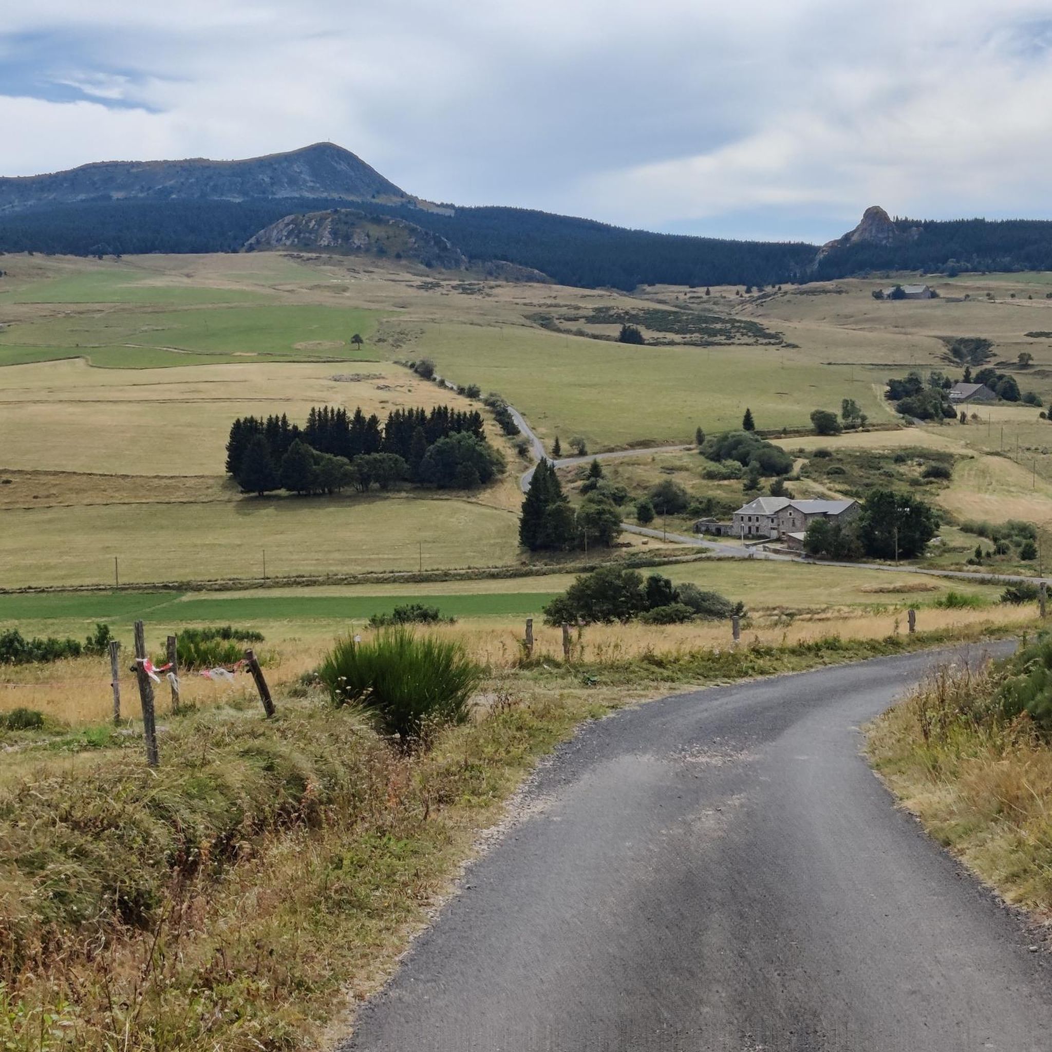
Hiking around Chaudeyrolles offers access to a diverse landscape within the Haute-Loire department of the Massif Central. The region is characterized by its unique volcanic formations, including ancient explosion craters that have evolved into wetlands, and prominent peaks. Hikers can explore high-altitude meadows, scattered forests, and distinctive volcanic terrains.
Best hiking trails around Chaudeyrolles
- The most popular hiking route is Narces de Chaudeyrolles – loop – Regional Natural Park of the Monts d'Ardèche, a 3.5 miles (5.6 km) trail…
Last updated: September 28, 2026
4.8
(14)
63
hikers
Moderate hike. Great for any fitness level. Mostly accessible paths. Sure-footedness required.
4.7
(43)
293
hikers
Hard hike. Very good fitness required. Mostly accessible paths. Sure-footedness required.

4.8
(28)
474
hikers
Moderate hike. Good fitness required. Mostly accessible paths. Sure-footedness required.
4.4
(9)
56
hikers
Moderate hike. Good fitness required. Mostly accessible paths. Sure-footedness required.
5.0
(5)
21
hikers
5.07km
01:23
80m
80m
Easy hike. Great for any fitness level. Easily-accessible paths. Suitable for all skill levels.
Get access to more routes and recommendations from other explorers.
Already have an account?
Our route recommendations are based on thousands of hikes, rides, and runs completed by other people on komoot.
Start today with a free account
Your next adventure awaits.

Tips from the Community

Lots of hikers. Be polite and share the trail. The descent with the small steps is a treat.
0
0

pretty flowers, pretty trees, pretty views, but what more could you ask for...oh yes, a windbreaker, because the mistral makes his grandmother cold.
0
0
If you are a short person and you venture into the fields of erigeron, say goodbye to your family and friends... it is very likely that they will never see you again.
0
0
If you are short, do not venture into the fields of erigeron, it is a one-way trip.
0
0
If you pass by, there is a beautiful waterfall not far from this very pleasant little town. Between two steps over stones, it is pleasant to soak your feet...
0
0
Who built this? Probably a grion who was passing by...
0
0
The cross is a bit ugly but it is not for it that we come to frolic in these green lands but rather for this landscape that would make a Caribou pale.
0
0
landscape that would make a caribou pale
0
0
Frequently Asked Questions
What types of hiking trails can I find around Chaudeyrolles?
Chaudeyrolles offers a diverse range of hiking trails, from easy strolls to more challenging treks. The landscape is characterized by unique volcanic formations, high-altitude meadows, and scattered forests. You can explore ancient explosion craters that have evolved into wetlands, and prominent peaks like Mont Mézenc.
Are there any easy hiking trails suitable for families or casual walkers?
Yes, Chaudeyrolles has several easy trails. For a gentle introduction to the area, consider the Chaudeyrolles loop from Chaudeyrolles, which is 3.1 miles (5.1 km) and takes about 1 hour 23 minutes. This route leads through the village surroundings.
What are the most notable natural features or landmarks to see while hiking in Chaudeyrolles?
The region is rich in natural wonders. You can explore the unique wetlands of the Narces de Chaudeyrolles, which are ancient volcanic explosion craters. The iconic Mont Mézenc offers breathtaking panoramic views. Other notable features include the volcanic 'Dents du Diable' and the captivating Cascade du Salin (also known as Cascade de Chaudeyrolles).
Are there any circular hiking routes in the Chaudeyrolles area?
Yes, many trails around Chaudeyrolles are circular. A popular moderate option is the Narces de Chaudeyrolles – loop – Regional Natural Park of the Monts d'Ardèche, which is 3.5 miles (5.6 km). For a more challenging circular hike, the North summit of Mont Mézenc – South summit of Mont Mézenc loop from Chaudeyrolles covers 10.9 miles (17.5 km) and offers extensive panoramic views.
What is the best time of year to go hiking in Chaudeyrolles?
The best time for hiking in Chaudeyrolles is generally from spring through autumn. During these seasons, the weather is more favorable for exploring the diverse landscapes, from high-altitude meadows to volcanic terrains. Summer offers lush greenery, while autumn brings vibrant colors. Winter hiking is possible but may require specialized gear due to snow and colder conditions, especially at higher elevations like Mont Mézenc.
Are dogs allowed on the hiking trails around Chaudeyrolles?
While many trails in the Haute-Loire region are dog-friendly, it's generally recommended to keep dogs on a leash, especially in natural areas like the Narces de Chaudeyrolles, to protect the local wildlife and unique plant species. Always check specific trail regulations before you go.
What are the more challenging hiking options available near Chaudeyrolles?
For experienced hikers seeking a challenge, the North summit of Mont Mézenc – South summit of Mont Mézenc loop from Chaudeyrolles is a difficult 10.9 miles (17.5 km) path with significant elevation changes. This route traverses high-altitude meadows and volcanic terrains, offering rewarding panoramic views across the Massif Central.
What do other hikers say about the trails in Chaudeyrolles?
The routes in Chaudeyrolles are highly rated by the komoot community, with an average score of 4.5 stars from over 400 reviews. Hikers often praise the unique volcanic landscapes, the serene atmosphere of the Narces, and the breathtaking views from Mont Mézenc.
Is there parking available near the trailheads in Chaudeyrolles?
Yes, parking is generally available in and around Chaudeyrolles, particularly near popular trailheads for routes like the Narces de Chaudeyrolles loop and access points for Mont Mézenc. Specific parking information can often be found on local signage or detailed route descriptions.
Can I reach the hiking trails around Chaudeyrolles using public transport?
While Chaudeyrolles is a small village in a rural area, public transport options might be limited. It's advisable to check local bus schedules or regional transport services in advance if you plan to rely on public transport to reach the trailheads. Driving often offers the most flexibility for accessing various hiking routes in the region.
Are there any specific natural monuments or viewpoints I should look out for?
Absolutely. Beyond Mont Mézenc, you can visit the Mount Gerbier de Jonc, a distinctive volcanic peak. The Boutières Cross Pass and Col de la Croix Peccata also offer excellent viewpoints and are often part of longer hiking routes.
How many hiking trails are there in total around Chaudeyrolles?
There are 17 hiking trails available around Chaudeyrolles, offering a variety of distances and difficulty levels to suit different preferences.
Most popular attractions around Chaudeyrolles

Get inspired with the komoot mobile app


Explore more
Browse the best Hikes in other regions.
