The best MTB trails around Gravières
4.3
(219)
1,161
riders
12
rides
Mountain biking around Gravières offers diverse landscapes within the Ardèche department of southern France. The region features the Chassezac River, dramatic gorges, and the distinctive Cévenol landscape, with routes ascending towards the Montselgues plateau. Trails traverse varied terrain, including dense forests and picturesque mountain areas within the Monts d'Ardèche Regional Nature Park. This area provides a mix of natural beauty and challenging terrain for mountain biking.
Best mountain bike trails around Gravières
- The most popular mountain bike trail is Brahic…
Last updated: September 28, 2026
4.0
(2)
21
riders
45.9km
03:05
540m
540m
Moderate mountain bike ride. Good fitness required. Advanced riding skills necessary.
4.2
(5)
19
riders
21.3km
02:01
580m
580m
Moderate mountain bike ride. Good fitness required. Advanced riding skills necessary.

8
riders
Hard mountain bike ride. Very good fitness required. Suitable for all skill levels.
5.0
(1)
8
riders
32.2km
02:39
820m
820m
Moderate mountain bike ride. Good fitness required. Suitable for all skill levels.
2.3
(3)
5
riders
23.7km
01:53
540m
550m
Moderate mountain bike ride. Good fitness required. Suitable for all skill levels.
Get access to more routes and recommendations from other explorers.
Already have an account?
Our route recommendations are based on thousands of hikes, rides, and runs completed by other people on komoot.
Start today with a free account
Your next adventure awaits.

Tips from the Community

The famous rocks with the bear and the lion in the beautiful Bois de Païolive
0
0

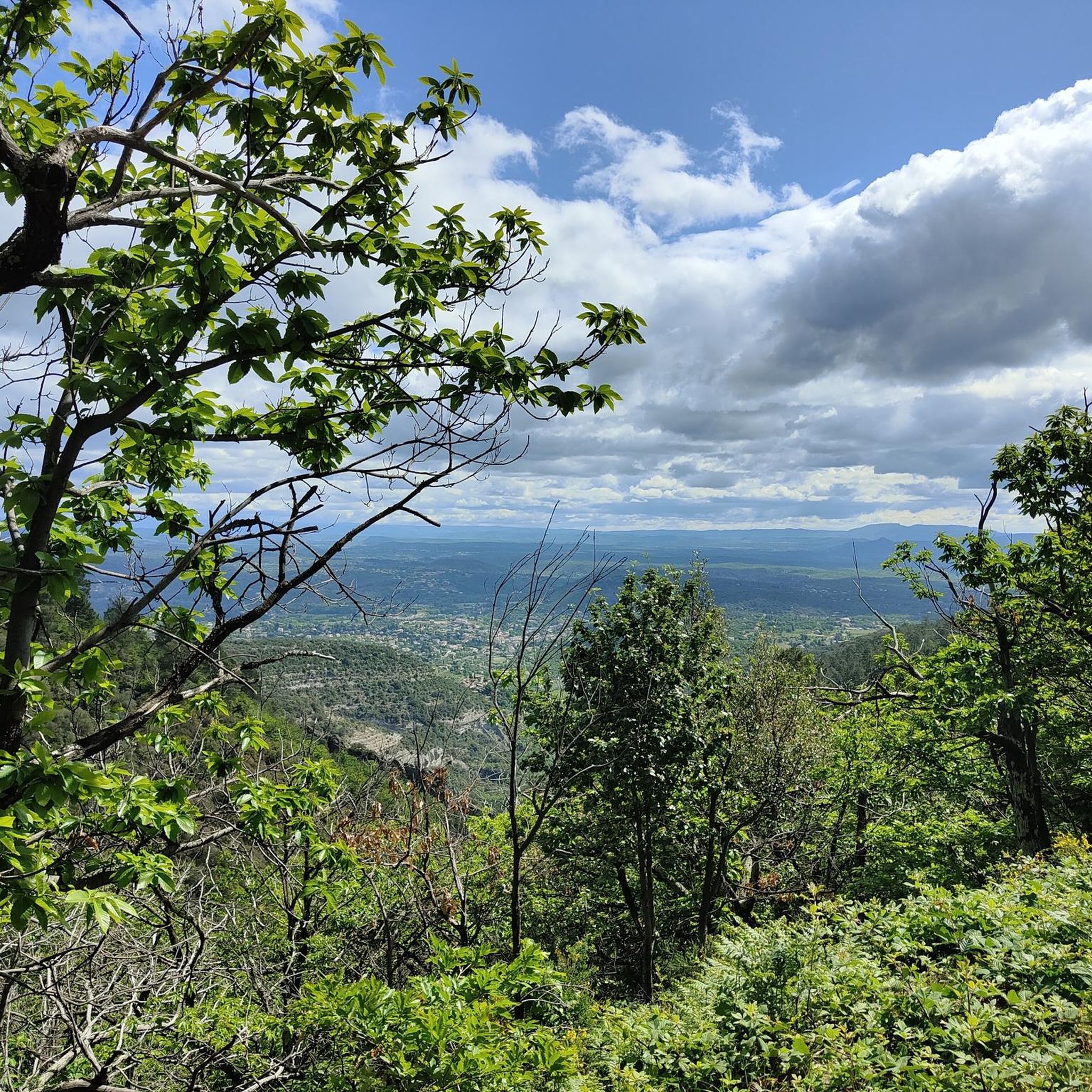
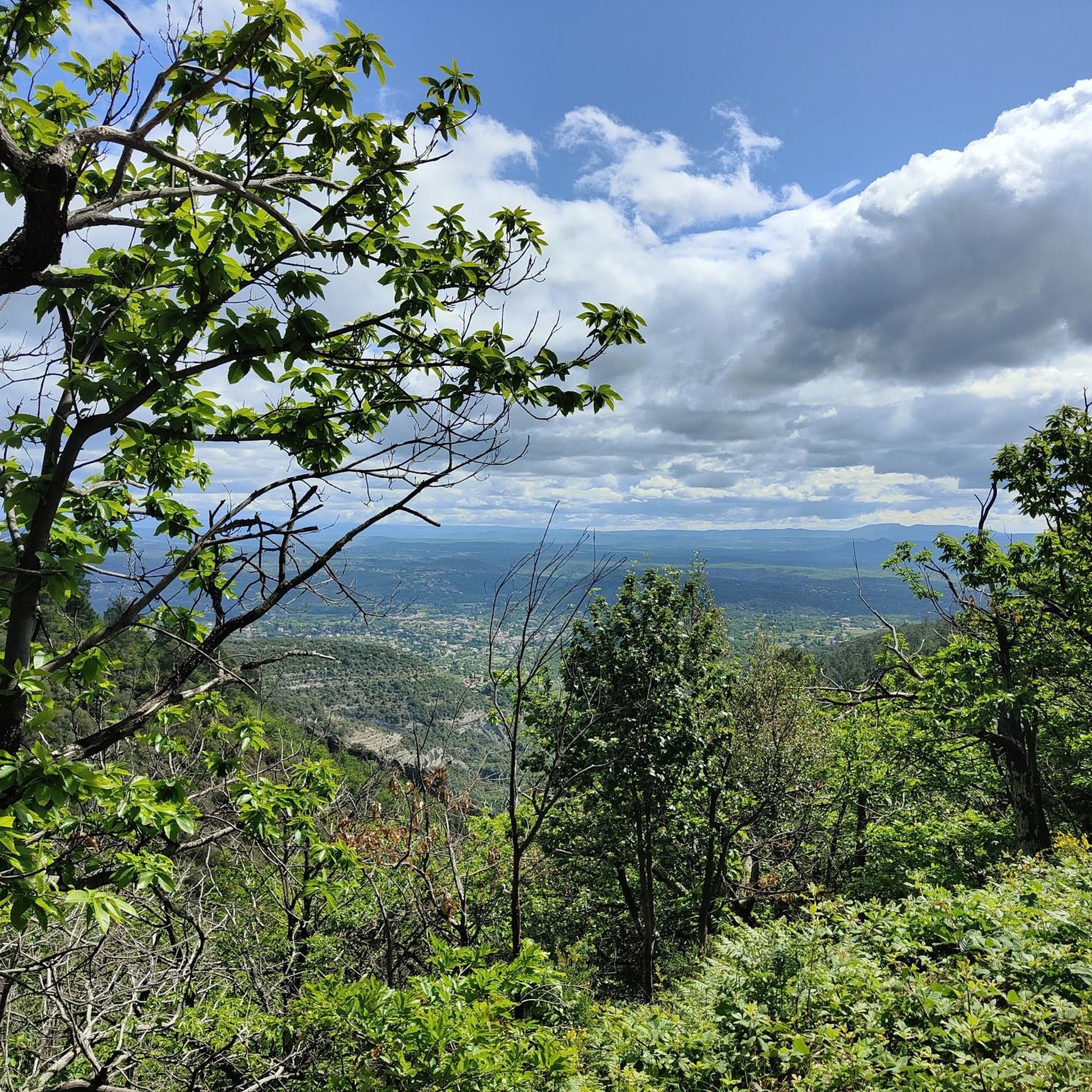
A beautiful view to catch your breath after the ascent.
0
0

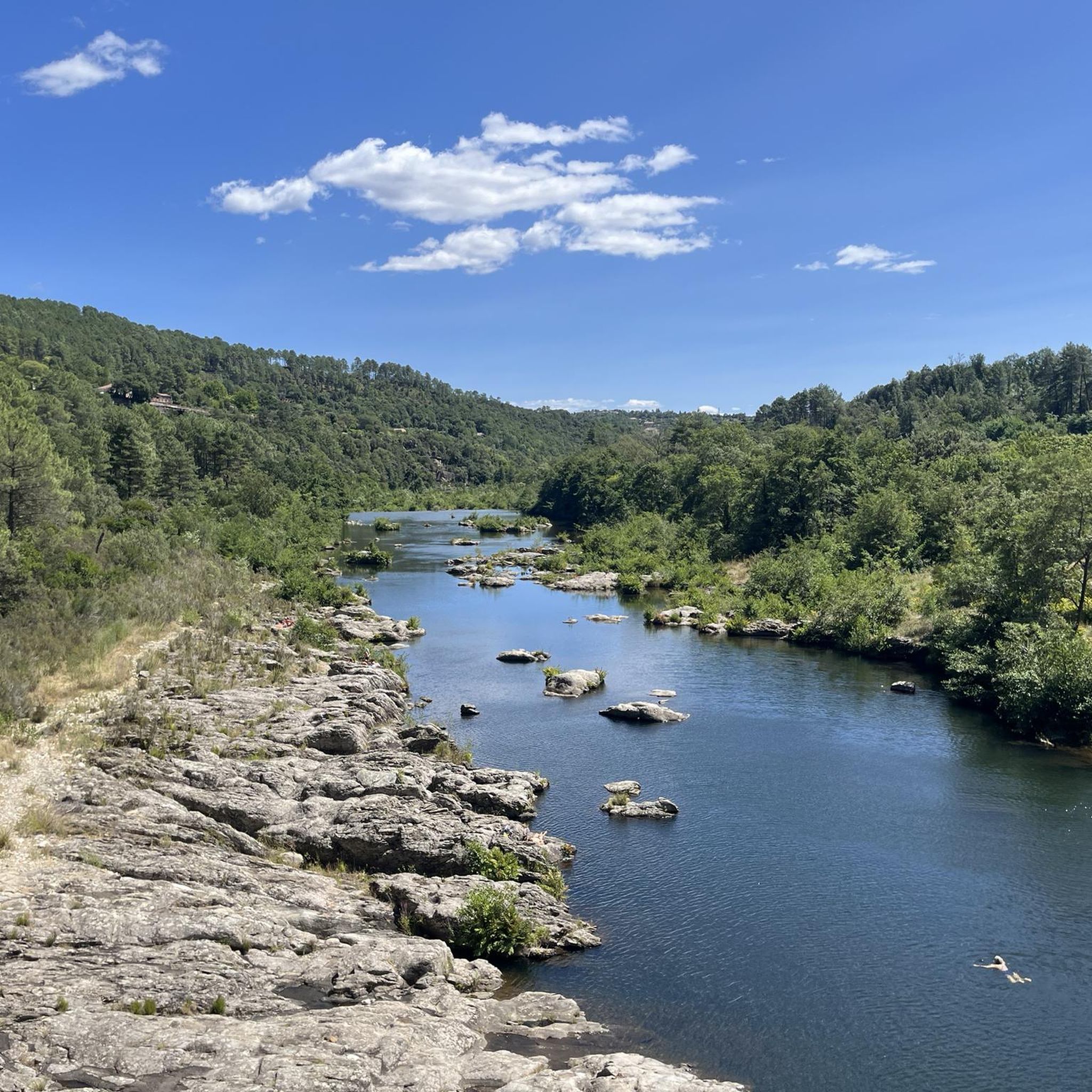
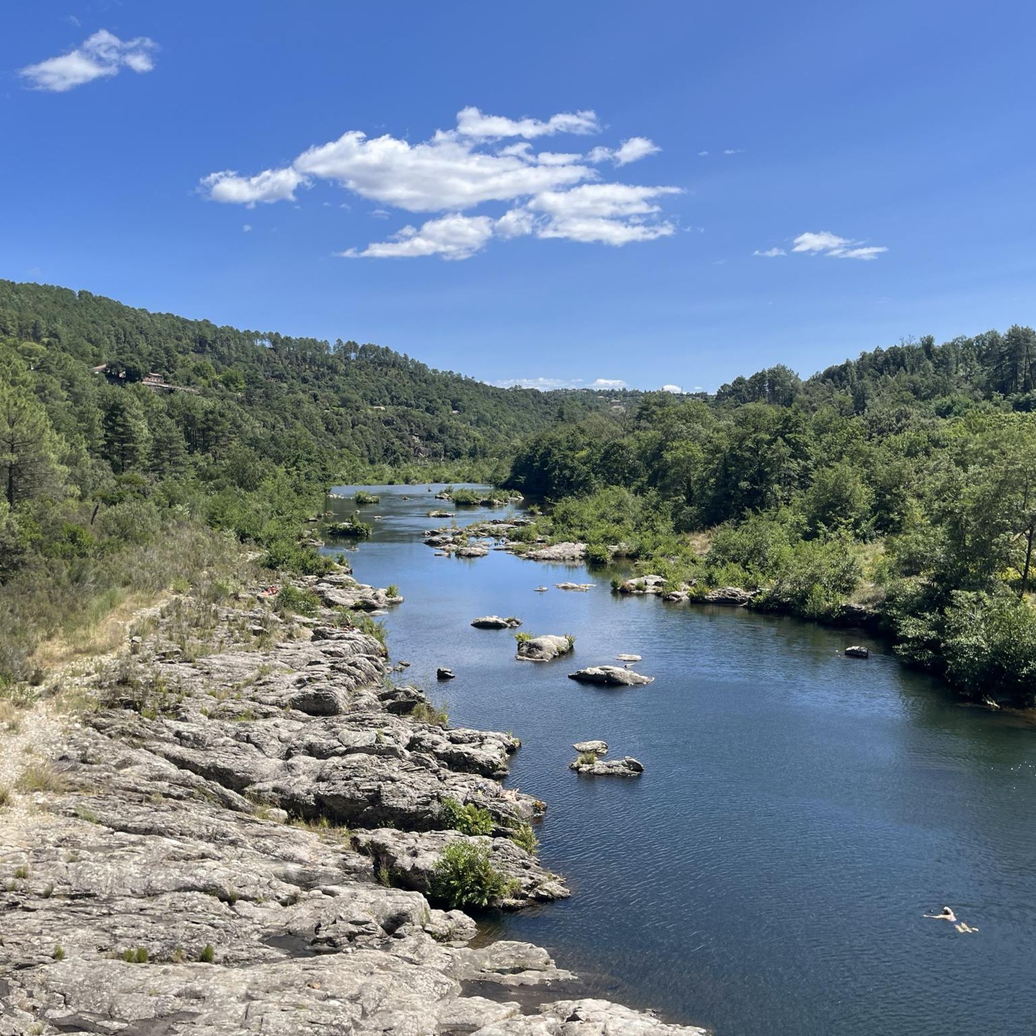
Swimming spot from the rocks or a mini beach, pleasant and magnificent
0
0

The Via Ardeche railway cycle path is a nice idea in itself, but unfortunately, the perfect surface (asphalt) is only present in the tunnel sections. The rest is rough concrete, gravel, and even worse. It's pleasantly cool in the tunnel.
1
0
The only thing I really liked was the campsite.
0
1
The Via Ardeche railway cycle path is a nice idea in itself, but unfortunately, the perfect surface (asphalt) is only present in the tunnel sections. The rest is rough concrete, gravel, and even worse.
0
0
Bridge over the Chassezac and beautiful landscape
2
0

Rock formations resembling a bear and a lion. South of the road through the Bois du Paiolive
1
0
Frequently Asked Questions
How many mountain bike trails are available around Gravières?
Gravières offers a wide selection of mountain biking opportunities, with over 100 trails listed on komoot. These routes cater to various skill levels, from easy riverside paths to challenging climbs through the Cévenol landscape.
What kind of terrain can I expect on mountain bike trails in Gravières?
The terrain around Gravières is diverse, ranging from mostly paved surfaces on easier routes to unpaved and potentially rocky sections on more challenging trails. You'll encounter varied atmospheres, including dense forests, picturesque mountain landscapes, and dramatic gorges along the Chassezac River. Routes often ascend to plateaus like Montselgues, offering a mix of climbs and descents.
Are there mountain bike trails suitable for beginners in Gravières?
Yes, there are trails suitable for beginners. For example, the Chassezac River – Nassier Beach loop from Malarce-sur-la-Thines is an easy 13.1-mile (21.1 km) path that follows the Chassezac River, providing refreshing views and pleasant riding without excessive difficulty.
What are some challenging mountain bike routes for experienced riders?
For experienced riders seeking a challenge, the Along the Thines – Col de la Croix Blanche (White Cross Pass) loop from Gravières is a difficult 23.3-mile (37.4 km) trail with significant elevation gain. Another demanding option is the Nassier Beach – Steep climb over single-track loop from Les Salelles, which covers 35.3 miles (56.8 km) with over 1100 meters of elevation gain.
What natural attractions can I see along the mountain bike trails in Gravières?
Many trails offer stunning views of the region's natural beauty. You can ride alongside the Chassezac River and through the dramatic Gorges du Chassezac, known for their steep cliffs and lush forests. Other notable features include the unique Labyrinth of Rocks of the Cévennes and the The elephant rock formation.
Are there any circular mountain bike routes around Gravières?
Yes, many mountain bike routes in the area are designed as loops, allowing you to start and finish in the same location. Examples include the moderate Brahic Village – View of Les Vans loop from Gravières and the more challenging Along the Thines – Col de la Croix Blanche (White Cross Pass) loop from Gravières.
What do other mountain bikers enjoy most about mountain biking in Gravières?
The mountain biking experience in Gravières is highly rated by the komoot community, with an average score of 4.3 stars from over 200 reviews. Riders frequently praise the diverse landscapes, the refreshing views of the Chassezac River, and the variety of trails that cater to different skill levels, from easy riverside paths to challenging climbs through the Cévenol landscapes.
Is Gravières a good destination for family-friendly mountain biking?
Gravières offers options for families, particularly on easier routes that follow the Chassezac River. These paths are generally less demanding and provide a pleasant experience for riders of varying ages and abilities. Always check the difficulty rating and elevation profile of a specific route to ensure it matches your family's comfort level.
What is the best time of year to go mountain biking in Gravières?
The Ardèche region, where Gravières is located, generally offers pleasant conditions for mountain biking during spring and autumn. These seasons typically provide milder temperatures and less crowded trails compared to the peak summer months. While summer can be warm, the Chassezac River offers opportunities for refreshing swims to cool down.
Are there any specific permits required for mountain biking in the Gravières area?
Generally, no specific permits are required for mountain biking on the established trails around Gravières. However, as parts of the region fall within the Monts d'Ardèche Regional Nature Park, it's always advisable to respect local regulations, stay on marked trails, and be mindful of protected areas to preserve the natural environment.
Where can I find parking for mountain biking in Gravières?
Parking is typically available in or near the villages that serve as starting points for many trails, such as Gravières itself or nearby Malarce-sur-la-Thines. Specific parking areas are often indicated on detailed route maps or in the descriptions of individual tours on komoot.
Are there mountain bike trails that pass by cafes or restaurants in Gravières?
While many trails traverse natural and sometimes remote areas, some routes may pass through or near villages where cafes and restaurants are available. It's recommended to check the specific route details on komoot or local tourist information to identify trails that offer convenient access to amenities for refreshments.
Most popular routes around Gravières
Most popular attractions around Gravières

Get inspired with the komoot mobile app


Explore more
Browse the best MTB trails in other regions.
