The best road cycling routes around La Rochette
4.6
(61)
2,002
riders
37
rides
Road cycling routes around La Rochette traverse a varied landscape characterized by mountainous terrain, valleys, and elevated vantage points. The region offers diverse routes with significant elevation gains, catering to different fitness levels. Cyclists can expect mostly paved surfaces, though some segments may be unpaved. The area is defined by its natural features, including proximity to Mont Mézenc and the Parc naturel régional des Monts d'Ardèche.
Best road cycling routes around La Rochette
- The most popular road cycling route is…
Last updated: October 4, 2026
4.5
(2)
36
riders
59.0km
03:19
1,310m
1,310m
Hard road ride. Very good fitness required. Mostly well-paved surfaces and easy to ride.
38
riders
50.1km
02:23
650m
650m
Moderate road ride. Good fitness required. Mostly well-paved surfaces and easy to ride.

4.7
(3)
28
riders
52.7km
02:54
910m
920m
Hard road ride. Very good fitness required. Mostly well-paved surfaces and easy to ride.
5.0
(1)
29
riders
60.0km
03:23
1,350m
1,350m
Hard road ride. Very good fitness required. Mostly well-paved surfaces and easy to ride.
4.0
(2)
22
riders
40.4km
02:15
890m
890m
Moderate road ride. Good fitness required. Mostly well-paved surfaces and easy to ride.
Get access to more routes and recommendations from other explorers.
Already have an account?
Our route recommendations are based on thousands of hikes, rides, and runs completed by other people on komoot.
Start today with a free account
Your next adventure awaits.

Tips from the Community

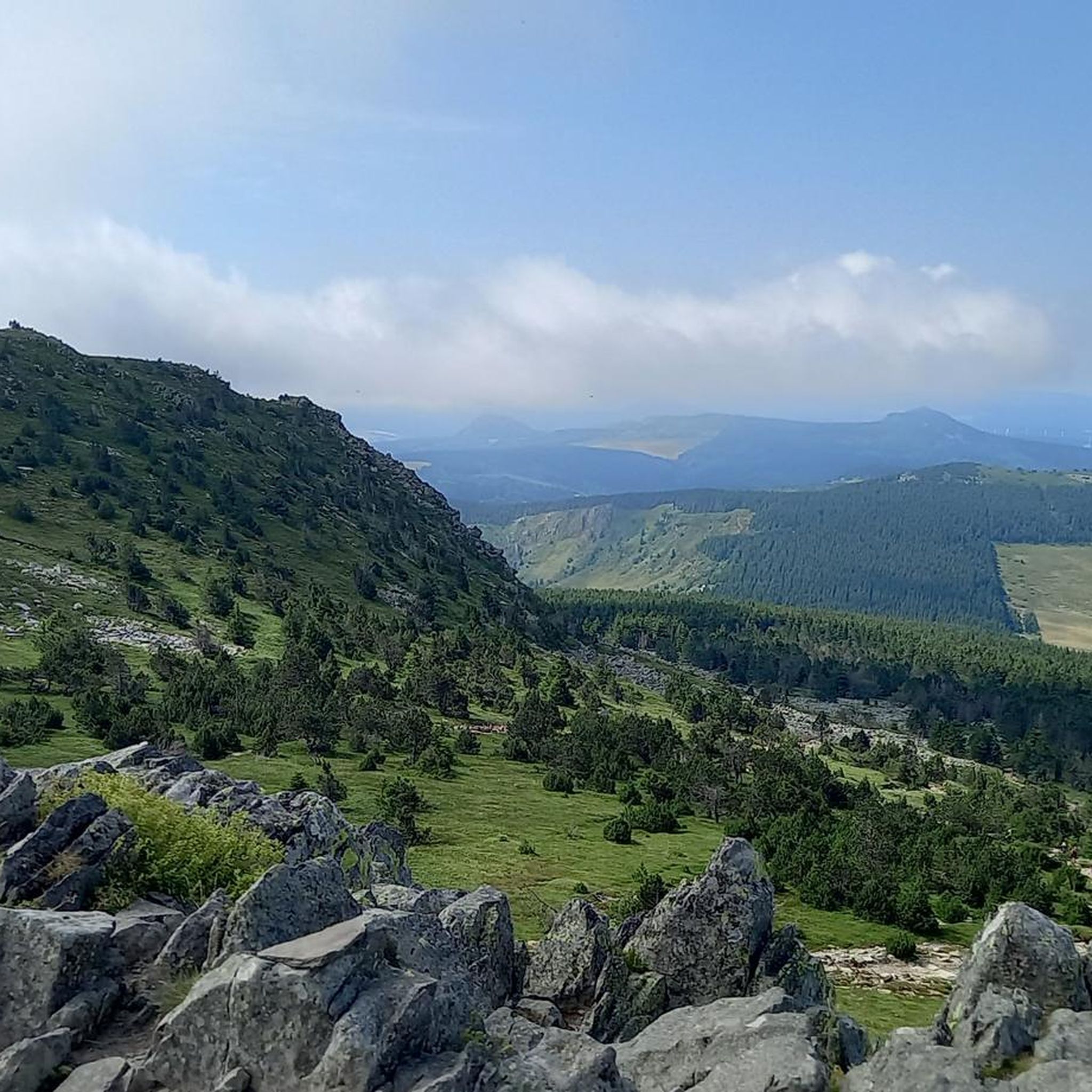
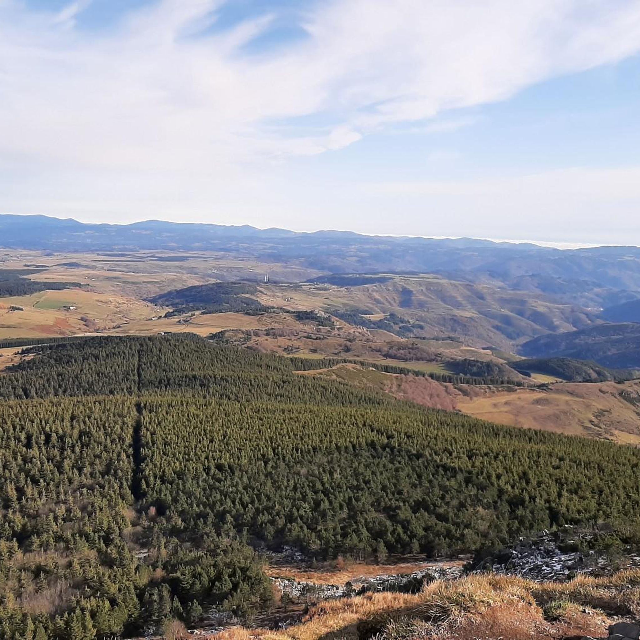
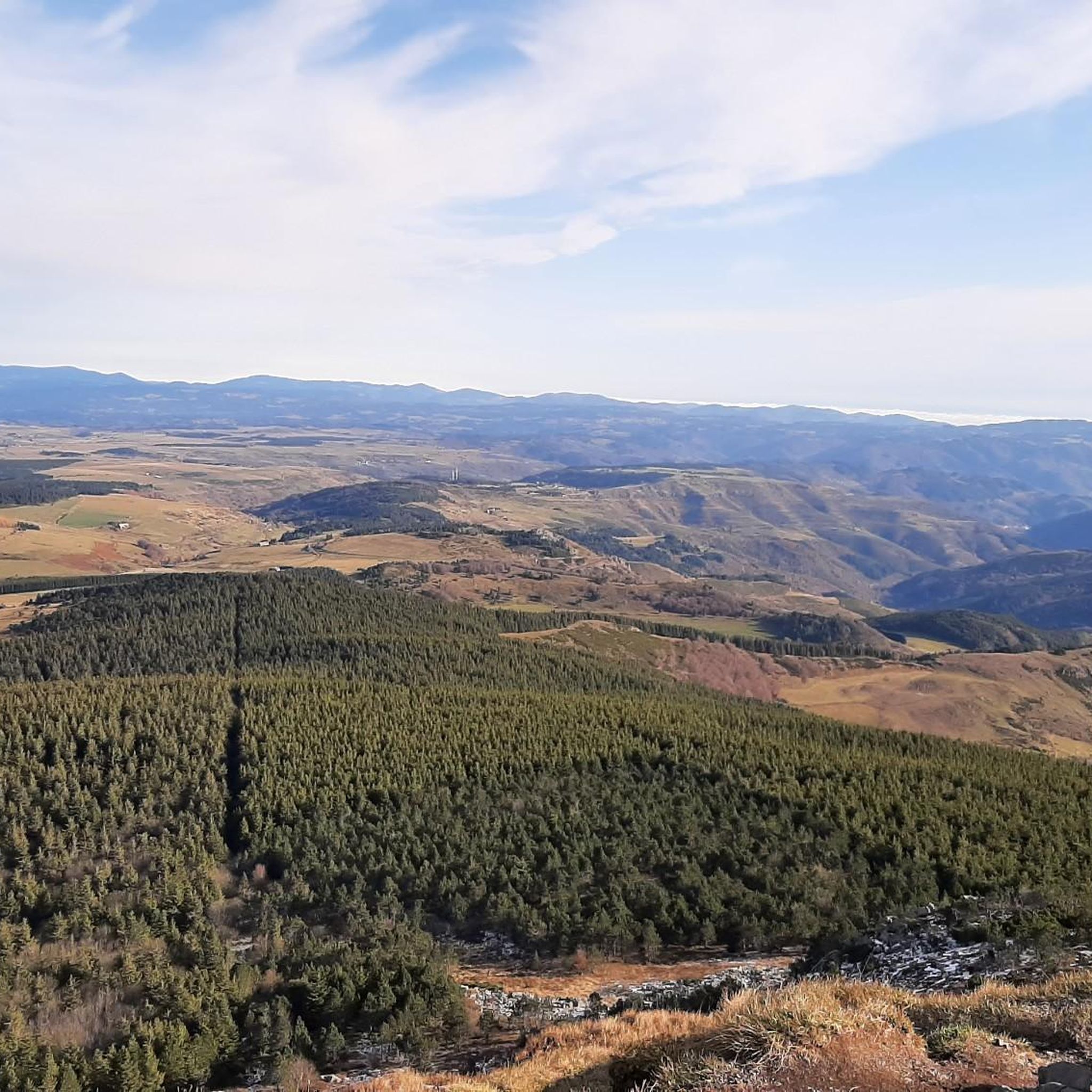
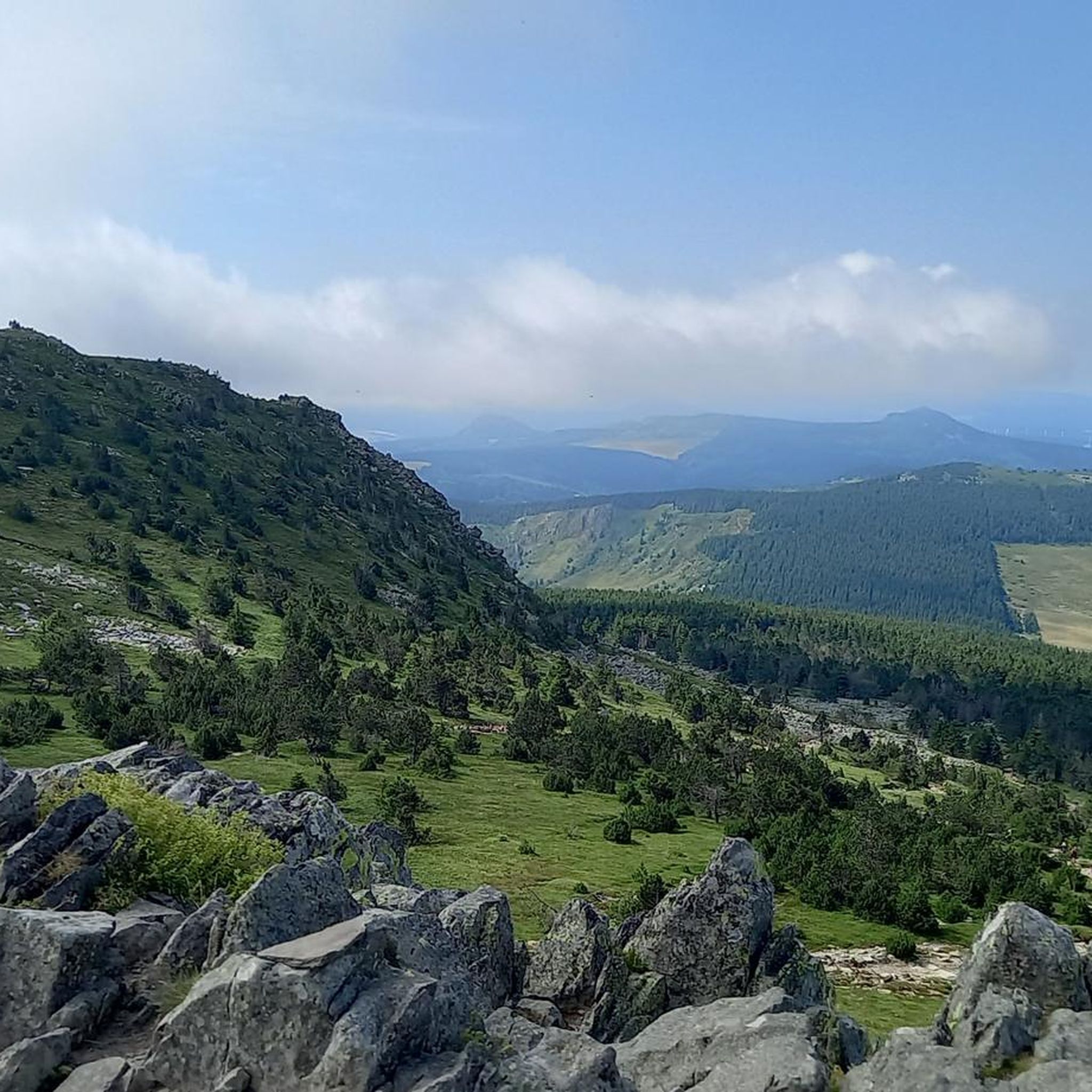
Located at an altitude of 1,330 meters, Lachamp-Raphaël is the highest village in the Ardèche. Dominated by the Montivernoux peak, the village offers exceptional panoramic views of the Alps and the Ardèche mountains. https://lachamp-raphael.fr/
0
0

Facing the Lizieux at sunset 🌅 Simple and soothing nature as we like it.
0
0

pretty flowers, pretty trees, pretty views, but what more could you ask for...oh yes, a windbreaker, because the mistral makes his grandmother cold.
0
0
If you are a short person and you venture into the fields of erigeron, say goodbye to your family and friends... it is very likely that they will never see you again.
0
0
If you are short, do not venture into the fields of erigeron, it is a one-way trip.
0
0
The cross is a bit ugly but it is not for it that we come to frolic in these green lands but rather for this landscape that would make a Caribou pale.
0
0
landscape that would make a caribou pale
0
0

Frequently Asked Questions
What kind of terrain can I expect when road cycling around La Rochette?
Road cycling routes around La Rochette traverse a varied landscape characterized by mountainous terrain, valleys, and elevated vantage points. You'll encounter significant elevation gains, with most surfaces being paved, though some segments might be unpaved. The region is defined by its natural features, including proximity to Mont Mézenc and the Parc naturel régional des Monts d'Ardèche.
Are there road cycling routes suitable for different fitness levels?
Yes, La Rochette offers a diverse range of road cycling routes catering to various fitness levels. You can find moderate loops, such as the Rest area loop from Chaudeyrolles, which covers 50.1 km with 651 meters of elevation gain. For more challenging rides, there are difficult paths with substantial climbing, like the Viaduc de la Recoumène – Château de Beaufort loop from Les Estables, spanning 67.7 km with over 1150 meters of ascent.
What natural features or landmarks can I see along the road cycling routes?
The region around La Rochette is rich in natural beauty and notable landmarks. Cyclists can enjoy views of significant summits like South summit of Mont Mézenc and Mount Gerbier de Jonc. You might also pass through mountain passes such as Boutières Cross Pass or enjoy panoramic views from Col de la Croix Peccata.
Are there any circular road cycling routes available?
Many of the road cycling routes around La Rochette are designed as loops, offering a convenient way to explore the region. Examples include the Lake Issarlès – Water / Bench loop from Les Estables, a difficult 52.6 km path, or the Col de la Croix de Boutières – Col de la Clède (1,385 m) loop from Les Estables, which is a moderate 40.4 km ride through mountain passes.
What do other cyclists say about road cycling in La Rochette?
The road cycling routes in La Rochette are highly regarded by the komoot community, holding an average score of 4.4 stars from over 30 reviews. Cyclists often praise the varied terrain, the challenging climbs, and the scenic beauty of the mountainous environments and valleys.
Are there any routes that pass by lakes or significant water features?
Yes, some routes offer beautiful views of lakes. For instance, the Lake Issarlès – Water / Bench loop from Les Estables is a challenging 52.6 km route that provides scenic views around Lake Issarlès. Another option is the Saint-Front Lake loop from Les Estables, a moderate 47.8 km ride.
What is the best time of year for road cycling in La Rochette?
Given the mountainous environment and potential for significant elevation, the best time for road cycling in La Rochette is typically from late spring through early autumn. During these months, the weather is generally more stable, and mountain passes are clear of snow, offering optimal conditions for exploring the diverse routes.
Are there any particularly long or challenging road cycling routes for experienced riders?
Experienced riders looking for a challenge will find several difficult routes. The Viaduc de la Recoumène – Château de Beaufort loop from Les Estables is a demanding 67.7 km route with over 1150 meters of elevation gain. Another difficult option is the Lake Issarlès – Water / Bench loop from Les Estables, covering 52.6 km with 911 meters of climbing.
How many road cycling routes are there in total around La Rochette?
There are 34 road cycling routes available around La Rochette, offering a wide variety of options for cyclists. These routes range from moderate to difficult, ensuring there's something for every skill level.
Are there any routes that go through mountain passes?
Yes, the region is known for its mountain passes. The Col de la Croix de Boutières – Col de la Clède (1,385 m) loop from Les Estables is a prime example, leading you directly through significant mountain passes. You can also find highlights like the Boutières Cross Pass in the area.
What is the typical duration for a road cycling route in this area?
The duration of road cycling routes around La Rochette varies significantly based on distance and elevation. Moderate routes like the Rest area loop from Chaudeyrolles typically take around 2 hours 23 minutes, while longer, more difficult routes can take upwards of 3 to 4 hours or more.
Most popular attractions around La Rochette

Get inspired with the komoot mobile app


Explore more
Browse the best Road cycling routes in other regions.
